Abbots Wood

Wood, Forest in Gloucestershire Forest of Dean

England

Abbots Wood

Former Lightmoor Colliery Engine House The derelict engine house of the former Lightmoor Colliery viewed from the cycleway which passes by following a former railway.
Former Lightmoor Colliery Engine House Credit: Philip Halling

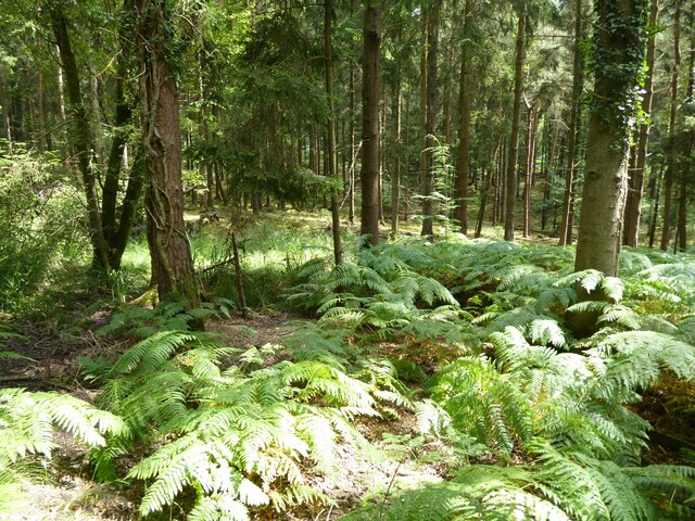
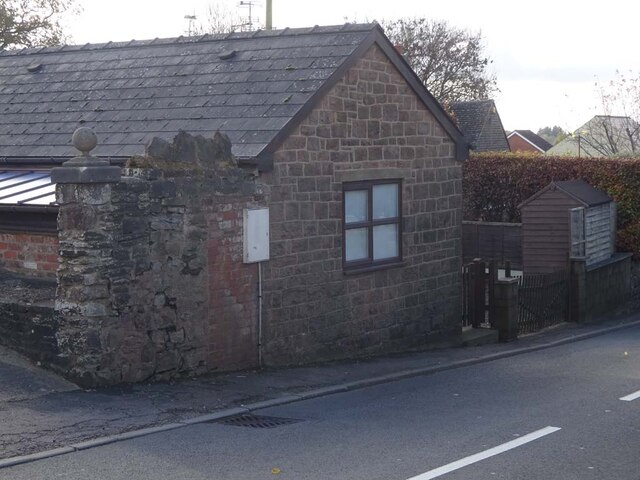
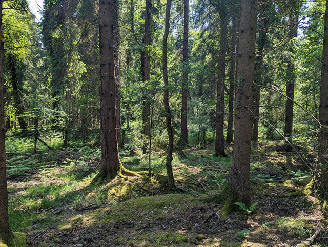
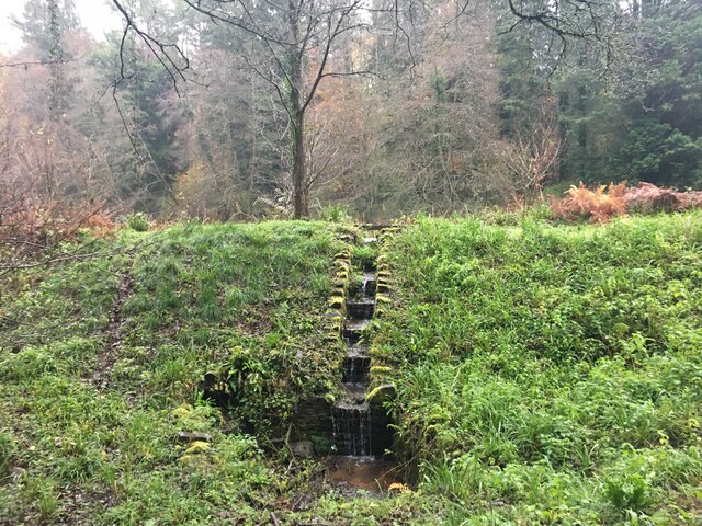
Abbots Wood is a picturesque forest located in the county of Gloucestershire, England. Spanning an area of approximately 150 acres, it is renowned for its natural beauty and diverse ecosystem. The wood is primarily composed of mixed deciduous trees, including oak, beech, and birch, which create a stunning display of colors during the autumn months.

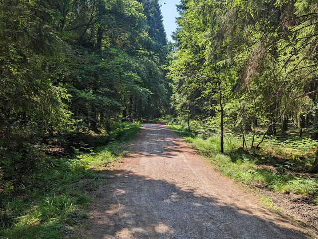
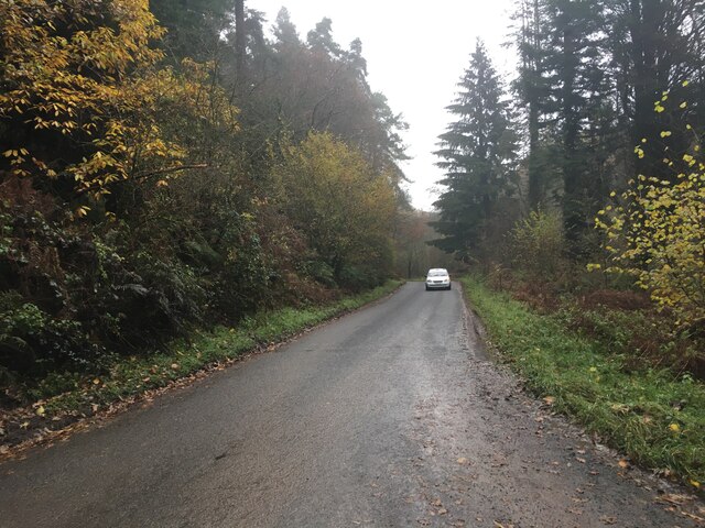
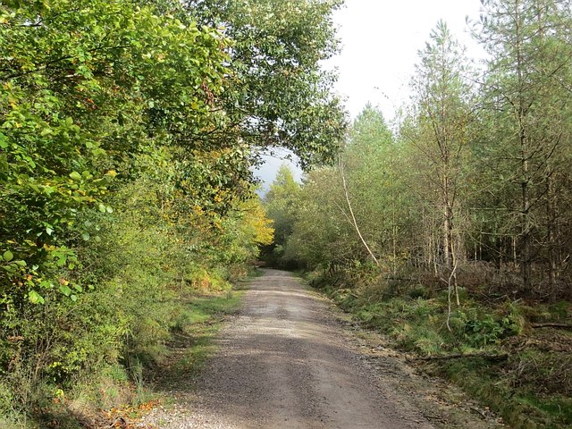
The woodland is crisscrossed with numerous well-maintained paths and trails, making it a popular destination for nature enthusiasts, walkers, and cyclists. These paths offer visitors the opportunity to explore the wood at their own pace, providing a tranquil and serene environment in which to unwind and appreciate the natural surroundings.

In addition to its scenic charm, Abbots Wood is also home to a rich variety of wildlife. The forest provides a habitat for numerous species of birds, including woodpeckers, owls, and various songbirds. Squirrels and rabbits can be spotted darting through the undergrowth, while deer occasionally graze in the more secluded areas of the wood.

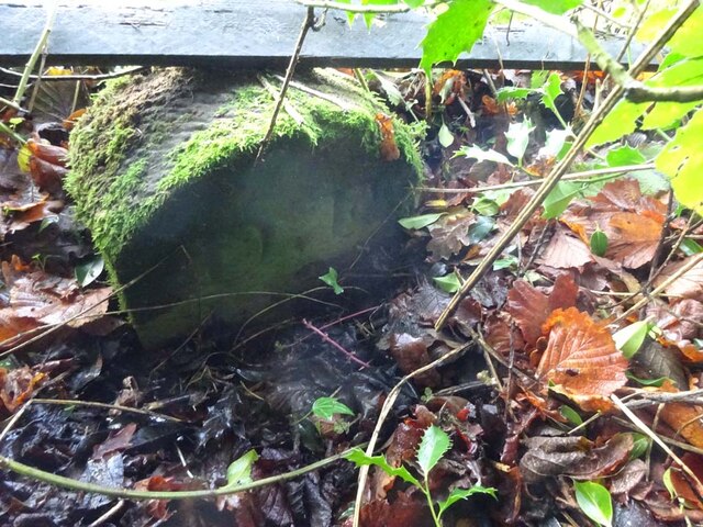
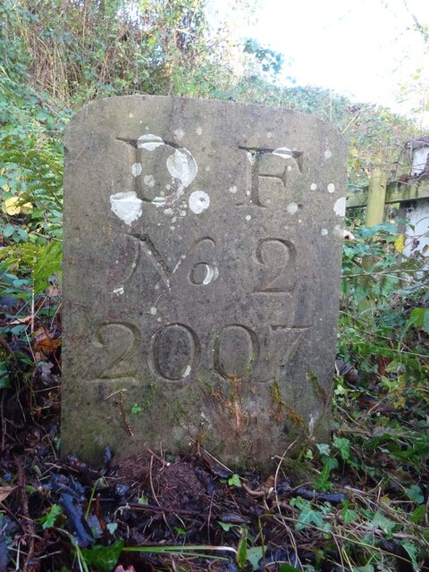
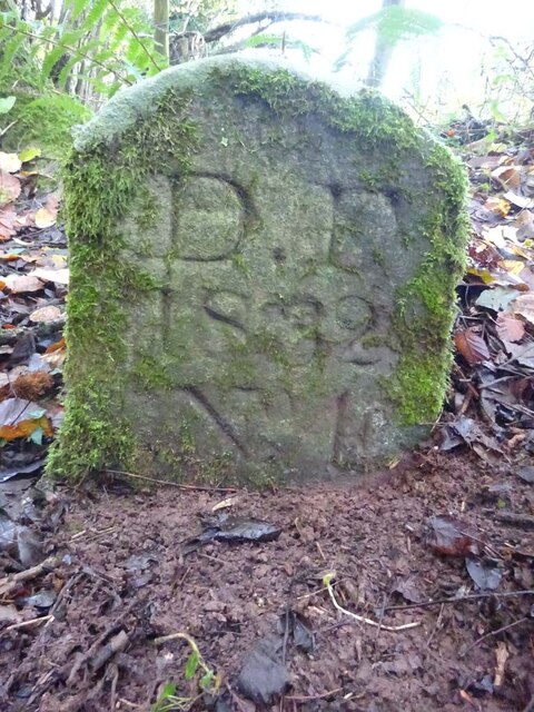
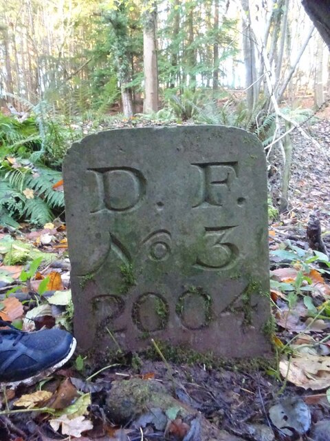
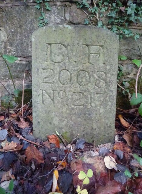
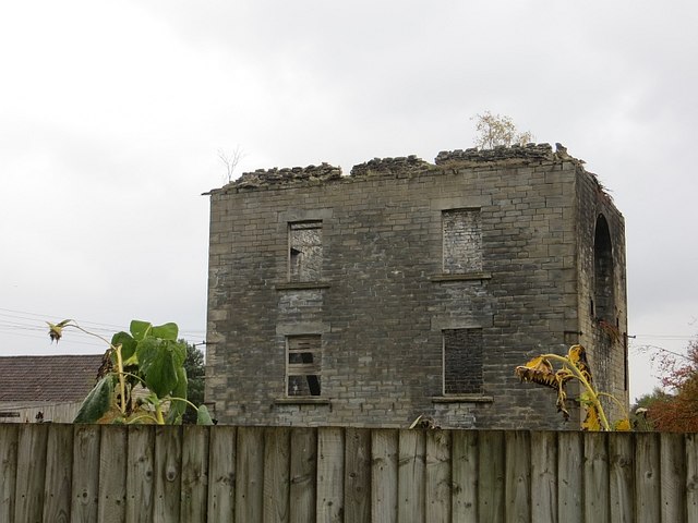
The wood has a long history, with evidence of human activity dating back centuries. Remnants of ancient earthworks and archaeological finds have been discovered within its boundaries, adding an air of mystery and intrigue to the forest's allure.

Abbots Wood offers visitors a unique opportunity to immerse themselves in nature and experience the tranquility of an ancient woodland. With its stunning landscapes, diverse wildlife, and rich history, it is a true gem of Gloucestershire and a must-visit destination for anyone seeking a peaceful retreat in nature.

If you have any feedback on the listing, please let us know in the comments section below.
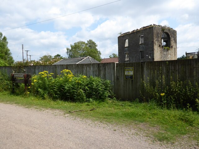
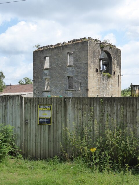
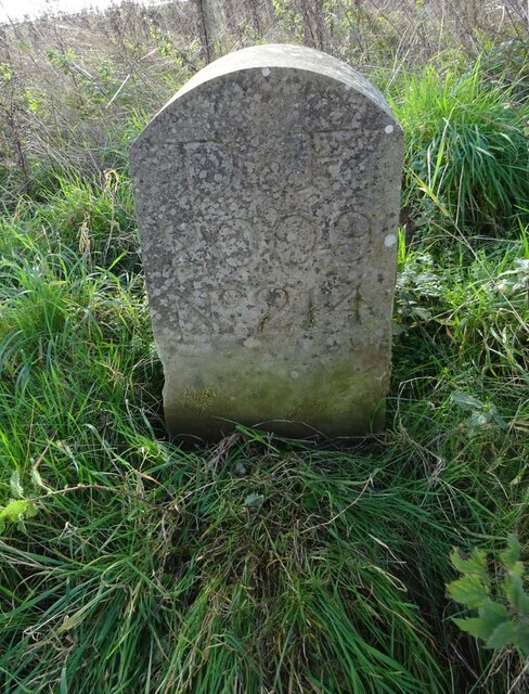
Abbots Wood Images

Images are sourced within 2km of 51.799658/-2.495904 or Grid Reference SO6511. Thanks to Geograph Open Source API. All images are credited.

Former Lightmoor Colliery Engine House The derelict engine house of the former Lightmoor Colliery viewed from the cycleway which passes by following a former railway.
Former Lightmoor Colliery Engine House
The derelict engine house of the former Lightmoor Colliery viewed from the cycleway which passes by following a former railway.
Forestry at Great Palescot Ferns and trees at Great Palescot in the Forest of Dean.
Forestry at Great Palescot
Ferns and trees at Great Palescot in the Forest of Dean.
Boundary Stone, Cinderford Technically in the modern parish of Ruspidge and Soudley. Cinderford is the Northern side of the road.

Inscription: D.F / 2015 / Nᴼ. 214

Milestone Society National ID: GL_DFRUSU214em
Boundary Stone, Cinderford
Technically in the modern parish of Ruspidge and Soudley. Cinderford is the Northern side of the road. Inscription: D.F / 2015 / Nᴼ. 214 Milestone Society National ID: GL_DFRUSU214em
Old Tollhouse, 26 St White's Road In the modern parish of Ruspidge and Soudley. Within the boundaries of the "Forest of Dean", and still showing a "TP" on the 1873 map. This building served the Forest of Dean Turnpike Trust.

Milestone Society National ID: GL.CIN01
Old Tollhouse, 26 St White's Road
In the modern parish of Ruspidge and Soudley. Within the boundaries of the "Forest of Dean", and still showing a "TP" on the 1873 map. This building served the Forest of Dean Turnpike Trust. Milestone Society National ID: GL.CIN01
Old Boundary Stone, Blaise Bailey Marking the boundary of the "Forest of Dean" seen from Forestry Commission land but actually just in the private field beyond. One of the few originals.

Inscription: D. F. / Nᴼ. 218 / 1832

Milestone Society National ID: GL_DFRUSU218em
Old Boundary Stone, Blaise Bailey
Marking the boundary of the "Forest of Dean" seen from Forestry Commission land but actually just in the private field beyond. One of the few originals. Inscription: D. F. / Nᴼ. 218 / 1832 Milestone Society National ID: GL_DFRUSU218em
Boundary Stone, Grange At the end of Gloucestershire bridleway ENE4, near Grange Village. Signposted to "Precious Pets" boarding kennels.

Inscription: D.F / Nᴼ. 2 / 2007

Milestone Society National ID: GL_DFNEWN2em
Boundary Stone, Grange
At the end of Gloucestershire bridleway ENE4, near Grange Village. Signposted to "Precious Pets" boarding kennels. Inscription: D.F / Nᴼ. 2 / 2007 Milestone Society National ID: GL_DFNEWN2em
Old Boundary Stone, Grange Just after the end of Gloucestershire footpath ENE34 marking the boundary of the "Forest of Dean". A modern companion stone, Nᴼ.3, can be seen 50m North at <a href="https://www.geograph.org.uk/photo/7352881">SO6711 : Boundary Stone, Blaise Bailey</a>.

Inscription: D. F. / 1832 / Nᴼ. 4

Milestone Society National ID: GL_DFNEWN4em
Old Boundary Stone, Grange
Just after the end of Gloucestershire footpath ENE34 marking the boundary of the "Forest of Dean". A modern companion stone, Nᴼ.3, can be seen 50m North at SO6711 : Boundary Stone, Blaise Bailey. Inscription: D. F. / 1832 / Nᴼ. 4 Milestone Society National ID: GL_DFNEWN4em
Boundary Stone, Blaise Bailey In the wood just past Gloucestershire footpath ENE34. A companion stone Nᴼ.4, an 1832 stone, can be seen 50m South, at <a href="https://www.geograph.org.uk/photo/7352856">SO6711 : Old Boundary Stone, Grange</a>.

Inscription: D. F. / Nᴼ. 3 / 2004

Milestone Society National ID: GL_DFNEWN3em
Boundary Stone, Blaise Bailey
In the wood just past Gloucestershire footpath ENE34. A companion stone Nᴼ.4, an 1832 stone, can be seen 50m South, at SO6711 : Old Boundary Stone, Grange. Inscription: D. F. / Nᴼ. 3 / 2004 Milestone Society National ID: GL_DFNEWN3em
Modern Boundary Stone, Buckshaft Road On the verge/berm against a wall, adjacent to 2 telephone poles, opposite house 1a.
It marks the boundary of the "Forest of Dean", in the parish of Ruspidge and Soudley.

Inscription: D. F. / 2008 / Nᴼ. 217

Milestone Society National ID: GL_DFRUSU217em
Modern Boundary Stone, Buckshaft Road
On the verge/berm against a wall, adjacent to 2 telephone poles, opposite house 1a. It marks the boundary of the "Forest of Dean", in the parish of Ruspidge and Soudley. Inscription: D. F. / 2008 / Nᴼ. 217 Milestone Society National ID: GL_DFRUSU217em
Forest of Dean Looking from the Family Cycle Trail which over this part generally follows the old Mineral Loop Line of the Severn and Wye Railway. Just here, it has deviated to the west for a short distance to avoid a sawmill at a former colliery site.
Forest of Dean
Looking from the Family Cycle Trail which over this part generally follows the old Mineral Loop Line of the Severn and Wye Railway. Just here, it has deviated to the west for a short distance to avoid a sawmill at a former colliery site.
Family Cycle Trail, Forest of Dean The Cycle Trail follows the main line of Severn and Wye Railway to the site of Drybrook Road Junction and then the northern part of the Mineral Loop Line.  There is a deviation off the railway route here, past the site of  Lightmoor colliery, now used as a timber yard.
Family Cycle Trail, Forest of Dean
The Cycle Trail follows the main line of Severn and Wye Railway to the site of Drybrook Road Junction and then the northern part of the Mineral Loop Line. There is a deviation off the railway route here, past the site of Lightmoor colliery, now used as a timber yard.
Pond outflow near Upper Soudley
Minor road towards Littledean
B4227 near Cinderford
Dean Heritage Centre Ducks on the pond beside the centre.
Dean Heritage Centre
Ducks on the pond beside the centre.
Lightmoor Colliery Ruins of Lightmoor Colliery, defended by sunflowers.
Lightmoor Colliery
Ruins of Lightmoor Colliery, defended by sunflowers.
Forest road near Cinderford
Show me another place!

Abbots Wood is located at Grid Ref: SO6511 (Lat: 51.799658, Lng: -2.495904)

Administrative County: Gloucestershire

District: Forest of Dean

Police Authority: Gloucestershire

What 3 Words

///figs.promise.rivals. Near Cinderford, Gloucestershire

Related Wikis

Soudley Ponds

Lying close to the village of Soudley in the Forest of Dean, west Gloucestershire, Soudley Ponds (grid reference SO662112), also known as Sutton Ponds...

Soudley

Soudley, including Upper Soudley, is a village to the west of Cinderford, in the Forest of Dean, Gloucestershire, England. It joins with Ruspidge to form...

Upper Soudley Halt railway station

Upper Soudley Halt railway station is a disused railway station that was opened by the Great Western Railway (GWR) on the former Bullo Pill Railway, later...

Buckshraft Mine & Bradley Hill Railway Tunnel

Buckshaft Mine & Bradley Hill Railway Tunnel (SO655121 and SO662104) is a 5.66-hectare (14.0-acre) biological Site of Special Scientific Interest in Gloucestershire...

Dean Heritage Centre

The Dean Heritage Centre is located in the valley of Soudley, Gloucestershire, England in the Forest of Dean and exists to record and preserve the social...

Ruspidge

Ruspidge is a village in the Forest of Dean district of west Gloucestershire, England. The civil parish includes Soudley It is located near the town of...

Eastern United Colliery

Eastern United Colliery was a drift mine in the Forest of Dean, Gloucestershire, England served by the Great Western Railway's Forest of Dean Branch. The...

Staple Edge Halt railway station

Staple Edge Halt railway station is a disused railway station opened by the Great Western Railway (GWR) on the former Bullo Pill Railway, later known as...

Nearby Amenities

Located within 500m of 51.799658,-2.495904
Dry Wood
Is In: Gloucestershire, England, UK
Place: locality
Source: NPE
Lat/Long: 51.8002649/-2.4892544
The data included in this document is from www.openstreetmap.org. The data is made available under ODbL.

Have you been to Abbots Wood?

Leave your review of Abbots Wood below (or comments, questions and feedback).