Coed y Mynydd

Wood, Forest in Monmouthshire

Wales

Coed y Mynydd

The Rock and Fountain Inn, Penhow Beside the A48.
The Rock and Fountain Inn, Penhow Credit: Eirian Evans

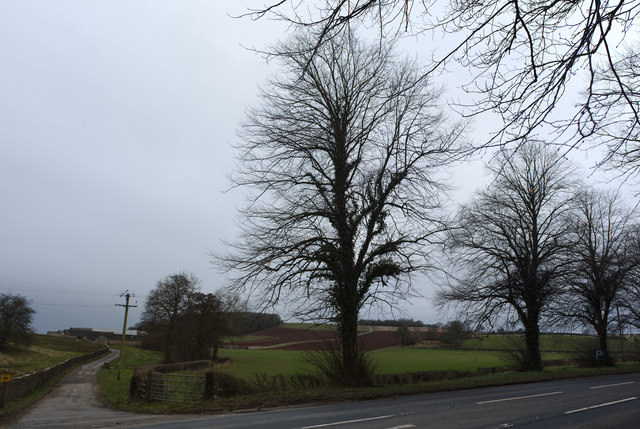
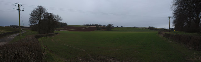
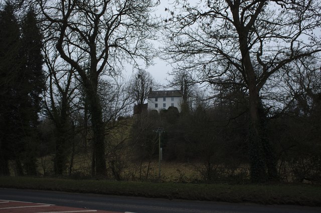
Coed y Mynydd is a beautiful woodland located in Monmouthshire, Wales. Stretching across an area of approximately 200 acres, this forest offers a serene escape for nature lovers and outdoor enthusiasts. The name "Coed y Mynydd" translates to "Wood on the Mountain," which accurately reflects its location on the slopes of the picturesque mountains.

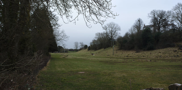
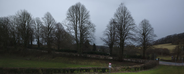
The woodland is predominantly composed of native broadleaf trees, including oak, beech, and birch. These trees create a dense canopy that provides shade and shelter for a variety of wildlife. Visitors can expect to encounter a diverse range of bird species, such as woodpeckers, owls, and songbirds, as well as small mammals like foxes, badgers, and squirrels.

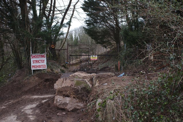
A network of well-maintained footpaths and trails weaves through Coed y Mynydd, allowing visitors to explore the forest's natural beauty. These paths offer different levels of difficulty, catering to both casual strollers and more experienced hikers. Along the way, hikers will be treated to stunning views of the surrounding countryside and may stumble upon hidden streams and small waterfalls.

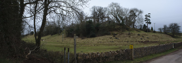
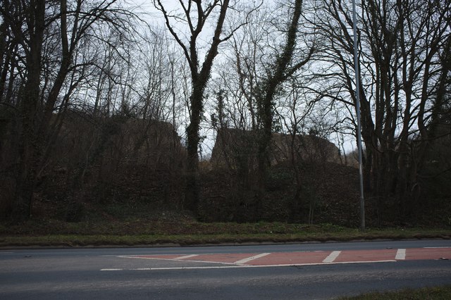
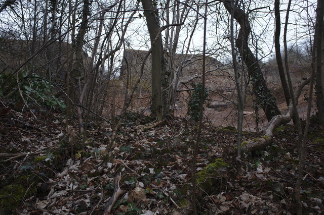
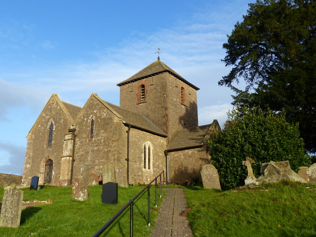
Coed y Mynydd is not only a haven for wildlife and outdoor enthusiasts but also a site of historical significance. The forest contains remnants of ancient settlements, including Iron Age hillforts and burial mounds, which serve as a reminder of the area's rich cultural heritage.

Overall, Coed y Mynydd is a true gem in Monmouthshire, offering visitors a chance to immerse themselves in the beauty of nature, explore its history, and experience the tranquility that only a woodland can provide.

If you have any feedback on the listing, please let us know in the comments section below.

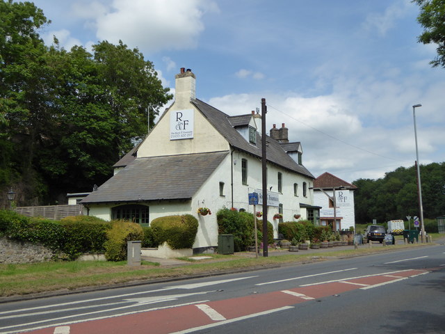
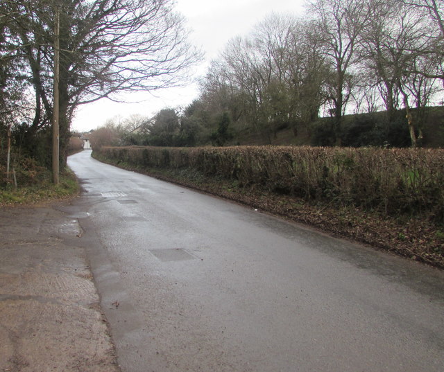
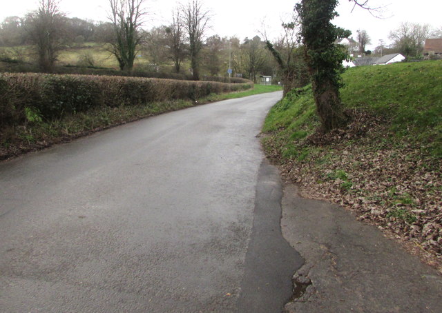
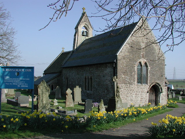
Coed y Mynydd Images

Images are sourced within 2km of 51.604147/-2.8168208 or Grid Reference ST4389. Thanks to Geograph Open Source API. All images are credited.

The Rock and Fountain Inn, Penhow Beside the A48.
The Rock and Fountain Inn, Penhow
Beside the A48.
The track to Castle Farm
The house on the hill A 17th century house on the site of Penhow Castle
<span class="nowrap"><a title="http://map.coflein.gov.uk/index.php?action=do_details&numlink=221292" rel="nofollow ugc noopener" href="http://map.coflein.gov.uk/index.php?action=do_details&numlink=221292">Link</a><img style="margin-left:2px;" alt="External link" title="External link - shift click to open in new window" src="https://s1.geograph.org.uk/img/external.png" width="10" height="10"/></span>
The house on the hill
A 17th century house on the site of Penhow Castle LinkExternal link
A natural moat l land below Penhow Castle the natural plain and its little stream forms a natural barrier
A natural moat
l land below Penhow Castle the natural plain and its little stream forms a natural barrier
Field at Penhow
Field at Penhow
Row of trees
Row of trees
Quarry wall A curious ring wall left around a quarry, and then breached.
Quarry wall
A curious ring wall left around a quarry, and then breached.
Disused Quarry Another view of <a href="https://www.geograph.org.uk/photo/5703090">ST4291 : Quarry wall</a>
Disused Quarry
Another view of ST4291 : Quarry wall
Quarry entrance a series of stern warnings
Quarry entrance
a series of stern warnings
The A48 The A48 runs 119 miles from Gloucester to Carmarthen across South Wales. <span class="nowrap"><a title="http://www.sabre-roads.org.uk/wiki/index.php?title=A48" rel="nofollow ugc noopener" href="http://www.sabre-roads.org.uk/wiki/index.php?title=A48">Link</a><img style="margin-left:2px;" alt="External link" title="External link - shift click to open in new window" src="https://s1.geograph.org.uk/img/external.png" width="10" height="10"/></span>
The A48
The A48 runs 119 miles from Gloucester to Carmarthen across South Wales. LinkExternal link
A48 The A48 runs 119 miles from Gloucester to Carmarthen across South Wales. <span class="nowrap"><a title="http://www.sabre-roads.org.uk/wiki/index.php?title=A48" rel="nofollow ugc noopener" href="http://www.sabre-roads.org.uk/wiki/index.php?title=A48">Link</a><img style="margin-left:2px;" alt="External link" title="External link - shift click to open in new window" src="https://s1.geograph.org.uk/img/external.png" width="10" height="10"/></span>
A48
The A48 runs 119 miles from Gloucester to Carmarthen across South Wales. LinkExternal link
Barn at the Rock and Fountain Inn This is an ancient monument, a 17th century barn and stable
<span class="nowrap"><a title="http://map.coflein.gov.uk/index.php?action=do_details&numlink=43361" rel="nofollow ugc noopener" href="http://map.coflein.gov.uk/index.php?action=do_details&numlink=43361">Link</a><img style="margin-left:2px;" alt="External link" title="External link - shift click to open in new window" src="https://s1.geograph.org.uk/img/external.png" width="10" height="10"/></span>
Barn at the Rock and Fountain Inn
This is an ancient monument, a 17th century barn and stable LinkExternal link
Penhow Castle Grade II* Listed Penhow was developed from a heavily-built keep and was the first castle with a stone keep to be built in Britain by the conquering Normans in 1070 and has claims to be the oldest inhabited castle in Wales. Less than a century after the keep tower was built the larger area of the inner bailey was enclosed within a thick stone curtain wall. By the 14th century Penhow was quite a stronghold. The drawbridge was operated by counterweights of stone rediscovered in 1979. Above the lower hall, the Great Hall achieved its present shape in the late 1480s. The Lewis family converted Penhow from an old-fashioned castle to a modern house shortly after 1674. Thomas Lewis' son Thomas was High Sheriff of the county. Stephen Weeks bought the Norman stronghold in 1973 and rebuilt the ruins into an award-winning attraction that opened to the public in 1978. Penhow Castle was sold to a London businessman and closed to the public on 29th December 2002. The important thing about the house is that it was home to the famous Seymour family which eventually produced a King and Queen of England in Jane Seymour and Edward VI.
Penhow Castle
Grade II* Listed Penhow was developed from a heavily-built keep and was the first castle with a stone keep to be built in Britain by the conquering Normans in 1070 and has claims to be the oldest inhabited castle in Wales. Less than a century after the keep tower was built the larger area of the inner bailey was enclosed within a thick stone curtain wall. By the 14th century Penhow was quite a stronghold. The drawbridge was operated by counterweights of stone rediscovered in 1979. Above the lower hall, the Great Hall achieved its present shape in the late 1480s. The Lewis family converted Penhow from an old-fashioned castle to a modern house shortly after 1674. Thomas Lewis' son Thomas was High Sheriff of the county. Stephen Weeks bought the Norman stronghold in 1973 and rebuilt the ruins into an award-winning attraction that opened to the public in 1978. Penhow Castle was sold to a London businessman and closed to the public on 29th December 2002. The important thing about the house is that it was home to the famous Seymour family which eventually produced a King and Queen of England in Jane Seymour and Edward VI.
St John's church, Penhow
St John's church, Penhow - interior
Perfect Doggy Daycare & Grooming Centre, Llanvaches Set back from Pike Road, viewed in January 2019. Penhow Film Studio <a title="https://www.geograph.org.uk/photo/3935768" href="https://www.geograph.org.uk/photo/3935768">Link</a> was here in 2012.
Perfect Doggy Daycare & Grooming Centre, Llanvaches
Set back from Pike Road, viewed in January 2019. Penhow Film Studio Link was here in 2012.
Pike Road, Llanvaches Looking to the northeast along Pike Road towards Old Turnpike Cottages. <a title="https://www.geograph.org.uk/photo/3782406" href="https://www.geograph.org.uk/photo/3782406">Link</a>
Pike Road, Llanvaches
Looking to the northeast along Pike Road towards Old Turnpike Cottages. Link
Pike Road towards the A48, Llanvaches Ahead for the Rock & Fountain and Penhow.
Pike Road towards the A48, Llanvaches
Ahead for the Rock & Fountain and Penhow.
Show me another place!

Coed y Mynydd is located at Grid Ref: ST4389 (Lat: 51.604147, Lng: -2.8168208)

Unitary Authority: Monmouthshire

Police Authority: Gwent

What 3 Words

///really.concerts.illogical. Near Llanvaches, Newport

Related Wikis

St. Brides Netherwent

St. Brides Netherwent (Welsh: Sant-y-brid) is a parish and largely deserted village in Monmouthshire, south-east Wales. It is centred 2 miles north of...

Penhow Woodlands National Nature Reserve

Penhow Woodlands National Nature Reserve is a national nature reserve and Site of Special Scientific Interest located in south east Wales near the village...

Penhow Castle

Penhow Castle, Penhow, Newport dates from the early 12th century. Extended and reconstructed in almost every century since, it has been claimed to be the...

Penhow

Penhow (Welsh: Pen-hŵ) is a small village and community (parish) just inside the eastern edge of the boundary of the city of Newport, South Wales, within...

Llanvaches

Llanvaches or Llanfaches is a village and community parish within the boundaries of the city of Newport, Wales. It lies to the east of the urban area...
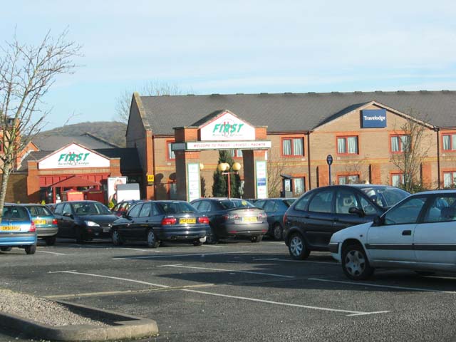
Magor services

Magor services (in Welsh: Gwasanaethau Magwyr) is a motorway service station on the M4, located just off junction 23A, at Magor near Newport, in Monmouthshire...

Undy

Undy (Welsh: Gwndy) is a village in Monmouthshire, south east Wales, adjoining the village of Magor with which it forms the community and parish of Magor...

St Michael and All Angels Church, Llanfihangel Rogiet

St Michael and All Angels Church, Llanfihangel Rogiet, is a redundant church in the hamlet of Llanfihangel Rogiet near the village of Rogiet, Monmouthshire...

Have you been to Coed y Mynydd?

Leave your review of Coed y Mynydd below (or comments, questions and feedback).