Mousetter

Coastal Marsh, Saltings in Orkney

Scotland

Mousetter

Copinsay: sunset over the lighthouse Looking across to the silhouetted lighthouse on the isle of Copinsay from the Aberdeen-Kirkwall-Lerwick ferry. It is four minutes to ten.
Copinsay: sunset over the lighthouse Credit: Chris Downer

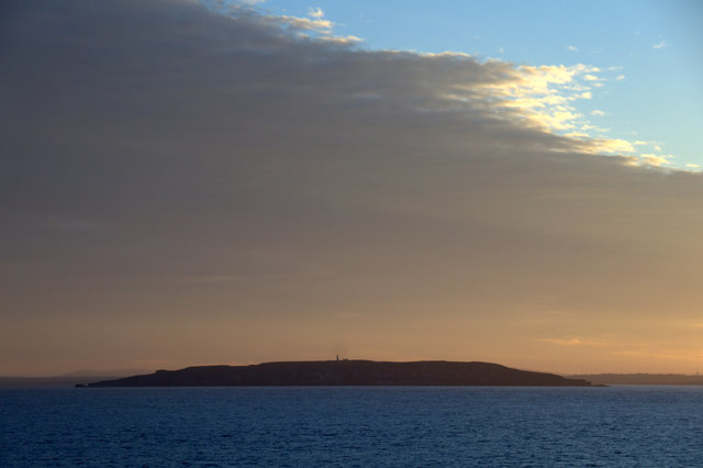
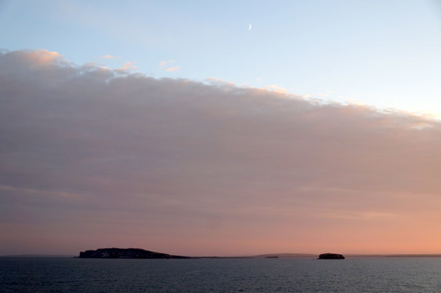
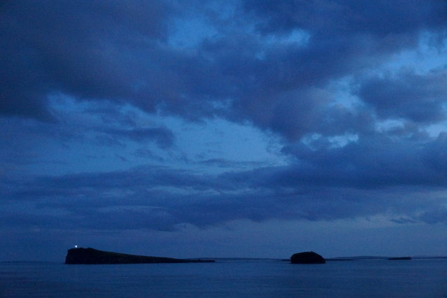
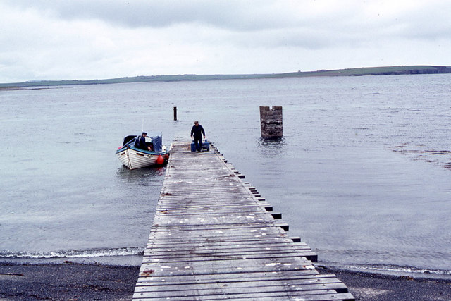
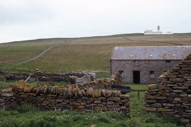
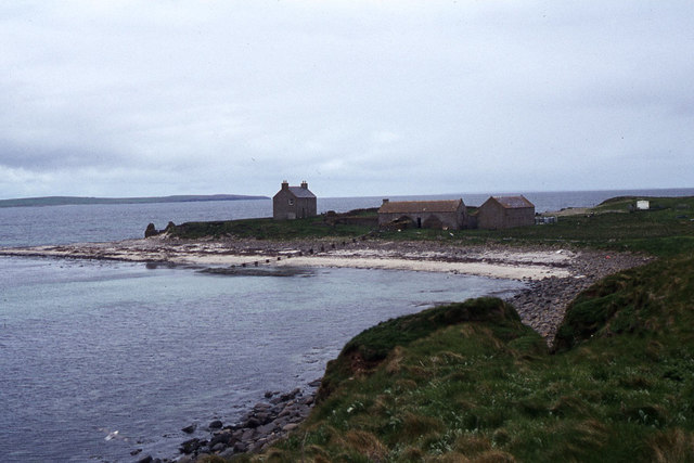
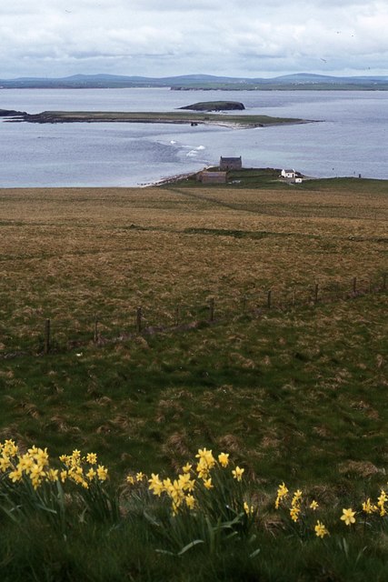
Mousetter, Orkney, is a coastal marshland located in the Orkney Islands, which are part of Scotland. It is situated on the western coast of Mainland, the largest island in the archipelago. The marshland stretches along the coastline, encompassing a diverse range of habitats, including salt marshes and saltings.

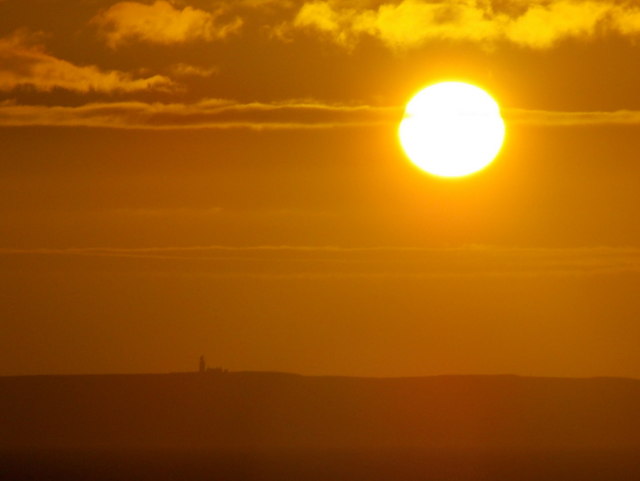
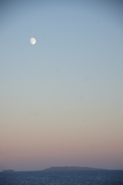
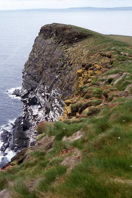
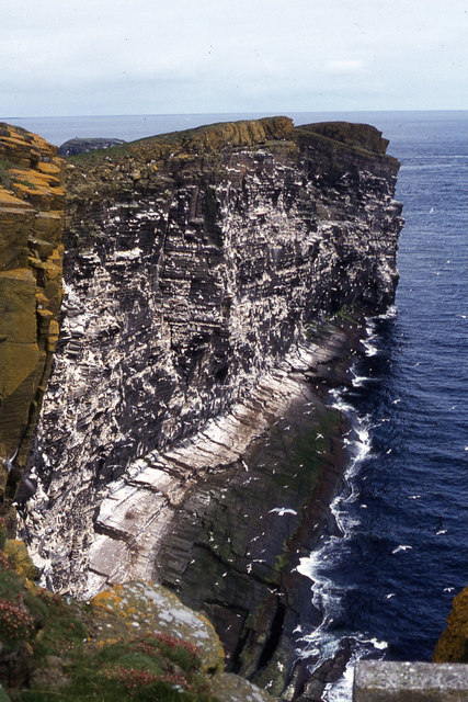
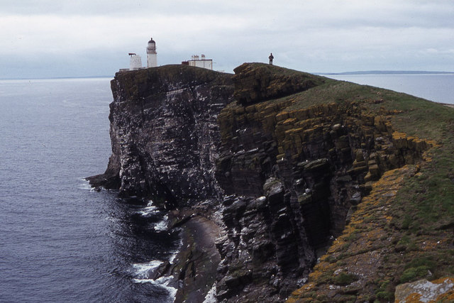
Mousetter is characterized by its unique ecological features and scenic beauty. The area is influenced by the dynamic interplay between land and sea, resulting in a rich and varied ecosystem. The marshes are subject to tidal influences, with the ebb and flow of the sea shaping the landscape and creating a mosaic of salt-tolerant vegetation.

The salt marshes of Mousetter are home to a wide array of plant species, adapted to the challenging conditions of high salt content and periodic flooding. Grasses, sedges, and herbs are common, providing a vital habitat for various bird species and invertebrates. The area serves as an important feeding and nesting ground for migratory birds, such as curlews, oystercatchers, and dunlins.

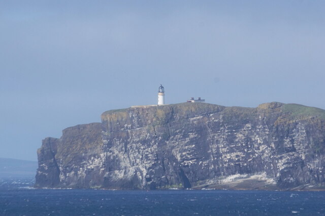
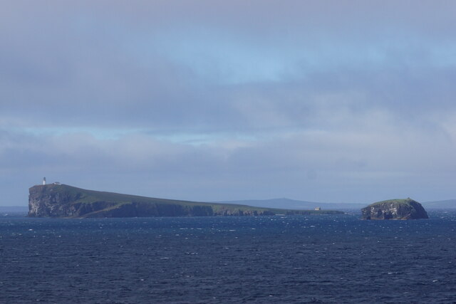
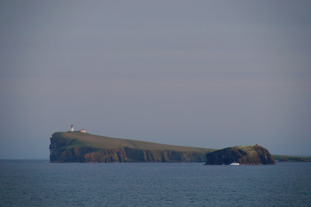
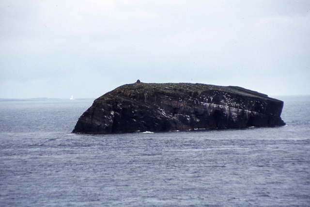
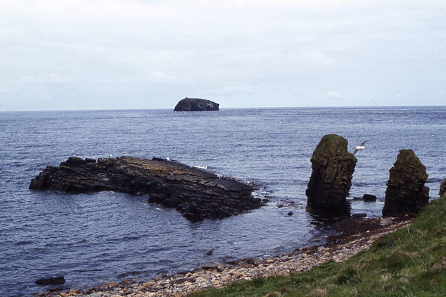
Visitors to Mousetter can explore the marshland through a network of footpaths and observation points. The area offers stunning views of the rugged coastline, with its cliffs and rocky outcrops. The intertidal zone is teeming with marine life, including crabs, mollusks, and small fish, making it a popular spot for coastal exploration and birdwatching.

Mousetter, Orkney, is not only a place of natural beauty but also an important ecological site, contributing to the biodiversity of the region and providing valuable ecosystem services. Its preservation and conservation efforts are crucial for the continued existence of these unique coastal habitats.

If you have any feedback on the listing, please let us know in the comments section below.

Mousetter Images

Images are sourced within 2km of 58.895716/-2.6725787 or Grid Reference HY6101. Thanks to Geograph Open Source API. All images are credited.

Copinsay: sunset over the lighthouse Looking across to the silhouetted lighthouse on the isle of Copinsay from the Aberdeen-Kirkwall-Lerwick ferry. It is four minutes to ten.
Copinsay: sunset over the lighthouse
Looking across to the silhouetted lighthouse on the isle of Copinsay from the Aberdeen-Kirkwall-Lerwick ferry. It is four minutes to ten.
Moon over Copinsay Horse of Copinsay on the left, with the lighthouse just visible on the island. Taken from the ferry from Shetland, somewhere around HY6014.
Moon over Copinsay
Horse of Copinsay on the left, with the lighthouse just visible on the island. Taken from the ferry from Shetland, somewhere around HY6014.
Lighthouse on Copinsay
Copinsay and the Horse of Copinsay
Copinsay from the east Taken from the Aberdeen-Orkney-Shetland ferry 2-3 km to the east.
Copinsay from the east
Taken from the Aberdeen-Orkney-Shetland ferry 2-3 km to the east.
Copinsay and the Horse of Copinsay from the east Taken from the Aberdeen-Orkney-Shetland ferry 2-3 km to the east.
Copinsay and the Horse of Copinsay from the east
Taken from the Aberdeen-Orkney-Shetland ferry 2-3 km to the east.
Horse of Copinsay and Copinsay from the north-east Taken from the Aberdeen-Orkney-Shetland ferry several km to the NE.
Horse of Copinsay and Copinsay from the north-east
Taken from the Aberdeen-Orkney-Shetland ferry several km to the NE.
Copinsay and the Horse of Copinsay at dusk Taken from the Aberdeen-Orkney-Shetland ferry a few kilometres to the NE.
Copinsay and the Horse of Copinsay at dusk
Taken from the Aberdeen-Orkney-Shetland ferry a few kilometres to the NE.
Landing jetty on Copinsay
Copinsay - Island farm and road up to lighthouse
Copinsay - Island farm and associated buildings
Copinsay - southeast facing cliffs near lighthouse
Copinsay - rough grazing on slope west of lighthouse
Copinsay - The lighthouse
Copinsay - cliffs northeast of lighthouse
Copinsay - view southwest along cliffs to lighthouse
The Horse of Copinsay from North View, Copinsay
Copinsay - rock stacks at Sandgeo Taing
Show me another place!

Mousetter is located at Grid Ref: HY6101 (Lat: 58.895716, Lng: -2.6725787)

Unitary Authority: Orkney Islands

Police Authority: Highlands and Islands

What 3 Words

///radiated.photocopy.trappings. Near Deerness, Orkney Islands

Related Wikis

Copinsay

Copinsay (Old Norse: Kolbeinsey) is one of the Orkney Islands in Scotland, lying off the east coast of the Orkney Mainland. The smaller companion island...

Corn Holm

Corn Holm is a small tidal island in Orkney, near Copinsay to the west, off the north-eastern coast of Scotland. There was once a small chapel there, and...

Horse of Copinsay

The Horse of Copinsay, also known as the Horse, is a rectangular uninhabited sea stack to the north east of Copinsay in the Orkney Islands, Scotland....

Black Holm

Black Holm is a small tidal island in the Orkney Islands, near Copinsay to the west of Corn Holm off the north-eastern coast of Scotland. == Geography... ==

Point of Ayre, Orkney

There are also two similarly named points in the British Isles: Point of Ayre, Isle of Man and Point of Ayr, Wales.Point of Ayre is a headland in the parish...

The Gloup

The Gloup () is a collapsed sea cave in the Mull Head Nature Reserve in the islands of Orkney, Scotland. The name derives from the Old Norse "gluppa",...

Deerness

Deerness (, locally , Old Norse: Dyrnes) is a quoad sacra parish (i.e. one created and functioning for ecclesiastical purposes only) and peninsula in Mainland...

St Peter's Pool, Orkney

St Peter's Pool is a bay in the East Mainland of Orkney, Scotland. This bay was the site of significant coastal defences during World War II, when a German...

Nearby Amenities

Located within 500m of 58.895716,-2.6725787
Created By: almien_coastlines mod
Lat/Long: 58.896968/-2.680921
Created By: almien_coastlines mod
Lat/Long: 58.895671/-2.673761
Created By: almien_coastlines mod
Lat/Long: 58.895541/-2.673268
Created By: almien_coastlines mod
Lat/Long: 58.894776/-2.674264
Created By: almien_coastlines mod
Lat/Long: 58.898982/-2.6673
Created By: almien_coastlines mod
Lat/Long: 58.898346/-2.669284
Created By: almien_coastlines mod
Lat/Long: 58.893888/-2.67724
Created By: almien_coastlines mod
Lat/Long: 58.894903/-2.674016
Created By: almien_coastlines mod
Lat/Long: 58.893247/-2.677246
Created By: almien_coastlines mod
Lat/Long: 58.893375/-2.676998
Created By: almien_coastlines mod
Lat/Long: 58.894522/-2.675255
Created By: almien_coastlines mod
Lat/Long: 58.895794/-2.672276
Created By: almien_coastlines mod
Lat/Long: 58.897709/-2.670033
Created By: almien_coastlines mod
Lat/Long: 58.896177/-2.671532
Created By: almien_coastlines mod
Lat/Long: 58.897197/-2.670038
Created By: almien_coastlines mod
Lat/Long: 58.8962/-2.680928
Created By: almien_coastlines mod
Lat/Long: 58.894013/-2.676249
Created By: almien_coastlines mod
Lat/Long: 58.893631/-2.676996
Created By: almien_coastlines mod
Lat/Long: 58.89554/-2.672773
Created By: almien_coastlines mod
Lat/Long: 58.89643/-2.670292
Created By: almien_coastlines mod
Lat/Long: 58.892739/-2.678734
Created By: almien_coastlines mod
Lat/Long: 58.898856/-2.66829
Created By: almien_coastlines mod
Lat/Long: 58.892994/-2.678237
Copinsay Lighthouse
Man Made: lighthouse
Seamark Light Character: Fl
Seamark Light Colour: white
Seamark Light Group: 5
Seamark Light Height: 79
Seamark Light Period: 30
Seamark Light Range: 21
Seamark Light Reference: A 3676
Seamark Light Sequence: 0.7+(2.5)+0.7+(2.5)+0.7+(2.5)+0.7+(2.5)+0.7+(16.5)
Seamark Name: Copinsay
Seamark Type: light_major
Wikidata: Q17828593
Lat/Long: 58.8964102/-2.6720538
The data included in this document is from www.openstreetmap.org. The data is made available under ODbL.

Have you been to Mousetter?

Leave your review of Mousetter below (or comments, questions and feedback).