Guzzle Down

Downs, Moorland in Devon

England

Guzzle Down

Daffodils near Brixham After a cold winter, the daffodils are bursting into bloom.
Daffodils near Brixham Credit: Tom Jolliffe

Guzzle Down, Devon, also known as Downs or Moorland, is an expansive area located in the county of Devon, England. Covering an area of approximately 100 square miles, it is renowned for its picturesque landscapes, diverse wildlife, and rich cultural heritage.

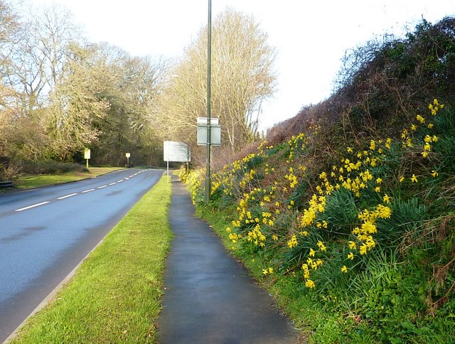
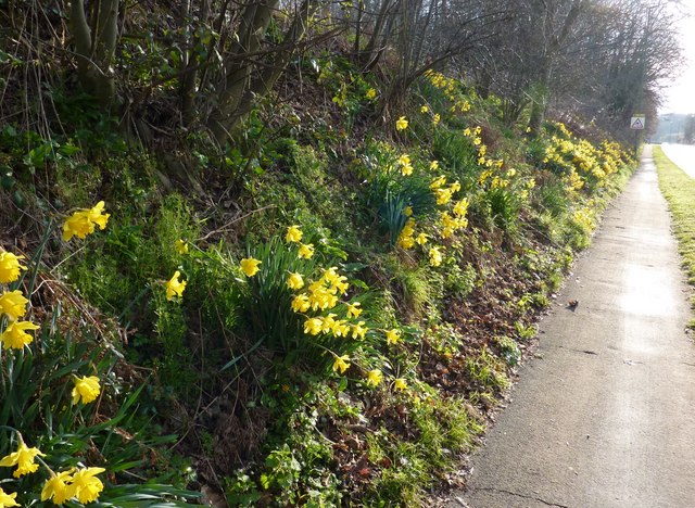
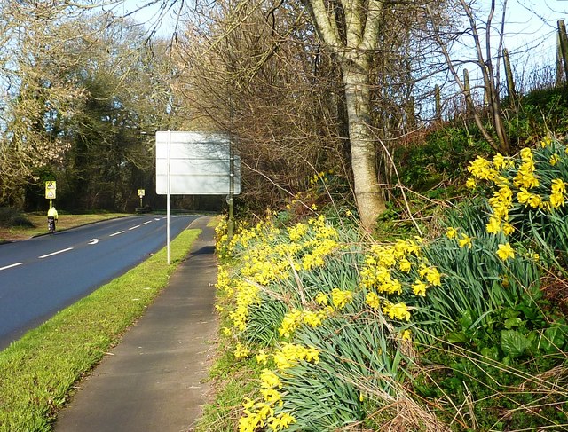
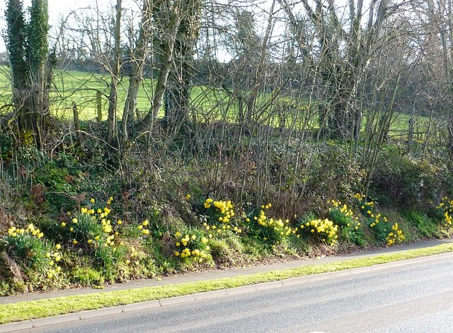
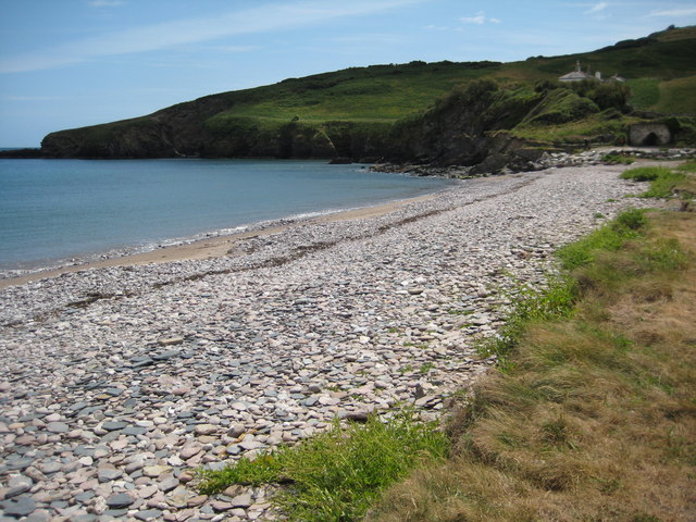
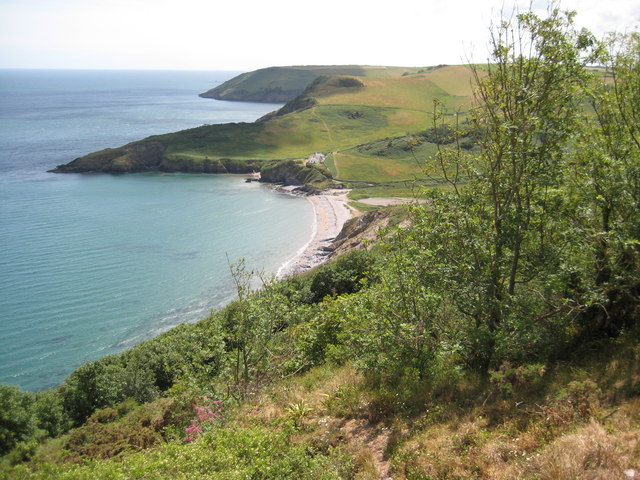
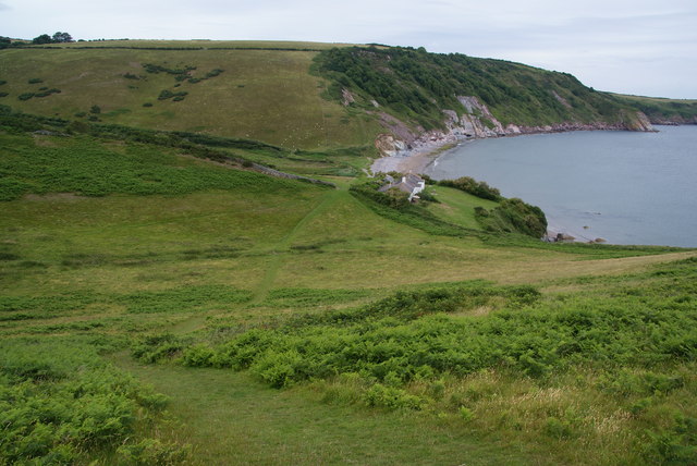
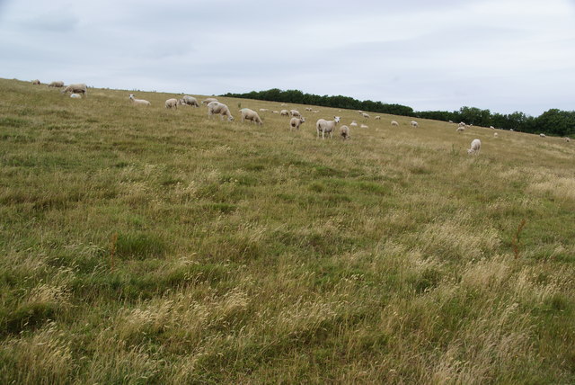
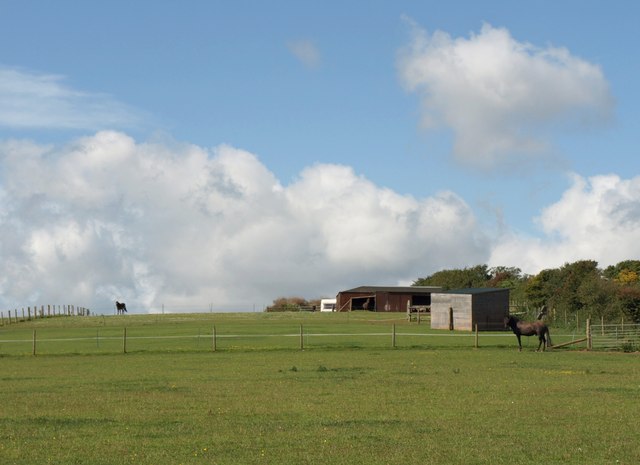
The terrain of Guzzle Down is characterized by rolling hills, wide open spaces, and vast moorland, providing visitors with breathtaking views and ample opportunities for outdoor activities such as hiking, cycling, and horse riding. The area is also home to a number of rivers, streams, and ponds, adding to its scenic beauty.

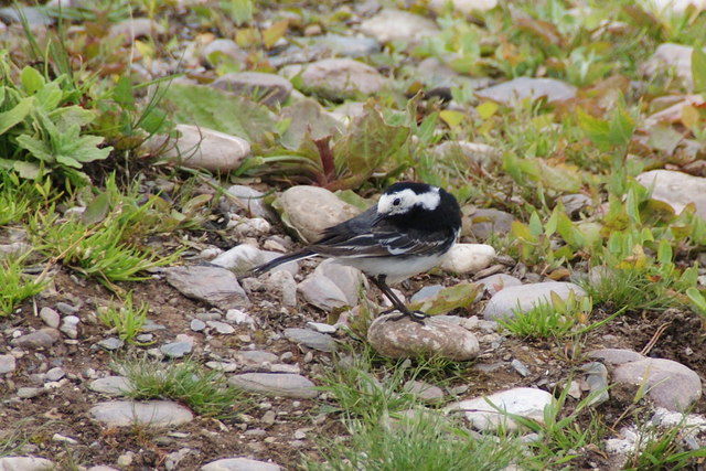
The moorland of Guzzle Down is particularly famous for its unique flora and fauna. It is home to a variety of plant species, including heather, gorse, and bilberry, which create a vibrant tapestry of colors throughout the year. Additionally, the area supports a thriving population of wildlife, including red deer, ponies, and a wide range of bird species such as skylarks and buzzards.

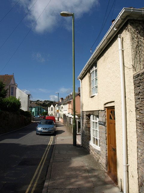
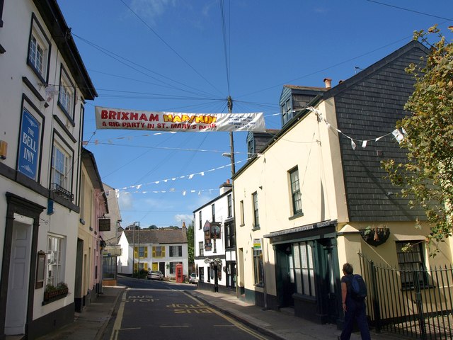
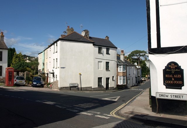
Guzzle Down has a rich cultural history, with evidence of human habitation dating back thousands of years. There are numerous prehistoric sites, ancient monuments, and burial mounds scattered across the landscape, providing insight into the region's past. The area also boasts several quaint villages and historic towns, where visitors can explore local traditions, architecture, and enjoy traditional Devonshire cuisine.

Overall, Guzzle Down, Devon, offers a unique blend of natural beauty, biodiversity, and cultural heritage, making it a popular destination for nature enthusiasts, history buffs, and those seeking a peaceful retreat in the heart of Devon.

If you have any feedback on the listing, please let us know in the comments section below.
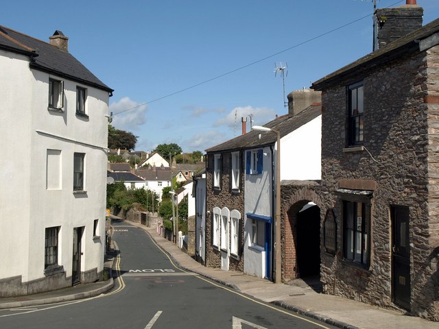
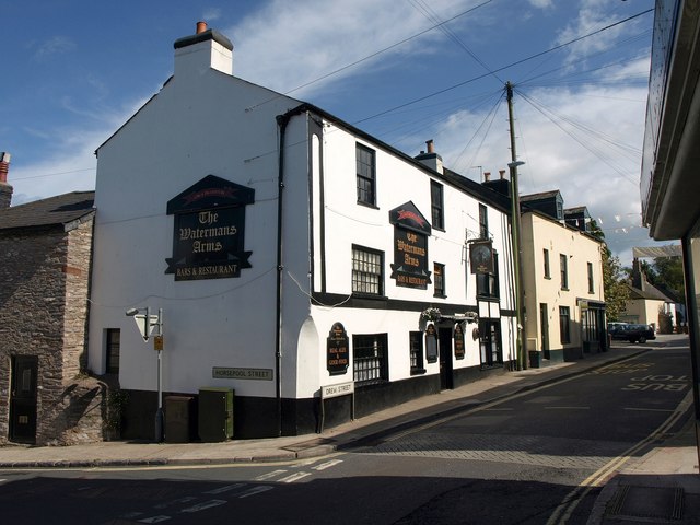
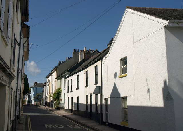
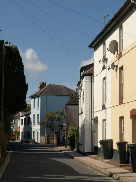
Guzzle Down Images

Images are sourced within 2km of 50.377028/-3.5422174 or Grid Reference SX9054. Thanks to Geograph Open Source API. All images are credited.

Daffodils near Brixham After a cold winter, the daffodils are bursting into bloom.
Daffodils near Brixham
After a cold winter, the daffodils are bursting into bloom.
Daffodils near Brixham Taken at the roadside on the way into Brixham opposite Lupton House entrance.
Daffodils near Brixham
Taken at the roadside on the way into Brixham opposite Lupton House entrance.
Daffodils near Brixham Daffodils rising up the bank on the way out of Brixham near Strawberry Bends are a cheering sight for the pedestrian or the cyclist on the shared footpath.
Daffodils near Brixham
Daffodils rising up the bank on the way out of Brixham near Strawberry Bends are a cheering sight for the pedestrian or the cyclist on the shared footpath.
Daffodils near Brixham It is encouraging to see this part of a bank on the way into Brixham near Lupton House entrance covered in daffodils as the rest of the year it is just grass and shrubby hedgerow.
Daffodils near Brixham
It is encouraging to see this part of a bank on the way into Brixham near Lupton House entrance covered in daffodils as the rest of the year it is just grass and shrubby hedgerow.
Man Sands Man Sands with Crabrock Point in the background.
Man Sands
Man Sands with Crabrock Point in the background.
View over Man Sands View over Man Sands to Crabrock Point and Scabbacombe Head.
View over Man Sands
View over Man Sands to Crabrock Point and Scabbacombe Head.
A pied wagtail? On the beach near the freshwater pond at Man Sands.
A pied wagtail?
On the beach near the freshwater pond at Man Sands.
Approaching Man Sands from the south
Sheep on Southdown Cliff These were grazing happily above the coastal path.
Sheep on Southdown Cliff
These were grazing happily above the coastal path.
Drew Street, Brixham The street approaching "Cowtown", the upper part of old Brixham.
Drew Street, Brixham
The street approaching "Cowtown", the upper part of old Brixham.
Cowtown, Brixham The last stretch of Drew Street. The telephone box is on the corner of Horsepool Street and is in <a href="https://www.geograph.org.uk/gridref/SX9255">SX9255</a>. Milton Street continues ahead, slightly to the left. The banner advertises "Brixham Hapinin: a big party".
Cowtown, Brixham
The last stretch of Drew Street. The telephone box is on the corner of Horsepool Street and is in SX9255. Milton Street continues ahead, slightly to the left. The banner advertises "Brixham Hapinin: a big party".
St Mary's Square, Brixham The junction visible in <a href="https://www.geograph.org.uk/photo/2591842">SX9255 : Cowtown, Brixham</a> and also shown in <a href="https://www.geograph.org.uk/photo/1754090">SX9155 : St Marys Square, Higher Brixham</a> and the very similar <a href="https://www.geograph.org.uk/photo/366820">SX9155 : Horsepool Street, Higher Brixham</a>; Horsepool Street runs down to the right (see <a href="https://www.geograph.org.uk/photo/2591898">SX9155 : Horsepool Street, Brixham</a>). The pub on the right is the Waterman's Arms. The telephone kiosk is listed  <span class="nowrap"><a title="http://www.britishlistedbuildings.co.uk/en-383722-k6-telephone-kiosk-in-centre-of-square-b" rel="nofollow ugc noopener" href="http://www.britishlistedbuildings.co.uk/en-383722-k6-telephone-kiosk-in-centre-of-square-b">Link</a><img style="margin-left:2px;" alt="External link" title="External link - shift click to open in new window" src="https://s1.geograph.org.uk/img/external.png" width="10" height="10"/></span> , as is the central terrace running away along the side of the square <span class="nowrap"><a title="http://www.britishlistedbuildings.co.uk/en-383721-1-5-brixham" rel="nofollow ugc noopener" href="http://www.britishlistedbuildings.co.uk/en-383721-1-5-brixham">Link</a><img style="margin-left:2px;" alt="External link" title="External link - shift click to open in new window" src="https://s1.geograph.org.uk/img/external.png" width="10" height="10"/></span> . This is at the heart of "Cowtown".
St Mary's Square, Brixham
The junction visible in SX9255 : Cowtown, Brixham and also shown in SX9155 : St Marys Square, Higher Brixham and the very similar SX9155 : Horsepool Street, Higher Brixham; Horsepool Street runs down to the right (see SX9155 : Horsepool Street, Brixham). The pub on the right is the Waterman's Arms. The telephone kiosk is listed LinkExternal link , as is the central terrace running away along the side of the square LinkExternal link . This is at the heart of "Cowtown".
Horsepool Street, Brixham Taken a few yards left of <a href="https://www.geograph.org.uk/photo/2591870">SX9155 : St Mary's Square, Brixham</a>, and looking down the street to the right. On the left is the end terrace of <span class="nowrap"><a title="http://www.britishlistedbuildings.co.uk/en-383721-1-5-brixham" rel="nofollow ugc noopener" href="http://www.britishlistedbuildings.co.uk/en-383721-1-5-brixham">Link</a><img style="margin-left:2px;" alt="External link" title="External link - shift click to open in new window" src="https://s1.geograph.org.uk/img/external.png" width="10" height="10"/></span> .
Horsepool Street, Brixham
Taken a few yards left of SX9155 : St Mary's Square, Brixham, and looking down the street to the right. On the left is the end terrace of LinkExternal link .
Waterman's Arms, Brixham The corner of the pub appears in <a href="https://www.geograph.org.uk/photo/2591870">SX9155 : St Mary's Square, Brixham</a>. The building dates from the C17 <span class="nowrap"><a title="http://www.britishlistedbuildings.co.uk/en-383606-watermans-arms-public-house-105-brixham" rel="nofollow ugc noopener" href="http://www.britishlistedbuildings.co.uk/en-383606-watermans-arms-public-house-105-brixham">Link</a><img style="margin-left:2px;" alt="External link" title="External link - shift click to open in new window" src="https://s1.geograph.org.uk/img/external.png" width="10" height="10"/></span> .
Waterman's Arms, Brixham
The corner of the pub appears in SX9155 : St Mary's Square, Brixham. The building dates from the C17 LinkExternal link .
Milton Street, Brixham From the junction shown in <a href="https://www.geograph.org.uk/photo/2591870">SX9155 : St Mary's Square, Brixham</a>; this is the road to the left, leading towards Kingswear. Several houses here are listed; the lower-roofed houses in the centre, for instance, are "early C19, probably a 
remodelling of a C17 or C18 structure" <span class="nowrap"><a title="http://www.britishlistedbuildings.co.uk/en-383662-1-and-3-brixham" rel="nofollow ugc noopener" href="http://www.britishlistedbuildings.co.uk/en-383662-1-and-3-brixham">Link</a><img style="margin-left:2px;" alt="External link" title="External link - shift click to open in new window" src="https://s1.geograph.org.uk/img/external.png" width="10" height="10"/></span> .
Milton Street, Brixham
From the junction shown in SX9155 : St Mary's Square, Brixham; this is the road to the left, leading towards Kingswear. Several houses here are listed; the lower-roofed houses in the centre, for instance, are "early C19, probably a remodelling of a C17 or C18 structure" LinkExternal link .
Milton Street, Brixham These buildings can be made out on the left of <a href="https://www.geograph.org.uk/photo/2591945">SX9155 : Milton Street, Brixham</a>. The three-storey blue house is described at <span class="nowrap"><a title="http://www.britishlistedbuildings.co.uk/en-383669-21-brixham" rel="nofollow ugc noopener" href="http://www.britishlistedbuildings.co.uk/en-383669-21-brixham">Link</a><img style="margin-left:2px;" alt="External link" title="External link - shift click to open in new window" src="https://s1.geograph.org.uk/img/external.png" width="10" height="10"/></span> ; for the terrace on the immediate right, see <span class="nowrap"><a title="http://www.britishlistedbuildings.co.uk/en-383664-9-15-brixham" rel="nofollow ugc noopener" href="http://www.britishlistedbuildings.co.uk/en-383664-9-15-brixham">Link</a><img style="margin-left:2px;" alt="External link" title="External link - shift click to open in new window" src="https://s1.geograph.org.uk/img/external.png" width="10" height="10"/></span> .
Milton Street, Brixham
These buildings can be made out on the left of SX9155 : Milton Street, Brixham. The three-storey blue house is described at LinkExternal link ; for the terrace on the immediate right, see LinkExternal link .
Former manor house, Brixham The former town manor house of the Gillards, dating from the C16, now divided into three dwellings <span class="nowrap"><a title="http://www.britishlistedbuildings.co.uk/en-383667-friars-pardon-black-house-black-friars-h" rel="nofollow ugc noopener" href="http://www.britishlistedbuildings.co.uk/en-383667-friars-pardon-black-house-black-friars-h">Link</a><img style="margin-left:2px;" alt="External link" title="External link - shift click to open in new window" src="https://s1.geograph.org.uk/img/external.png" width="10" height="10"/></span> .
Former manor house, Brixham
The former town manor house of the Gillards, dating from the C16, now divided into three dwellings LinkExternal link .
Field on Southdown Hill Livestock at large on a hilltop field beside Southdown Road.
Field on Southdown Hill
Livestock at large on a hilltop field beside Southdown Road.
Show me another place!

Guzzle Down is located at Grid Ref: SX9054 (Lat: 50.377028, Lng: -3.5422174)

Unitary Authority: Torbay

Police Authority: Devon and Cornwall

What 3 Words

///trimmer.bluffing.titles. Near Brixham, Devon

Related Wikis

Lupton, Brixham

Lupton is an historic manor in the parish of Brixham, Devon. The surviving manor house known as Lupton House, is a Palladian Country house built by Charles...

Greenway Camp

Greenway Camp (also called Noss) is an Iron Age hill fort in the parish of Kingswear close to Dartmouth in Devon, England. The fort is situated on the...

Churston Court

Churston Court is the manor house of the former manor of Churston Ferrers (anciently Cercetone (Domesday Book, 1086), Churecheton (Book of Fees, 13th c...

Churston railway station

Churston railway station is on the Dartmouth Steam Railway, a heritage railway in Torbay, Devon, England. It is situated beside the main road to Brixham...

Churston Ferrers Grammar School

Churston Ferrers Grammar School (also known as CFGS) is a selective coeducational Grammar School with Academy status, situated in the village of Galmpton...

Greenway Halt railway station (Devon)

Greenway Halt railway station is a small railway station on the Dartmouth Steam Railway, a heritage railway in Devon, England. It is situated near the...

Galmpton, Torbay

Galmpton is a semi-rural village in Torbay, in the ceremonial county of Devon, England. It is located in the ward of Churston-with-Galmpton and the historic...

Brixham Heritage Museum

Brixham Heritage Museum, also known as Brixham Museum is a museum in the town of Brixham, Devon, England. == Exhibitions == There are exhibitions to the...

Nearby Amenities

Located within 500m of 50.377028,-3.5422174
Bus Stop
Bus: yes
Public Transport: platform
Route Ref: 22;24
Lat/Long: 50.3760609/-3.5365944
Barrier: cycle_barrier
Lat/Long: 50.3736348/-3.5417211
Hillhead
Is In: Devon, England, UK
Place: hamlet
Lat/Long: 50.3732346/-3.5417208
Post Box
Brand: Royal Mail
Brand Wikidata: Q638098
Brand Wikipedia: en:Royal Mail
Collection Times: Mo-Fr 17:00; Sa 07:45; Su off
Operator: Royal Mail
Operator Wikidata: Q638098
Post Box Design: type_b
Post Box Mounting: brick_pillar
Post Box Type: wall
Postal Code: TQ5
Ref: TQ5 155
Royal Cypher: EIIR
Royal Cypher Wikidata: Q33102113
Source: survey;streetlevel imagery;aerial imagery
Lat/Long: 50.3746619/-3.539286
Guzzle Down
Ele: 160
Natural: peak
Source: OS 1:25k
Lat/Long: 50.3772505/-3.5423267
Vodafone
Communication Mobile Phone: yes
Man Made: tower
Operator: Vodafone
Operator Wikidata: Q122141
Ref: 33122
Tower Type: communication
Lat/Long: 50.3776864/-3.5452822
Barrier: stile
Lat/Long: 50.3802481/-3.5408515
Man Made: reservoir_covered
Lat/Long: 50.375013/-3.5456563
Barrier: cycle_barrier
Lat/Long: 50.3735627/-3.5418066
Post Box
Brand: Royal Mail
Brand Wikidata: Q638098
Brand Wikipedia: en:Royal Mail
Collection Times: Mo-Fr 09:00; Sa 07:00; Su off
Operator: Royal Mail
Operator Wikidata: Q638098
Post Box Design: 2010_pattern
Post Box Mounting: pier
Post Box Type: lamp
Postal Code: TQ5
Ref: TQ5 249D
Royal Cypher: EIIR
Royal Cypher Wikidata: Q33102113
Source: survey;streetlevel imagery;aerial imagery
Lat/Long: 50.3741461/-3.5429263
Bus Stop
Brixham Cross
Bench: yes
Bin: no
Bus: yes
Lit: yes
Naptan AtcoCode: 1190TOA10027
Naptan Bearing: NE
Naptan CommonName: Brixham Cross
Naptan NaptanCode: tbydjmg
Naptan Street: Kingswear Road
Naptan Verified: yes
Public Transport: platform
Shelter: yes
Source: naptan_import;survey
Tactile Paving: no
Lat/Long: 50.3733714/-3.5440856
Bus Stop
Raddicombe Drive Hillhead
Bus: yes
Naptan AtcoCode: 1190TOA88875
Naptan Bearing: W
Naptan CommonName: Raddicombe Drive Hillhead
Naptan Crossing: Raddicombe Drive
Naptan NaptanCode: tbyjajd
Naptan Street: Kingswear Road
Naptan Verified: yes
Public Transport: platform
Source: naptan_import;survey
Lat/Long: 50.3753494/-3.5391928
Bus Stop
Raddicombe Drive
Bus: yes
Naptan AtcoCode: 1190TOA10026
Naptan Bearing: E
Naptan CommonName: Raddicombe Drive
Naptan Crossing: Raddicombe Drive
Naptan Indicator: Opp
Naptan NaptanCode: tbydmgt
Naptan ShortCommonName: Hillhead
Naptan Street: Kingswear Road
Naptan Verified: yes
Public Transport: platform
Source: naptan_import;survey
Lat/Long: 50.3754949/-3.5387007
Bus Stop
Brixham Cross
Bench: yes
Bus: yes
Lit: yes
Naptan AtcoCode: 1190TOA10027
Naptan Bearing: NE
Naptan CommonName: Brixham Cross
Naptan Indicator: NE-bound
Naptan NaptanCode: tbydjmg
Naptan PlusbusZoneRef: NABT
Naptan Street: Kingswear Road
Naptan Verified: no
Public Transport: platform
Shelter: yes
Tactile Paving: no
Lat/Long: 50.3739545/-3.544017
Generator Method: photovoltaic
Generator Output Electricity: yes
Generator Source: solar
Generator Type: solar_photovoltaic_panel
Location: roof
Power: generator
Lat/Long: 50.3728409/-3.5418042
Generator Method: photovoltaic
Generator Output Electricity: yes
Generator Source: solar
Generator Type: solar_photovoltaic_panel
Location: roof
Power: generator
Lat/Long: 50.372938/-3.5426753
Generator Method: photovoltaic
Generator Output Electricity: yes
Generator Source: solar
Generator Type: solar_photovoltaic_panel
Location: roof
Power: generator
Lat/Long: 50.373777/-3.5425917
Generator Method: photovoltaic
Generator Output Electricity: yes
Generator Source: solar
Generator Type: solar_photovoltaic_panel
Location: roof
Power: generator
Lat/Long: 50.3740479/-3.5428298
Generator Method: photovoltaic
Generator Output Electricity: yes
Generator Source: solar
Generator Type: solar_photovoltaic_panel
Location: roof
Power: generator
Lat/Long: 50.374297/-3.5416346
Generator Method: photovoltaic
Generator Output Electricity: yes
Generator Source: solar
Generator Type: solar_photovoltaic_panel
Location: roof
Power: generator
Lat/Long: 50.3739521/-3.5402667
Generator Method: photovoltaic
Generator Output Electricity: yes
Generator Source: solar
Generator Type: solar_photovoltaic_panel
Location: roof
Power: generator
Lat/Long: 50.3734923/-3.5384181
Generator Method: photovoltaic
Generator Output Electricity: yes
Generator Source: solar
Generator Type: solar_photovoltaic_panel
Location: roof
Power: generator
Lat/Long: 50.3747137/-3.5387389
Power: pole
Lat/Long: 50.3799396/-3.5385941
Power: pole
Lat/Long: 50.3798513/-3.5385707
Power: pole
Lat/Long: 50.3796712/-3.539384
Power: pole
Lat/Long: 50.3794694/-3.5402155
Power: pole
Lat/Long: 50.3791016/-3.5416612
Power: pole
Lat/Long: 50.3786877/-3.5433564
Power: pole
Lat/Long: 50.3778205/-3.5445204
Power: pole
Lat/Long: 50.3769327/-3.5456657
Power: pole
Lat/Long: 50.3765906/-3.5471571
Power: pole
Lat/Long: 50.3762537/-3.5485652
Telephone
Defibrillator
Booth: KX100
Covered: booth
Defibrillator Location: inside phone box on Raddicombe Drive, Hillhead, Kingswear
Emergency: defibrillator
Man Made: telephone_box
Lat/Long: 50.3749723/-3.5392001
Fire Hydrant
Emergency: fire_hydrant
Fire Hydrant Type: underground
Survey Date: 2022-04-15
Lat/Long: 50.3729876/-3.543744
Bench
Backrest: yes
Survey Date: 2022-04-15
Lat/Long: 50.3738879/-3.5442237
The data included in this document is from www.openstreetmap.org. The data is made available under ODbL.

Have you been to Guzzle Down?

Leave your review of Guzzle Down below (or comments, questions and feedback).