Windmill Copse

Wood, Forest in Devon

England

Windmill Copse

Fallen tree, Marridge Wood Impressively weathered, this is on the Greenway Walk.
Fallen tree, Marridge Wood Credit: Derek Harper

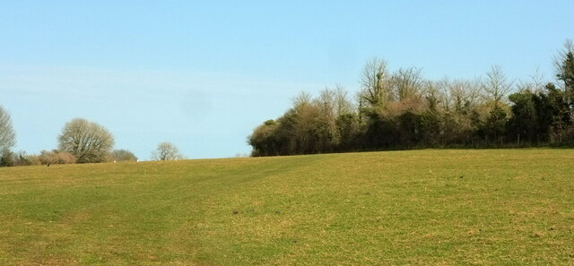
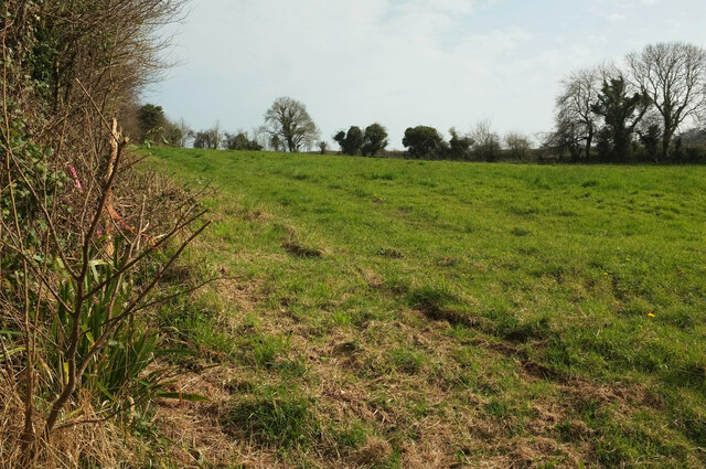
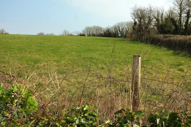
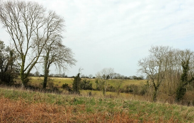
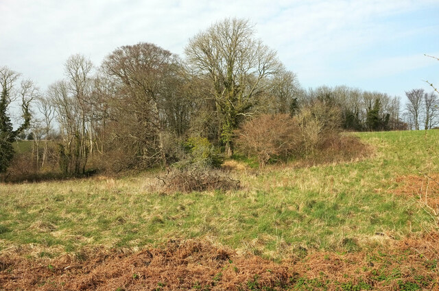
Windmill Copse is a picturesque wood located in the county of Devon, England. Nestled in the heart of the stunning countryside, this enchanting forest covers an area of approximately 50 acres. It is a popular destination for nature enthusiasts, hikers, and those seeking a peaceful retreat.

The copse gets its name from the ancient windmill that once stood on its grounds. While the windmill itself no longer remains, its presence is still felt through the gently swaying trees and the rustic charm of the surrounding landscape.

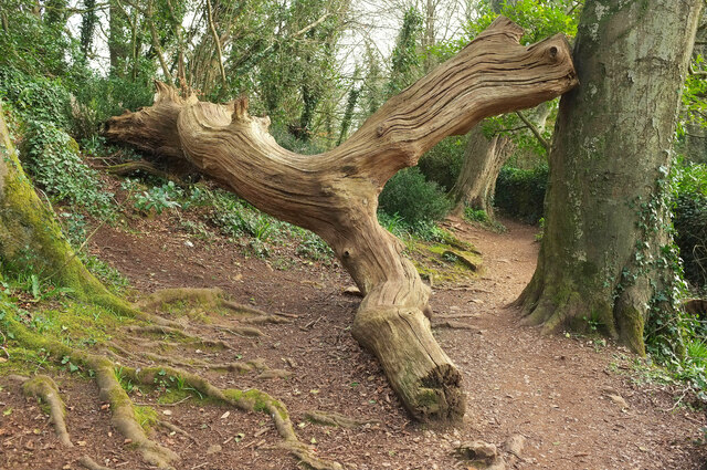
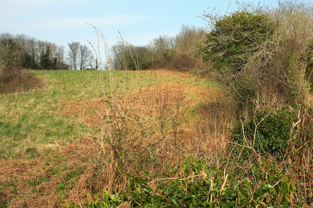
The woodland is predominantly made up of a mix of deciduous and coniferous trees, creating a diverse and vibrant habitat for a variety of flora and fauna. Visitors can expect to see majestic oak, beech, and ash trees, alongside fragrant pine and spruce. The forest floor is adorned with an array of wildflowers during the spring and summer months, adding bursts of color to the serene surroundings.

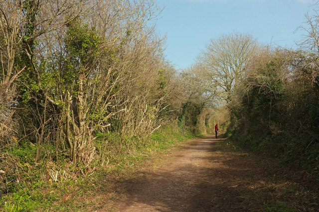
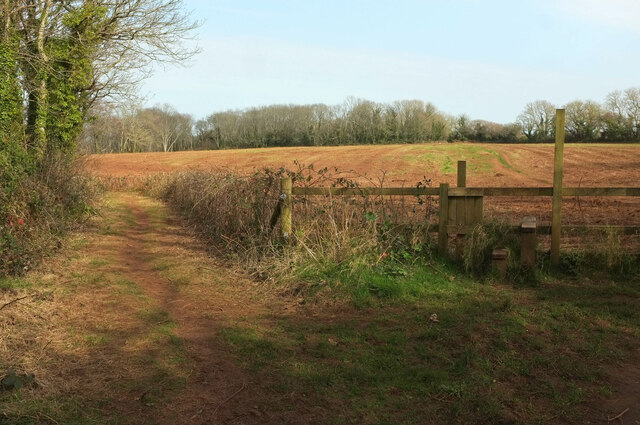
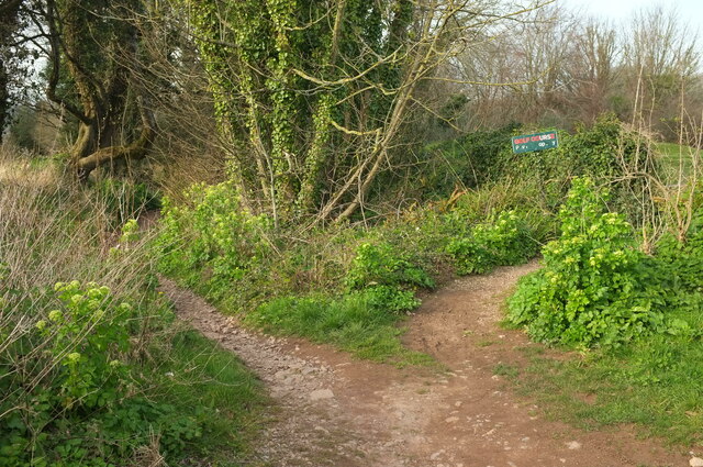
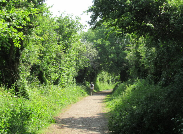
A network of well-maintained walking trails wind their way through Windmill Copse, allowing visitors to explore its beauty at their own pace. From leisurely strolls to more challenging hikes, there is a route to suit every level of fitness. Along the way, hikers may encounter small streams, charming footbridges, and occasional glimpses of wildlife such as deer, foxes, and a variety of bird species.

Windmill Copse is not only a haven for flora and fauna but also a place of tranquility and solace. The peaceful ambiance, combined with the natural beauty of the wood, makes it an ideal destination for those looking to escape the hustle and bustle of everyday life.

If you have any feedback on the listing, please let us know in the comments section below.

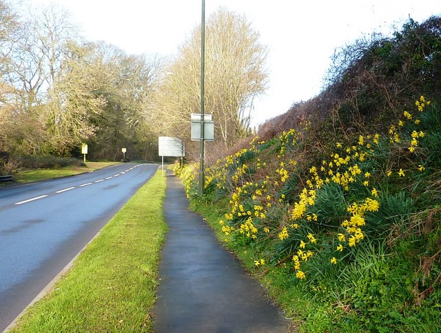
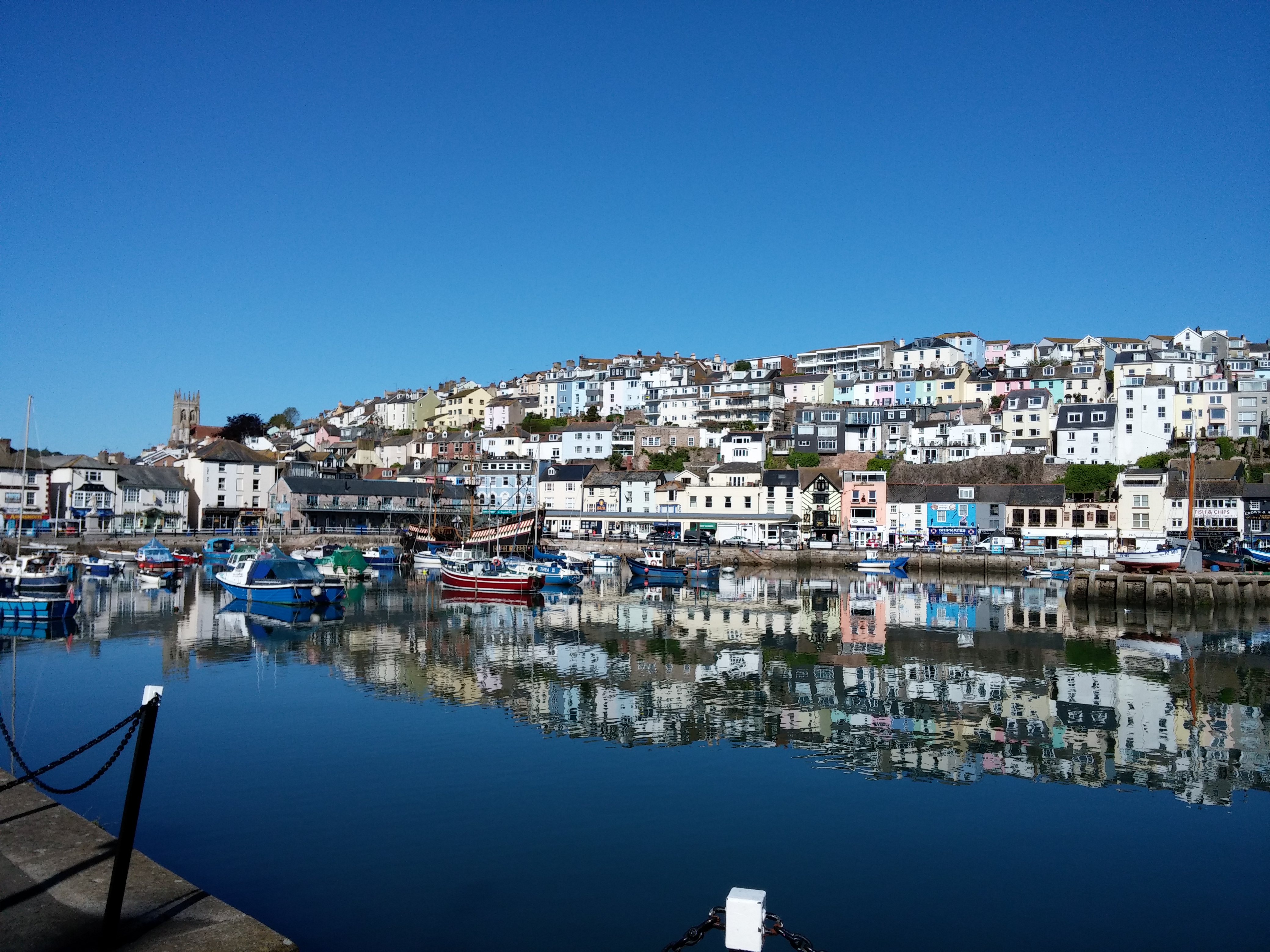
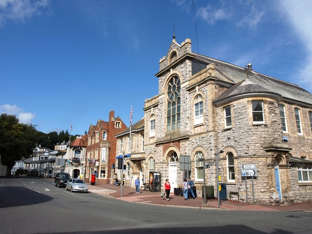
Windmill Copse Images

Images are sourced within 2km of 50.382605/-3.5400915 or Grid Reference SX9054. Thanks to Geograph Open Source API. All images are credited.

Fallen tree, Marridge Wood Impressively weathered, this is on the Greenway Walk.
Fallen tree, Marridge Wood
Impressively weathered, this is on the Greenway Walk.
Sheep, Churston From Bascombe Road, with Churston Court <span class="nowrap"><a title="https://historicengland.org.uk/listing/the-list/list-entry/1208761?section=official-list-entry" rel="nofollow ugc noopener" href="https://historicengland.org.uk/listing/the-list/list-entry/1208761?section=official-list-entry">Link</a><img style="margin-left:2px;" alt="External link" title="External link - shift click to open in new window" src="https://s1.geograph.org.uk/img/external.png" width="10" height="10"/></span> on this side of St Mary's church <span class="nowrap"><a title="https://historicengland.org.uk/listing/the-list/list-entry/1293060?section=official-list-entry" rel="nofollow ugc noopener" href="https://historicengland.org.uk/listing/the-list/list-entry/1293060?section=official-list-entry">Link</a><img style="margin-left:2px;" alt="External link" title="External link - shift click to open in new window" src="https://s1.geograph.org.uk/img/external.png" width="10" height="10"/></span> , both of which are grade II* listed.
Sheep, Churston
From Bascombe Road, with Churston Court LinkExternal link on this side of St Mary's church LinkExternal link , both of which are grade II* listed.
Field, Churston From a gateway at the junction of Church Road with Bascombe Road, and on the route of the:John Musgrave Heritage Trail. <a href="https://www.geograph.org.uk/photo/7130354">SX9056 : Field, Churston</a> and <a href="https://www.geograph.org.uk/photo/7130347">SX9056 : Field, Churston</a> look right from here.
Field, Churston
From a gateway at the junction of Church Road with Bascombe Road, and on the route of the:John Musgrave Heritage Trail. SX9056 : Field, Churston and SX9056 : Field, Churston look right from here.
Field, Churston Looking right from <a href="https://www.geograph.org.uk/photo/7130354">SX9056 : Field, Churston</a>. The hedge ahead borders the John Musgrave Heritage Trail as it follows a track to The Grove.
Field, Churston
Looking right from SX9056 : Field, Churston. The hedge ahead borders the John Musgrave Heritage Trail as it follows a track to The Grove.
Field, Churston A narrow rectangular field, 400 metres long but only 50 metres wide. This looks along much of its length from the gateway where <a href="https://www.geograph.org.uk/photo/7130339">SX9056 : Field, Churston</a> looks left and <a href="https://www.geograph.org.uk/photo/7130347">SX9056 : Field, Churston</a> looks right, so that the John Musgrave Heritage Trail continues behind the hedge on the right.
Field, Churston
A narrow rectangular field, 400 metres long but only 50 metres wide. This looks along much of its length from the gateway where SX9056 : Field, Churston looks left and SX9056 : Field, Churston looks right, so that the John Musgrave Heritage Trail continues behind the hedge on the right.
Junction, Churston The view behind the camera in <a href="https://www.geograph.org.uk/photo/7130354">SX9056 : Field, Churston</a>, [[[7130339]] and <a href="https://www.geograph.org.uk/photo/7130347">SX9056 : Field, Churston</a>. The  John Musgrave Heritage Trail arrives from the left and follows Bascombe Road around the left bend.
Junction, Churston
The view behind the camera in SX9056 : Field, Churston, [[[7130339]] and SX9056 : Field, Churston. The John Musgrave Heritage Trail arrives from the left and follows Bascombe Road around the left bend.
Field, Churston A view on the other side of the junction shown in <a href="https://www.geograph.org.uk/photo/7130476">SX9056 : Junction, Churston</a>. The trees on the far side are along the line of the dismantled Churston to Brixham railway line.
Field, Churston
A view on the other side of the junction shown in SX9056 : Junction, Churston. The trees on the far side are along the line of the dismantled Churston to Brixham railway line.
Field, Churston From the stile shown in <a href="https://www.geograph.org.uk/photo/6702948">SX9056 : Stone stile, Churston</a>. On the right is the hedge bordering Copythorne Road. The trees at the far end of the field are along the line of the dismantled Churston to Brixham railway line.
Field, Churston
From the stile shown in SX9056 : Stone stile, Churston. On the right is the hedge bordering Copythorne Road. The trees at the far end of the field are along the line of the dismantled Churston to Brixham railway line.
John Musgrave Heritage Trail near Churston Following footpath BX 56 towards The Grove.
John Musgrave Heritage Trail near Churston
Following footpath BX 56 towards The Grove.
Field and trees, Ball Copse Trees along the southern edge of the wood seen from the John Musgrave Heritage Trail.
Field and trees, Ball Copse
Trees along the southern edge of the wood seen from the John Musgrave Heritage Trail.
Field by Ball Copse As explained at <a href="https://www.geograph.org.uk/photo/991003">SX9156 : Ball Copse</a>, the field encompasses the southern extension of the wood seen here.
Field by Ball Copse
As explained at SX9156 : Ball Copse, the field encompasses the southern extension of the wood seen here.
Field by Ball Copse Looking right from <a href="https://www.geograph.org.uk/photo/7130591">SX9156 : Field by Ball Copse</a>, with overlap. The John Musgrave Heritage Trail continues behind the hedge on the right.
Field by Ball Copse
Looking right from SX9156 : Field by Ball Copse, with overlap. The John Musgrave Heritage Trail continues behind the hedge on the right.
Path junction by The Grove The John Musgrave Heritage Trail crosses the stile on the right and follows footpath BX 56 over the field beyond. A wide track continues on the left beside the top of the wood.
Path junction by The Grove
The John Musgrave Heritage Trail crosses the stile on the right and follows footpath BX 56 over the field beyond. A wide track continues on the left beside the top of the wood.
Paths, Churston Golf Club The left fork runs down to meet Elberry Lane. The right fork is probably intended for golfers only.
Paths, Churston Golf Club
The left fork runs down to meet Elberry Lane. The right fork is probably intended for golfers only.
Churston Golf Course Looking left from <a href="https://www.geograph.org.uk/photo/7131448">SX9056 : Paths, Churston Golf Club</a>.
Churston Golf Course
Brixham branch line railway bridge, Churston Ferrers
The John Musgrave Heritage Trail leaving Churston Ferrers
Daffodils near Brixham After a cold winter, the daffodils are bursting into bloom.
Daffodils near Brixham
After a cold winter, the daffodils are bursting into bloom.
Show me another place!

Windmill Copse is located at Grid Ref: SX9054 (Lat: 50.382605, Lng: -3.5400915)

Unitary Authority: Torbay

Police Authority: Devon and Cornwall

What 3 Words

///copes.pleaser.clogging. Near Brixham, Devon

Related Wikis

Lupton, Brixham

Lupton is an historic manor in the parish of Brixham, Devon. The surviving manor house known as Lupton House, is a Palladian Country house built by Charles...

Churston Court

Churston Court is the manor house of the former manor of Churston Ferrers (anciently Cercetone (Domesday Book, 1086), Churecheton (Book of Fees, 13th c...

Churston railway station

Churston railway station is on the Dartmouth Steam Railway, a heritage railway in Torbay, Devon, England. It is situated beside the main road to Brixham...

Churston Ferrers Grammar School

Churston Ferrers Grammar School (also known as CFGS) is a selective coeducational Grammar School with Academy status, situated in the village of Galmpton...

Greenway Camp

Greenway Camp (also called Noss) is an Iron Age hill fort in the parish of Kingswear close to Dartmouth in Devon, England. The fort is situated on the...

Brixham Heritage Museum

Brixham Heritage Museum, also known as Brixham Museum is a museum in the town of Brixham, Devon, England. == Exhibitions == There are exhibitions to the...

Brixham

Brixham is a coastal town and civil parish in the borough of Torbay in the county of Devon, in the south-west of England. As of the 2021 census, Brixham...

Brixham Town Hall

Brixham Town Hall is a municipal building in New Street, Brixham, Devon, England. The structure, which is the meeting place of Brixham Town Council, is...

Nearby Amenities

Located within 500m of 50.382605,-3.5400915
Post Box
Brand: Royal Mail
Brand Wikidata: Q638098
Brand Wikipedia: en:Royal Mail
Collection Times: Mo-Fr 17:00; Sa 11:45; Su off
Operator: Royal Mail
Operator Wikidata: Q638098
Post Box Mounting: pier
Post Box Type: lamp
Ref: TQ5 407D
Royal Cypher: EIIR
Royal Cypher Wikidata: Q33102113
Source: survey;streetlevel imagery;aerial imagery
Lat/Long: 50.3822742/-3.5355444
Barrier: stile
Lat/Long: 50.3833423/-3.5417366
Barrier: stile
Lat/Long: 50.3830006/-3.5421346
Barrier: stile
Lat/Long: 50.3834764/-3.5414049
Bus Stop
Bellever Tor Drive
Bus: yes
Naptan AtcoCode: 1190PLY38681
Naptan Bearing: SW
Naptan CommonName: Bellever Tor Drive
Naptan Crossing: Rippon Close
Naptan NaptanCode: tbydmwt
Naptan PlusbusZoneRef: NABT
Naptan Street: Bellever Tor Drive
Naptan Verified: no
Public Transport: platform
Source: naptan_import
Lat/Long: 50.3820517/-3.5356972
Bus Stop
Higher Brixham Primary School
Bus: yes
Naptan AtcoCode: 1190TOA10115
Naptan Bearing: SW
Naptan CommonName: Higher Brixham Primary School
Naptan Crossing: Rowan Way
Naptan NaptanCode: tbydpdj
Naptan PlusbusZoneRef: NABT
Naptan Street: Chestnut Drive
Naptan Verified: no
Public Transport: platform
Source: naptan_import
Lat/Long: 50.3809325/-3.5346343
Bus Stop
Chesnut Drive
Bus: yes
Naptan AtcoCode: 1190TOA56663
Naptan Bearing: E
Naptan CommonName: Chesnut Drive
Naptan Crossing: Rowan Way
Naptan NaptanCode: tbygwmd
Naptan PlusbusZoneRef: NABT
Naptan Street: Chestnut Drive
Naptan Verified: no
Public Transport: platform
Source: naptan_import
Lat/Long: 50.3807532/-3.5352755
Bus Stop
Chestnut Drive
Bus: yes
Naptan AtcoCode: 1190TOA88856
Naptan Bearing: W
Naptan CommonName: Chestnut Drive
Naptan Crossing: Yew Close
Naptan NaptanCode: tbygwtj
Naptan PlusbusZoneRef: NABT
Naptan Street: Chestnut Drive
Naptan Verified: no
Public Transport: platform
Source: naptan_import
Lat/Long: 50.3806689/-3.535526
Bus Stop
Bellever Tor Drive
Bus: yes
Naptan AtcoCode: 1190TOZ00833
Naptan Bearing: SW
Naptan CommonName: Bellever Tor Drive
Naptan Crossing: Rippon Close
Naptan NaptanCode: tbydmwp
Naptan PlusbusZoneRef: NABT
Naptan Street: Bellever Tor Drive
Naptan Verified: no
Public Transport: platform
Source: naptan_import
Lat/Long: 50.3822914/-3.5354997
Bus Stop
Chesnut Drive
Bus: yes
Naptan AtcoCode: 1190TOZ00866
Naptan Bearing: E
Naptan CommonName: Chesnut Drive
Naptan Crossing: Packhall Lane
Naptan NaptanCode: tbydpgj
Naptan PlusbusZoneRef: NABT
Naptan Street: Chestnut Drive
Naptan Verified: no
Public Transport: platform
Source: naptan_import
Lat/Long: 50.3814853/-3.5336393
Barrier: stile
Lat/Long: 50.3860785/-3.5418081
Barrier: stile
Lat/Long: 50.3837348/-3.546761
Barrier: stile
Lat/Long: 50.3802481/-3.5408515
Barrier: stile
Lat/Long: 50.3832527/-3.5418233
Barrier: stile
Lat/Long: 50.3844582/-3.5415218
Barrier: stile
Lat/Long: 50.3850612/-3.5416041
Natural: peak
Source: OS 1:25k
Lat/Long: 50.3828978/-3.5401011
Generator Method: photovoltaic
Generator Output Electricity: yes
Generator Source: solar
Generator Type: solar_photovoltaic_panel
Location: roof
Power: generator
Lat/Long: 50.3815713/-3.5394343
Generator Method: photovoltaic
Generator Output Electricity: yes
Generator Source: solar
Generator Type: solar_photovoltaic_panel
Location: roof
Power: generator
Lat/Long: 50.3821932/-3.5387087
Generator Method: photovoltaic
Generator Output Electricity: yes
Generator Source: solar
Generator Type: solar_photovoltaic_panel
Location: roof
Power: generator
Lat/Long: 50.3807511/-3.5367015
Generator Method: photovoltaic
Generator Output Electricity: yes
Generator Source: solar
Generator Type: solar_photovoltaic_panel
Location: roof
Power: generator
Lat/Long: 50.381786/-3.5347286
Generator Method: photovoltaic
Generator Output Electricity: yes
Generator Source: solar
Generator Type: solar_photovoltaic_panel
Location: roof
Power: generator
Lat/Long: 50.3819998/-3.5351471
Generator Method: photovoltaic
Generator Output Electricity: yes
Generator Source: solar
Generator Type: solar_photovoltaic_panel
Location: roof
Power: generator
Lat/Long: 50.382896/-3.5364452
Generator Method: photovoltaic
Generator Output Electricity: yes
Generator Source: solar
Generator Type: solar_photovoltaic_panel
Location: roof
Power: generator
Lat/Long: 50.3801689/-3.5343585
Generator Method: photovoltaic
Generator Output Electricity: yes
Generator Source: solar
Generator Type: solar_photovoltaic_panel
Location: roof
Power: generator
Lat/Long: 50.3801449/-3.5344054
Generator Method: photovoltaic
Generator Output Electricity: yes
Generator Source: solar
Generator Type: solar_photovoltaic_panel
Location: roof
Power: generator
Lat/Long: 50.384213/-3.5336504
Generator Method: photovoltaic
Generator Output Electricity: yes
Generator Source: solar
Generator Type: solar_photovoltaic_panel
Location: roof
Power: generator
Lat/Long: 50.3839855/-3.533468
Generator Method: photovoltaic
Generator Output Electricity: yes
Generator Source: solar
Generator Type: solar_photovoltaic_panel
Location: roof
Power: generator
Lat/Long: 50.3839872/-3.5336826
Power: pole
Lat/Long: 50.3799396/-3.5385941
Power: pole
Lat/Long: 50.3798513/-3.5385707
Power: pole
Lat/Long: 50.3796712/-3.539384
Power: pole
Lat/Long: 50.3794694/-3.5402155
Power: pole
Lat/Long: 50.3791016/-3.5416612
Power: pole
Lat/Long: 50.3786877/-3.5433564
The data included in this document is from www.openstreetmap.org. The data is made available under ODbL.

Have you been to Windmill Copse?

Leave your review of Windmill Copse below (or comments, questions and feedback).