Coronation Plantation

Wood, Forest in Devon

England

Coronation Plantation

Fallen tree, Marridge Wood Impressively weathered, this is on the Greenway Walk.
Fallen tree, Marridge Wood Credit: Derek Harper

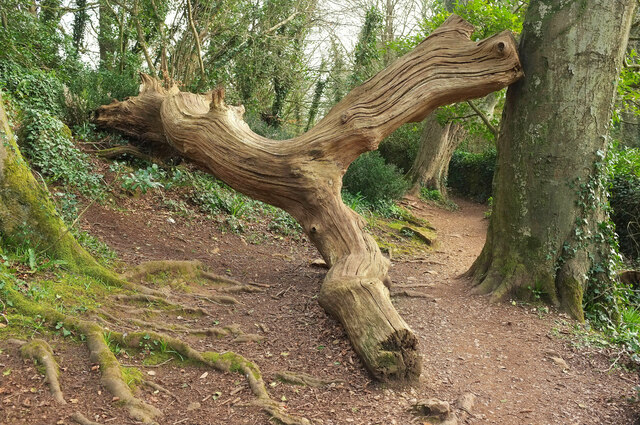
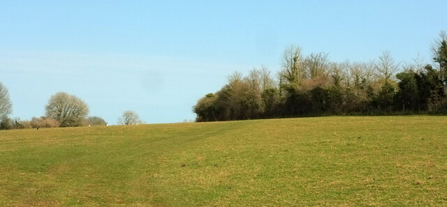
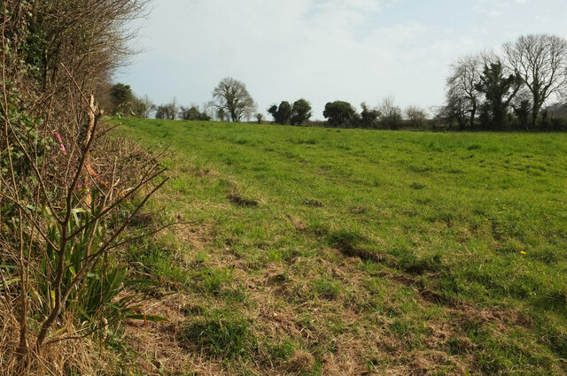
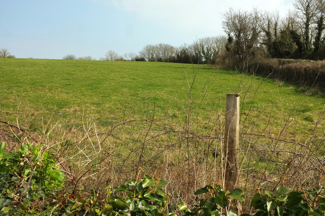
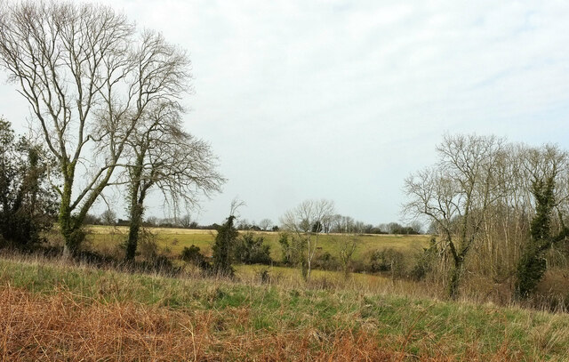
Coronation Plantation is a picturesque woodland located in Devon, England. Situated in the heart of the county, this enchanting forest covers an area of approximately 50 hectares. It is a popular destination for nature enthusiasts and outdoor adventurers alike, offering a serene escape from the hustle and bustle of everyday life.

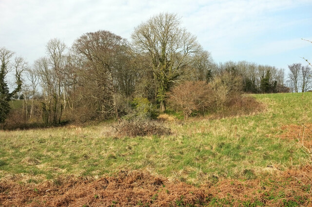
The plantation is predominantly composed of a mix of native tree species, including oak, beech, and birch, creating a diverse and vibrant ecosystem. The dense canopy provides shelter for a wide variety of wildlife, making it an ideal haven for birdwatchers and animal lovers. Visitors can expect to spot woodland creatures such as deer, foxes, and a plethora of bird species as they explore the trails that wind through the forest.

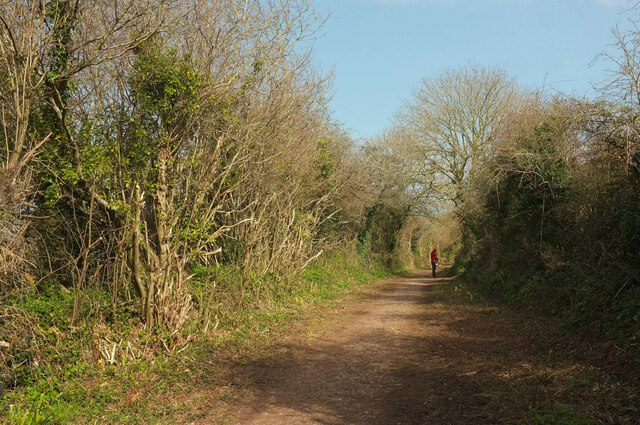
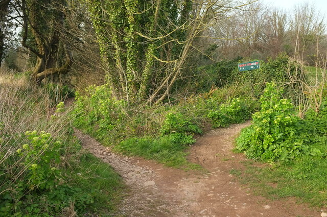
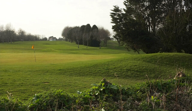
The well-maintained paths throughout Coronation Plantation make it accessible to visitors of all ages and abilities. There are several walking and cycling routes to choose from, ranging from leisurely strolls to more challenging hikes. Along the way, visitors can admire the stunning scenery, which includes rolling hills, babbling brooks, and vibrant wildflowers that adorn the forest floor.

For those seeking a peaceful retreat, there are designated picnic areas scattered throughout the plantation, providing the perfect spot to relax and enjoy a packed lunch amidst nature's splendor. Additionally, the plantation offers a small visitor center where guests can learn more about the local flora and fauna, as well as pick up maps and guides to ensure a memorable and informative visit.

Overall, Coronation Plantation in Devon is a captivating woodland that offers a tranquil escape for nature lovers, boasting breathtaking scenery, abundant wildlife, and a range of recreational activities.

If you have any feedback on the listing, please let us know in the comments section below.

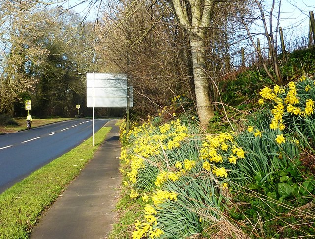
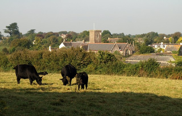
Coronation Plantation Images

Images are sourced within 2km of 50.382257/-3.5473663 or Grid Reference SX9054. Thanks to Geograph Open Source API. All images are credited.
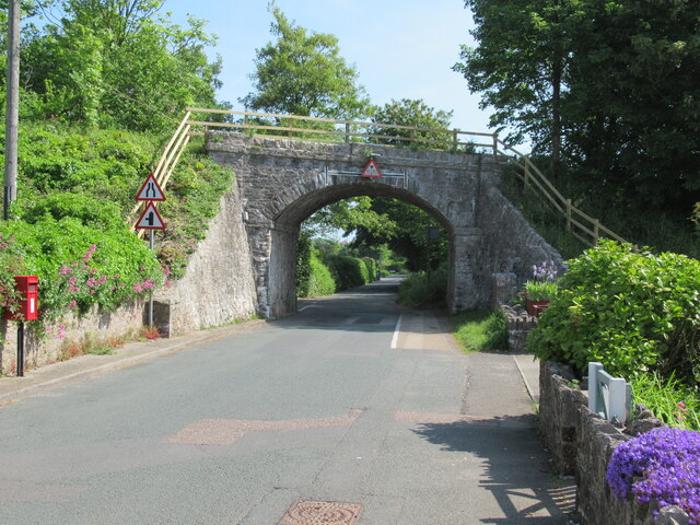
Fallen tree, Marridge Wood Impressively weathered, this is on the Greenway Walk.
Fallen tree, Marridge Wood
Impressively weathered, this is on the Greenway Walk.
Sheep, Churston From Bascombe Road, with Churston Court <span class="nowrap"><a title="https://historicengland.org.uk/listing/the-list/list-entry/1208761?section=official-list-entry" rel="nofollow ugc noopener" href="https://historicengland.org.uk/listing/the-list/list-entry/1208761?section=official-list-entry">Link</a><img style="margin-left:2px;" alt="External link" title="External link - shift click to open in new window" src="https://s1.geograph.org.uk/img/external.png" width="10" height="10"/></span> on this side of St Mary's church <span class="nowrap"><a title="https://historicengland.org.uk/listing/the-list/list-entry/1293060?section=official-list-entry" rel="nofollow ugc noopener" href="https://historicengland.org.uk/listing/the-list/list-entry/1293060?section=official-list-entry">Link</a><img style="margin-left:2px;" alt="External link" title="External link - shift click to open in new window" src="https://s1.geograph.org.uk/img/external.png" width="10" height="10"/></span> , both of which are grade II* listed.
Sheep, Churston
From Bascombe Road, with Churston Court LinkExternal link on this side of St Mary's church LinkExternal link , both of which are grade II* listed.
Field, Churston From a gateway at the junction of Church Road with Bascombe Road, and on the route of the:John Musgrave Heritage Trail. <a href="https://www.geograph.org.uk/photo/7130354">SX9056 : Field, Churston</a> and <a href="https://www.geograph.org.uk/photo/7130347">SX9056 : Field, Churston</a> look right from here.
Field, Churston
From a gateway at the junction of Church Road with Bascombe Road, and on the route of the:John Musgrave Heritage Trail. SX9056 : Field, Churston and SX9056 : Field, Churston look right from here.
Field, Churston Looking right from <a href="https://www.geograph.org.uk/photo/7130354">SX9056 : Field, Churston</a>. The hedge ahead borders the John Musgrave Heritage Trail as it follows a track to The Grove.
Field, Churston
Looking right from SX9056 : Field, Churston. The hedge ahead borders the John Musgrave Heritage Trail as it follows a track to The Grove.
Field, Churston A narrow rectangular field, 400 metres long but only 50 metres wide. This looks along much of its length from the gateway where <a href="https://www.geograph.org.uk/photo/7130339">SX9056 : Field, Churston</a> looks left and <a href="https://www.geograph.org.uk/photo/7130347">SX9056 : Field, Churston</a> looks right, so that the John Musgrave Heritage Trail continues behind the hedge on the right.
Field, Churston
A narrow rectangular field, 400 metres long but only 50 metres wide. This looks along much of its length from the gateway where SX9056 : Field, Churston looks left and SX9056 : Field, Churston looks right, so that the John Musgrave Heritage Trail continues behind the hedge on the right.
Junction, Churston The view behind the camera in <a href="https://www.geograph.org.uk/photo/7130354">SX9056 : Field, Churston</a>, [[[7130339]] and <a href="https://www.geograph.org.uk/photo/7130347">SX9056 : Field, Churston</a>. The  John Musgrave Heritage Trail arrives from the left and follows Bascombe Road around the left bend.
Junction, Churston
The view behind the camera in SX9056 : Field, Churston, [[[7130339]] and SX9056 : Field, Churston. The John Musgrave Heritage Trail arrives from the left and follows Bascombe Road around the left bend.
Field, Churston A view on the other side of the junction shown in <a href="https://www.geograph.org.uk/photo/7130476">SX9056 : Junction, Churston</a>. The trees on the far side are along the line of the dismantled Churston to Brixham railway line.
Field, Churston
A view on the other side of the junction shown in SX9056 : Junction, Churston. The trees on the far side are along the line of the dismantled Churston to Brixham railway line.
Field, Churston From the stile shown in <a href="https://www.geograph.org.uk/photo/6702948">SX9056 : Stone stile, Churston</a>. On the right is the hedge bordering Copythorne Road. The trees at the far end of the field are along the line of the dismantled Churston to Brixham railway line.
Field, Churston
From the stile shown in SX9056 : Stone stile, Churston. On the right is the hedge bordering Copythorne Road. The trees at the far end of the field are along the line of the dismantled Churston to Brixham railway line.
John Musgrave Heritage Trail near Churston Following footpath BX 56 towards The Grove.
John Musgrave Heritage Trail near Churston
Following footpath BX 56 towards The Grove.
Field and trees, Ball Copse Trees along the southern edge of the wood seen from the John Musgrave Heritage Trail.
Field and trees, Ball Copse
Trees along the southern edge of the wood seen from the John Musgrave Heritage Trail.
Field by Ball Copse As explained at <a href="https://www.geograph.org.uk/photo/991003">SX9156 : Ball Copse</a>, the field encompasses the southern extension of the wood seen here.
Field by Ball Copse
As explained at SX9156 : Ball Copse, the field encompasses the southern extension of the wood seen here.
Paths, Churston Golf Club The left fork runs down to meet Elberry Lane. The right fork is probably intended for golfers only.
Paths, Churston Golf Club
The left fork runs down to meet Elberry Lane. The right fork is probably intended for golfers only.
Churston Golf Course Looking left from <a href="https://www.geograph.org.uk/photo/7131448">SX9056 : Paths, Churston Golf Club</a>.
Churston Golf Course
Brixham branch line railway bridge, Churston Ferrers
The John Musgrave Heritage Trail leaving Churston Ferrers
Daffodils near Brixham After a cold winter, the daffodils are bursting into bloom.
Daffodils near Brixham
After a cold winter, the daffodils are bursting into bloom.
Daffodils near Brixham Taken at the roadside on the way into Brixham opposite Lupton House entrance.
Daffodils near Brixham
Taken at the roadside on the way into Brixham opposite Lupton House entrance.
Daffodils near Brixham Daffodils rising up the bank on the way out of Brixham near Strawberry Bends are a cheering sight for the pedestrian or the cyclist on the shared footpath.
Daffodils near Brixham
Daffodils rising up the bank on the way out of Brixham near Strawberry Bends are a cheering sight for the pedestrian or the cyclist on the shared footpath.
Show me another place!

Coronation Plantation is located at Grid Ref: SX9054 (Lat: 50.382257, Lng: -3.5473663)

Unitary Authority: Torbay

Police Authority: Devon and Cornwall

What 3 Words

///user.goodnight.measuring. Near Brixham, Devon

Related Wikis

Lupton, Brixham

Lupton is an historic manor in the parish of Brixham, Devon. The surviving manor house known as Lupton House, is a Palladian Country house built by Charles...

Greenway Camp

Greenway Camp (also called Noss) is an Iron Age hill fort in the parish of Kingswear close to Dartmouth in Devon, England. The fort is situated on the...

Churston railway station

Churston railway station is on the Dartmouth Steam Railway, a heritage railway in Torbay, Devon, England. It is situated beside the main road to Brixham...

Churston Ferrers Grammar School

Churston Ferrers Grammar School (also known as CFGS) is a selective coeducational Grammar School with Academy status, situated in the village of Galmpton...

Churston Court

Churston Court is the manor house of the former manor of Churston Ferrers (anciently Cercetone (Domesday Book, 1086), Churecheton (Book of Fees, 13th c...

Galmpton, Torbay

Galmpton is a semi-rural village in Torbay, in the ceremonial county of Devon, England. It is located in the ward of Churston-with-Galmpton and the historic...

Greenway Halt railway station (Devon)

Greenway Halt railway station is a small railway station on the Dartmouth Steam Railway, a heritage railway in Devon, England. It is situated near the...

Churston Ferrers

Churston Ferrers is an area and former civil parish, in the borough of Torbay, Devon, England, situated between the south coast towns of Paignton and Brixham...

Nearby Amenities

Located within 500m of 50.382257,-3.5473663
Barrier: stile
Lat/Long: 50.3833423/-3.5417366
Barrier: stile
Lat/Long: 50.3830006/-3.5421346
Barrier: stile
Lat/Long: 50.3834764/-3.5414049
Barrier: stile
Lat/Long: 50.3818171/-3.5535764
Barrier: stile
Lat/Long: 50.3837348/-3.546761
Barrier: stile
Lat/Long: 50.3832527/-3.5418233
Barrier: stile
Lat/Long: 50.3844582/-3.5415218
Power: pole
Lat/Long: 50.3786877/-3.5433564
The data included in this document is from www.openstreetmap.org. The data is made available under ODbL.

Have you been to Coronation Plantation?

Leave your review of Coronation Plantation below (or comments, questions and feedback).