Bulmer Moss

Downs, Moorland in Lanarkshire

Scotland

Bulmer Moss

Looking down on the B7040 Taken from the track between the B7040 and the disused Leadhills and Wanlockhead railway.
Looking down on the B7040 Credit: Alistair Stewart

Bulmer Moss is a scenic area located in Lanarkshire, Scotland, known for its breathtaking downs and expansive moorland. Situated amidst picturesque surroundings, it offers a tranquil escape for nature enthusiasts and outdoor adventurers alike.

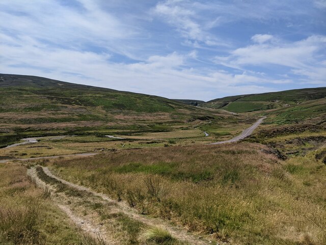
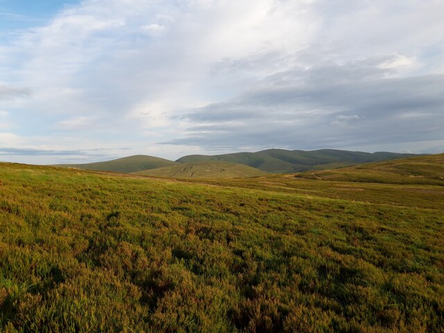
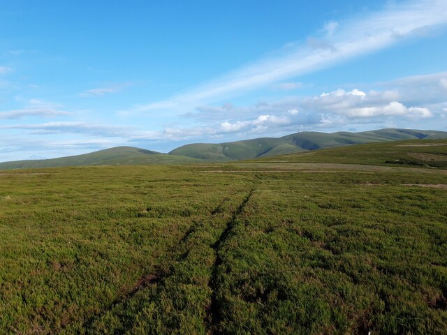
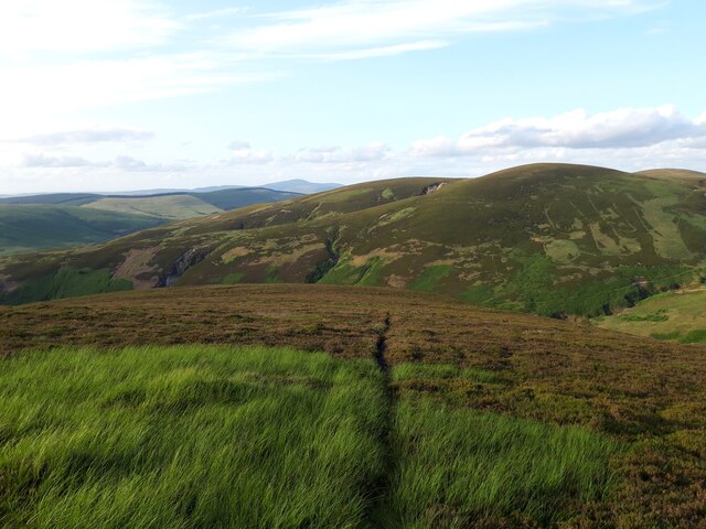
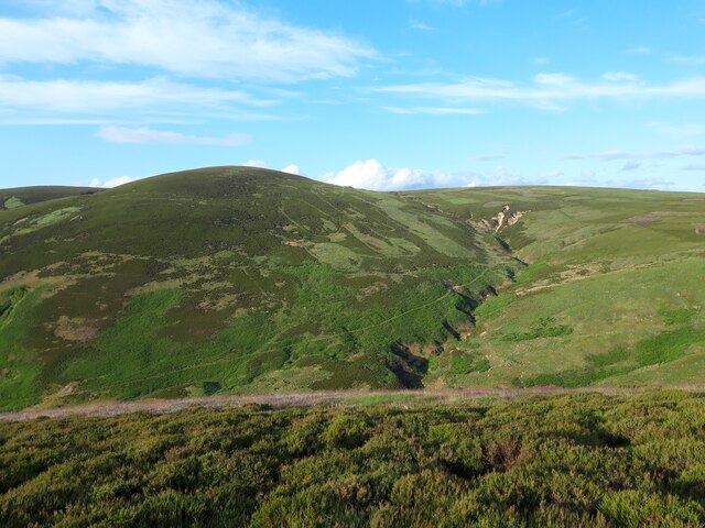
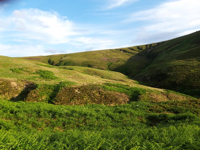
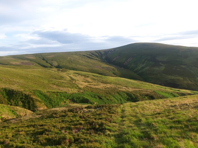
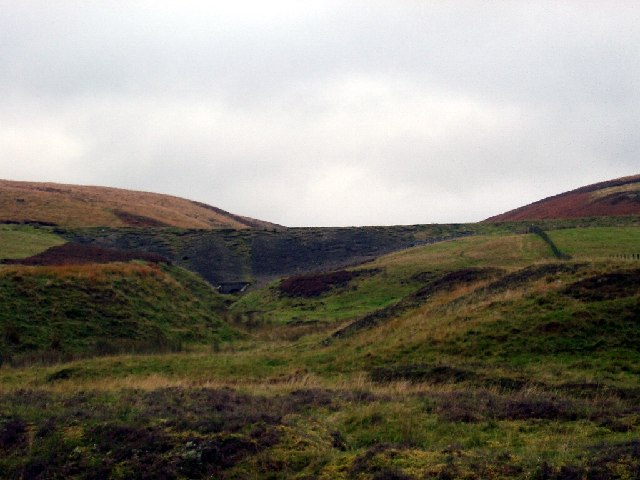
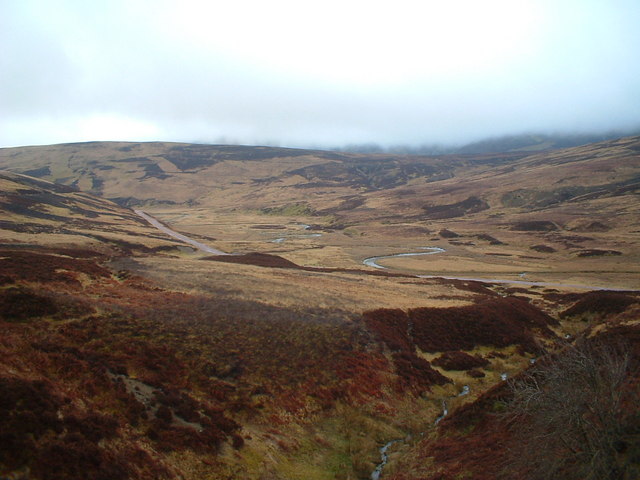
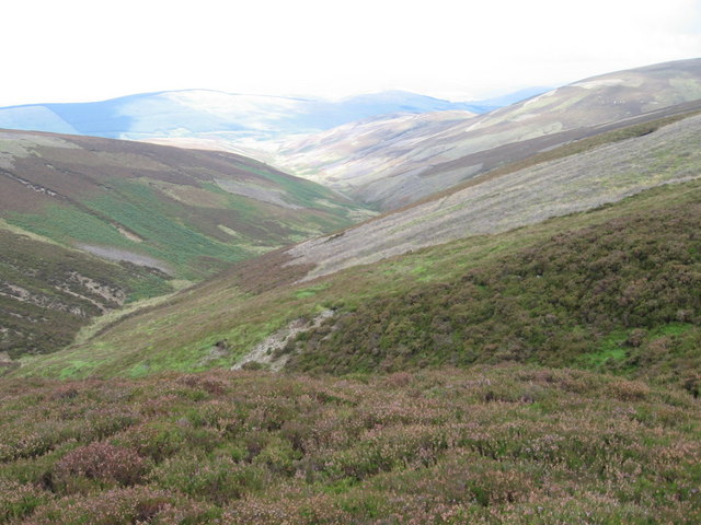
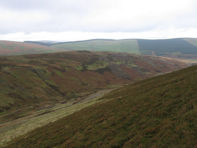
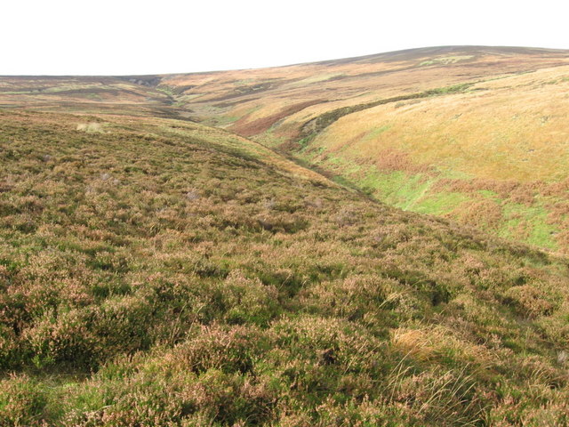
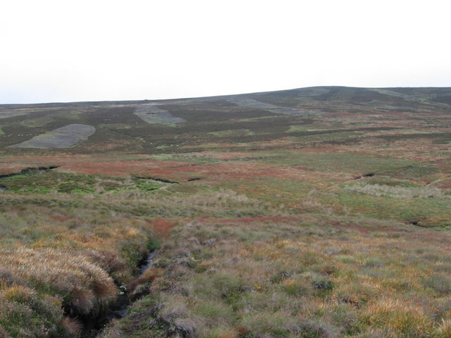
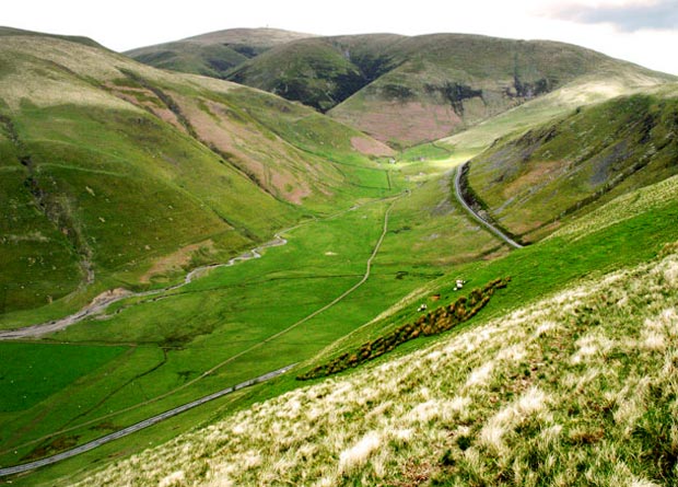
The downs of Bulmer Moss present a remarkable landscape characterized by rolling hills and gentle slopes. These downs are covered in lush green grass, creating a picturesque setting that changes colors with the seasons. The area is dotted with small streams and ponds, adding to its charm and providing a habitat for various species of flora and fauna.

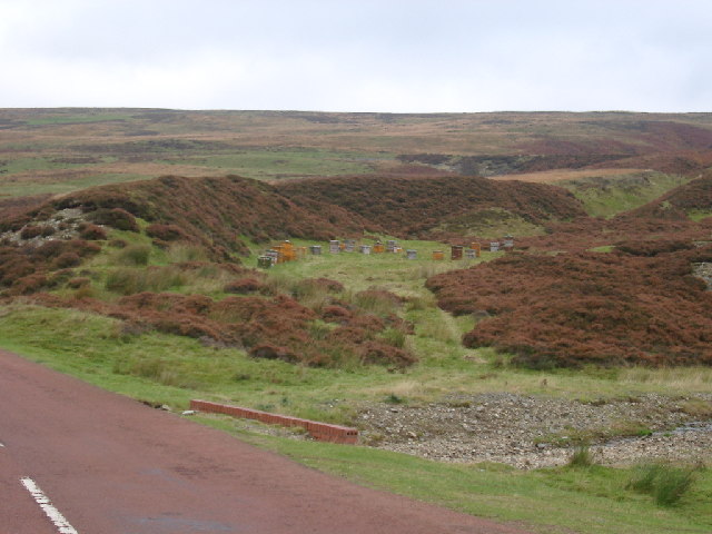
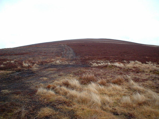
Adjacent to the downs, Bulmer Moss boasts extensive moorland, which is a unique feature of the region. The moorland is characterized by vast stretches of open, uncultivated land, covered in heather and grasses. This habitat supports a diverse range of wildlife, including birds, small mammals, and insects.

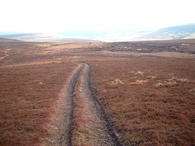
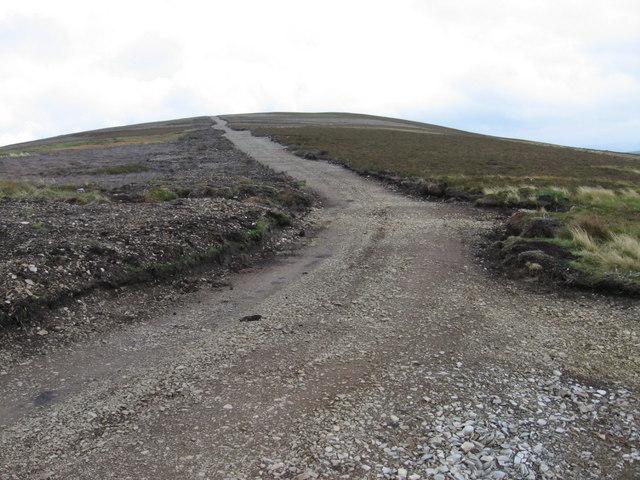
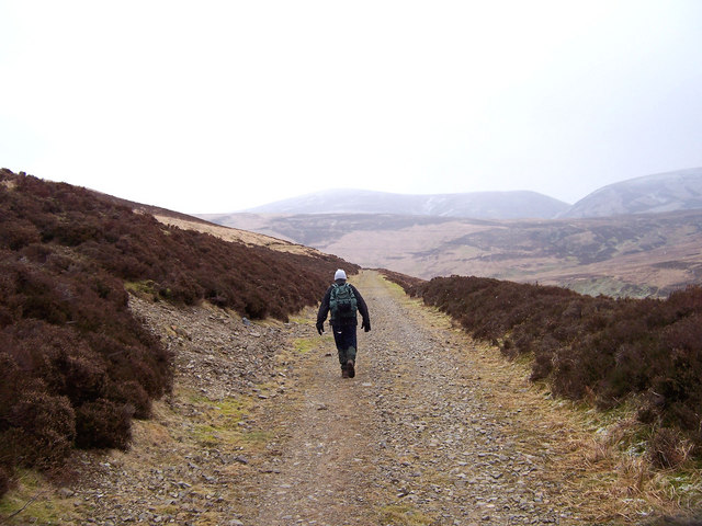
Bulmer Moss attracts visitors throughout the year, who come to enjoy the natural beauty and engage in various outdoor activities. Hiking and walking trails crisscross the area, providing opportunities to explore the downs and moorland at one's own pace. The tranquil surroundings also make it an ideal spot for picnics and outdoor gatherings.

The area's natural beauty and peaceful ambiance make Bulmer Moss a popular destination for locals and tourists seeking a retreat from the hustle and bustle of city life. Whether it's admiring the stunning downs, exploring the moorland, or simply enjoying the tranquility, Bulmer Moss offers a picturesque escape into nature's embrace.

If you have any feedback on the listing, please let us know in the comments section below.

Bulmer Moss Images

Images are sourced within 2km of 55.438119/-3.7340382 or Grid Reference NS9017. Thanks to Geograph Open Source API. All images are credited.

Looking down on the B7040 Taken from the track between the B7040 and the disused Leadhills and Wanlockhead railway.
Looking down on the B7040
Taken from the track between the B7040 and the disused Leadhills and Wanlockhead railway.
Summer evening view towards the Lowther Hills A view across heather moorland south of Bulmer Moss on a late-June evening.
Summer evening view towards the Lowther Hills
A view across heather moorland south of Bulmer Moss on a late-June evening.
Wheel ruts on Wool Law Looking towards Dun Law, Dungrain Law and the Lowther Hills on a late-June evening.
Wheel ruts on Wool Law
Looking towards Dun Law, Dungrain Law and the Lowther Hills on a late-June evening.
Faint path on the north-eastern spur of Wool Law Looking towards Clowgill Dod and Wellgrain Dod, on the opposite side of the Bellgill Burn.
Faint path on the north-eastern spur of Wool Law
Looking towards Clowgill Dod and Wellgrain Dod, on the opposite side of the Bellgill Burn.
View into Well Grain Various paths, erosion scars and signs of old lead-mining workings are visible on these hillsides.
View into Well Grain
Various paths, erosion scars and signs of old lead-mining workings are visible on these hillsides.
Grains (stream valleys) at the head of the Bellgill Burn The various gullies visible here are named Well Grain, Middle Grain and Rushy Grain. 'Grain' is a Scots word meaning 'the branch or fork of a stream or river'. It usually describes small branches at the upper reaches of a burn.
Grains (stream valleys) at the head of the Bellgill Burn
The various gullies visible here are named Well Grain, Middle Grain and Rushy Grain. 'Grain' is a Scots word meaning 'the branch or fork of a stream or river'. It usually describes small branches at the upper reaches of a burn.
Looking towards Wool Law from slopes near Well Grain A view of the hillsides around the headwaters of the Bellgill Burn on a late-June evening.
Looking towards Wool Law from slopes near Well Grain
A view of the hillsides around the headwaters of the Bellgill Burn on a late-June evening.
Beehives, near Leadhills You can just make out the old railway track above the hives. This does show the type of vegetation well - and lots of potential Heather Honey.
Beehives, near Leadhills
You can just make out the old railway track above the hives. This does show the type of vegetation well - and lots of potential Heather Honey.
Old railway embankment near Leadhills This is looking up Scapcleugh Burn but really just shows the old railway embankment and typical Leadhills hills.
Old railway embankment near Leadhills
This is looking up Scapcleugh Burn but really just shows the old railway embankment and typical Leadhills hills.
Elvan Water
Elvan Water
Wellgrain Dod
Wellgrain Dod
Coom Dod
Coom Dod
Laggen  Gill below Wellgrain Dod
Laggen Gill below Wellgrain Dod
New track on Coom Dod
Laggen Gill
Laggen Gill
Long Cleuch from Middle Wood
Coom Dod ridge from Dun Moss
The old railway line on Howkwood Rig. An old branch line running from Elvanfoot to the lead mines at Leadhills and Wanlockhead.
The old railway line on Howkwood Rig.
An old branch line running from Elvanfoot to the lead mines at Leadhills and Wanlockhead.
Show me another place!

Bulmer Moss is located at Grid Ref: NS9017 (Lat: 55.438119, Lng: -3.7340382)

Unitary Authority: South Lanarkshire

Police Authority: Lanarkshire

What 3 Words

///active.advances.upstarts. Near Sanquhar, Dumfries & Galloway

Related Wikis

Leadhills

Leadhills, originally settled for the accommodation of miners, is a village in South Lanarkshire, Scotland, 5+3⁄4 miles (9.3 km) WSW of Elvanfoot. The...

Scots Mining Company House

The Scots Mining Company House, also known as Woodlands Hall, is an early-18th-century mansion house in Leadhills, South Lanarkshire, Scotland. The house...

Leadhills railway station

Leadhills railway station was opened on 1 October 1901 as the intermediate stop on the Leadhills and Wanlockhead Light Railway and served the lead mining...

Leadhills and Wanlockhead Railway

The Leadhills and Wanlockhead Railway is a 2 ft (610 mm) narrow gauge railway in South Lanarkshire, Scotland. It is laid on the trackbed of the former...

Lowther Hills

The Lowther Hills, also sometimes known as the Lowthers, are an extensive area of hill country in the Southern Uplands of Scotland, though some sub-ranges...

Elvanfoot

Elvanfoot is a small village in South Lanarkshire, Scotland. Elvanfoot is located at the confluence of the River Clyde and Elvan Water. The Clyde is crossed...

Elvanfoot railway station

Elvanfoot railway station was a station which served Elvanfoot, in the Scottish county of South Lanarkshire. It was served by local trains on what is now...

Crawford, South Lanarkshire

Crawford is a village and civil parish in South Lanarkshire, Scotland.Crawford is close to the source of the River Clyde and the M74 motorway, 50 miles...

Nearby Amenities

Located within 500m of 55.438119,-3.7340382
Bulmer Moss
Place: locality
Source: OS 1:25k
Lat/Long: 55.4387419/-3.7329825
Old lead mine
Historic: mine
Lat/Long: 55.439245/-3.7387774
Old lead mine
Historic: mine
Lat/Long: 55.4417402/-3.7369106
Old lead mine
Historic: mine
Lat/Long: 55.4413142/-3.7357948
The data included in this document is from www.openstreetmap.org. The data is made available under ODbL.

Have you been to Bulmer Moss?

Leave your review of Bulmer Moss below (or comments, questions and feedback).