Coombes

Settlement in Sussex Adur

England

Coombes

Tapsel gate and squeeze gate at Coombes Church, West Sussex The entrance to Coombes Parish Church is marked by a Tapsel gate and a squeeze gate. The Tapsel gate is shown here in the closed position.
Tapsel gate and squeeze gate at Coombes Church, West Sussex Credit: Andrew Diack

Coombes is a small village located in the Adur district of West Sussex, England. Situated in the South Downs National Park, the village lies approximately 9 miles northwest of the coastal town of Brighton and Hove. With a population of around 200 residents, Coombes is known for its tranquil and picturesque countryside setting.

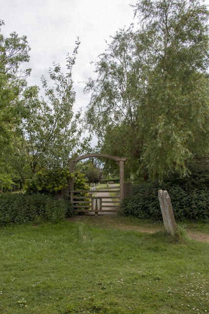
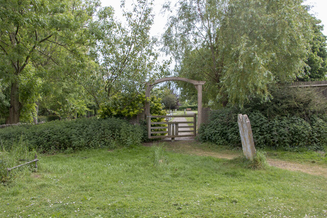
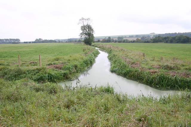
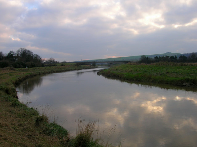
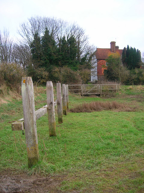
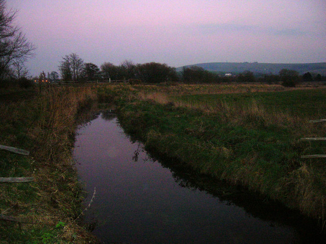
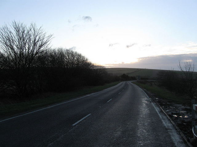
The village is characterized by its charming rural atmosphere, with traditional English cottages and farmhouses dotting the landscape. Surrounded by rolling hills and verdant fields, Coombes offers stunning views of the South Downs, making it a popular destination for nature enthusiasts and hikers. Numerous footpaths and bridleways crisscross the area, providing ample opportunities for outdoor activities.

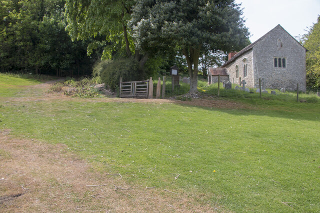
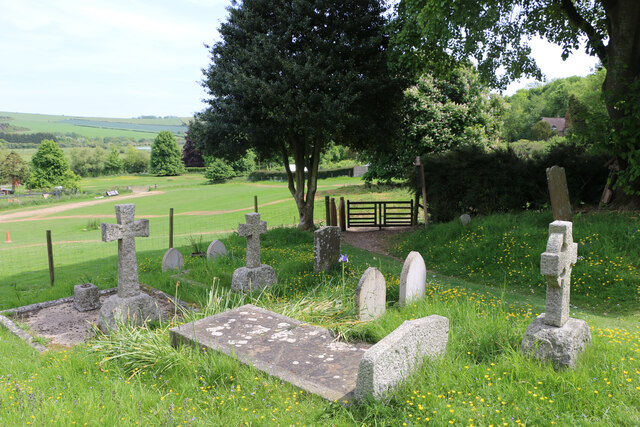
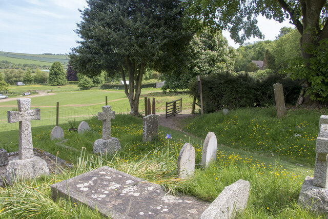
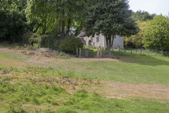
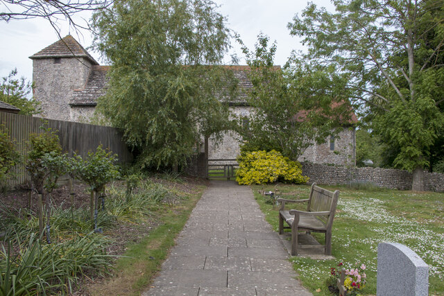
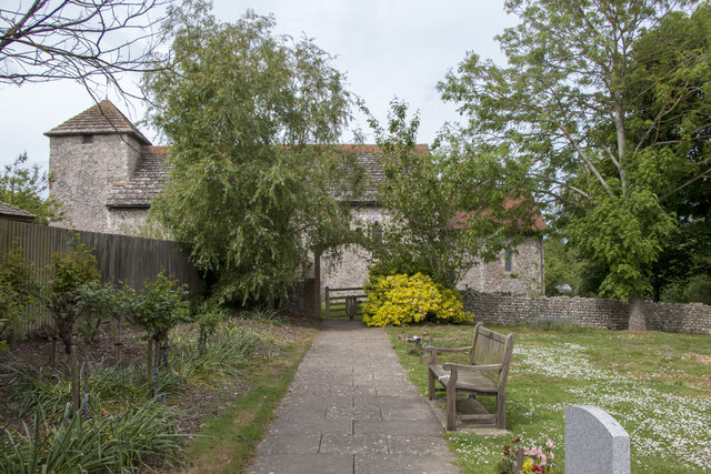
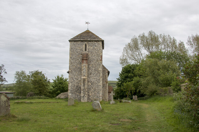
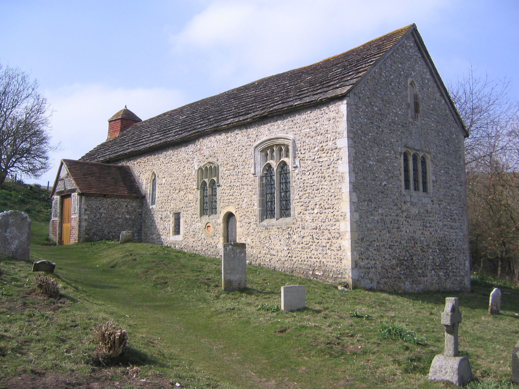
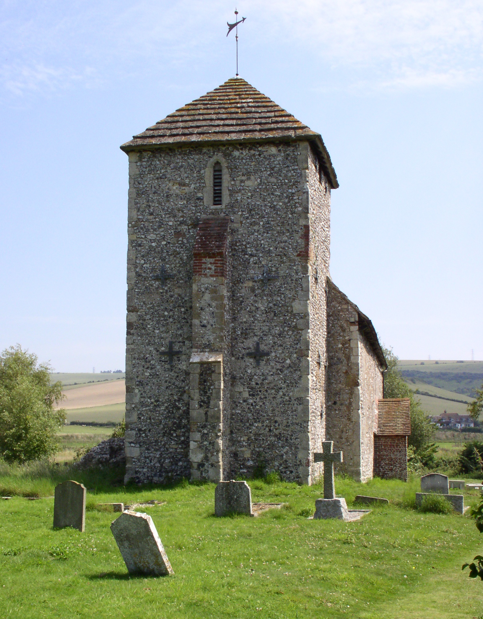
Despite its small size, Coombes boasts a rich history that can be traced back to the medieval period. The nearby St. Mary's Church, dating back to the 12th century, stands as a testament to the village's long-standing heritage. The church features beautiful stained glass windows and a distinctive flint and stone construction.

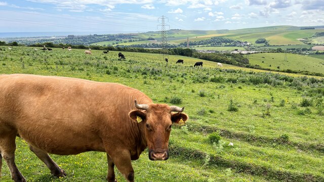
Coombes is also notable for its agricultural activities, with farms and orchards playing a significant role in the local economy. The fertile soil and favorable climate make it an ideal location for crop cultivation, particularly fruit trees such as apples and cherries.

While Coombes may lack the amenities and services commonly found in larger towns, its peaceful and idyllic setting makes it an attractive place for those seeking a more rural and secluded way of life.

If you have any feedback on the listing, please let us know in the comments section below.

Coombes Images

Images are sourced within 2km of 50.86164/-0.30756 or Grid Reference TQ1908. Thanks to Geograph Open Source API. All images are credited.

Tapsel gate and squeeze gate at Coombes Church, West Sussex The entrance to Coombes Parish Church is marked by a Tapsel gate and a squeeze gate. The Tapsel gate is shown here in the closed position.
Tapsel gate and squeeze gate at Coombes Church, West Sussex
The entrance to Coombes Parish Church is marked by a Tapsel gate and a squeeze gate. The Tapsel gate is shown here in the closed position.
Tapsel gate in closed position at Coombes Parish Church, West Sussex This photo shows the Tapsel gate and adjacent squeeze gate at Coombes Parish Church. The Tapsel gate is in a closed position. The photo was taken from inside the churchyard while looking in an east-southeast direction.
Tapsel gate in closed position at Coombes Parish Church, West Sussex
This photo shows the Tapsel gate and adjacent squeeze gate at Coombes Parish Church. The Tapsel gate is in a closed position. The photo was taken from inside the churchyard while looking in an east-southeast direction.
Tapsel gate at Coombes Parish Church in an open position, West Sussex The photo shows the Tapsel gate at Coombes Parish Church in an open position. The adjacent squeeze gate, which prevents cattle or other large animals entering the churchyard, is in a permanently open position. The photo was taken from inside the churchyard and it looks in an east-southeast direction.
Tapsel gate at Coombes Parish Church in an open position, West Sussex
The photo shows the Tapsel gate at Coombes Parish Church in an open position. The adjacent squeeze gate, which prevents cattle or other large animals entering the churchyard, is in a permanently open position. The photo was taken from inside the churchyard and it looks in an east-southeast direction.
Tapsel gate at Coombes Parish Church in an open position, Sussex This view was taken from the car park looking east-southeast and it shows the Tapsel gate at Coombes Parish Church in an open position. Next to the Tapsel gate, there is a squeeze gate which, because of its design, remains permanently open.
Tapsel gate at Coombes Parish Church in an open position, Sussex
This view was taken from the car park looking east-southeast and it shows the Tapsel gate at Coombes Parish Church in an open position. Next to the Tapsel gate, there is a squeeze gate which, because of its design, remains permanently open.
Tapsel gate at St Botolph's Church, West Sussex, in a closed position, This photo shows the Tapsel gate at St Botolph's church in a closed position. The photo was taken looking north and it shows the Grade I listed church in the background. The Tapsel gate links the churchyard of St Botolph's with an adjacent council burial ground. The gate was installed in late 2003 and it was consecrated in 2004 by Bishop Lindsay Urwin, who was the Bishop of Horsham between 1993 and 2009.
Tapsel gate at St Botolph's Church, West Sussex, in a closed position,
This photo shows the Tapsel gate at St Botolph's church in a closed position. The photo was taken looking north and it shows the Grade I listed church in the background. The Tapsel gate links the churchyard of St Botolph's with an adjacent council burial ground. The gate was installed in late 2003 and it was consecrated in 2004 by Bishop Lindsay Urwin, who was the Bishop of Horsham between 1993 and 2009.
Tapsel gate in an open position at St Botolph's Church, West Sussex This photo shows the Tapsel gate at St Botolph's church as seen looking north from the churchyard. The arched frame of the five bar gate is reminiscent of the Tapsel gate design at St Mary the Virgin church at Friston in East Sussex.
Tapsel gate in an open position at St Botolph's Church, West Sussex
This photo shows the Tapsel gate at St Botolph's church as seen looking north from the churchyard. The arched frame of the five bar gate is reminiscent of the Tapsel gate design at St Mary the Virgin church at Friston in East Sussex.
Closed Tapsel gate at St Botolph's church seen looking south The Tapsel gate at St Botolph's church in West Sussex is a modern one having been installed in 2003. This date is carved into the top of arched wooden frame. The gate was funded by the joint parish council of the area to enable the use of the church by visitors to the burial ground.
Closed Tapsel gate at St Botolph's church seen looking south
The Tapsel gate at St Botolph's church in West Sussex is a modern one having been installed in 2003. This date is carved into the top of arched wooden frame. The gate was funded by the joint parish council of the area to enable the use of the church by visitors to the burial ground.
Open Tapsel gate at St Botolph's Church seen looking south The Tapsel gate at St Botolph's church in West Sussex is a modern one having been installed in late 2003. Although this date is carved into the top of arched wooden frame, it is difficult to see, in this photo, without added magnification. At present, the central pivot is slightly more stiff to open than other Tapsel gates but an application of lubricant would remedy this.
Open Tapsel gate at St Botolph's Church seen looking south
The Tapsel gate at St Botolph's church in West Sussex is a modern one having been installed in late 2003. Although this date is carved into the top of arched wooden frame, it is difficult to see, in this photo, without added magnification. At present, the central pivot is slightly more stiff to open than other Tapsel gates but an application of lubricant would remedy this.
St Botolph's Church viewed looking east, West Sussex On the 15th March 1955, the Saxon Church of St Botolph's was listed as a Grade I building and by definition that means that the site was considered to be of exceptional, national importance. The building dates to about AD 950 and it is listed as one of the 500 holiest sites in Britain. Notable features of the church include three bells made, in 1536, by John Tonne which commemorate the old dedication to St Peter with the inscription “Sancte Petre ora pro nobis”;  an oak, Jacobean pulpit dating from 1630; traces of wall murals which were recorded in 1897 and a square baptism font, supported by a brick plinth, which probably dates to the 18th century. Another interesting feature, of the church, are the slanted side windows which allowed lepers, from the leper colony in Bramber, to stand outside and see the service taking place without transmitting the disease to the congregation inside the church.
St Botolph's Church viewed looking east, West Sussex
On the 15th March 1955, the Saxon Church of St Botolph's was listed as a Grade I building and by definition that means that the site was considered to be of exceptional, national importance. The building dates to about AD 950 and it is listed as one of the 500 holiest sites in Britain. Notable features of the church include three bells made, in 1536, by John Tonne which commemorate the old dedication to St Peter with the inscription “Sancte Petre ora pro nobis”; an oak, Jacobean pulpit dating from 1630; traces of wall murals which were recorded in 1897 and a square baptism font, supported by a brick plinth, which probably dates to the 18th century. Another interesting feature, of the church, are the slanted side windows which allowed lepers, from the leper colony in Bramber, to stand outside and see the service taking place without transmitting the disease to the congregation inside the church.
Cattle - and view SW over the Adur Valley You can see the sea and Lancing College Chapel on the left of the photo.
Cattle - and view SW over the Adur Valley
You can see the sea and Lancing College Chapel on the left of the photo.
Autumn Lady Tresses Autumn Lady Tresses, Spiranthes spiralis in flower at Anchor Bottom next to the A283 in East Sussex.
Autumn Lady Tresses
Autumn Lady Tresses, Spiranthes spiralis in flower at Anchor Bottom next to the A283 in East Sussex.
A283 Roadbridge The A283 roadbridge at Bramber which forms part of the Steyning Bypass.
A283 Roadbridge
The A283 roadbridge at Bramber which forms part of the Steyning Bypass.
Field and drainage channel alongside the A283
Field drainage channels Field drainage channels alongside A283
Field drainage channels
Field drainage channels alongside A283
River Adur Looking south towards the A283 road bridge with Coombe Head in the distance on the right.
River Adur
Looking south towards the A283 road bridge with Coombe Head in the distance on the right.
Beeding Court The former manor house of the village lying to the south next to the River Adur. The footpath actually turns inland and crosses the bridge at this point indicating that this part may well have been a former jetty or wharf for the house that will occasionally flood at very high tides. The river was also fordable opposite this point during medieval times and was still possible to cross in the 1980s at very low tides.
Beeding Court
The former manor house of the village lying to the south next to the River Adur. The footpath actually turns inland and crosses the bridge at this point indicating that this part may well have been a former jetty or wharf for the house that will occasionally flood at very high tides. The river was also fordable opposite this point during medieval times and was still possible to cross in the 1980s at very low tides.
Annington Sewer Looking towards the A283 by pass. Truleigh Hill is in the background.
Annington Sewer
Looking towards the A283 by pass. Truleigh Hill is in the background.
Steyning By-Pass Built in the 1980s to avoid the congested centres of Steyning, Bramber and Upper Beeding. A fair proportion runs along the old Shoreham-Horsham line closed in 1966 though not this section which crosses the flood plain before bridging the Adur itself.
Steyning By-Pass
Built in the 1980s to avoid the congested centres of Steyning, Bramber and Upper Beeding. A fair proportion runs along the old Shoreham-Horsham line closed in 1966 though not this section which crosses the flood plain before bridging the Adur itself.
Show me another place!

Coombes is located at Grid Ref: TQ1908 (Lat: 50.86164, Lng: -0.30756)

Administrative County: West Sussex

District: Adur

Police Authority: Sussex

What 3 Words

///stole.husky.price. Near Steyning, West Sussex

Related Wikis

Coombes

Coombes is a small village and civil parish in the Adur District of West Sussex, England. The village is in the Adur Valley 2 miles (3.2 km) northwest...

Coombes Church

Coombes Church is a Church of England parish church in the rural hamlet of Coombes in the Adur District of West Sussex, England. It has served the rural...

St Botolph's Church, Botolphs

The Grade I listed Saxon church of St Botolph's at Botolphs, West Sussex, England, is situated in the valley of the River Adur and is now part of the Church...

Botolphs

Botolphs, formerly known as Annington, is a tiny village and former civil parish, now in the parish of Bramber, in the Horsham District of West Sussex...

Erringham chapel

Erringham chapel is a former place of worship in the deserted medieval village of Old Erringham, north of Shoreham-by-Sea in the district of Adur, one...

Lancing College Chapel

Lancing College Chapel is the chapel to Lancing College in West Sussex, England, and is an example of Gothic Revival architecture. The chapel was designed...

Mill Hill, Shoreham

Mill Hill is a 13.5-hectare (33-acre) Local Nature Reserve on the northern outskirts of Shoreham-by-Sea in West Sussex. It is owned by Adur District Council...

Towers Convent School

The Towers Convent School was a private Roman Catholic boarding and day school for girls aged 4–16 and boys up to age 11 in Upper Beeding near Steyning...

Nearby Amenities

Located within 500m of 50.86164,-0.30756
Barrier: stile
Lat/Long: 50.8575408/-0.3103578
Man Made: tower
Tower Type: communication
Lat/Long: 50.8657428/-0.3076599
Bench
Backrest: yes
Seats: 3
Lat/Long: 50.8605188/-0.3096254
Post Box
Brand: Royal Mail
Brand Wikidata: Q638098
Collection Times: Mo-Fr 15:45; Sa 10:30
Letters Only: yes
Operator: Royal Mail
Operator Wikidata: Q638098
Post Box Type: lamp
Ref: BN15 1413
Royal Cypher: GVIR
Royal Cypher Wikidata: Q33102169
Lat/Long: 50.8613644/-0.3080464
Telephone
Booth: K6
Covered: booth
Listed Status: Grade II
Wikidata: Q26636682
Lat/Long: 50.8616992/-0.3078681
Coombes
Place: hamlet
Wikidata: Q511380
Wikipedia: en:Coombes
Lat/Long: 50.8609324/-0.309173
Barrier: cattle_grid
Lat/Long: 50.8612842/-0.3106083
The data included in this document is from www.openstreetmap.org. The data is made available under ODbL.

Have you been to Coombes?

Leave your review of Coombes below (or comments, questions and feedback).