Ellis Wood
Wood, Forest in Westmorland Eden
England
Ellis Wood
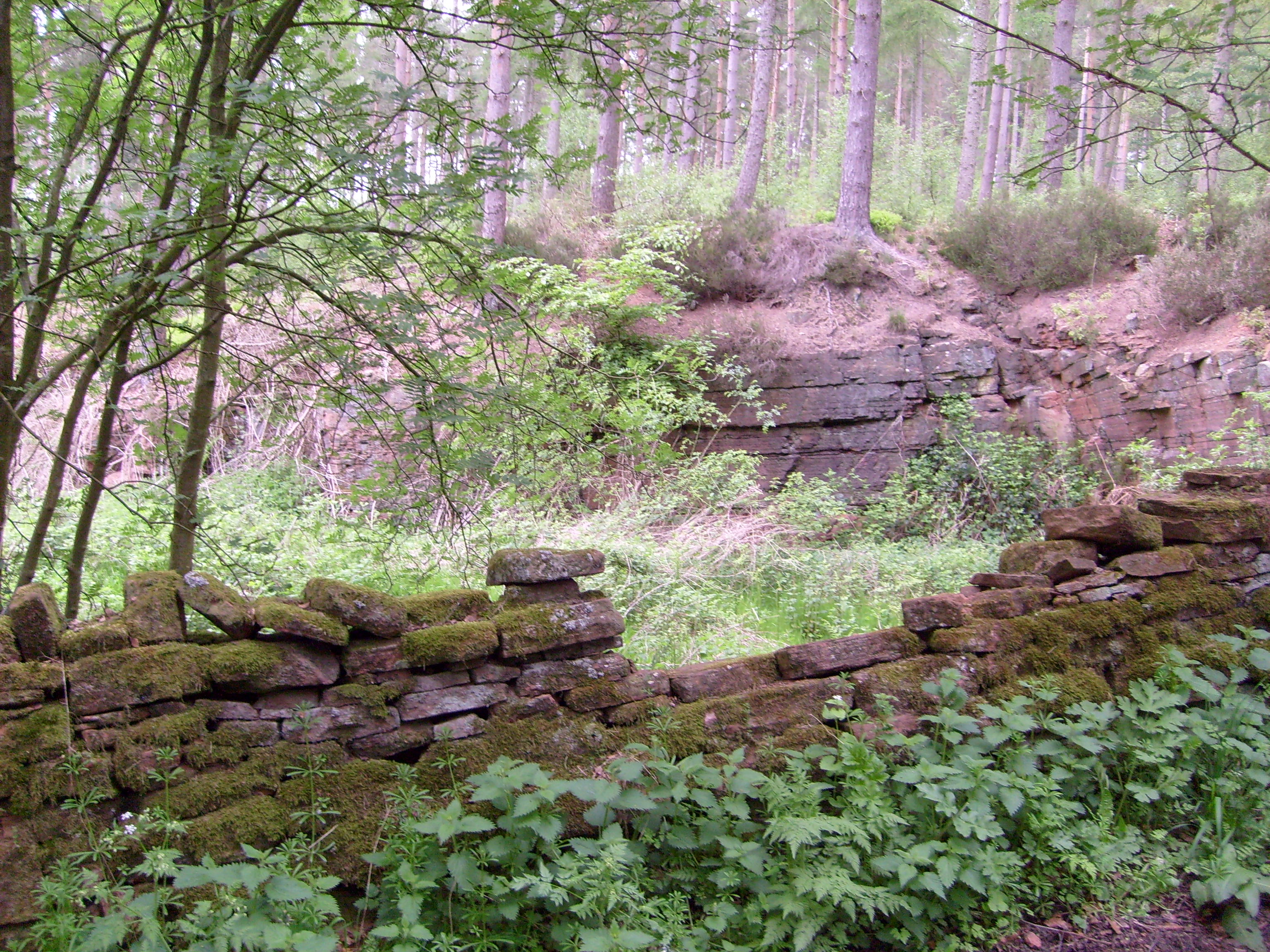
Ellis Wood, located in the county of Westmorland, is a dense forest area known for its stunning natural beauty and rich biodiversity. Covering approximately 1,500 acres, this enchanting woodland is a cherished destination for nature lovers, hikers, and birdwatchers alike.
The forest is characterized by its diverse range of tree species, including oak, beech, ash, and birch, which create a picturesque landscape of towering canopies and lush undergrowth. The dense vegetation provides a haven for a wide array of wildlife, with sightings of deer, foxes, badgers, and various species of birds being common occurrences.
Ellis Wood offers an extensive network of well-maintained walking trails, allowing visitors to immerse themselves in the tranquility of the surroundings. These trails cater to different skill levels, providing options for both leisurely strolls and more challenging hikes. Along the way, walkers can appreciate the stunning vistas, serene ponds, and babbling brooks that dot the forest.
The forest also boasts a designated birdwatching area, where avid ornithologists can observe a plethora of feathered inhabitants. From the elusive woodpeckers to the melodious nightingales, Ellis Wood attracts a diverse range of bird species, making it a paradise for bird enthusiasts.
Visitors to Ellis Wood can also enjoy various recreational activities such as picnicking, camping, and photography. The forest's peaceful ambiance and unspoiled natural surroundings make it an ideal retreat for those seeking solace and connection with nature.
In summary, Ellis Wood in Westmorland is a captivating forest, offering a picturesque landscape, abundant wildlife, and a range of outdoor activities. It is a must-visit destination for nature enthusiasts and those yearning for a tranquil escape from the hustle and bustle of everyday life.
If you have any feedback on the listing, please let us know in the comments section below.
Ellis Wood Images
Images are sourced within 2km of 54.643562/-2.6335382 or Grid Reference NY5927. Thanks to Geograph Open Source API. All images are credited.


Ellis Wood is located at Grid Ref: NY5927 (Lat: 54.643562, Lng: -2.6335382)
Administrative County: Cumbria
District: Eden
Police Authority: Cumbria
What 3 Words
///recital.defenders.isolating. Near Penrith, Cumbria
Nearby Locations
Related Wikis
Whinfell Forest
Whinfell Forest is a small area of woodland in the parish of Brougham, Cumbria, south east of Penrith in Cumbria and just off the A66 road leading to Appleby...
Cliburn railway station
Cliburn railway station was a station situated on the Eden Valley Railway in Westmorland (now in Cumbria), England. It served the village of Cliburn to...

Temple Sowerby
Temple Sowerby is a village and civil parish in Cumbria, northern England. It is close to the main east–west A66 road about 8 miles (13 km) east of Penrith...

Culgaith railway station
Culgaith railway station served the village of Culgaith in Cumberland (now in Cumbria), England. == History == The Settle-Carlisle Line is open however...

River Lyvennet
The River Lyvennet is a river flowing through the county of Cumbria in England. The source of the Lyvennet (as Lyvennet Beck) is to be found close to Robin...

RAF Hornby Hall
RAF Hornby Hall was a Royal Air Force satellite landing ground located near Brougham, 4 miles (6.4 km) east of Penrith, Cumbria and 8.8 miles (14.2 km...
Acorn Bank Garden & Watermill
Acorn Bank Garden & Watermill is a National Trust property situated just north of Temple Sowerby, near Penrith, Cumbria, England. The property is noted...
Cliburn Moss
Cliburn Moss is a national nature reserve located northwest of the village of Cliburn, in the county of Cumbria, England. It contains wetland habitats...
Nearby Amenities
Located within 500m of 54.643562,-2.6335382Have you been to Ellis Wood?
Leave your review of Ellis Wood below (or comments, questions and feedback).