Monument Common

Wood, Forest in Herefordshire

England

Monument Common

Old trackway lined with hawthorns The landscape up here is in decay a little, with plenty of evidence of old use.
Old trackway lined with hawthorns Credit: Jeremy Bolwell

Monument Common is a picturesque woodland area located in Herefordshire, England. Covering an expansive area, this ancient forest is renowned for its natural beauty and rich biodiversity. The common is nestled within the stunning Herefordshire countryside, offering visitors a tranquil and peaceful retreat from the hustle and bustle of everyday life.

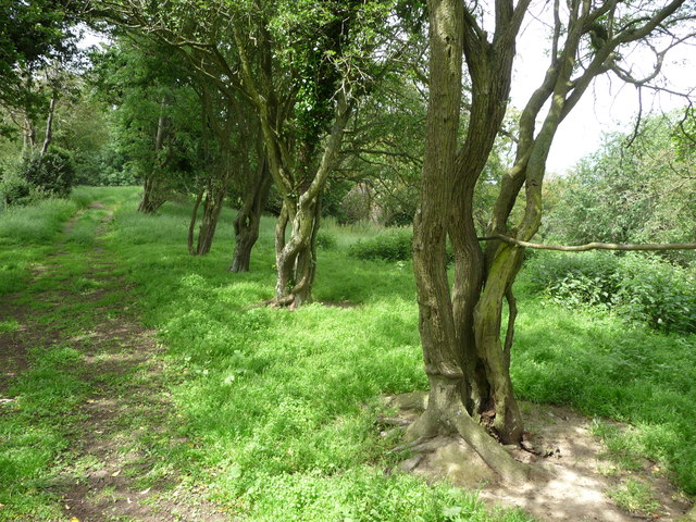
The woodland is dominated by a variety of towering trees, including oak, beech, and ash, which create a dense canopy overhead. These majestic trees provide a habitat for a diverse range of flora and fauna, making the common a haven for nature enthusiasts and wildlife lovers alike. Visitors can expect to encounter an array of bird species, including buzzards and woodpeckers, as well as mammals such as deer and squirrels.

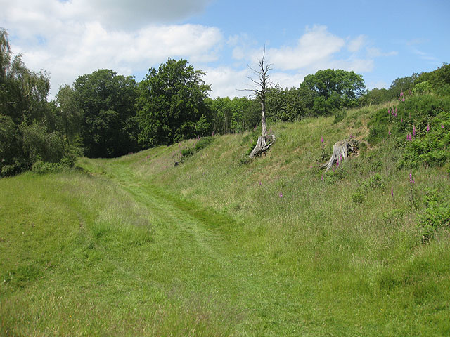
Monument Common is crisscrossed by a network of walking trails and footpaths, allowing visitors to explore the area at their own pace. The paths wind through the forest, offering glimpses of babbling brooks, hidden ponds, and carpets of wildflowers. The common is particularly enchanting during the spring months when the forest floor is adorned with a vibrant display of bluebells and primroses.

In addition to its natural beauty, Monument Common also holds historical significance. The name of the common is derived from a monument erected in memory of fallen soldiers from World War I. This monument serves as a poignant reminder of the sacrifices made by those who fought for their country.

Overall, Monument Common is a true gem in the Herefordshire landscape, offering visitors an opportunity to connect with nature, explore ancient woodlands, and reflect on the past.

If you have any feedback on the listing, please let us know in the comments section below.

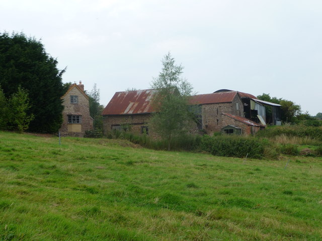
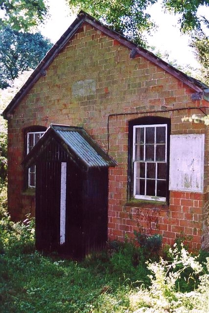
Monument Common Images

Images are sourced within 2km of 52.008307/-2.5955434 or Grid Reference SO5934. Thanks to Geograph Open Source API. All images are credited.

Old trackway lined with hawthorns The landscape up here is in decay a little, with plenty of evidence of old use.
Old trackway lined with hawthorns
The landscape up here is in decay a little, with plenty of evidence of old use.
Farm buildings Rural farm and outbuildings.
Farm buildings
Rural farm and outbuildings.
Timber framed cottage A picturesque cottage and outbuildings.
Timber framed cottage
A picturesque cottage and outbuildings.
Part of Lower Buckenhill Farmhouse An old 'black and white' timber framed farm house with a respectable date.
Part of Lower Buckenhill Farmhouse
An old 'black and white' timber framed farm house with a respectable date.
1592 date on Lower Buckenhill Farm 1592 - think Elizabeth I on the throne, Will Shakespeare's Richard III is performed, plague breaks out again, buildings like this are built from local oak.
1592 date on Lower Buckenhill Farm
1592 - think Elizabeth I on the throne, Will Shakespeare's Richard III is performed, plague breaks out again, buildings like this are built from local oak.
Rural property above Lower Buckenhill Dutch style architecture sets this rural property above run of the mill.
Rural property above Lower Buckenhill
Dutch style architecture sets this rural property above run of the mill.
Sheep pasture on an August morning Sheep seek shelter and shade from the rays on a muggy day.
Sheep pasture on an August morning
Sheep seek shelter and shade from the rays on a muggy day.
Rural lane in Herefordshire Walking the lane from the mill towards Woolhope. The church is just visible in the distance.
Rural lane in Herefordshire
Walking the lane from the mill towards Woolhope. The church is just visible in the distance.
Farmland at Terrace Farm
Buckenhill Wood
Buckenhill Wood
Sutton Hill
Sutton Hill
A Former Methodist Chapel on Broadmoor Common in Woolhope
Broadmoor Common in December, 2 Long shadows towards the end of a December afternoon.
Broadmoor Common in December, 2
Long shadows towards the end of a December afternoon.
Galanthus nivalis, Common Snowdrop Lovely specimen by the lane north of Lower Buckenhill.
Galanthus nivalis, Common Snowdrop
Lovely specimen by the lane north of Lower Buckenhill.
Lower Buckenhill Farm house Timber framed building with a date of 1592.
Lower Buckenhill Farm house
Timber framed building with a date of 1592.
Woodland strip, Wessington Beyond the trees there is an area of wet grassland.
Woodland strip, Wessington
Beyond the trees there is an area of wet grassland.
Fields, Wessington Near Woolhope.
Fields, Wessington
Near Woolhope.
Trees and cottage on Broadmoor Common Trees and cottage on edge of Broadmoor Common in Woolhope.
Trees and cottage on Broadmoor Common
Trees and cottage on edge of Broadmoor Common in Woolhope.
Show me another place!

Monument Common is located at Grid Ref: SO5934 (Lat: 52.008307, Lng: -2.5955434)

Unitary Authority: County of Herefordshire

Police Authority: West Mercia

What 3 Words

///point.maximum.arranges. Near Brockhampton, Herefordshire

Related Wikis

Capler Camp

Capler Camp is an Iron Age hill fort located 2.5 km south of Fownhope, Herefordshire. The Camp is on a hill top above the River Wye. It has a double layer...

Woolhope

Woolhope is a village and civil parish in the English county of Herefordshire. The population of the civil parish was 486 at the 2011 census. The civil...

St Cuthbert's Church, Holme Lacy

St Cuthbert's Church is a redundant Anglican church about 1 mile (1.6 km) to the southeast of the village of Holme Lacy, Herefordshire, England. It stands...

All Saints' Church, Brockhampton

The Church of All Saints is a Church of England parish church at Brockhampton in the English county of Herefordshire. The church was commissioned by Alice...

Fiddler's Green, Herefordshire

Fiddler's Green is a hamlet in the English county of Herefordshire. It is located near the River Wye on the B4224 road that connects Hereford and Ross...

Sollers Hope

Sollers Hope or Sollershope is a village and civil parish 8 miles (13 km) south east of Hereford, in the county of Herefordshire, England. In 2001 the...

The Park, Brockhampton

The Park is a cricket ground in Brockhampton-by-Ross, Herefordshire. The ground was part of the Brockhampton Court estate.The first recorded match on...

Brockhampton (near Ross-on-Wye)

Brockhampton is a village and civil parish in Herefordshire, England. The village is near the River Wye, 14 kilometres (9 mi) south east of Hereford, 13...

Nearby Amenities

Located within 500m of 52.008307,-2.5955434
Telephone
Booth: K6
Disused: yes
Man Made: telephone_box
Tourism: information
Lat/Long: 52.0089682/-2.5991645
Barrier: kissing_gate
Lat/Long: 52.008607/-2.5958183
Post Box
Collection Times: Mo-Fr 10:15; Sa 10:15
Post Box Design: hovis
Post Box Mounting: wooden_post
Post Box Type: lamp
Ref: HR1 269
Royal Cypher: GR
Royal Cypher Wikidata: Q33102273
Lat/Long: 52.0089618/-2.5992931
Power: pole
Lat/Long: 52.0110153/-2.5897359
Power: pole
Lat/Long: 52.0112665/-2.5917127
Power: pole
Lat/Long: 52.0115859/-2.5940948
Power: pole
Lat/Long: 52.0117695/-2.5955167
Power: pole
Lat/Long: 52.0120512/-2.5977142
Barrier: stile
Bicycle: yes
Foot: yes
Lat/Long: 52.0101391/-2.5992007
Generator Method: photovoltaic
Generator Output Electricity: yes
Generator Source: solar
Generator Type: solar_photovoltaic_panel
Location: roof
Power: generator
Lat/Long: 52.0076358/-2.5945732
Generator Method: photovoltaic
Generator Output Electricity: yes
Generator Source: solar
Generator Type: solar_photovoltaic_panel
Location: roof
Power: generator
Lat/Long: 52.008699/-2.5987199
Generator Method: photovoltaic
Generator Output Electricity: yes
Generator Source: solar
Generator Type: solar_photovoltaic_panel
Location: roof
Power: generator
Lat/Long: 52.009565/-2.6006028
Generator Method: photovoltaic
Generator Output Electricity: yes
Generator Source: solar
Generator Type: solar_photovoltaic_panel
Location: roof
Power: generator
Lat/Long: 52.0095765/-2.6004848
Shelter
Lat/Long: 52.0090372/-2.5991952
Power: pole
Source: bing
Lat/Long: 52.0039595/-2.5937243
Power: pole
Source: bing
Lat/Long: 52.0041701/-2.5948548
Power: pole
Source: bing
Lat/Long: 52.0042081/-2.5960122
Power: pole
Source: bing
Lat/Long: 52.0042402/-2.5969175
Power: pole
Source: bing
Lat/Long: 52.00427/-2.598221
Generator Method: photovoltaic
Generator Output Electricity: yes
Generator Source: solar
Generator Type: solar_photovoltaic_panel
Location: roof
Power: generator
Lat/Long: 52.0100743/-2.5983015
Power: pole
Lat/Long: 52.0039447/-2.5965124
Power: pole
Lat/Long: 52.0118738/-2.5998102
Power: pole
Lat/Long: 52.0111581/-2.5998028
Power: pole
Lat/Long: 52.0106084/-2.5998008
Old Lime Kiln
Power: pole
Transformer: distribution
Voltage Primary: 11000
Lat/Long: 52.0080436/-2.589123
Power: pole
Lat/Long: 52.0081352/-2.5896842
Power: pole
Lat/Long: 52.0082479/-2.5903628
Power: pole
Lat/Long: 52.0083511/-2.5910253
Power: pole
Lat/Long: 52.0085401/-2.5915678
Common Hill East
Power: pole
Transformer: distribution
Voltage Primary: 11000
Lat/Long: 52.0089062/-2.5922678
Melrose House
Power: pole
Transformer: distribution
Voltage Primary: 11000
Lat/Long: 52.0076424/-2.5949688
Power: pole
Lat/Long: 52.0078859/-2.5949293
Power: pole
Lat/Long: 52.0082285/-2.5948575
Power: pole
Lat/Long: 52.0084699/-2.5945296
Power: pole
Lat/Long: 52.0087576/-2.5940254
Power: pole
Lat/Long: 52.0090045/-2.5935727
Power: pole
Lat/Long: 52.0093078/-2.5929974
Power: pole
Lat/Long: 52.0096814/-2.5936874
Power: pole
Lat/Long: 52.0100252/-2.5943378
Power: pole
Lat/Long: 52.0101354/-2.5949185
Common Hill North
Power: pole
Transformer: distribution
Voltage Primary: 11000
Lat/Long: 52.010246/-2.5954717
Power: pole
Lat/Long: 52.0103723/-2.5961054
Power: pole
Lat/Long: 52.0103116/-2.5969208
Power: pole
Lat/Long: 52.0102559/-2.5978193
Power: pole
Lat/Long: 52.010189/-2.5986649
Common Hill West
Power: pole
Transformer: distribution
Voltage Primary: 11000
Lat/Long: 52.0094894/-2.6024636
Power: pole
Lat/Long: 52.009411/-2.6013974
Power: pole
Lat/Long: 52.0096599/-2.6007564
Power: pole
Lat/Long: 52.0099447/-2.6
Power: pole
Lat/Long: 52.0101251/-2.5995279
Power: pole
Lat/Long: 52.01/-2.5994662
Common Hill
Power: pole
Transformer: distribution
Voltage Primary: 11000
Lat/Long: 52.0095319/-2.5992463
Power: pole
Lat/Long: 52.0088947/-2.5989197
Power: pole
Lat/Long: 52.0085426/-2.5989023
Power: pole
Lat/Long: 52.0062505/-2.5983632
Nash Hill North
Power: pole
Transformer: distribution
Voltage Primary: 11000
Lat/Long: 52.0080283/-2.6028042
Power: pole
Lat/Long: 52.0079247/-2.6023804
Power: pole
Lat/Long: 52.0077872/-2.6018158
Power: pole
Lat/Long: 52.0076609/-2.6013029
Common Hill South
Power: pole
Transformer: distribution
Voltage Primary: 11000
Lat/Long: 52.0074905/-2.6006001
Power: pole
Lat/Long: 52.0077625/-2.5995527
Power: pole
Lat/Long: 52.0080357/-2.5984812
Power: pole
Lat/Long: 52.007076/-2.5984208
Melrose House South
Power: pole
Transformer: distribution
Voltage Primary: 11000
Lat/Long: 52.0058138/-2.5983303
Power: pole
Lat/Long: 52.0049709/-2.598276
The data included in this document is from www.openstreetmap.org. The data is made available under ODbL.

Have you been to Monument Common?

Leave your review of Monument Common below (or comments, questions and feedback).