Ellwood Inclosure

Wood, Forest in Gloucestershire Forest of Dean

England

Ellwood Inclosure

Former toll house The Pike House, built as a turnpike house.  A 19th century former toll house which was enlarged in the early 20th century.   The house stands on the junction of the B4431 and the road to Bream.  The house is Grade II listed, see: <span class="nowrap"><a title="https://historicengland.org.uk/listing/the-list/list-entry/1299231" rel="nofollow ugc noopener" href="https://historicengland.org.uk/listing/the-list/list-entry/1299231">Link</a><img style="margin-left:2px;" alt="External link" title="External link - shift click to open in new window" src="https://s1.geograph.org.uk/img/external.png" width="10" height="10"/></span>
Former toll house Credit: Philip Halling

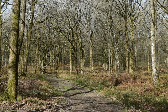
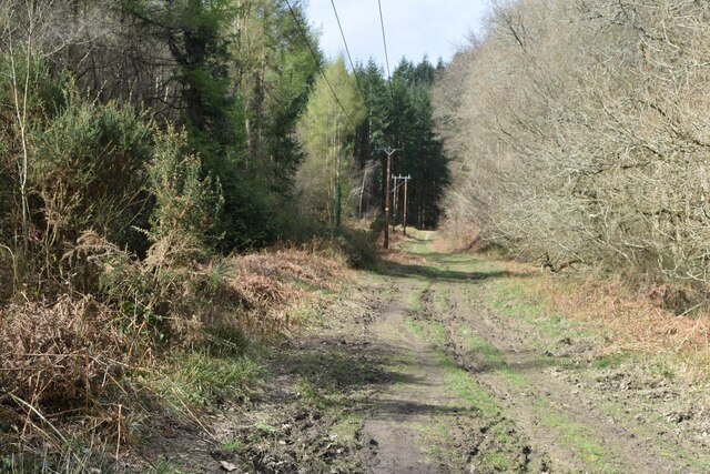
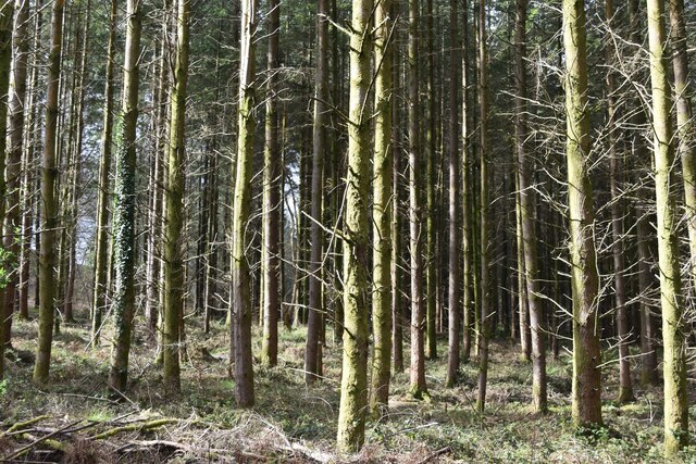
Ellwood Inclosure is a picturesque woodland located in Gloucestershire, England. Situated in the heart of the Forest of Dean, it covers an area of approximately 500 hectares. The woodland is known for its diverse range of tree species, including oak, beech, birch, and pine. These trees provide a rich habitat for a variety of wildlife, making Ellwood Inclosure a popular destination for nature enthusiasts and birdwatchers.

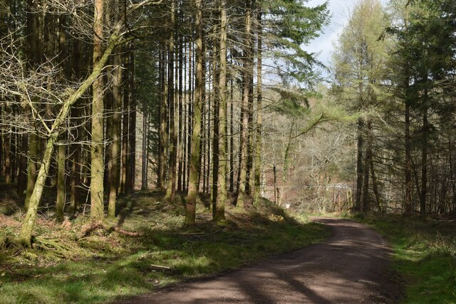
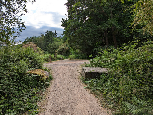
The area is crisscrossed with a network of well-maintained footpaths, allowing visitors to explore the woodland at their own pace. The paths wind through the trees, offering stunning views of the surrounding countryside and glimpses of wildlife along the way. There are also several picnic areas and benches scattered throughout the inclosure, providing opportunities for visitors to relax and enjoy the tranquil surroundings.

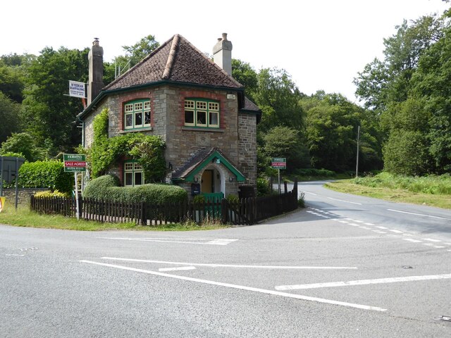
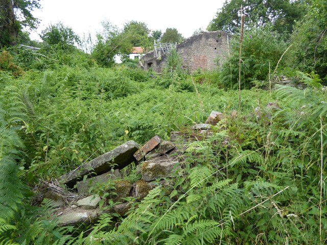
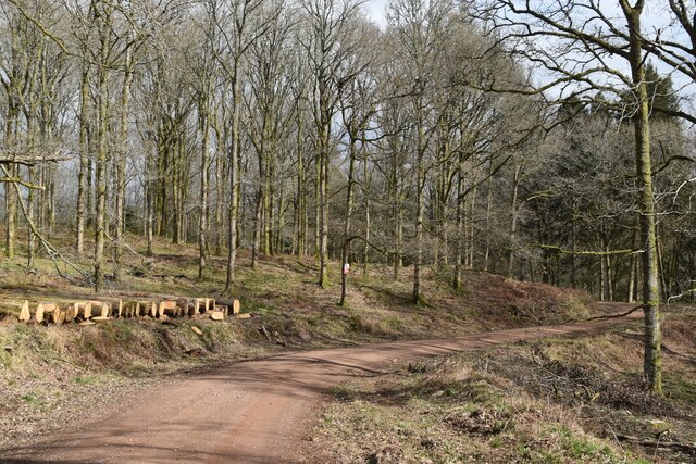
Ellwood Inclosure has a rich history, with evidence of human activity dating back to prehistoric times. The woodland was once used for timber production and charcoal burning, contributing to the local economy. Today, remnants of these activities can still be seen, adding to the charm and character of the area.

The inclosure is managed by the Forestry Commission, who strive to balance conservation and recreational use. They regularly undertake tree thinning and replanting projects to maintain a healthy and sustainable woodland ecosystem. Additionally, the Forestry Commission organizes various events and educational programs to promote awareness and appreciation of the natural environment.

Overall, Ellwood Inclosure offers a peaceful and idyllic retreat for nature lovers, providing the perfect opportunity to immerse oneself in the beauty of Gloucestershire's woodlands.

If you have any feedback on the listing, please let us know in the comments section below.

Ellwood Inclosure Images

Images are sourced within 2km of 51.766356/-2.5927295 or Grid Reference SO5907. Thanks to Geograph Open Source API. All images are credited.

Former toll house The Pike House, built as a turnpike house.  A 19th century former toll house which was enlarged in the early 20th century.   The house stands on the junction of the B4431 and the road to Bream.  The house is Grade II listed, see: <span class="nowrap"><a title="https://historicengland.org.uk/listing/the-list/list-entry/1299231" rel="nofollow ugc noopener" href="https://historicengland.org.uk/listing/the-list/list-entry/1299231">Link</a><img style="margin-left:2px;" alt="External link" title="External link - shift click to open in new window" src="https://s1.geograph.org.uk/img/external.png" width="10" height="10"/></span>
Former toll house
The Pike House, built as a turnpike house. A 19th century former toll house which was enlarged in the early 20th century. The house stands on the junction of the B4431 and the road to Bream. The house is Grade II listed, see: LinkExternal link
The remains of the Titanic Steelworks The Titanic steelworks were so named because Robert Mushet the owner was experimenting with Titanium at that time.  Robert Mushet was working on solving the problems with the Bessemer steel making process.
The remains of the Titanic Steelworks
The Titanic steelworks were so named because Robert Mushet the owner was experimenting with Titanium at that time. Robert Mushet was working on solving the problems with the Bessemer steel making process.
Woodland path at Parkend Walk
Timber stacked beside the Gloucestershire Way
Forest track beside Dry Brook
View into woods at Parkend Walk
Forest tack at Parkend Walk
Track and house below former railway line
Cycle route on former railway from Parkend to Coleford
Houses in valley bottom The Gloucestershire Way descends steeply, crosses the road and climbs again behind these buildings, one of which hosts a pottery studio.
Houses in valley bottom
The Gloucestershire Way descends steeply, crosses the road and climbs again behind these buildings, one of which hosts a pottery studio.
Pond at RSPB Nagshead One of the ponds within RSPB Nagshead nature reserve.
Pond at RSPB Nagshead
One of the ponds within RSPB Nagshead nature reserve.
Signed long loop path, RSPB Nagshead There is a short and a  long loop to the north of the car park.
Signed long loop path, RSPB Nagshead
There is a short and a long loop to the north of the car park.
Coleford Link cycle trail Looking towards Parkend on the route of the former  branch railway to Coleford, closed 1967.
Coleford Link cycle trail
Looking towards Parkend on the route of the former branch railway to Coleford, closed 1967.
Coleford Link cycle trail Looking towards Coleford on the route of the former  branch railway  from Parkend, closed 1967. It is uphill all the way, steeply, for a railway, much at 1 in 30.
Coleford Link cycle trail
Looking towards Coleford on the route of the former branch railway from Parkend, closed 1967. It is uphill all the way, steeply, for a railway, much at 1 in 30.
White Horehound, Parkend A plant of Marrubium vulgare a little way up the cycle trail to Coleford.
White Horehound, Parkend
A plant of Marrubium vulgare a little way up the cycle trail to Coleford.
Coleford Link cycle trail, Parkend For most of the way the route follows that of the old Coleford branch of the Severn and Wye Railway, which in turn follows, more or less,  that of the plateway it supplanted. Here, to the right traces of both these routes  have now been lost under levelling off for a timber yard here.  The cycle trail is here rounding the end of the yard to get onto the old railway route.
Coleford Link cycle trail, Parkend
For most of the way the route follows that of the old Coleford branch of the Severn and Wye Railway, which in turn follows, more or less, that of the plateway it supplanted. Here, to the right traces of both these routes have now been lost under levelling off for a timber yard here. The cycle trail is here rounding the end of the yard to get onto the old railway route.
A glimpse of the entrance to Whitemead Park, Parkend Whitemead Park is a camping and caravan site.
A glimpse of the entrance to Whitemead Park, Parkend
Whitemead Park is a camping and caravan site.
Coleford Link cycle trail crosses track An unlikely hump in the old railway route followed by the trail. This is because the crossing track was diverted and regraded after the railway closed in 1967, to ease the gradient and improve the junction with the road below. The track goes to the Nagshead nature reserve.
Coleford Link cycle trail crosses track
An unlikely hump in the old railway route followed by the trail. This is because the crossing track was diverted and regraded after the railway closed in 1967, to ease the gradient and improve the junction with the road below. The track goes to the Nagshead nature reserve.
Show me another place!

Ellwood Inclosure is located at Grid Ref: SO5907 (Lat: 51.766356, Lng: -2.5927295)

Administrative County: Gloucestershire

District: Forest of Dean

Police Authority: Gloucestershire

What 3 Words

///allergy.tablet.walls. Near Bream, Gloucestershire

Related Wikis

Ellwood, Gloucestershire

Ellwood is a hamlet in the Forest of Dean district in Gloucestershire, England. It lies around 3 kilometres (1.9 mi) south-east of Coleford. The hamlet...

Sling, Gloucestershire

Sling is a village in Gloucestershire, England. The village is located between Clearwell and Bream. It is just south of the village of Milkwall. ��2�...

Darkhill Ironworks

Darkhill Ironworks, and the neighbouring Titanic Steelworks, are internationally important industrial remains associated with the development of the iron...

Milkwall

Milkwall is a village in the Forest of Dean in Gloucestershire, England. It lies between the village of Sling to the south, and the town of Coleford to...

Mary Rose Young

Mary Rose Young is a ceramic artist who lives and works in the Forest of Dean, Gloucestershire, in the UK. == Early life == Mary Rose Young was born near...
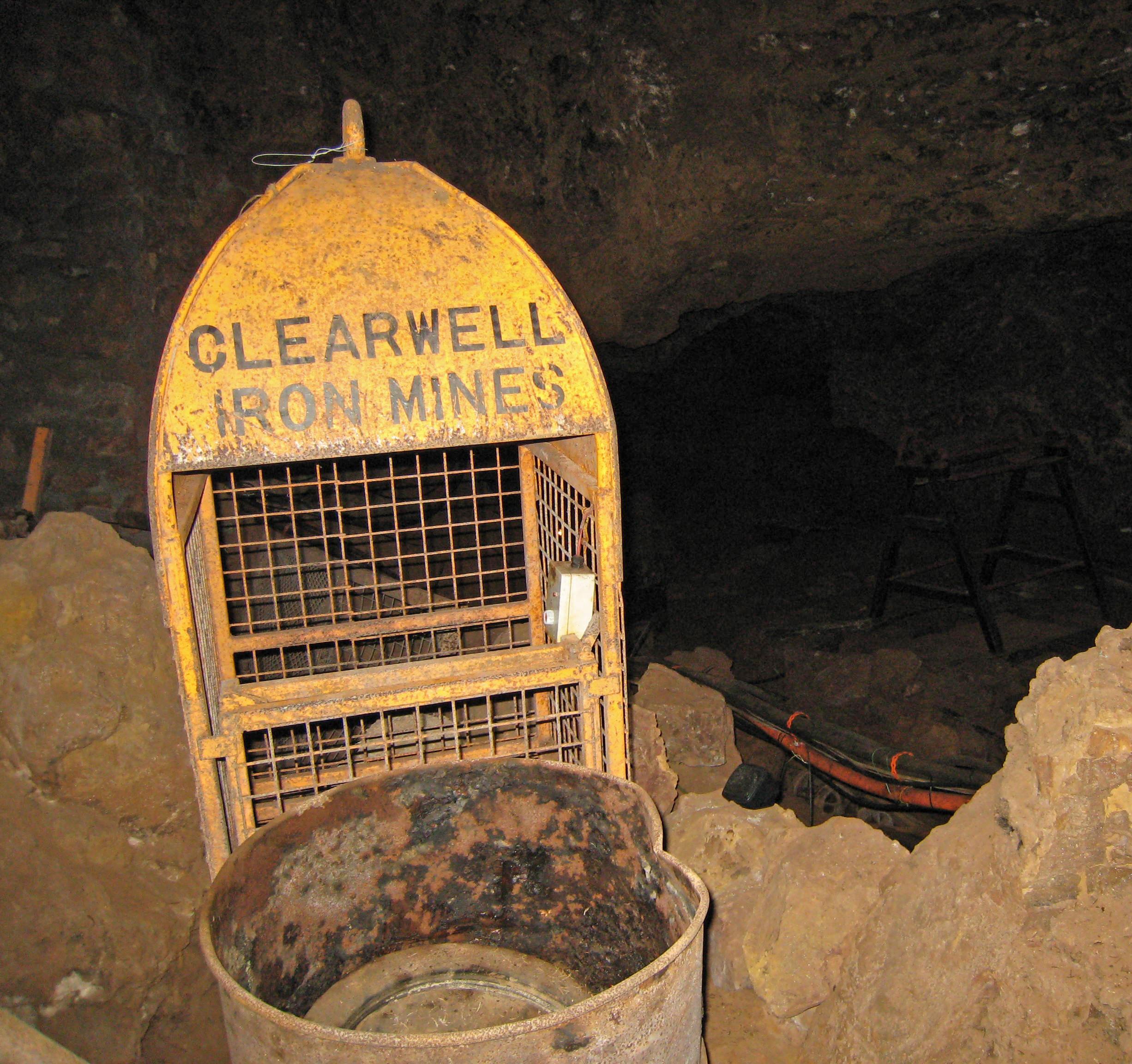
Clearwell Caves

Clearwell Caves, at Clearwell in the Forest of Dean, Gloucestershire, England, is a natural cave system which has been extensively mined for iron ore....

Gorsty Knoll

Gorsty Knoll is a small hamlet, located in the Forest of Dean, Gloucestershire, England. The internationally important remains of Darkhill Ironworks and...

Old Bow and Old Ham Mines

Old Bow And Old Ham Mines (grid reference SO579088) is a 40.3-hectare (100-acre) biological Site of Special Scientific Interest in Gloucestershire, notified...

Nearby Amenities

Located within 500m of 51.766356,-2.5927295
Little Drybrook
Is In: Gloucestershire, England, UK
Is In Town: Coleford
Note: This a different village to the one in the northern parts of the forest, this one is in Coleford
Place: hamlet
Source: NPE
Wikidata: Q22672376
Lat/Long: 51.7622834/-2.5902198
Bus Stop
Holly Ln
Naptan AtcoCode: 1600GLF867
Naptan Bearing: SW
Naptan CommonName: Holly Ln
Naptan Indicator: Opp
Naptan NaptanCode: glogjwtm
Naptan Street: Bromley Rd
Naptan Verified: no
Source: naptan_import
Lat/Long: 51.7680641/-2.5893378
Power: pole
Lat/Long: 51.7649299/-2.5886856
Location Transition: yes
Power: pole
Lat/Long: 51.7680224/-2.5904988
Power: pole
Lat/Long: 51.7641799/-2.5879884
Power: pole
Lat/Long: 51.7656656/-2.5892973
Power: pole
Lat/Long: 51.7664704/-2.5898229
Power: pole
Lat/Long: 51.7672821/-2.5901769
Power: pole
Lat/Long: 51.7620988/-2.5944605
Power: pole
Lat/Long: 51.7629604/-2.5948193
Power: pole
Lat/Long: 51.763597/-2.5950775
Power: pole
Lat/Long: 51.7642287/-2.5953282
Power: pole
Lat/Long: 51.7647292/-2.5955348
Power: pole
Lat/Long: 51.7664281/-2.5962415
Power: pole
Lat/Long: 51.7673195/-2.5965768
Power: pole
Lat/Long: 51.768137/-2.5969175
Power: pole
Lat/Long: 51.7691877/-2.59736
Power: pole
Lat/Long: 51.7693404/-2.5959411
Power: pole
Lat/Long: 51.7695197/-2.5942782
Power: pole
Lat/Long: 51.7696101/-2.5935204
Power: pole
Lat/Long: 51.7696964/-2.5926742
Power: pole
Lat/Long: 51.7695172/-2.5916442
Power: pole
Lat/Long: 51.7693147/-2.5905405
Power: pole
Lat/Long: 51.7690599/-2.5891364
The data included in this document is from www.openstreetmap.org. The data is made available under ODbL.

Have you been to Ellwood Inclosure?

Leave your review of Ellwood Inclosure below (or comments, questions and feedback).