Drybrook, Little

Settlement in Gloucestershire Forest of Dean

England

Drybrook, Little

Train from Coleford to Parkend The Coleford Branch was part of the Severn and Wye railway in the Forest of Dean. The railway (now closed and lifted) was crossed here by the waymarked path from St Briavels to Mitcheldean.
Train from Coleford to Parkend Credit: John Thorn

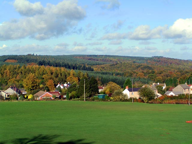
Drybrook is a small village located in the Forest of Dean district of Gloucestershire, England. Situated approximately 17 miles west of Gloucester, it is part of the rural community of Littledean. With a population of around 2,500 residents, the village is surrounded by picturesque countryside and is known for its natural beauty.

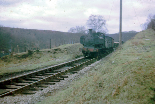
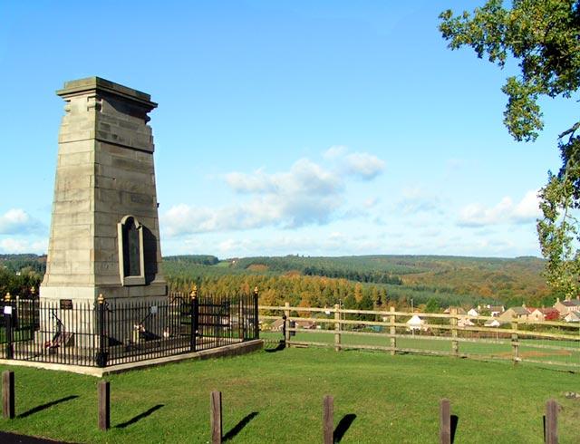
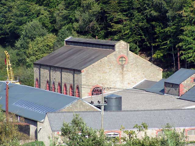
The village of Drybrook has a rich history, dating back to the 19th century when it was primarily a mining community. The local economy was heavily dependent on the coal industry until its decline in the mid-20th century. Today, the village has diversified its economy, with residents engaged in various industries such as forestry, agriculture, and tourism.

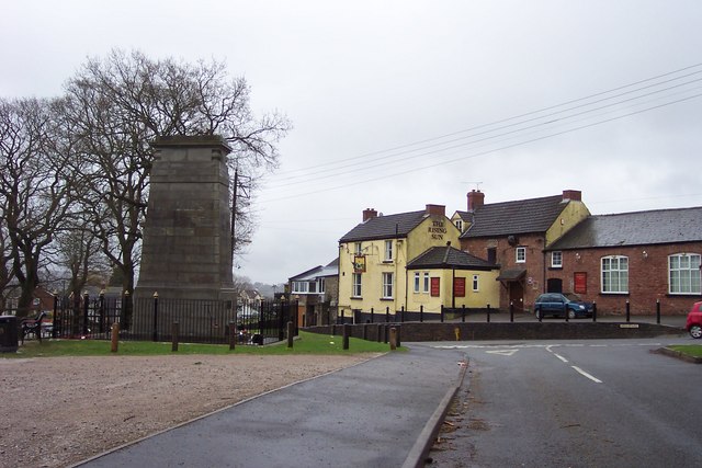
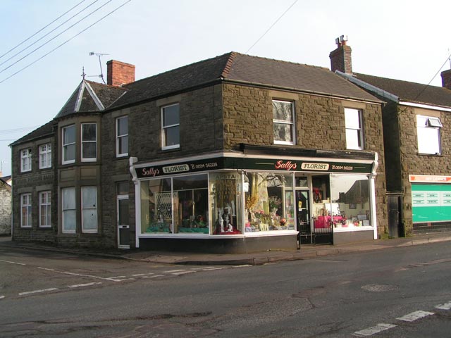
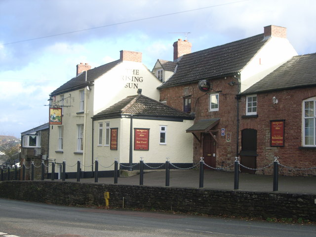
Drybrook offers a range of amenities to its residents, including a primary school, a community center, a post office, and several small shops. The village also has a football club and a cricket club, providing recreational opportunities for sports enthusiasts. Additionally, there are several pubs and restaurants where residents and visitors can enjoy a meal or a drink.

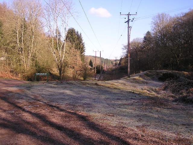
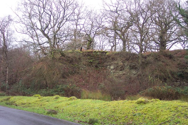
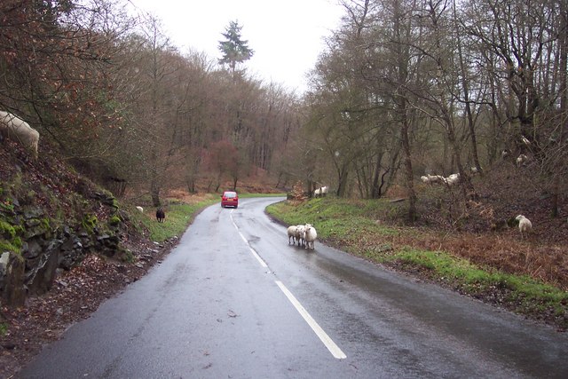
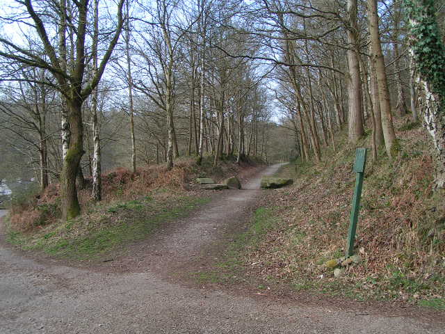
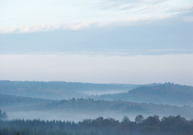
The surrounding Forest of Dean offers numerous outdoor activities, including walking, cycling, and horse riding trails. The area is known for its beautiful woodland scenery, with many visitors drawn to its tranquil atmosphere and abundant wildlife.

In conclusion, Drybrook is a charming village in the heart of Gloucestershire, offering a peaceful rural lifestyle and access to the stunning Forest of Dean. With its rich history, picturesque surroundings, and range of amenities, it is a desirable place to live and visit.

If you have any feedback on the listing, please let us know in the comments section below.

Drybrook, Little Images

Images are sourced within 2km of 51.761348/-2.58946 or Grid Reference SO5907. Thanks to Geograph Open Source API. All images are credited.

Train from Coleford to Parkend The Coleford Branch was part of the Severn and Wye railway in the Forest of Dean. The railway (now closed and lifted) was crossed here by the waymarked path from St Briavels to Mitcheldean.
Train from Coleford to Parkend
The Coleford Branch was part of the Severn and Wye railway in the Forest of Dean. The railway (now closed and lifted) was crossed here by the waymarked path from St Briavels to Mitcheldean.
Power lines through the forest Looking towards the North West.
Power lines through the forest
Looking towards the North West.
Bream War Memorial. The yellow pub is the Rising Sun.
Bream War Memorial.
The yellow pub is the Rising Sun.
Disused quarry near Parkend. One of the many reminders of the industrial past of the Forest of Dean.
Disused quarry near Parkend.
One of the many reminders of the industrial past of the Forest of Dean.
Sheep in the road! A common sight in the Forest of Dean, and quite a traffic hazard.
Sheep in the road!
A common sight in the Forest of Dean, and quite a traffic hazard.
Bream Cenotaph Bream Cenotaph. The names of those who died in World War II are commemorated on the tablet. Those who died in World War I are listed on the North face.
Bream Cenotaph
Bream Cenotaph. The names of those who died in World War II are commemorated on the tablet. Those who died in World War I are listed on the North face.
Sun Green, Bream Most of Sun Green is now covered by the sports fields of Bream Sports Club. In the background are the hills of the Forest of Dean. To the right of the photographer is Bream Cenotaph SO 60306 05839.
Sun Green, Bream
Most of Sun Green is now covered by the sports fields of Bream Sports Club. In the background are the hills of the Forest of Dean. To the right of the photographer is Bream Cenotaph SO 60306 05839.
Manchester House at 'Bream Schools' Manchester House at 'Bream Schools', one of Bream's early shops - now Sally's Florist.
Manchester House at 'Bream Schools'
Manchester House at 'Bream Schools', one of Bream's early shops - now Sally's Florist.
The Flour Mill The site of the former Flour Mill Colliery.
The Flour Mill
The site of the former Flour Mill Colliery.
Old Railway Track from Coleford to Parkend Photo taken from the same position as <a href="https://www.geograph.org.uk/photo/85548">SO6008 : Train from Coleford to Parkend</a>, but 44 years later. The line closed in 1967 and few traces remain. The trackbed is now a walkway and cycleway.
Old Railway Track from Coleford to Parkend
Photo taken from the same position as SO6008 : Train from Coleford to Parkend, but 44 years later. The line closed in 1967 and few traces remain. The trackbed is now a walkway and cycleway.
Bream Community Centre
The Rising Sun public House, Bream
Mary Rose Young pottery and gallery One of many "craft" places in the forest.  The yellow is a strong attractor when driving or walking past.
Mary Rose Young pottery and gallery
One of many "craft" places in the forest. The yellow is a strong attractor when driving or walking past.
Pike House One of a number of such buildings, at the junctions of (turn)pikes within the forest.  The forest is a maze of roads and presumably these toll houses were frequent to make sure that no-one sneaked past with valuable coal.
Pike House
One of a number of such buildings, at the junctions of (turn)pikes within the forest. The forest is a maze of roads and presumably these toll houses were frequent to make sure that no-one sneaked past with valuable coal.
Farming in the Forest Not all of the Forest of Dean consists of woodland.  And not all of the sheep are grazing on the roads.  Here is conventional sheep pasture, with a fair few moles as well.
Farming in the Forest
Not all of the Forest of Dean consists of woodland. And not all of the sheep are grazing on the roads. Here is conventional sheep pasture, with a fair few moles as well.
Forest dwellers These two lambs are growing up next to the Coleford Road.  They seem contented in the spring sunshine.
Forest dwellers
These two lambs are growing up next to the Coleford Road. They seem contented in the spring sunshine.
The view north from Bream Cenotaph Taken in November 2007 and not in any way digitally altered. These are "those blue remembered hills"
The view north from Bream Cenotaph
Taken in November 2007 and not in any way digitally altered. These are "those blue remembered hills"
Show me another place!

Drybrook, Little is located at Grid Ref: SO5907 (Lat: 51.761348, Lng: -2.58946)

Administrative County: Gloucestershire

District: Forest of Dean

Police Authority: Gloucestershire

What 3 Words

///tonal.gratitude.mixed. Near Bream, Gloucestershire

Related Wikis

Ellwood, Gloucestershire

Ellwood is a hamlet in the Forest of Dean district in Gloucestershire, England. It lies around 3 kilometres (1.9 mi) south-east of Coleford. The hamlet...

Sling, Gloucestershire

Sling is a village in Gloucestershire, England. The village is located between Clearwell and Bream. It is just south of the village of Milkwall. ��2�...

Mary Rose Young

Mary Rose Young is a ceramic artist who lives and works in the Forest of Dean, Gloucestershire, in the UK. == Early life == Mary Rose Young was born near...

Bream, Gloucestershire

Bream (historically known as Breem) is a village in the Forest of Dean, west Gloucestershire, England. The population was around 3,170 in the 2011 census...

Nearby Amenities

Located within 500m of 51.761348,-2.58946
Clement's Tump
Created By: Potlatch 0.10f
Historic: monument
Source: NPE
Lat/Long: 51.7587537/-2.5895981
Little Drybrook
Is In: Gloucestershire, England, UK
Is In Town: Coleford
Note: This a different village to the one in the northern parts of the forest, this one is in Coleford
Place: hamlet
Source: NPE
Wikidata: Q22672376
Lat/Long: 51.7622834/-2.5902198
Bus Stop
Elwall Farm Turn
Naptan AtcoCode: 1600GL1339
Naptan Bearing: NW
Naptan CommonName: Elwall Farm Turn
Naptan NaptanCode: gloagatd
Naptan Street: Main Road
Naptan Verified: no
Source: naptan_import
Lat/Long: 51.7597267/-2.5923937
Elwall Farm Turn
Naptan AtcoCode: 1600GL1340
Naptan Bearing: SE
Naptan BusStopType: CUS
Naptan CommonName: Elwall Farm Turn
Naptan NaptanCode: gloagatg
Naptan Street: Main Road
Naptan Verified: no
Source: naptan_import
Lat/Long: 51.7597685/-2.5922146
Bus Stop
Bronllys
Naptan AtcoCode: 1600GLF519
Naptan Bearing: NW
Naptan CommonName: Bronllys
Naptan Indicator: Opp
Naptan NaptanCode: gloagamg
Naptan Street: Main Road
Naptan Verified: no
Source: naptan_import
Lat/Long: 51.7616024/-2.5958465
Bus Stop
Bronllys
Naptan AtcoCode: 1600GLF520
Naptan Bearing: SE
Naptan CommonName: Bronllys
Naptan NaptanCode: gloagamj
Naptan Street: Main Road
Naptan Verified: no
Source: naptan_import
Lat/Long: 51.7616835/-2.5958186
Post Box
Fixme: Reference
Post Box Type: lamp
Royal Cypher: EIIR
Royal Cypher Wikidata: Q33102113
Lat/Long: 51.7597365/-2.592435
Telephone
Booth: K6
Covered: booth
Man Made: telephone_box
Source: Bing
Lat/Long: 51.7597518/-2.5924215
Power: pole
Lat/Long: 51.7624551/-2.5858963
Power: pole
Lat/Long: 51.7649299/-2.5886856
Power: pole
Lat/Long: 51.7641799/-2.5879884
Power: pole
Lat/Long: 51.7634279/-2.5871194
Power: pole
Lat/Long: 51.7621181/-2.5845632
Power: pole
Lat/Long: 51.7656656/-2.5892973
Power: pole
Lat/Long: 51.7584888/-2.5849937
Power: pole
Lat/Long: 51.7593944/-2.5874895
Power: pole
Lat/Long: 51.7596194/-2.5883451
Power: pole
Lat/Long: 51.7599714/-2.5899008
Power: pole
Lat/Long: 51.7603457/-2.5914833
Power: pole
Lat/Long: 51.7605408/-2.592245
Power: pole
Lat/Long: 51.7618041/-2.5940314
Power: pole
Lat/Long: 51.7620988/-2.5944605
Power: pole
Lat/Long: 51.7629604/-2.5948193
Power: pole
Lat/Long: 51.763597/-2.5950775
Bench
Lat/Long: 51.7597307/-2.5924526
Defibrillator
Defibrillator Location: on back of bus shelter
Emergency: defibrillator
Indoor: no
Lat/Long: 51.7597279/-2.5924159
The data included in this document is from www.openstreetmap.org. The data is made available under ODbL.

Have you been to Drybrook, Little?

Leave your review of Drybrook, Little below (or comments, questions and feedback).