Clementsendgreen Inclosure

Wood, Forest in Gloucestershire Forest of Dean

England

Clementsendgreen Inclosure

The remains of the Titanic Steelworks The Titanic steelworks were so named because Robert Mushet the owner was experimenting with Titanium at that time.  Robert Mushet was working on solving the problems with the Bessemer steel making process.
The remains of the Titanic Steelworks Credit: Philip Halling

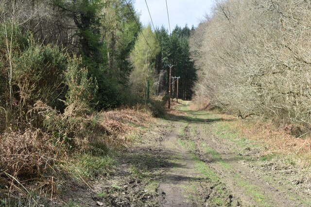
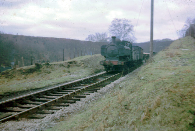
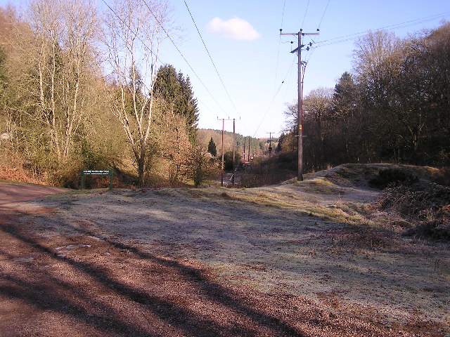
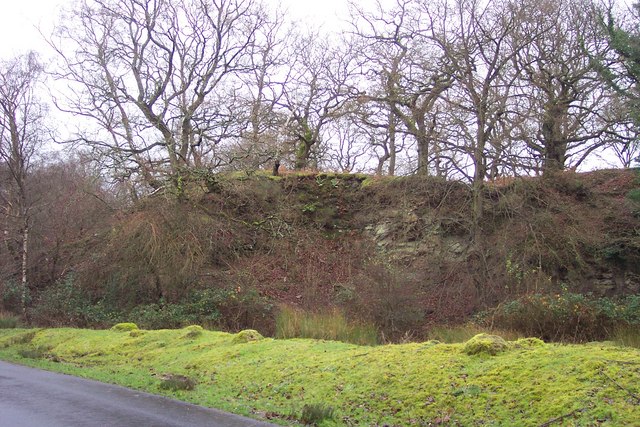
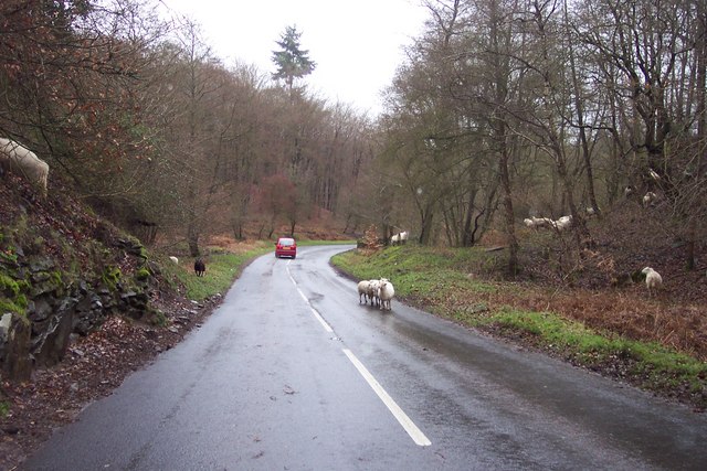
Clementsendgreen Inclosure is a woodland area located in Gloucestershire, England. Situated in the heart of the Forest of Dean, it covers an approximate area of 200 acres and is known for its diverse ecosystem and scenic beauty.

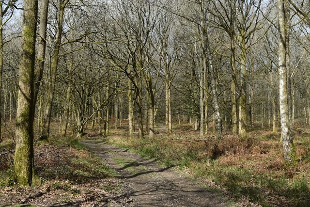
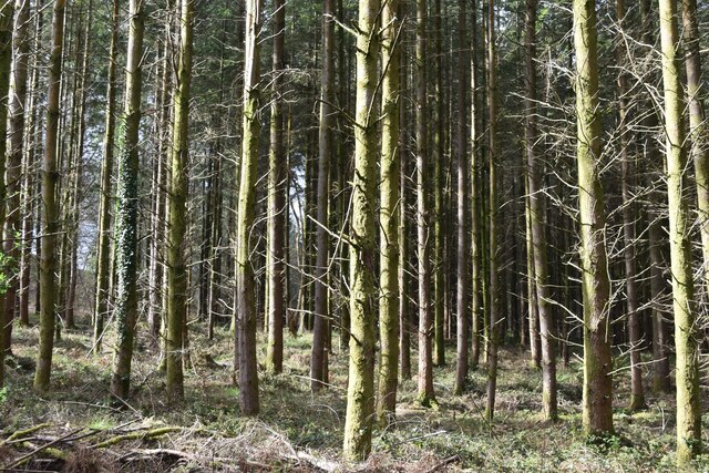
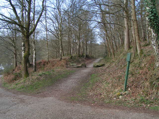
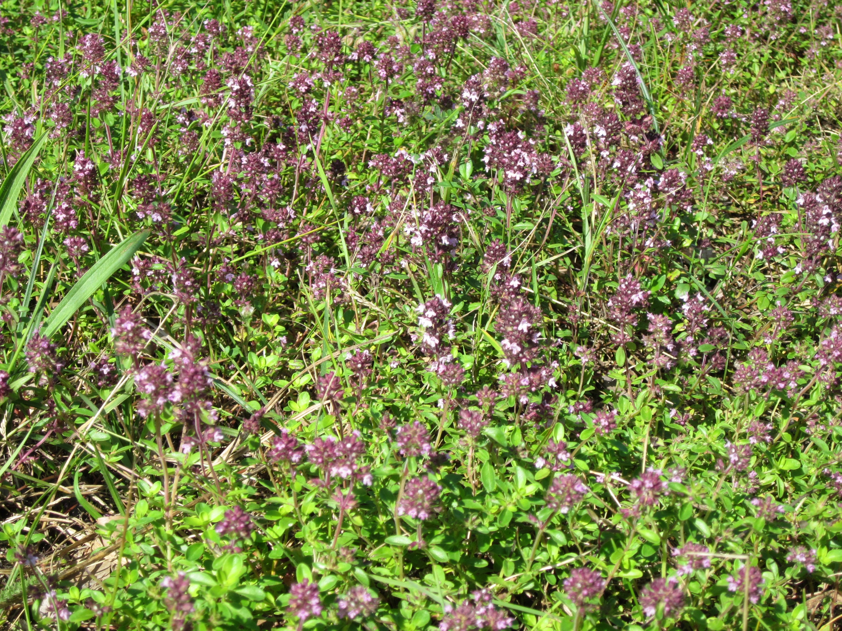
The woodland is predominantly composed of deciduous trees such as oak, beech, and ash, creating a lush and vibrant environment. The canopy provides ample shade, while the forest floor is covered with a thick layer of leaf litter, supporting a rich variety of plants and fungi.

Clementsendgreen Inclosure is home to a wide range of wildlife, including several species of mammals, birds, and insects. Roe deer, badgers, and foxes are frequently spotted within the woodland, along with numerous bird species such as woodpeckers, owls, and thrushes. The diverse habitat also attracts a multitude of butterflies, bees, and other insects, contributing to the overall biodiversity of the area.

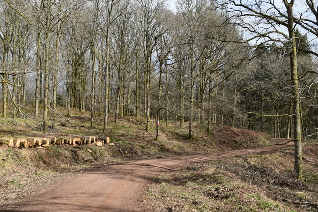
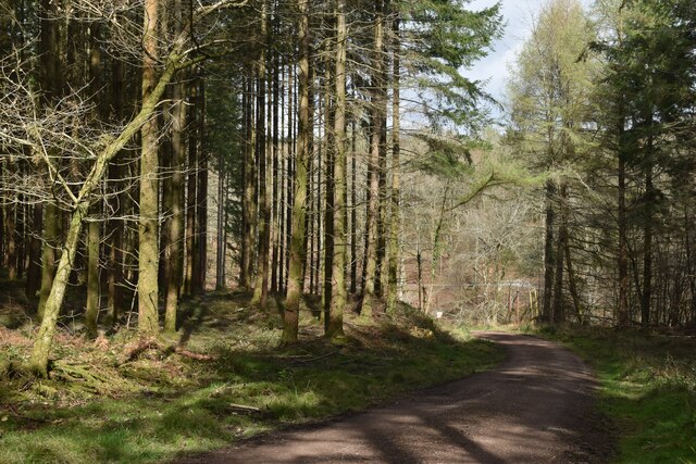
The woodland is a popular destination for nature enthusiasts and hikers. Several well-maintained trails wind through the forest, offering visitors the opportunity to explore its natural wonders. There are also designated picnic areas and viewpoints that provide stunning vistas of the surrounding landscape.

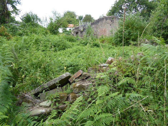
Clementsendgreen Inclosure holds historical significance as well. It was once part of the royal hunting ground known as the Forest of Dean, dating back to medieval times. The area has seen various land management practices over the years, including timber extraction and coppicing, which have shaped the woodland's present-day characteristics.

Overall, Clementsendgreen Inclosure is a cherished natural asset in Gloucestershire, offering a sanctuary for wildlife and a serene escape for those seeking to immerse themselves in the beauty of the Forest of Dean.

If you have any feedback on the listing, please let us know in the comments section below.

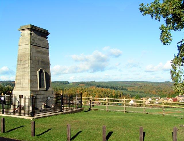
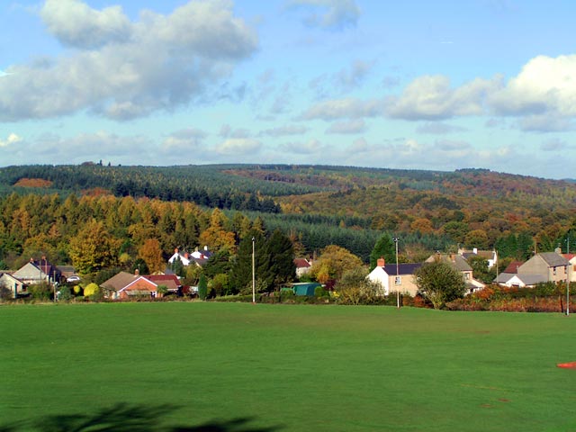
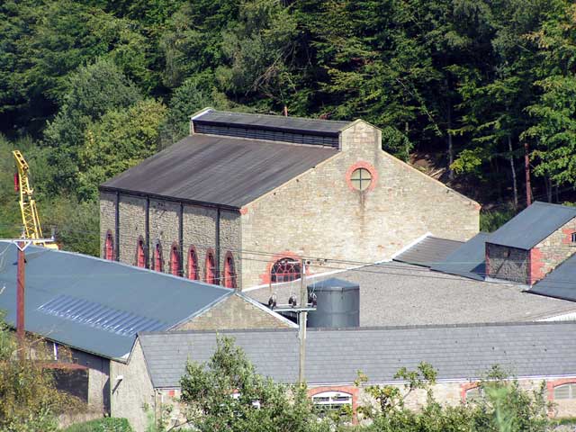
Clementsendgreen Inclosure Images

Images are sourced within 2km of 51.7617/-2.5978268 or Grid Reference SO5807. Thanks to Geograph Open Source API. All images are credited.

The remains of the Titanic Steelworks The Titanic steelworks were so named because Robert Mushet the owner was experimenting with Titanium at that time.  Robert Mushet was working on solving the problems with the Bessemer steel making process.
The remains of the Titanic Steelworks
The Titanic steelworks were so named because Robert Mushet the owner was experimenting with Titanium at that time. Robert Mushet was working on solving the problems with the Bessemer steel making process.
Sports ground at Bream Seen from the Cenotaph.
Sports ground at Bream
Seen from the Cenotaph.
Woodland path at Parkend Walk
Timber stacked beside the Gloucestershire Way
Forest track beside Dry Brook
View into woods at Parkend Walk
Forest tack at Parkend Walk
Track and house below former railway line
Houses in valley bottom The Gloucestershire Way descends steeply, crosses the road and climbs again behind these buildings, one of which hosts a pottery studio.
Houses in valley bottom
The Gloucestershire Way descends steeply, crosses the road and climbs again behind these buildings, one of which hosts a pottery studio.
Boundary Stone, Bream In the garden eating area of a coffee shop in the High Street, opposite another Royal Forest of Dean BS <a href="https://www.geograph.org.uk/photo/7483933">SO6005 : Boundary Stone, Bream</a>, in the minuscule front garden of Drywell Cottage.

Inscription: D. F. / Nᴼ. 47 / 2004

Milestone Society National ID: GL_DFWDEA47em
Boundary Stone, Bream
In the garden eating area of a coffee shop in the High Street, opposite another Royal Forest of Dean BS SO6005 : Boundary Stone, Bream, in the minuscule front garden of Drywell Cottage. Inscription: D. F. / Nᴼ. 47 / 2004 Milestone Society National ID: GL_DFWDEA47em
Train from Coleford to Parkend The Coleford Branch was part of the Severn and Wye railway in the Forest of Dean. The railway (now closed and lifted) was crossed here by the waymarked path from St Briavels to Mitcheldean.
Train from Coleford to Parkend
The Coleford Branch was part of the Severn and Wye railway in the Forest of Dean. The railway (now closed and lifted) was crossed here by the waymarked path from St Briavels to Mitcheldean.
Power lines through the forest Looking towards the North West.
Power lines through the forest
Looking towards the North West.
Disused quarry near Parkend. One of the many reminders of the industrial past of the Forest of Dean.
Disused quarry near Parkend.
One of the many reminders of the industrial past of the Forest of Dean.
Sheep in the road! A common sight in the Forest of Dean, and quite a traffic hazard.
Sheep in the road!
A common sight in the Forest of Dean, and quite a traffic hazard.
Bream Cenotaph Bream Cenotaph. The names of those who died in World War II are commemorated on the tablet. Those who died in World War I are listed on the North face.
Bream Cenotaph
Bream Cenotaph. The names of those who died in World War II are commemorated on the tablet. Those who died in World War I are listed on the North face.
Sun Green, Bream Most of Sun Green is now covered by the sports fields of Bream Sports Club. In the background are the hills of the Forest of Dean. To the right of the photographer is Bream Cenotaph SO 60306 05839.
Sun Green, Bream
Most of Sun Green is now covered by the sports fields of Bream Sports Club. In the background are the hills of the Forest of Dean. To the right of the photographer is Bream Cenotaph SO 60306 05839.
The Flour Mill The site of the former Flour Mill Colliery.
The Flour Mill
The site of the former Flour Mill Colliery.
Old Railway Track from Coleford to Parkend Photo taken from the same position as <a href="https://www.geograph.org.uk/photo/85548">SO6008 : Train from Coleford to Parkend</a>, but 44 years later. The line closed in 1967 and few traces remain. The trackbed is now a walkway and cycleway.
Old Railway Track from Coleford to Parkend
Photo taken from the same position as SO6008 : Train from Coleford to Parkend, but 44 years later. The line closed in 1967 and few traces remain. The trackbed is now a walkway and cycleway.
Show me another place!

Clementsendgreen Inclosure is located at Grid Ref: SO5807 (Lat: 51.7617, Lng: -2.5978268)

Administrative County: Gloucestershire

District: Forest of Dean

Police Authority: Gloucestershire

What 3 Words

///daffodils.fool.marginal. Near Bream, Gloucestershire

Related Wikis

Sling, Gloucestershire

Sling is a village in Gloucestershire, England. The village is located between Clearwell and Bream. It is just south of the village of Milkwall. ��2�...

Ellwood, Gloucestershire

Ellwood is a hamlet in the Forest of Dean district in Gloucestershire, England. It lies around 3 kilometres (1.9 mi) south-east of Coleford. The hamlet...
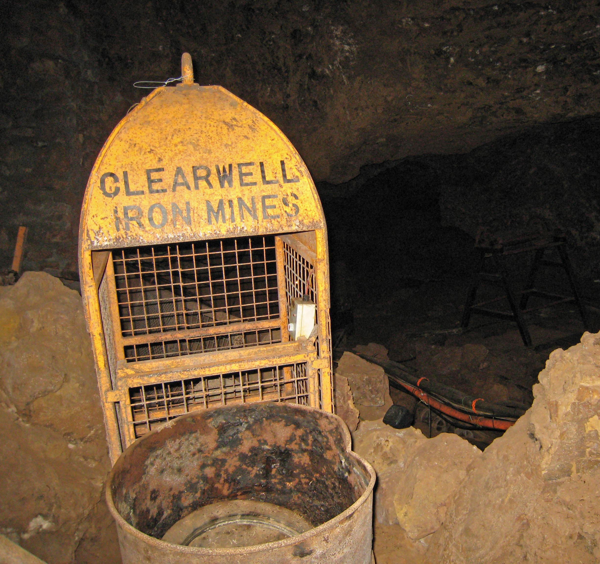
Clearwell Caves

Clearwell Caves, at Clearwell in the Forest of Dean, Gloucestershire, England, is a natural cave system which has been extensively mined for iron ore....

Darkhill Ironworks

Darkhill Ironworks, and the neighbouring Titanic Steelworks, are internationally important industrial remains associated with the development of the iron...

Milkwall

Milkwall is a village in the Forest of Dean in Gloucestershire, England. It lies between the village of Sling to the south, and the town of Coleford to...

Tudor Farm Bank

Tudor Farm Bank (grid reference SO573081) is a 3.68-hectare (9.1-acre) biological Site of Special Scientific Interest in Gloucestershire, notified in 1999...

Old Bow and Old Ham Mines

Old Bow And Old Ham Mines (grid reference SO579088) is a 40.3-hectare (100-acre) biological Site of Special Scientific Interest in Gloucestershire, notified...
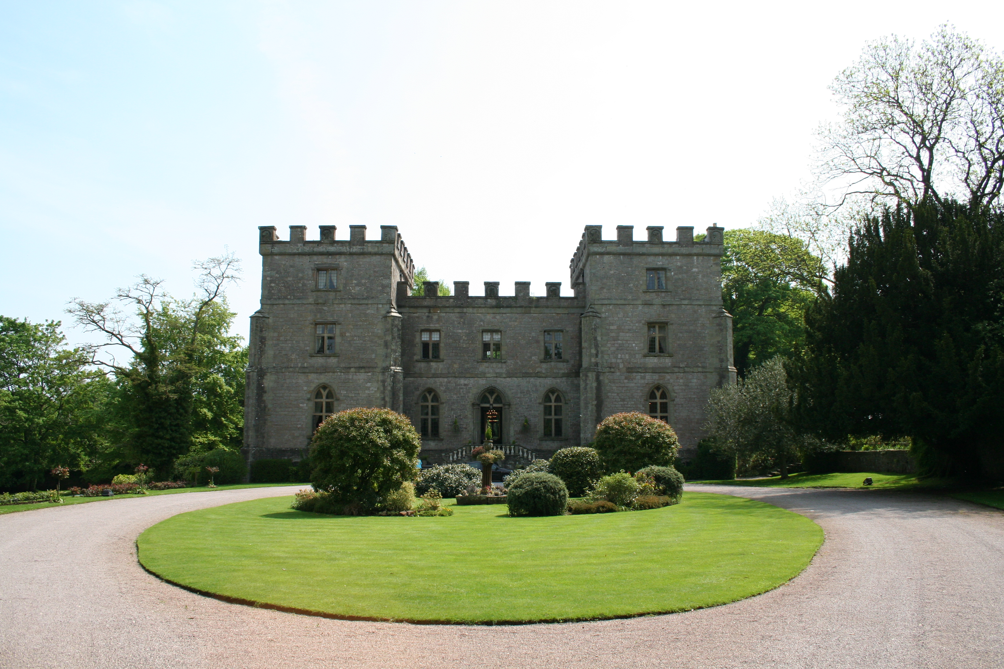
Clearwell Castle

Clearwell Castle in Clearwell, the Forest of Dean, Gloucestershire, is a Gothic Revival house constructed from 1727. Built by Thomas Wyndham to the designs...

Nearby Amenities

Located within 500m of 51.7617,-2.5978268
Bus Stop
Elwall Farm Turn
Naptan AtcoCode: 1600GL1339
Naptan Bearing: NW
Naptan CommonName: Elwall Farm Turn
Naptan NaptanCode: gloagatd
Naptan Street: Main Road
Naptan Verified: no
Source: naptan_import
Lat/Long: 51.7597267/-2.5923937
Elwall Farm Turn
Naptan AtcoCode: 1600GL1340
Naptan Bearing: SE
Naptan BusStopType: CUS
Naptan CommonName: Elwall Farm Turn
Naptan NaptanCode: gloagatg
Naptan Street: Main Road
Naptan Verified: no
Source: naptan_import
Lat/Long: 51.7597685/-2.5922146
Bus Stop
Montague Inn
Naptan AtcoCode: 1600GLF299
Naptan Bearing: NW
Naptan CommonName: Montague Inn
Naptan NaptanCode: gloadwpw
Naptan Street: Clements End Rd
Naptan Verified: no
Source: naptan_import
Lat/Long: 51.7647535/-2.6021046
Bus Stop
Montague Inn
Naptan AtcoCode: 1600GLF300
Naptan Bearing: SE
Naptan BusStopType: CUS
Naptan CommonName: Montague Inn
Naptan Indicator: Opp
Naptan NaptanCode: gloadwta
Naptan Street: Clements End Rd
Naptan Verified: no
Source: naptan_import
Lat/Long: 51.7646559/-2.6018425
Bus Stop
Bronllys
Naptan AtcoCode: 1600GLF519
Naptan Bearing: NW
Naptan CommonName: Bronllys
Naptan Indicator: Opp
Naptan NaptanCode: gloagamg
Naptan Street: Main Road
Naptan Verified: no
Source: naptan_import
Lat/Long: 51.7616024/-2.5958465
Bus Stop
Bronllys
Naptan AtcoCode: 1600GLF520
Naptan Bearing: SE
Naptan CommonName: Bronllys
Naptan NaptanCode: gloagamj
Naptan Street: Main Road
Naptan Verified: no
Source: naptan_import
Lat/Long: 51.7616835/-2.5958186
Post Box
Fixme: Reference
Post Box Type: lamp
Royal Cypher: EIIR
Royal Cypher Wikidata: Q33102113
Lat/Long: 51.7597365/-2.592435
Telephone
Booth: K6
Covered: booth
Man Made: telephone_box
Source: Bing
Lat/Long: 51.7597518/-2.5924215
Power: pole
Lat/Long: 51.7603457/-2.5914833
Power: pole
Lat/Long: 51.7605408/-2.592245
Power: pole
Lat/Long: 51.7618041/-2.5940314
Power: pole
Lat/Long: 51.7620988/-2.5944605
Power: pole
Lat/Long: 51.7629604/-2.5948193
Power: pole
Lat/Long: 51.763597/-2.5950775
Power: pole
Lat/Long: 51.7642287/-2.5953282
Power: pole
Lat/Long: 51.7647292/-2.5955348
Bench
Lat/Long: 51.7597307/-2.5924526
Defibrillator
Defibrillator Location: on back of bus shelter
Emergency: defibrillator
Indoor: no
Lat/Long: 51.7597279/-2.5924159
Ford: yes
Lat/Long: 51.7575321/-2.59615
The data included in this document is from www.openstreetmap.org. The data is made available under ODbL.

Have you been to Clementsendgreen Inclosure?

Leave your review of Clementsendgreen Inclosure below (or comments, questions and feedback).