Cuerdale Wood

Wood, Forest in Lancashire South Ribble

England

Cuerdale Wood

M6 approaching crossing of River Ribble
M6 approaching crossing of River Ribble Credit: Alpin Stewart

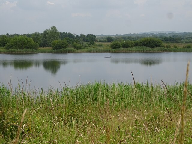
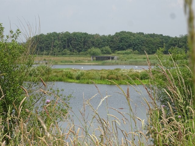
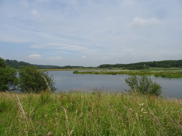
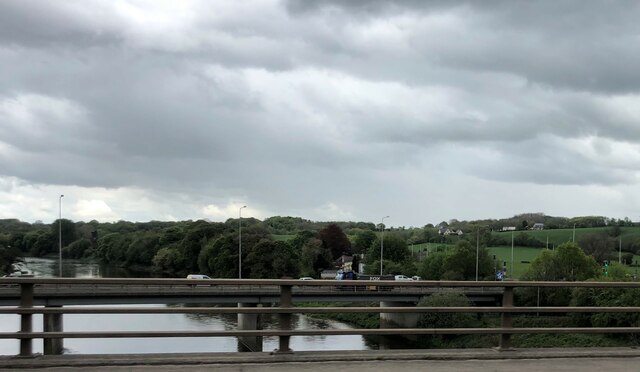
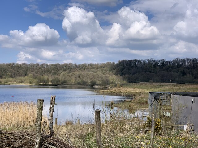
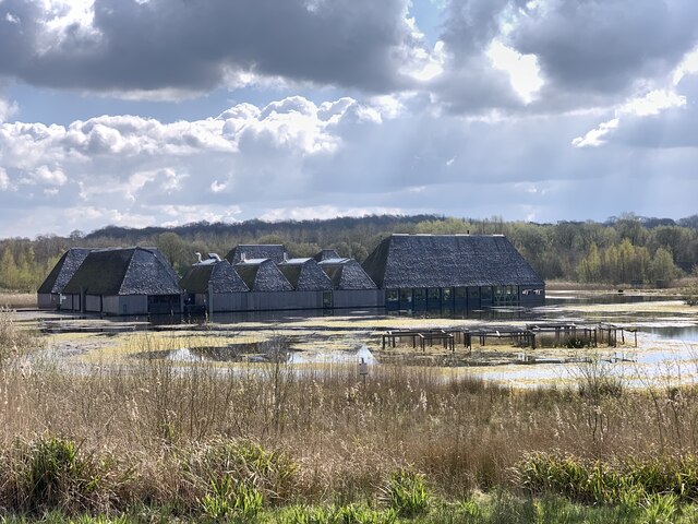
Cuerdale Wood is a picturesque woodland located in Lancashire, England. Covering an area of approximately 650 acres, it is a popular destination for nature lovers and outdoor enthusiasts. Situated along the banks of the River Ribble, the wood offers a tranquil and serene atmosphere, making it an ideal escape from the hustle and bustle of city life.

The wood is primarily composed of broadleaf trees such as oak, birch, and beech, which create a dense canopy and provide a habitat for a diverse range of wildlife. Visitors can spot various species of birds, including woodpeckers, owls, and kingfishers, as well as mammals like deer, foxes, and squirrels.

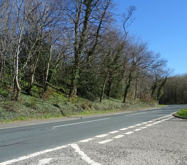
There are several well-maintained footpaths that meander through the wood, allowing visitors to explore its beauty at their own pace. These paths offer stunning views of the surrounding countryside and the River Ribble, making it a popular spot for photographers and nature enthusiasts.

Cuerdale Wood is also known for its historical significance. It is home to the Cuerdale Hoard, the largest Viking silver treasure ever found in Western Europe. Discovered in 1840, this hoard consists of over 8,600 items, including coins, jewelry, and other valuable artifacts. Today, the hoard is housed in the British Museum, but its discovery has added to the allure and intrigue of Cuerdale Wood.

Overall, Cuerdale Wood is a captivating destination that offers a blend of natural beauty, wildlife, and historical significance. Whether one is seeking a peaceful stroll, a bird-watching adventure, or a glimpse into the past, this woodland has something to offer for everyone.

If you have any feedback on the listing, please let us know in the comments section below.

Cuerdale Wood Images

Images are sourced within 2km of 53.756523/-2.6414778 or Grid Reference SD5729. Thanks to Geograph Open Source API. All images are credited.

M6 approaching crossing of River Ribble
Ribbleton Pool, Brockholes Nature Reserve
Number One Pit, Brockholes Nature Reserve
Number One Pit, Brockholes Nature Reserve The south end of the Number One Pit at Brockholes Nature Reserve.
Number One Pit, Brockholes Nature Reserve
The south end of the Number One Pit at Brockholes Nature Reserve.
Workings at Lower Brockholes
Matrix board - northbound M6
M5 crossing the River Ribble east of Preston Slipway for the A677 on the other viaduct
M5 crossing the River Ribble east of Preston
Slipway for the A677 on the other viaduct
St. Mary and St John Southworth Church, Salmesbury Unusual Roman Catholic Church in the scattered community of Salmesbury
<a href="https://www.geograph.org.uk/photo/3876178">SD5930 : St Mary's And St John Southworth Church, Samlesbury</a>
St. Mary and St John Southworth Church, Salmesbury
Unusual Roman Catholic Church in the scattered community of Salmesbury SD5930 : St Mary's And St John Southworth Church, Samlesbury
St. Leonard the Less Church, Salmesbury Grade I Listed Building mostly dating from the 1550's. 
There are roughly around 10 saints called Leonard - but I cannot identify which one is applicable to this church.
St. Leonard the Less Church, Salmesbury
Grade I Listed Building mostly dating from the 1550's. There are roughly around 10 saints called Leonard - but I cannot identify which one is applicable to this church.
St Leonard The Less, Samlesbury
OS Published Abstract Bolt: Samlesbury, St. Leonard's Church <span class="nowrap"><a title="https://www.bench-marks.org.uk/bm29550" rel="nofollow ugc noopener" href="https://www.bench-marks.org.uk/bm29550">Link</a><img style="margin-left:2px;" alt="External link" title="External link - shift click to open in new window" src="https://s1.geograph.org.uk/img/external.png" width="10" height="10"/></span>
OS Published Abstract Bolt: Samlesbury, St. Leonard's Church
Location of OS Published Abstract Bolt: Samlesbury, St. Leonard's Church
Visitor Village at Brockholes Nature Reserve Most of the site was originally farmland, on the floodplain of the River Ribble. It was bordered by woodland on the slopes to the north, and by the river to the east and south. The M6 motorway was opened in 1958.
Sand and gravel was quarried east of the M6 from 1996 to 2007, when the activity transferred to the west of the M6 (Lower Brockholes).
The site was bought by the Lancashire Wildlife Trust in 2007.
The gravel pits have been modified to improve the habitat for wildlife, and enable water levels to be controlled. The creation of wildflower meadows, reedbeds and woodland continues. 
The reserve opened to the public at Easter 2011, after the floating visitor village had been completed.
See <span class="nowrap"><a title="http://www.brockholes.org/" rel="nofollow ugc noopener" href="http://www.brockholes.org/">Link</a><img style="margin-left:2px;" alt="External link" title="External link - shift click to open in new window" src="https://s1.geograph.org.uk/img/external.png" width="10" height="10"/></span> .
Visitor Village at Brockholes Nature Reserve
Most of the site was originally farmland, on the floodplain of the River Ribble. It was bordered by woodland on the slopes to the north, and by the river to the east and south. The M6 motorway was opened in 1958. Sand and gravel was quarried east of the M6 from 1996 to 2007, when the activity transferred to the west of the M6 (Lower Brockholes). The site was bought by the Lancashire Wildlife Trust in 2007. The gravel pits have been modified to improve the habitat for wildlife, and enable water levels to be controlled. The creation of wildflower meadows, reedbeds and woodland continues. The reserve opened to the public at Easter 2011, after the floating visitor village had been completed. See LinkExternal link .
Number One Pit, Brockholes Nature Reserve Most of the site was originally farmland, on the floodplain of the River Ribble. It was bordered by woodland on the slopes to the north, and by the river to the east and south. The M6 motorway was opened in 1958.
Sand and gravel was quarried east of the M6 from 1996 to 2007, when the activity transferred to the west of the M6 (Lower Brockholes).
The site was bought by the Lancashire Wildlife Trust in 2007.
The gravel pits have been modified to improve the habitat for wildlife, and enable water levels to be controlled. The creation of wildflower meadows, reedbeds and woodland continues. 
The reserve opened to the public at Easter 2011, after the floating visitor village had been completed.
See <span class="nowrap"><a title="http://www.brockholes.org/" rel="nofollow ugc noopener" href="http://www.brockholes.org/">Link</a><img style="margin-left:2px;" alt="External link" title="External link - shift click to open in new window" src="https://s1.geograph.org.uk/img/external.png" width="10" height="10"/></span> .
Number One Pit, Brockholes Nature Reserve
Most of the site was originally farmland, on the floodplain of the River Ribble. It was bordered by woodland on the slopes to the north, and by the river to the east and south. The M6 motorway was opened in 1958. Sand and gravel was quarried east of the M6 from 1996 to 2007, when the activity transferred to the west of the M6 (Lower Brockholes). The site was bought by the Lancashire Wildlife Trust in 2007. The gravel pits have been modified to improve the habitat for wildlife, and enable water levels to be controlled. The creation of wildflower meadows, reedbeds and woodland continues. The reserve opened to the public at Easter 2011, after the floating visitor village had been completed. See LinkExternal link .
Visitor Village at Brockholes Nature Reserve Most of the site was originally farmland, on the floodplain of the River Ribble. It was bordered by woodland on the slopes to the north, and by the river to the east and south. The M6 motorway was opened in 1958.
Sand and gravel was quarried east of the M6 from 1996 to 2007, when the activity transferred to the west of the M6 (Lower Brockholes).
The site was bought by the Lancashire Wildlife Trust in 2007.
The gravel pits have been modified to improve the habitat for wildlife, and enable water levels to be controlled. The creation of wildflower meadows, reedbeds and woodland continues. 
The reserve opened to the public at Easter 2011, after the floating visitor village had been completed.
See <span class="nowrap"><a title="http://www.brockholes.org/" rel="nofollow ugc noopener" href="http://www.brockholes.org/">Link</a><img style="margin-left:2px;" alt="External link" title="External link - shift click to open in new window" src="https://s1.geograph.org.uk/img/external.png" width="10" height="10"/></span> .
Visitor Village at Brockholes Nature Reserve
Most of the site was originally farmland, on the floodplain of the River Ribble. It was bordered by woodland on the slopes to the north, and by the river to the east and south. The M6 motorway was opened in 1958. Sand and gravel was quarried east of the M6 from 1996 to 2007, when the activity transferred to the west of the M6 (Lower Brockholes). The site was bought by the Lancashire Wildlife Trust in 2007. The gravel pits have been modified to improve the habitat for wildlife, and enable water levels to be controlled. The creation of wildflower meadows, reedbeds and woodland continues. The reserve opened to the public at Easter 2011, after the floating visitor village had been completed. See LinkExternal link .
The A59 At its junction with Vicarage Lane in Cuerdale.
The A59
At its junction with Vicarage Lane in Cuerdale.
Show me another place!

Cuerdale Wood is located at Grid Ref: SD5729 (Lat: 53.756523, Lng: -2.6414778)

Administrative County: Lancashire

District: South Ribble

Police Authority: Lancashire

What 3 Words

///bound.mixed.wins. Near Preston, Lancashire

Related Wikis

Cuerdale

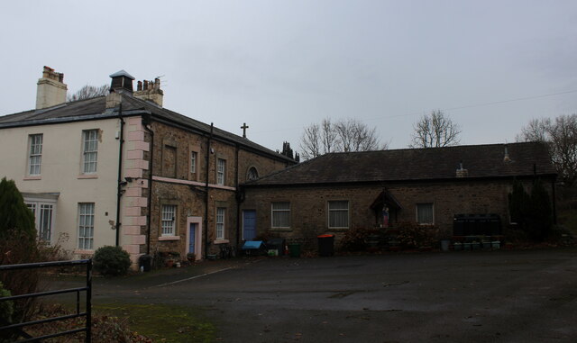
Cuerdale is a civil parish in the South Ribble district of Lancashire, England. It includes Cuerdale Hall and has no substantive settlements. It originated...

Cuerdale Hoard

The Cuerdale Hoard is a hoard of more than 8,600 items, including silver coins, English and Carolingian jewellery, hacksilver and ingots. It was discovered...

Higher Walton, Lancashire

Higher Walton is a village in South Ribble, Lancashire, England. It is on the old road between Blackburn and Preston where it crosses the River Darwen...

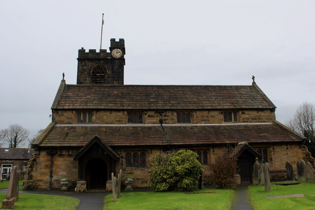
Church of St Leonard the Less, Samlesbury

The Church of St Leonard the Less is an Anglican church in the village of Samlesbury, Lancashire, England, situated close to the banks of the River Ribble...

All Saints Church, Higher Walton

All Saints Church is in Blackburn Road in the village of Higher Walton, Lancashire, England. It is an active Anglican parish church in the deanery of Leyland...

Samlesbury

Samlesbury ( or locally ) is a village and civil parish in South Ribble, Lancashire, England. Samlesbury Hall, a historic house, is in the village, as...

St Leonard's Church, Walton-le-Dale

St Leonard's Church is an Anglican church in Walton-le-Dale, Lancashire, England. It is an active parish church in the Diocese of Blackburn and the archdeaconry...

Walton-le-Dale

Walton-le-Dale is a large village in the borough of South Ribble, in Lancashire, England. It lies on the south bank of the River Ribble, opposite the city...

Nearby Amenities

Located within 500m of 53.756523,-2.6414778
Barrier: stile
Foot: yes
Lat/Long: 53.7531341/-2.6365608
The data included in this document is from www.openstreetmap.org. The data is made available under ODbL.

Have you been to Cuerdale Wood?

Leave your review of Cuerdale Wood below (or comments, questions and feedback).