Cooklaw

Settlement in Northumberland

England

Cooklaw

In Humshaugh village
In Humshaugh village Credit: David Purchase

Cooklaw is a small rural village located in Northumberland, England. Situated near the Scottish border, Cooklaw is surrounded by picturesque countryside and rolling hills, making it an ideal destination for those seeking a peaceful retreat from city life.

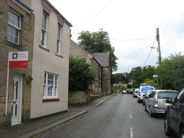
The village is home to a close-knit community of residents who take pride in their surroundings and often come together for village events and activities. Cooklaw is known for its charming stone cottages, quaint village green, and historic church, adding to its traditional English village charm.

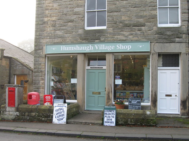
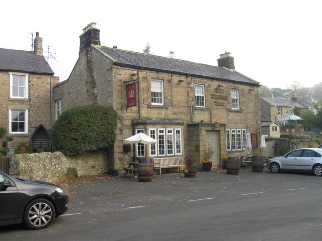
Despite its small size, Cooklaw offers a range of amenities for residents and visitors, including a local pub, village hall, and a small selection of shops. The village is also well-connected to larger towns and cities in the region, with good road links making it easy to explore the surrounding area.

Whether you're looking to enjoy a leisurely stroll through the countryside, sample traditional English fare at the local pub, or simply relax and unwind in a tranquil setting, Cooklaw offers a peaceful and idyllic escape in the heart of Northumberland.

If you have any feedback on the listing, please let us know in the comments section below.

Cooklaw Images

Images are sourced within 2km of 55.033471/-2.1110512 or Grid Reference NY9371. Thanks to Geograph Open Source API. All images are credited.

In Humshaugh village
St Peter's church, Humshaugh
Ordnance Survey 1GL Bolt This OS Bolt can be found on the west face of St Giles Church. It marks a point 77.962m above mean sea level.
Ordnance Survey 1GL Bolt
This OS Bolt can be found on the west face of St Giles Church. It marks a point 77.962m above mean sea level.
Humshaugh Village Shop
The Crown Inn
The Crown Inn
Graveyard
Graveyard
River North Tyne Looking across to the remains of the Roman bridge at Chesters Fort on Hadrian's Wall.
River North Tyne
Looking across to the remains of the Roman bridge at Chesters Fort on Hadrian's Wall.
Gateway and Lodge at Chesters This is not the entrance used by visitors to the Roman fort. Note the guardian stone lions.
Gateway and Lodge at Chesters
This is not the entrance used by visitors to the Roman fort. Note the guardian stone lions.
Field at Low Brunton Looking towards the pavilion of a sports field.
Field at Low Brunton
Looking towards the pavilion of a sports field.
Humshaugh (former) station, with Special DMU, 1957 View northward on the ex-NBR Border Counties (Hexham - Riccarton Junction) line.  The station (Chollerford until 1/8/19) and line had been closed for passengers since 15/10/56, but was still open for goods (until 1/9/58). This was a Special run for the Institute of Transport of a new Metropolitan-Cammell four-car DMU.
Humshaugh (former) station, with Special DMU, 1957
View northward on the ex-NBR Border Counties (Hexham - Riccarton Junction) line. The station (Chollerford until 1/8/19) and line had been closed for passengers since 15/10/56, but was still open for goods (until 1/9/58). This was a Special run for the Institute of Transport of a new Metropolitan-Cammell four-car DMU.
Outdoor chess, the George Hotel, Chollerford A pleasant place to have late summer refreshments after walking along the Wall.
Outdoor chess, the George Hotel, Chollerford
A pleasant place to have late summer refreshments after walking along the Wall.
Converted remains of Humshaugh station, 1981 View SE, towards Hexham, in the North Tyne valley on the ex-NBR former Border Counties line from Bellingham and Riccarton Junction, closed to passengers 15/10/56, to goods 1/9/58. The new owners have done a good job with preservation.
Converted remains of Humshaugh station, 1981
View SE, towards Hexham, in the North Tyne valley on the ex-NBR former Border Counties line from Bellingham and Riccarton Junction, closed to passengers 15/10/56, to goods 1/9/58. The new owners have done a good job with preservation.
Ford on Swallow Burn This ford can be seen on the byway which leads up to Hadrian's Wall crossing Swallow Burn.
<span class="nowrap"><a title="http://youtu.be/xp_407ZV5iM" rel="nofollow ugc noopener" href="http://youtu.be/xp_407ZV5iM">Link</a><img style="margin-left:2px;" alt="External link" title="External link - shift click to open in new window" src="https://s1.geograph.org.uk/img/external.png" width="10" height="10"/></span>
Ford on Swallow Burn
This ford can be seen on the byway which leads up to Hadrian's Wall crossing Swallow Burn. LinkExternal link
Chollerton - Minor Road
Disused Railway Bridge at Chollerton The bridge carried the former Border Counties Railway over the A6079 and the Erring Burn south of Chollerton.
Disused Railway Bridge at Chollerton
The bridge carried the former Border Counties Railway over the A6079 and the Erring Burn south of Chollerton.
Erring Burn Erring Burn is a small tributary of the North Tyne. Chollerton Farm can be seen in the distance.
Erring Burn
Erring Burn is a small tributary of the North Tyne. Chollerton Farm can be seen in the distance.
Derelict Cottage Beside The Erring Burn The building is named on the OS map as 'Burnside'.
Derelict Cottage Beside The Erring Burn
The building is named on the OS map as 'Burnside'.
Barracks, Chesters Roman Fort The fort was occupied by a Roman cavalry regiment of 500 men and horses. Each barrack provided quarters for a troop (turma) of 32 men. Each room was divided in two and occupied by three men in the rear compartment with their horses in the front. By around AD 180, the fort garrison was the Second Asturian Cavalry Regiment (Ala II Asturum).

"O proud Cilurnum, city of the past!
Where are thy legions in their fierce array?
No more, no more the martial trumpets blast
May summon thy plumed cohorts to the fray."
From 'An Ode to the Roman Camp at Chesters, Northumberland' by Frederick Palmer (1912).
Barracks, Chesters Roman Fort
The fort was occupied by a Roman cavalry regiment of 500 men and horses. Each barrack provided quarters for a troop (turma) of 32 men. Each room was divided in two and occupied by three men in the rear compartment with their horses in the front. By around AD 180, the fort garrison was the Second Asturian Cavalry Regiment (Ala II Asturum). "O proud Cilurnum, city of the past! Where are thy legions in their fierce array? No more, no more the martial trumpets blast May summon thy plumed cohorts to the fray." From 'An Ode to the Roman Camp at Chesters, Northumberland' by Frederick Palmer (1912).
Show me another place!

Cooklaw is located at Grid Ref: NY9371 (Lat: 55.033471, Lng: -2.1110512)

Unitary Authority: Northumberland

Police Authority: Northumbria

What 3 Words

///beak.takers.squirted. Near Wall, Northumberland

Nearby Locations

Cocklaw Cooklaw

Related Wikis

Cooklaw

Cooklaw is a small settlement and (as Cocklaw) a former civil parish, now in the parish of Wall, in Northumberland, England. It is near the A6079 road...

Chollerton railway station

Chollerton railway station served the village of Chollerton, Northumberland, England from 1859 to 1958 on the Border Counties Railway. == History == The...

Humshaugh railway station

Humshaugh railway station served the village of Chollerford, Northumberland, England from 1858 to 1958 on the Border Counties Railway. == History == The...

Tynedale

Tynedale was a local government district in Northumberland, England. The district had a resident population of 58,808 according to the 2001 census. The...

Nearby Amenities

Located within 500m of 55.033471,-2.1110512
Power: pole
Lat/Long: 55.0366477/-2.1161226
Power: pole
Lat/Long: 55.0370843/-2.115041
Power: pole
Lat/Long: 55.0375065/-2.1139593
Power: pole
Lat/Long: 55.0302255/-2.1060848
Power: pole
Lat/Long: 55.030881/-2.1053742
Power: pole
Lat/Long: 55.0315038/-2.1046837
Power: pole
Lat/Long: 55.0321181/-2.103967
Power: pole
Lat/Long: 55.0327098/-2.1042206
Power: pole
Lat/Long: 55.0334076/-2.1046199
Power: pole
Lat/Long: 55.033958/-2.1048981
Power: pole
Lat/Long: 55.0345329/-2.1051877
Power: pole
Lat/Long: 55.0352756/-2.1055379
Power: pole
Lat/Long: 55.0360221/-2.1058881
Power: pole
Lat/Long: 55.0361482/-2.1068535
Power: pole
Lat/Long: 55.0364368/-2.1074327
Power: pole
Lat/Long: 55.0367723/-2.1062333
Power: pole
Lat/Long: 55.036201/-2.1172131
The data included in this document is from www.openstreetmap.org. The data is made available under ODbL.

Have you been to Cooklaw?

Leave your review of Cooklaw below (or comments, questions and feedback).