Cookhill

Settlement in Worcestershire / Warwickshire Wychavon

England

Cookhill

The Salt Way joins The Ridgeway at New End
The Salt Way joins The Ridgeway at New End Credit: Jeff Gogarty

Cookhill is a small village located on the border of Worcestershire and Warwickshire counties in England. It is situated approximately 15 miles south of the city of Birmingham and 11 miles east of the town of Redditch. The village is nestled in a rural area, surrounded by picturesque countryside and farmlands.

Cookhill has a population of around 500 residents and is known for its peaceful and close-knit community. The village offers a tranquil escape from the hustle and bustle of city life, with its charming houses and well-maintained gardens. The local architecture is predominantly traditional, featuring a mix of historic cottages and newer residences.

Despite its small size, Cookhill provides essential amenities for its residents. These include a primary school, a village hall, a post office, and a local pub. The village also benefits from several recreational areas, including a playground and sports fields, which are well-used by both residents and visitors.

The surrounding countryside offers numerous opportunities for outdoor activities. Residents can enjoy scenic walks along the nearby Worcestershire and Warwickshire Canal or explore the beautiful countryside on foot or by bike. Additionally, the village is conveniently located near several nature reserves and parks, providing ample opportunities for wildlife spotting and nature enthusiasts.

Overall, Cookhill offers a tranquil and idyllic setting for those seeking a peaceful rural lifestyle while still having easy access to nearby urban areas. Its friendly community, charming architecture, and natural beauty make it a desirable place to live or visit.

If you have any feedback on the listing, please let us know in the comments section below.
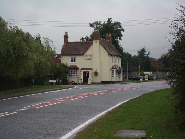
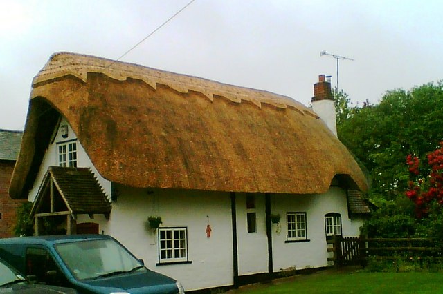
Cookhill Images

Images are sourced within 2km of 52.223736/-1.920695 or Grid Reference SP0558. Thanks to Geograph Open Source API. All images are credited.

The Salt Way joins The Ridgeway at New End
Nevill Arms at New End Take from where the Millennium Way joins the Ridgeway.
Nevill Arms at New End
Take from where the Millennium Way joins the Ridgeway.
Deer running across a field Near 145 Park Farm, Alcester and taken from the Millennium Way.
Deer running across a field
Near 145 Park Farm, Alcester and taken from the Millennium Way.
The Nevill Arms, New End Only just within this grid square, the Nevill Arms pub at the junction of the A441 and the Salt Way (B4090), New End, is a recognisable local landmark.
The Nevill Arms, New End
Only just within this grid square, the Nevill Arms pub at the junction of the A441 and the Salt Way (B4090), New End, is a recognisable local landmark.
Butler's Coppice Looking from near the SW corner of the square on Alcester Heath.
Butler's Coppice
Looking from near the SW corner of the square on Alcester Heath.
Country road near Little Mearse Farm Country road near Little Mearse Farm near Inkberrow.
Country road near Little Mearse Farm
Country road near Little Mearse Farm near Inkberrow.
Fields of wheat Fields of wheat beside Mearse Lane near Inkberrow.
Fields of wheat
Fields of wheat beside Mearse Lane near Inkberrow.
Wheatfields near New End Wheatfields to the south of the B4090 near New End.
Wheatfields near New End
Wheatfields to the south of the B4090 near New End.
Footpath by Thornhill Wood The footpath from Old Park Wood and the A422 passes through the middle of Thornhill Farm, and runs alongside Thornhill Wood on its way towards the B4088 and Nunnery Wood.
Footpath by Thornhill Wood
The footpath from Old Park Wood and the A422 passes through the middle of Thornhill Farm, and runs alongside Thornhill Wood on its way towards the B4088 and Nunnery Wood.
Footpath through Thornhill Farm The footpath from the B4088 and Nunnery Wood, passes through the middle of Thornhill Farm, on its way towards the A422 and Old Park Wood seen in the distance in <a href="https://www.geograph.org.uk/gridref/SP0657">SP0657</a>
Footpath through Thornhill Farm
The footpath from the B4088 and Nunnery Wood, passes through the middle of Thornhill Farm, on its way towards the A422 and Old Park Wood seen in the distance in SP0657
Bluebells in Old Park Wood From the footpath along the southern edge.
Bluebells in Old Park Wood
From the footpath along the southern edge.
Cross-field towards Cookhill From the edge of Old Park Wood.
Cross-field towards Cookhill
From the edge of Old Park Wood.
Milestone on the Ridgeway,  Evesham Road,  Cookhill
Milestone on the Ridgeway, Evesham Road, Cookhill
The Monarch's Way through Cold Comfort Wood Poor ground conditions after a very wet period.
The Monarch's Way through Cold Comfort Wood
Poor ground conditions after a very wet period.
A422 towards Arrow Looking SE along the A422 as it heads towards Arrow.
A422 towards Arrow
Looking SE along the A422 as it heads towards Arrow.
Arable fields north of A422 Fields of recently harrowed stubble between the A422 and Old Park Wood.
Arable fields north of A422
Fields of recently harrowed stubble between the A422 and Old Park Wood.
Chainsaw carving tree trunks Looking NNW from the footpath from Thornhill Farm leading to Alcester. The wood on the left is Old Park Wood, and this area is part of the Ragley Hall Estate.

The lengths of tree trunk are being set out for a chainsaw carving competition as part of APF 2012 <span class="nowrap"><a title="http://www.apfexhibition.co.uk/index.php" rel="nofollow ugc noopener" href="http://www.apfexhibition.co.uk/index.php">Link</a><img style="margin-left:2px;" alt="External link" title="External link - shift click to open in new window" src="https://s1.geograph.org.uk/img/external.png" width="10" height="10"/></span> the UK's largest forestry, woodland and arboricultural exhibition.
Chainsaw carving tree trunks
Looking NNW from the footpath from Thornhill Farm leading to Alcester. The wood on the left is Old Park Wood, and this area is part of the Ragley Hall Estate. The lengths of tree trunk are being set out for a chainsaw carving competition as part of APF 2012 LinkExternal link the UK's largest forestry, woodland and arboricultural exhibition.
Horse logging timber Looking WNW from the footpath from Alcester towards Thornhill Farm. The wood in the background is Old Park Wood and the area is part of the Ragley Hall Estate.

The piles of timber are being prepared for the horse logging competition, part of APF 2012 <span class="nowrap"><a title="http://www.apfexhibition.co.uk/index.php" rel="nofollow ugc noopener" href="http://www.apfexhibition.co.uk/index.php">Link</a><img style="margin-left:2px;" alt="External link" title="External link - shift click to open in new window" src="https://s1.geograph.org.uk/img/external.png" width="10" height="10"/></span> the UK's largest forestry, woodland and arboricultural exhibition.
Horse logging timber
Looking WNW from the footpath from Alcester towards Thornhill Farm. The wood in the background is Old Park Wood and the area is part of the Ragley Hall Estate. The piles of timber are being prepared for the horse logging competition, part of APF 2012 LinkExternal link the UK's largest forestry, woodland and arboricultural exhibition.
Show me another place!

Cookhill is located at Grid Ref: SP0558 (Lat: 52.223736, Lng: -1.920695)

Administrative County: Worcestershire

District: Wychavon

Police Authority: West Mercia

What 3 Words

///milk.beak.deeply. Near Alcester, Warwickshire

Related Wikis

Cookhill

Cookhill is a village and civil parish in Worcestershire, England, on the county border near Alcester. It is close to a former Cistercian Priory of the...

Cookhill Priory

Cookhill Priory was a Cistercian nunnery near Cookhill in Worcestershire, England. == History == The Priory is believed to be founded by Isabel de Mauduit...

Arrow with Weethley

Arrow with Weethley is a civil parish in the Stratford-on-Avon district of Warwickshire, England. The parish lies midway between Redditch and Evesham....

Coughton railway station

Coughton railway station serving Coughton, Warwickshire was a station on the Barnt Green to Evesham line. The station was opened by the Evesham and Redditch...

Nearby Amenities

Located within 500m of 52.223736,-1.920695
Barrier: kissing_gate
Lat/Long: 52.2265628/-1.9230968
Bus Stop
Oaktree Lane
Bus: yes
Naptan AtcoCode: 2000G323363
Naptan Bearing: S
Naptan BusStopType: CUS
Naptan CommonName: Oaktree Lane
Naptan Crossing: Oaktree Lane
Naptan Indicator: opp
Naptan NaptanCode: wocgajpa
Naptan Street: Evesham Road
Naptan Verified: no
Public Transport: platform
Source: naptan_import
Lat/Long: 52.2238441/-1.9185743
Bus Stop
Oaktree Lane
Bus: yes
Naptan AtcoCode: 2000G632002
Naptan Bearing: NW
Naptan BusStopType: CUS
Naptan CommonName: Oaktree Lane
Naptan Crossing: Oaktree Lane
Naptan Indicator: Adj
Naptan NaptanCode: wocdmgpm
Naptan Street: Evesham Road
Naptan Verified: no
Public Transport: platform
Source: naptan_import
Lat/Long: 52.2238173/-1.9188379
Post Box
Collection Times: Mo-Fr 19:00; Sa 12:00
Note: collection times seem unlikely for a small village. Postobx appears to be in someone's front garden
Operator: Royal Mail
Operator Wikidata: Q638098
Post Box Type: lamp
Ref: S014
Royal Cypher: EIIR
Royal Cypher Wikidata: Q33102113
Source: survey
Lat/Long: 52.2274496/-1.9248096
Barrier: kissing_gate
Lat/Long: 52.2261226/-1.9227674
Post Box
Collection Times: Mo-Fr 16:30; Sa 09:00
Operator: Royal Mail
Operator Wikidata: Q638098
Post Box Type: lamp
Ref: B49 113
Royal Cypher: EIIR
Royal Cypher Wikidata: Q33102113
Lat/Long: 52.2239329/-1.9191414
Cookhill
Power: pole
Transformer: distribution
Voltage Primary: 11000
Lat/Long: 52.2232869/-1.9231398
Power: pole
Lat/Long: 52.219414/-1.9194987
Power: pole
Lat/Long: 52.2196597/-1.9198367
Malthouse
Power: pole
Transformer: distribution
Voltage Primary: 11000
Lat/Long: 52.2199144/-1.9202001
Power: pole
Lat/Long: 52.2203983/-1.9208559
Power: pole
Lat/Long: 52.2214557/-1.9223365
Power: pole
Lat/Long: 52.2209299/-1.9216096
Power: pole
Lat/Long: 52.2219946/-1.9230191
Power: pole
Lat/Long: 52.2225763/-1.9238989
Cladswell Farm
Power: pole
Transformer: distribution
Voltage Primary: 11000
Lat/Long: 52.2262493/-1.9243053
Power: pole
Lat/Long: 52.2252898/-1.9250228
Power: pole
Lat/Long: 52.2243943/-1.9247787
Power: pole
Lat/Long: 52.2233674/-1.9245051
Power: pole
Lat/Long: 52.2229304/-1.9244045
Power: pole
Lat/Long: 52.2226116/-1.9254519
Power: pole
Lat/Long: 52.2222789/-1.926565
The data included in this document is from www.openstreetmap.org. The data is made available under ODbL.

Have you been to Cookhill?

Leave your review of Cookhill below (or comments, questions and feedback).