Cookhill

Civil Parish in Worcestershire Wychavon

England

Cookhill

The Salt Way joins The Ridgeway at New End
The Salt Way joins The Ridgeway at New End Credit: Jeff Gogarty

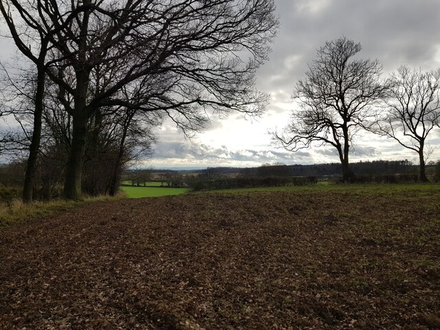
Cookhill is a civil parish located in the district of Worcestershire, England. It is situated approximately 9 miles southeast of the town of Redditch and covers an area of around 5.3 square miles. The parish is predominantly rural, with a mix of farmland, woodland, and residential areas.

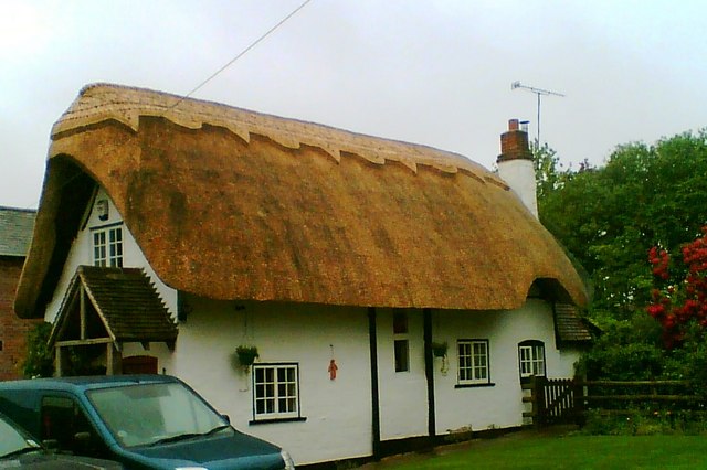
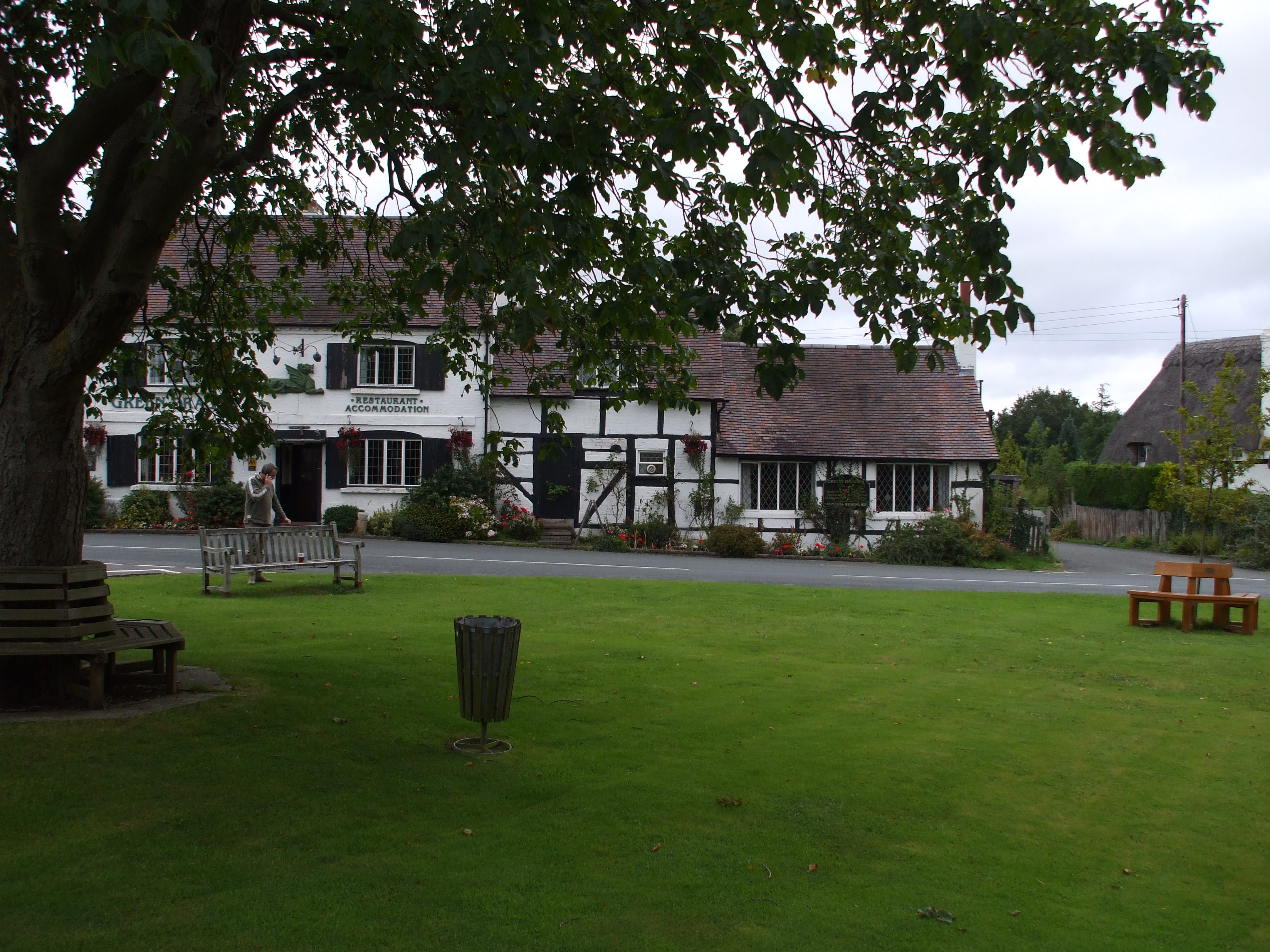
The village of Cookhill itself is the main settlement within the parish, providing basic amenities such as a primary school, village hall, and a local pub. The village is surrounded by picturesque countryside, offering residents and visitors opportunities for outdoor activities like walking, cycling, and horse riding.

Historically, Cookhill was an agricultural community, with farming being the main occupation for many residents. Today, while agriculture still plays a role in the local economy, the parish has seen some diversification with the growth of small businesses and commuting to nearby towns for employment.

Cookhill is known for its community spirit and events. The village hosts an annual summer fete and various social gatherings throughout the year. It also benefits from being close to the larger towns of Redditch and Evesham, which provide additional amenities and services.

Overall, Cookhill offers a peaceful and rural lifestyle, with a strong sense of community. Its proximity to larger towns ensures residents have access to a range of facilities, while still being able to enjoy the charm and tranquility of the countryside.

If you have any feedback on the listing, please let us know in the comments section below.

Cookhill Images

Images are sourced within 2km of 52.22909/-1.92783 or Grid Reference SP0558. Thanks to Geograph Open Source API. All images are credited.

The Salt Way joins The Ridgeway at New End
Nevill Arms at New End Take from where the Millennium Way joins the Ridgeway.
Nevill Arms at New End
Take from where the Millennium Way joins the Ridgeway.
Deer running across a field Near 145 Park Farm, Alcester and taken from the Millennium Way.
Deer running across a field
Near 145 Park Farm, Alcester and taken from the Millennium Way.
Fields on the west of Coughton Park woodland
Field edge near Hanging Well, Warwickshire
Fields off footpath, near Hanging Well, Warwickshire
Junction of Alcester Heath and Whitemoor Road, Warwickshire
Pond on The Ridgeway, near to New End
House with helicopter, The Ridgeway
Power lines crossing near the Monarch's Way
View over North Worcestershire from the Ridgeway Beyond the hills in the distant is the Teme Valley. The land in between was originally mainly the Forest of Feckenham.
View over North Worcestershire from the Ridgeway
Beyond the hills in the distant is the Teme Valley. The land in between was originally mainly the Forest of Feckenham.
Tree next to the Monarch's Way
Cattle near Lower Park Farm, New End Taken from the Monarch's Way.
Cattle near Lower Park Farm, New End
Taken from the Monarch's Way.
Walkers pass old buildings for livestock
Power lines above horses
Farm near The Ridgeway from a footpath
Wires crossing near Monarch's Way
Dilapidated gate into waste ground
Show me another place!

Cookhill is located at Grid Ref: SP0558 (Lat: 52.22909, Lng: -1.92783)

Administrative County: Worcestershire

District: Wychavon

Police Authority: West Mercia

What 3 Words

///ballroom.selects.unspoiled. Near Astwood Bank, Worcestershire

Related Wikis

Cookhill

Cookhill is a village and civil parish in Worcestershire, England, on the county border near Alcester. It is close to a former Cistercian Priory of the...

Cookhill Priory

Cookhill Priory was a Cistercian nunnery near Cookhill in Worcestershire, England. == History == The Priory is believed to be founded by Isabel de Mauduit...

Holberrow Green

Holberrow Green is a village in Worcestershire, England. == External links == Media related to Holberrow Green at Wikimedia Commons

Ridgeway Secondary School

Ridgeway Secondary School is a coeducational secondary school located in Astwood Bank (near Redditch) in the English county of Worcestershire.Established...

Redditch (UK Parliament constituency)

Redditch is a constituency in Worcestershire, England, represented in the House of Commons of the UK Parliament since 2017 by Rachel Maclean of the Conservative...

Coughton railway station

Coughton railway station serving Coughton, Warwickshire was a station on the Barnt Green to Evesham line. The station was opened by the Evesham and Redditch...

Coughton, Warwickshire

Coughton is a small village located between Studley 2.4 miles (4 km) to the North and Alcester, 2 miles (3 km) to the South, in the county of Warwickshire...

Sambourne

Sambourne, formerly spelled Sambourn, is a village and civil parish 1.5 miles (2.4 km) north-west of Coughton, 4.5 miles (7.2 km) south of Redditch, 12...

Nearby Amenities

Located within 500m of 52.22909,-1.92783
Barrier: kissing_gate
Lat/Long: 52.2265628/-1.9230968
Village Hall
Naptan AtcoCode: 2000G054200
Naptan Bearing: NW
Naptan BusStopType: CUS
Naptan CommonName: Village Hall
Naptan Crossing: Church Lane
Naptan Indicator: Adj
Naptan Landmark: Village Hall
Naptan NaptanCode: wocdwtpg
Naptan Street: Evesham Road
Naptan Verified: no
Source: naptan_import
Lat/Long: 52.2288449/-1.9216691
Bus Stop
Cladswell Lane
Bus: yes
Naptan AtcoCode: 2000G054202
Naptan Bearing: SE
Naptan BusStopType: CUS
Naptan CommonName: Cladswell Lane
Naptan Crossing: Church Lane
Naptan Indicator: Adj
Naptan NaptanCode: wocdwtpj
Naptan Street: Cladswell Lane
Naptan Verified: no
Public Transport: platform
Source: naptan_import
Lat/Long: 52.2277269/-1.9248492
Village Hall
Naptan AtcoCode: 2000G323364
Naptan Bearing: SE
Naptan BusStopType: CUS
Naptan CommonName: Village Hall
Naptan Crossing: Church Lane
Naptan Indicator: opp
Naptan Landmark: Village Hall
Naptan NaptanCode: wocgajpd
Naptan Street: Evesham Road
Naptan Verified: no
Source: naptan_import
Lat/Long: 52.2287099/-1.921318
Power: tower
Source: bing
Lat/Long: 52.2276706/-1.934158
Power: tower
Source: bing
Lat/Long: 52.2305909/-1.9337209
Power: pole
Lat/Long: 52.2331627/-1.927483
Power: pole
Lat/Long: 52.2329925/-1.9313593
Power: pole
Lat/Long: 52.2330827/-1.9293285
Power: pole
Lat/Long: 52.2321943/-1.928174
Power: pole
Lat/Long: 52.2294487/-1.9250858
Power: pole
Lat/Long: 52.2317499/-1.9257037
Cladswell Close
Power: pole
Transformer: distribution
Voltage Primary: 11000
Lat/Long: 52.2286156/-1.9254382
Power: pole
Lat/Long: 52.2330063/-1.9261383
Ridgeway Cottage
Location Transition: yes
Power: pole
Transformer: distribution
Voltage Primary: 11000
Lat/Long: 52.2328548/-1.9254556
Power: pole
Lat/Long: 52.2308073/-1.9253751
Power: pole
Lat/Long: 52.2325233/-1.9251952
Power: pole
Lat/Long: 52.2296464/-1.9241378
Barrier: kissing_gate
Foot: yes
Lat/Long: 52.2290285/-1.9272965
Church Lane
Power: pole
Transformer: distribution
Voltage Primary: 11000
Lat/Long: 52.2290514/-1.9234938
Power: pole
Lat/Long: 52.2302244/-1.9247551
Location Transition: yes
Power: pole
Lat/Long: 52.2321943/-1.9249293
Power: pole
Lat/Long: 52.2326248/-1.9260071
Barrier: stile
Foot: yes
Lat/Long: 52.2302633/-1.9263289
Bench
Backrest: yes
Source: survey
Lat/Long: 52.2288343/-1.9216317
Defibrillator
Defibrillator Location: outside Cookhill Village Hall
Emergency: defibrillator
Indoor: no
Source: W Mids Ambulance Service
Lat/Long: 52.2291144/-1.9221182
Post Box
Collection Times: Mo-Fr 19:00; Sa 12:00
Note: collection times seem unlikely for a small village. Postobx appears to be in someone's front garden
Operator: Royal Mail
Operator Wikidata: Q638098
Post Box Type: lamp
Ref: S014
Royal Cypher: EIIR
Royal Cypher Wikidata: Q33102113
Source: survey
Lat/Long: 52.2274496/-1.9248096
Barrier: kissing_gate
Lat/Long: 52.2261226/-1.9227674
Barrier: yes
Lat/Long: 52.230669/-1.9320426
Power: pole
Lat/Long: 52.2334757/-1.9273697
Power: pole
Lat/Long: 52.2300124/-1.9301538
Power: pole
Lat/Long: 52.2294349/-1.9303349
Power: pole
Lat/Long: 52.2290562/-1.9304569
Power: pole
Lat/Long: 52.2283367/-1.9306782
Location Transition: yes
Power: pole
Lat/Long: 52.2276861/-1.9305146
Power: pole
Lat/Long: 52.2302325/-1.9296281
Upper Cladswell Farm
Power: pole
Transformer: distribution
Voltage Primary: 11000
Lat/Long: 52.2300037/-1.9296516
Power: pole
Lat/Long: 52.2308325/-1.9295617
Linsey Farm
Power: pole
Transformer: distribution
Voltage Primary: 11000
Lat/Long: 52.2316437/-1.9303308
Power: pole
Lat/Long: 52.2316913/-1.9294699
Cladswell Farm
Power: pole
Transformer: distribution
Voltage Primary: 11000
Lat/Long: 52.2262493/-1.9243053
Power: pole
Lat/Long: 52.2252898/-1.9250228
Cladswell
Power: pole
Transformer: distribution
Voltage Primary: 11000
Lat/Long: 52.2274905/-1.9284962
Location Transition: yes
Power: pole
Lat/Long: 52.2269726/-1.9295027
Power: pole
Lat/Long: 52.2264358/-1.9304918
Cladswell Lane
Power: pole
Transformer: distribution
Voltage Primary: 11000
Lat/Long: 52.2263298/-1.9312522
Power: pole
Lat/Long: 52.2258147/-1.9304247
Power: pole
Lat/Long: 52.2250002/-1.9303382
Cookhill
Place: village
Wikidata: Q2402990
Lat/Long: 52.2283842/-1.9217159
The data included in this document is from www.openstreetmap.org. The data is made available under ODbL.

Have you been to Cookhill?

Leave your review of Cookhill below (or comments, questions and feedback).