Asplands Husk Coppice

Wood, Forest in Warwickshire Stratford-on-Avon

England

Asplands Husk Coppice

The Salt Way joins The Ridgeway at New End
The Salt Way joins The Ridgeway at New End Credit: Jeff Gogarty

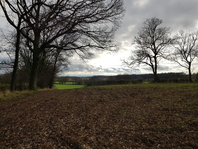
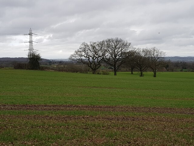
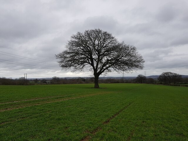
Asplands Husk Coppice is a picturesque woodland located in Warwickshire, England. Covering an area of approximately 50 acres, it is a notable forest that attracts nature enthusiasts and outdoor adventurers alike. The woodland is situated in close proximity to the village of Henley-in-Arden, providing easy access for visitors.

The coppice itself is predominantly made up of native tree species such as oak, ash, and birch, creating a diverse and vibrant ecosystem. The dense canopy of trees provides a sheltered habitat for a wide range of wildlife, including various bird species, small mammals, and insects. Nature lovers can expect to encounter squirrels, deer, and even the occasional fox during their exploration of the woodland.

The forest offers a network of well-maintained footpaths and trails, allowing visitors to fully immerse themselves in the natural surroundings. Hiking and cycling are popular activities, with designated routes catering to all levels of fitness and ability. The tranquil atmosphere and scenic beauty of Asplands Husk Coppice make it an ideal location for picnics, photography, and simply enjoying the peace and quiet of nature.

Managed by local conservation groups, the woodland is carefully maintained to preserve its ecological integrity. Regular tree thinning and selective harvesting of timber ensure the long-term sustainability of the forest. This management approach also promotes the growth of understory plants and encourages the regeneration of younger trees.

Whether you are a nature lover, outdoor enthusiast, or simply seeking a peaceful retreat, Asplands Husk Coppice offers a captivating experience in the heart of Warwickshire's natural beauty.

If you have any feedback on the listing, please let us know in the comments section below.

Asplands Husk Coppice Images

Images are sourced within 2km of 52.228696/-1.918552 or Grid Reference SP0558. Thanks to Geograph Open Source API. All images are credited.

The Salt Way joins The Ridgeway at New End
Nevill Arms at New End Take from where the Millennium Way joins the Ridgeway.
Nevill Arms at New End
Take from where the Millennium Way joins the Ridgeway.
Deer running across a field Near 145 Park Farm, Alcester and taken from the Millennium Way.
Deer running across a field
Near 145 Park Farm, Alcester and taken from the Millennium Way.
Bridleway through Coughton Park woodland There was an unusual lack of bird activity in these woods.
Bridleway through Coughton Park woodland
There was an unusual lack of bird activity in these woods.
Fields on the west of Coughton Park woodland
Field edge near Hanging Well, Warwickshire
Fields off footpath, near Hanging Well, Warwickshire
Junction of Alcester Heath and Whitemoor Road, Warwickshire
Pond on The Ridgeway, near to New End
House with helicopter, The Ridgeway
Power lines crossing near the Monarch's Way
Tree next to the Monarch's Way
Cattle near Lower Park Farm, New End Taken from the Monarch's Way.
Cattle near Lower Park Farm, New End
Taken from the Monarch's Way.
Dilapidated gate into waste ground
Cookhill - Brackenhurst sewage pumping station
Trees and pylon near The Ridgeway
Lone tree in a field with power lines
Ridgeway Donkeys and a trig pillar on the Ridgeway, a road that as the name suggests runs along a ridge from Redditch.  Being a road along a hill top, it attracted ribbon development for big houses  in the days before planning controls.
Ridgeway
Donkeys and a trig pillar on the Ridgeway, a road that as the name suggests runs along a ridge from Redditch. Being a road along a hill top, it attracted ribbon development for big houses in the days before planning controls.
Show me another place!

Asplands Husk Coppice is located at Grid Ref: SP0558 (Lat: 52.228696, Lng: -1.918552)

Administrative County: Warwickshire

District: Stratford-on-Avon

Police Authority: Warwickshire

What 3 Words

///nerve.glance.protect. Near Astwood Bank, Worcestershire

Related Wikis

Cookhill

Cookhill is a village and civil parish in Worcestershire, England, on the county border near Alcester. It is close to a former Cistercian Priory of the...

Cookhill Priory

Cookhill Priory was a Cistercian nunnery near Cookhill in Worcestershire, England. == History == The Priory is believed to be founded by Isabel de Mauduit...

Coughton railway station

Coughton railway station serving Coughton, Warwickshire was a station on the Barnt Green to Evesham line. The station was opened by the Evesham and Redditch...

Coughton, Warwickshire

Coughton is a small village located between Studley 2.4 miles (4 km) to the North and Alcester, 2 miles (3 km) to the South, in the county of Warwickshire...

Ridgeway Secondary School

Ridgeway Secondary School is a coeducational secondary school located in Astwood Bank (near Redditch) in the English county of Worcestershire.Established...

River Arrow Nature Reserve

River Arrow Nature Reserve is a local nature reserve located alongside the River Arrow in Alcester, Warwickshire, England. The reserve was set up by Stratford...

St Peter and St Paul and St Elizabeth Catholic Church, Coughton

St Peter and St Paul and St Elizabeth Catholic Church is a Catholic church built between 1851 and 1853 by the Throckmorton family in the grounds of their...

Alcester railway station

Alcester was a railway station serving Alcester in the English county of Warwickshire. == History == Opened by the Evesham and Redditch Railway, and joining...

Nearby Amenities

Located within 500m of 52.228696,-1.918552
Barrier: kissing_gate
Lat/Long: 52.2265628/-1.9230968
Village Hall
Naptan AtcoCode: 2000G054200
Naptan Bearing: NW
Naptan BusStopType: CUS
Naptan CommonName: Village Hall
Naptan Crossing: Church Lane
Naptan Indicator: Adj
Naptan Landmark: Village Hall
Naptan NaptanCode: wocdwtpg
Naptan Street: Evesham Road
Naptan Verified: no
Source: naptan_import
Lat/Long: 52.2288449/-1.9216691
Bus Stop
Cladswell Lane
Bus: yes
Naptan AtcoCode: 2000G054202
Naptan Bearing: SE
Naptan BusStopType: CUS
Naptan CommonName: Cladswell Lane
Naptan Crossing: Church Lane
Naptan Indicator: Adj
Naptan NaptanCode: wocdwtpj
Naptan Street: Cladswell Lane
Naptan Verified: no
Public Transport: platform
Source: naptan_import
Lat/Long: 52.2277269/-1.9248492
Village Hall
Naptan AtcoCode: 2000G323364
Naptan Bearing: SE
Naptan BusStopType: CUS
Naptan CommonName: Village Hall
Naptan Crossing: Church Lane
Naptan Indicator: opp
Naptan Landmark: Village Hall
Naptan NaptanCode: wocgajpd
Naptan Street: Evesham Road
Naptan Verified: no
Source: naptan_import
Lat/Long: 52.2287099/-1.921318
Power: pole
Lat/Long: 52.2294487/-1.9250858
Cladswell Close
Power: pole
Transformer: distribution
Voltage Primary: 11000
Lat/Long: 52.2286156/-1.9254382
Power: pole
Lat/Long: 52.2296464/-1.9241378
Church Lane
Power: pole
Transformer: distribution
Voltage Primary: 11000
Lat/Long: 52.2290514/-1.9234938
Power: pole
Lat/Long: 52.2302244/-1.9247551
Bench
Backrest: yes
Source: survey
Lat/Long: 52.2288343/-1.9216317
Defibrillator
Defibrillator Location: outside Cookhill Village Hall
Emergency: defibrillator
Indoor: no
Source: W Mids Ambulance Service
Lat/Long: 52.2291144/-1.9221182
Post Box
Collection Times: Mo-Fr 19:00; Sa 12:00
Note: collection times seem unlikely for a small village. Postobx appears to be in someone's front garden
Operator: Royal Mail
Operator Wikidata: Q638098
Post Box Type: lamp
Ref: S014
Royal Cypher: EIIR
Royal Cypher Wikidata: Q33102113
Source: survey
Lat/Long: 52.2274496/-1.9248096
Barrier: kissing_gate
Lat/Long: 52.2261226/-1.9227674
Cladswell Farm
Power: pole
Transformer: distribution
Voltage Primary: 11000
Lat/Long: 52.2262493/-1.9243053
Cookhill
Place: village
Wikidata: Q2402990
Lat/Long: 52.2283842/-1.9217159
The data included in this document is from www.openstreetmap.org. The data is made available under ODbL.

Have you been to Asplands Husk Coppice?

Leave your review of Asplands Husk Coppice below (or comments, questions and feedback).