Old Park Wood

Wood, Forest in Somerset

England

Old Park Wood

Fish Pond This lake in Fish Pond Wood once provided fish for the divines of Bristol Cathedral.
Fish Pond Credit: Graeme Churchard

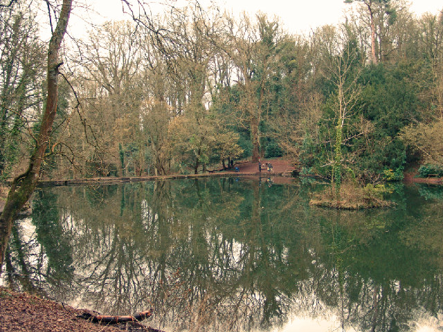
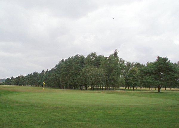
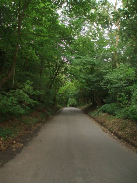
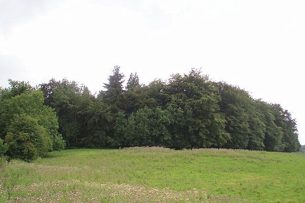
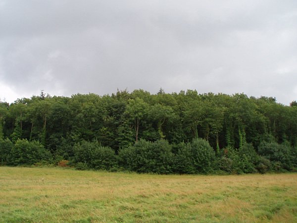
Old Park Wood is a picturesque woodland located in Somerset, England. This ancient forest covers an area of approximately 200 acres and is known for its diverse range of flora and fauna. It is situated near the village of Old Park and is easily accessible by foot or bicycle.

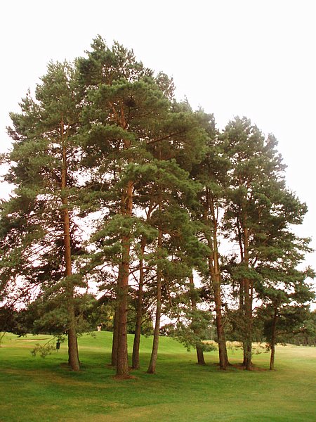
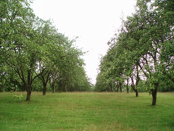
The wood is predominantly composed of broadleaf trees, including oak, beech, and ash, which provide a rich canopy that filters sunlight and creates a cool and tranquil atmosphere. The forest floor is carpeted with a variety of wildflowers, such as bluebells and primroses, adding bursts of color to the landscape.

Old Park Wood is home to a thriving ecosystem, with a wide array of wildlife species. Birdwatchers can spot various species of birds, including woodpeckers, owls, and nuthatches. The wood is also a habitat for mammals like deer, foxes, badgers, and squirrels, which roam freely among the trees.

For nature enthusiasts, Old Park Wood offers a range of recreational activities. There are numerous walking trails that wind through the forest, allowing visitors to explore the wood at their own pace. The tranquil ambiance makes it an ideal spot for picnics, photography, and nature observation.

The wood has a rich history, dating back centuries. It is believed to have been used as a hunting ground for the local nobility in medieval times. The site also holds archaeological significance, with remnants of ancient settlements and burial mounds found within its boundaries, providing a glimpse into the region's past.

Overall, Old Park Wood is a captivating woodland that offers a peaceful escape from the hustle and bustle of modern life. With its natural beauty and historical significance, it is a must-visit destination for nature lovers and history enthusiasts alike.

If you have any feedback on the listing, please let us know in the comments section below.

Old Park Wood Images

Images are sourced within 2km of 51.461245/-2.6720946 or Grid Reference ST5373. Thanks to Geograph Open Source API. All images are credited.

Fish Pond This lake in Fish Pond Wood once provided fish for the divines of Bristol Cathedral.
Fish Pond
This lake in Fish Pond Wood once provided fish for the divines of Bristol Cathedral.
Ham Green Halt This halt was mainly built to serve the nearby hospital. The line is still open to serve Portbury Docks
Ham Green Halt
This halt was mainly built to serve the nearby hospital. The line is still open to serve Portbury Docks
Abbot's Leigh - The George
Abbot's Leigh Church
Kite flying in Ashton Court Almost always guaranteed a breeze up here so it's a favourite with kite flyers, with both small and big kites, even on very cold days. The estate is owned by Bristol City Council.
Kite flying in Ashton Court
Almost always guaranteed a breeze up here so it's a favourite with kite flyers, with both small and big kites, even on very cold days. The estate is owned by Bristol City Council.
Bristol International Kite Festival, Ashton Court Each September this part of Ashton Court is used for the Bristol International Kite Festival, which has been running for 20 years. The trees in the background run along Beggar Bush Lane.
Bristol International Kite Festival, Ashton Court
Each September this part of Ashton Court is used for the Bristol International Kite Festival, which has been running for 20 years. The trees in the background run along Beggar Bush Lane.
Bristol and Clifton Golf Course A view of the 8th green and the fairway disappearing off to the left.
Bristol and Clifton Golf Course
A view of the 8th green and the fairway disappearing off to the left.
Weir Lane A view looking up Weir Lane (facing south).  Fifty Acre wood is on the left and the Bristol and Clifton golf course on the right.
Weir Lane
A view looking up Weir Lane (facing south). Fifty Acre wood is on the left and the Bristol and Clifton golf course on the right.
Trees A stand of trees near the 12th green on the Bristol and Clifton golf course.
Trees
A stand of trees near the 12th green on the Bristol and Clifton golf course.
Yew Tree Plantation The name of the plantation doesn't match the type of tree.  Evidently Yew Tree Plantation has become an apple orchard.
Yew Tree Plantation
The name of the plantation doesn't match the type of tree. Evidently Yew Tree Plantation has become an apple orchard.
Round Hill Clump A relatively small plantation on top of a small hill.  Taken from a bridleway to the north.
Round Hill Clump
A relatively small plantation on top of a small hill. Taken from a bridleway to the north.
Warren House Plantation
Trees at Ham Green This was the site of a former isolation hospital. The late sunshine catches the leaves on the trees.
A railway tunnel runs underneath the park to the left of the path.
Trees at Ham Green
This was the site of a former isolation hospital. The late sunshine catches the leaves on the trees. A railway tunnel runs underneath the park to the left of the path.
Sustrans Milepost at Ham Green This rowe type milepost is on the Bristol to Portishead Cycle Path, routes 33 and 41.
Sustrans Milepost at Ham Green
This rowe type milepost is on the Bristol to Portishead Cycle Path, routes 33 and 41.
White cottage, Lower Failand An isolated house, set in the folds of a steep sided valley.
White cottage, Lower Failand
An isolated house, set in the folds of a steep sided valley.
Dutch bungalows Line the A369 from Bristol to Portishead, near Pill.
Dutch bungalows
Line the A369 from Bristol to Portishead, near Pill.
Happerton farm Situated at a junction, half way along Happerton Lane.
Happerton farm
Situated at a junction, half way along Happerton Lane.
Common Lane Near Lower Failand.
Common Lane
Near Lower Failand.
Show me another place!

Old Park Wood is located at Grid Ref: ST5373 (Lat: 51.461245, Lng: -2.6720946)

Unitary Authority: North Somerset

Police Authority: Avon and Somerset

What 3 Words

///glass.deck.device. Near Easton-in-Gordano, Somerset

Related Wikis

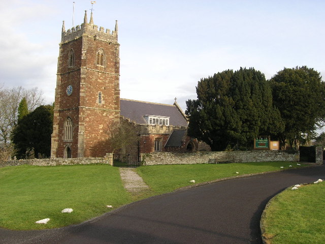
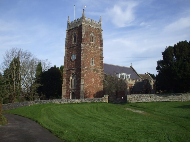
Holy Trinity Church, Abbots Leigh

Holy Trinity Church in Abbots Leigh within the English county of Somerset is a 15th-century Perpendicular Gothic building, restored and partially rebuilt...

Abbots Leigh

Abbots Leigh is a village and civil parish in North Somerset, England, about 3 miles (5 km) west of the centre of Bristol. == History == The original Middle...

Leigh Court

Leigh Court is a country house which is a Grade II* listed building in Abbots Leigh, Somerset, England. The grounds and park are listed, Grade II, on the...

St Katherine's School

St Katherine's School is a co-educational secondary school and sixth form located in the English county of Somerset. Commonly known to be located in Pill...

Ham Green SSSI

Ham Green SSSI (grid reference ST539758) is a 1.1 hectare geological Site of Special Scientific Interest near the village of Ham Green, North Somerset...

Ham Green Halt railway station

Ham Green Halt was a railway station near Bristol, England, on the Portishead Railway, opened in 1926 to serve Ham Green Hospital. == History == The station...

Pill, Somerset

Pill is a village in North Somerset, England, situated on the southern bank of the Avon, about 4 miles (6 km) northwest of Bristol city centre. The village...

Leigh Woods National Nature Reserve

Leigh Woods is a 2-square-kilometre (0.77 sq mi) area of woodland on the south-west side of the Avon Gorge, close to the Clifton Suspension Bridge, within...

Nearby Amenities

Located within 500m of 51.461245,-2.6720946
Bus Stop
Sandy Lane
Bench: yes
Bin: no
Mapillary: 177122394295832
Naptan AtcoCode: 0190NSC31002
Naptan Bearing: SE
Naptan CommonName: Sandy Lane
Naptan Crossing: Sandy Lane
Naptan NaptanCode: wsmjdtp
Naptan Street: Pill Road
Naptan Verified: no
Public Transport: platform
Shelter: yes
Source: naptan_import
Survey Date: 2021-03-27
Lat/Long: 51.4618324/-2.6655348
Bus Stop
Sandy Lane
Bench: no
Bin: no
Mapillary: 964401601036128
Naptan AtcoCode: 0190NSC31003
Naptan Bearing: NW
Naptan CommonName: Sandy Lane
Naptan Crossing: Sandy Lane
Naptan NaptanCode: wsmjdtm
Naptan Street: Pill Road
Naptan Verified: no
Public Transport: platform
Shelter: no
Source: naptan_import
Survey Date: 2021-03-27
Lat/Long: 51.4618637/-2.6660423
Grit Bin
Lat/Long: 51.4616994/-2.6656606
Barrier: cycle_barrier
Bicycle: yes
Foot: yes
Lat/Long: 51.463307/-2.6667807
Post Box
Post Box Type: lamp
Ref: BS8 107
Royal Cypher: EIIR
Royal Cypher Wikidata: Q33102113
Lat/Long: 51.4633083/-2.6670758
Post Box
Collection Times: Mo-Fr 09:00; Sa 07:00
Operator: Royal Mail
Ref: BS8 341
Royal Cypher: EIIR
Royal Cypher Wikidata: Q33102113
Lat/Long: 51.4594452/-2.6689225
The data included in this document is from www.openstreetmap.org. The data is made available under ODbL.

Have you been to Old Park Wood?

Leave your review of Old Park Wood below (or comments, questions and feedback).