Abbots Leigh

Settlement in Somerset

England

Abbots Leigh

Fish Pond This lake in Fish Pond Wood once provided fish for the divines of Bristol Cathedral.
Fish Pond Credit: Graeme Churchard

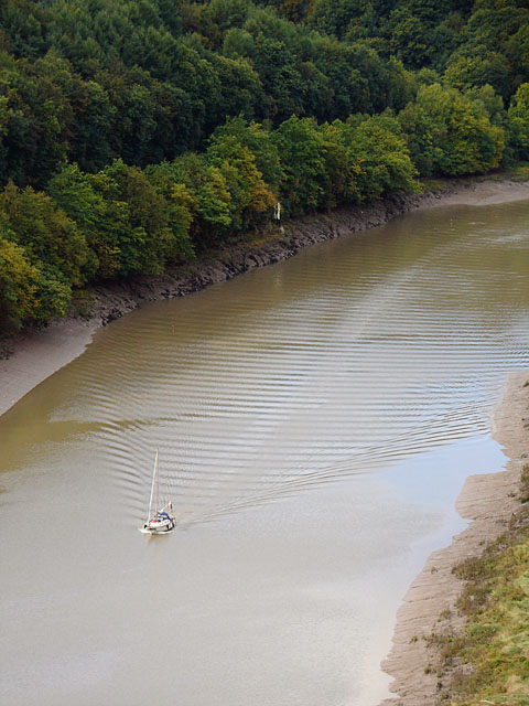
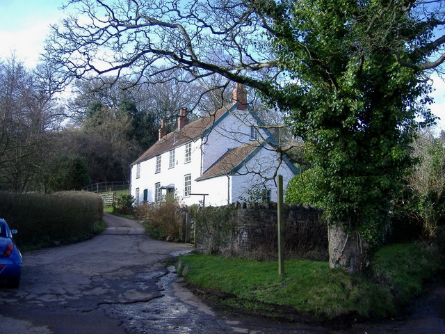
Abbots Leigh is a picturesque village located in the county of Somerset, England. Situated on the outskirts of Bristol, it lies on the western bank of the River Avon and is surrounded by beautiful countryside.

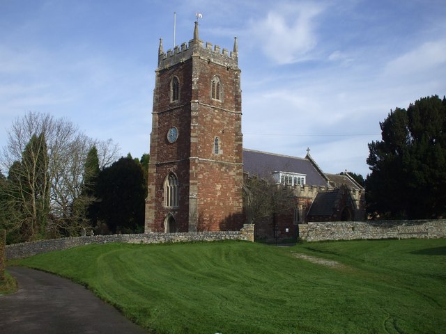
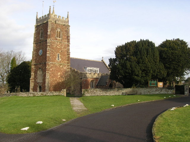
The village is known for its charming, traditional architecture, with many of its buildings dating back to the 18th and 19th centuries. The centerpiece of Abbots Leigh is the parish church, St. Mary the Virgin, which is a Grade I listed building and showcases stunning Norman and Gothic architectural styles.

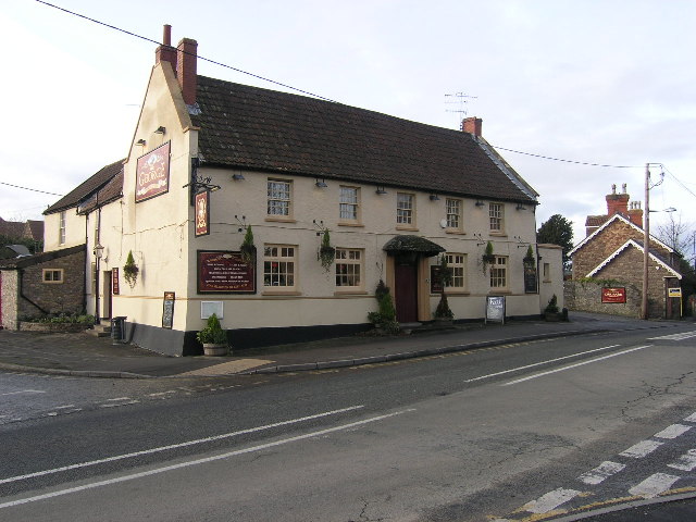
Abbots Leigh is a small community with a population of around 600 residents. Despite its size, the village boasts a strong sense of community spirit and has a range of amenities to cater to its residents' needs. These include a village hall, a primary school, a post office, and a local pub.

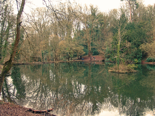
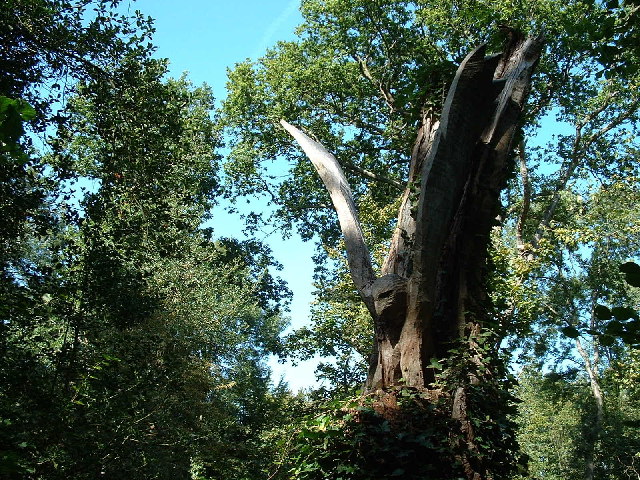
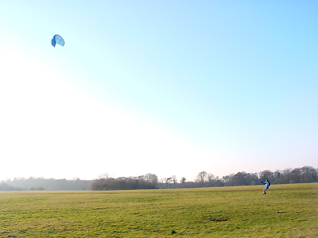
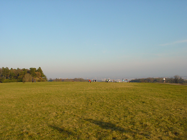
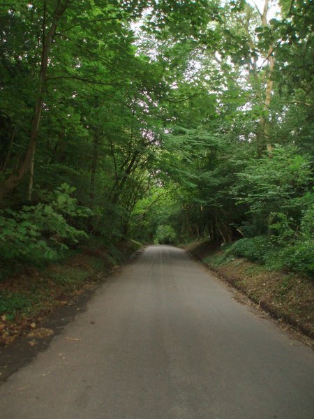
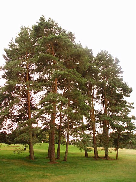
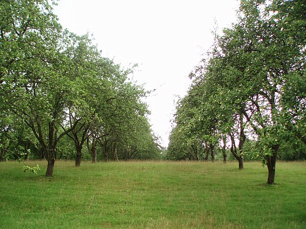
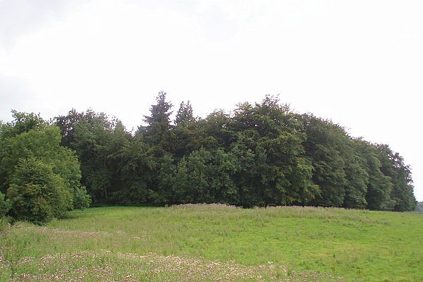
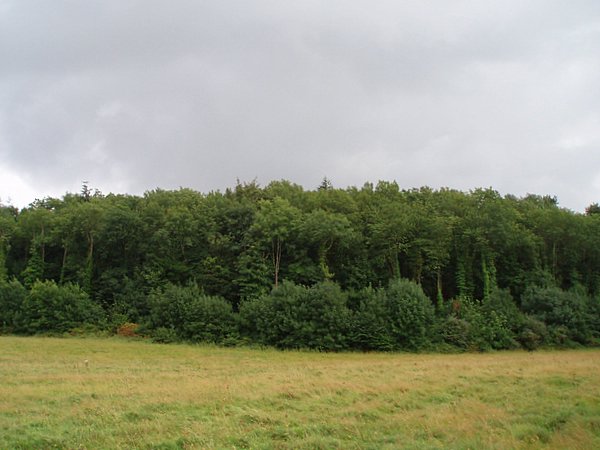
The surrounding natural beauty of Abbots Leigh provides residents and visitors with ample opportunities for outdoor activities. The village is surrounded by rolling hills and woodlands, making it a popular spot for walking, hiking, and exploring nature. The nearby Leigh Woods, managed by the National Trust, offers extensive trails and stunning views of the Avon Gorge.

Abbots Leigh's proximity to Bristol allows residents to enjoy the benefits of a larger city while still enjoying the tranquility of village life. Bristol's vibrant cultural scene, shopping centers, and employment opportunities are easily accessible, making Abbots Leigh an attractive place to live for those seeking a balance between rural and urban lifestyles.

In conclusion, Abbots Leigh is a peaceful and picturesque village in Somerset, offering a close-knit community, beautiful architecture, and stunning natural surroundings.

If you have any feedback on the listing, please let us know in the comments section below.

Abbots Leigh Images

Images are sourced within 2km of 51.460662/-2.666431 or Grid Reference ST5373. Thanks to Geograph Open Source API. All images are credited.

Fish Pond This lake in Fish Pond Wood once provided fish for the divines of Bristol Cathedral.
Fish Pond
This lake in Fish Pond Wood once provided fish for the divines of Bristol Cathedral.
Woodland sculpture In situ sculpture - Making use of the trees in Leigh Woods
Woodland sculpture
In situ sculpture - Making use of the trees in Leigh Woods
Ham Green Halt This halt was mainly built to serve the nearby hospital. The line is still open to serve Portbury Docks
Ham Green Halt
This halt was mainly built to serve the nearby hospital. The line is still open to serve Portbury Docks
Corus Hotel and Fitness Club, Beggar Bush Lane Formerly called Redwood Lodge, a group of rather dull buildings in wonderful countryside!
Corus Hotel and Fitness Club, Beggar Bush Lane
Formerly called Redwood Lodge, a group of rather dull buildings in wonderful countryside!
Abbot's Leigh - The George
Abbot's Leigh Church
Kite flying in Ashton Court Almost always guaranteed a breeze up here so it's a favourite with kite flyers, with both small and big kites, even on very cold days. The estate is owned by Bristol City Council.
Kite flying in Ashton Court
Almost always guaranteed a breeze up here so it's a favourite with kite flyers, with both small and big kites, even on very cold days. The estate is owned by Bristol City Council.
Ashton Court Beyond the people is Bristol seen in the distance (looking east). And just out of sight is part of the golf course.
Ashton Court
Beyond the people is Bristol seen in the distance (looking east). And just out of sight is part of the golf course.
Bristol International Kite Festival, Ashton Court Each September this part of Ashton Court is used for the Bristol International Kite Festival, which has been running for 20 years. The trees in the background run along Beggar Bush Lane.
Bristol International Kite Festival, Ashton Court
Each September this part of Ashton Court is used for the Bristol International Kite Festival, which has been running for 20 years. The trees in the background run along Beggar Bush Lane.
The Iris sailing up the Avon at high tide The Iris was on its way to the Bristol Harbour Festival, and had to wait for high tide to negotiate the river Avon. 
On the horizon is Avonmouth and the M5 bridge outlined by the sunset and beyond is Wales.
The Iris sailing up the Avon at high tide
The Iris was on its way to the Bristol Harbour Festival, and had to wait for high tide to negotiate the river Avon. On the horizon is Avonmouth and the M5 bridge outlined by the sunset and beyond is Wales.
Weir Lane A view looking up Weir Lane (facing south).  Fifty Acre wood is on the left and the Bristol and Clifton golf course on the right.
Weir Lane
A view looking up Weir Lane (facing south). Fifty Acre wood is on the left and the Bristol and Clifton golf course on the right.
Trees A stand of trees near the 12th green on the Bristol and Clifton golf course.
Trees
A stand of trees near the 12th green on the Bristol and Clifton golf course.
Yew Tree Plantation The name of the plantation doesn't match the type of tree.  Evidently Yew Tree Plantation has become an apple orchard.
Yew Tree Plantation
The name of the plantation doesn't match the type of tree. Evidently Yew Tree Plantation has become an apple orchard.
Round Hill Clump A relatively small plantation on top of a small hill.  Taken from a bridleway to the north.
Round Hill Clump
A relatively small plantation on top of a small hill. Taken from a bridleway to the north.
Warren House Plantation
River Avon passing through the Avon Gorge The boat is going towards Bristol on the River Avon. Most of the banks of the river are mud but in some places there are rocks. The line through the trees, parallel with the river is the Bristol to Pill cycle path.
River Avon passing through the Avon Gorge
The boat is going towards Bristol on the River Avon. Most of the banks of the river are mud but in some places there are rocks. The line through the trees, parallel with the river is the Bristol to Pill cycle path.
Sustrans Milepost at Ham Green This rowe type milepost is on the Bristol to Portishead Cycle Path, routes 33 and 41.
Sustrans Milepost at Ham Green
This rowe type milepost is on the Bristol to Portishead Cycle Path, routes 33 and 41.
White cottage, Lower Failand An isolated house, set in the folds of a steep sided valley.
White cottage, Lower Failand
An isolated house, set in the folds of a steep sided valley.
Show me another place!

Abbots Leigh is located at Grid Ref: ST5373 (Lat: 51.460662, Lng: -2.666431)

Unitary Authority: North Somerset

Police Authority: Avon and Somerset

What 3 Words

///bits.poppy.quick. Near Easton-in-Gordano, Somerset

Related Wikis

Abbots Leigh

Abbots Leigh is a village and civil parish in North Somerset, England, about 3 miles (5 km) west of the centre of Bristol. == History == The original Middle...

Holy Trinity Church, Abbots Leigh

Holy Trinity Church in Abbots Leigh within the English county of Somerset is a 15th-century Perpendicular Gothic building, restored and partially rebuilt...

Leigh Court

Leigh Court is a country house which is a Grade II* listed building in Abbots Leigh, Somerset, England. The grounds and park are listed, Grade II, on the...

St Katherine's School

St Katherine's School is a co-educational secondary school and sixth form located in the English county of Somerset. Commonly known to be located in Pill...

Ham Green SSSI

Ham Green SSSI (grid reference ST539758) is a 1.1 hectare geological Site of Special Scientific Interest near the village of Ham Green, North Somerset...

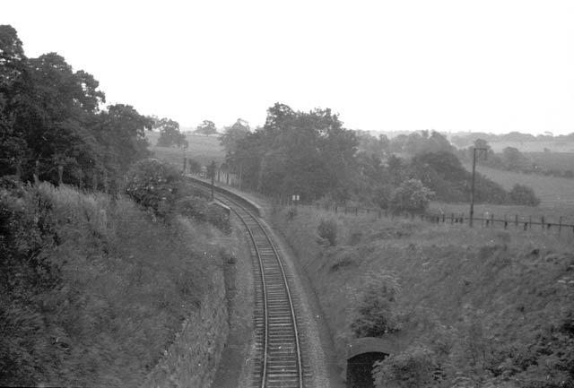
Ham Green Halt railway station

Ham Green Halt was a railway station near Bristol, England, on the Portishead Railway, opened in 1926 to serve Ham Green Hospital. == History == The station...

Leigh Woods National Nature Reserve

Leigh Woods is a 2-square-kilometre (0.77 sq mi) area of woodland on the south-west side of the Avon Gorge, close to the Clifton Suspension Bridge, within...

Stokeleigh Camp

Stokeleigh Camp is an Iron Age promontory fort in Leigh Woods North Somerset near Bristol, England. The hill fort is one of three Iron Age fortifications...

Nearby Amenities

Located within 500m of 51.460662,-2.666431
Kerb: no
Lat/Long: 51.4577242/-2.6654915
Bus Stop
Sandy Lane
Bench: yes
Bin: no
Mapillary: 177122394295832
Naptan AtcoCode: 0190NSC31002
Naptan Bearing: SE
Naptan CommonName: Sandy Lane
Naptan Crossing: Sandy Lane
Naptan NaptanCode: wsmjdtp
Naptan Street: Pill Road
Naptan Verified: no
Public Transport: platform
Shelter: yes
Source: naptan_import
Survey Date: 2021-03-27
Lat/Long: 51.4618324/-2.6655348
Bus Stop
Sandy Lane
Bench: no
Bin: no
Mapillary: 964401601036128
Naptan AtcoCode: 0190NSC31003
Naptan Bearing: NW
Naptan CommonName: Sandy Lane
Naptan Crossing: Sandy Lane
Naptan NaptanCode: wsmjdtm
Naptan Street: Pill Road
Naptan Verified: no
Public Transport: platform
Shelter: no
Source: naptan_import
Survey Date: 2021-03-27
Lat/Long: 51.4618637/-2.6660423
Bus Stop
Church Road
Bench: no
Bin: no
Mapillary: 203914081393800
Naptan AtcoCode: 0190NSC31004
Naptan Bearing: SE
Naptan CommonName: Church Road
Naptan Crossing: Church Road
Naptan NaptanCode: wsmjgad
Naptan Street: Pill Road
Naptan Verified: no
Public Transport: platform
Shelter: yes
Source: naptan_import
Survey Date: 2021-03-27
Lat/Long: 51.4598152/-2.6597047
Bus Stop
Church Road
Bench: no
Bin: no
Bus: yes
Mapillary: 1515009648838541
Naptan AtcoCode: 0190NSC31005
Naptan Bearing: NW
Naptan CommonName: Church Road
Naptan Crossing: Manor Road
Naptan NaptanCode: wsmjdwt
Naptan Street: Pill Road
Naptan Verified: no
Public Transport: platform
Shelter: no
Source: naptan_import
Survey Date: 2021-03-27
Lat/Long: 51.4597207/-2.6598792
Traffic Signals
Button Operated: yes
Crossing: traffic_signals
Crossing Ref: puffin
Tactile Paving: yes
Lat/Long: 51.4600876/-2.6601837
Abbots Pool And Woodland
Board Type: nature
Information: board
Tourism: information
Lat/Long: 51.456596/-2.6694309
Natural: cave_entrance
Lat/Long: 51.4564788/-2.6688355
Barrier: kissing_gate
Lat/Long: 51.4573331/-2.6679697
Crossing
Crossing: unmarked
Crossing Island: no
Crossing Markings: no
Tactile Paving: yes
Lat/Long: 51.4603269/-2.66055
Grit Bin
Lat/Long: 51.4616994/-2.6656606
Barrier: cycle_barrier
Bicycle: yes
Foot: yes
Lat/Long: 51.463307/-2.6667807
Post Box
Post Box Type: lamp
Ref: BS8 107
Royal Cypher: EIIR
Royal Cypher Wikidata: Q33102113
Lat/Long: 51.4633083/-2.6670758
Power: substation
Lat/Long: 51.4593929/-2.6595421
Waste Basket
Lat/Long: 51.4599412/-2.6598895
Post Box
Mapillary: 226899365436356
Post Box Type: lamp
Ref: BS8 606D
Royal Cypher: EIIR
Royal Cypher Wikidata: Q33102113
Source Position: Mapillary 2019-06-23
Survey Date: 2021-03-27
Lat/Long: 51.4599643/-2.6599227
Telephone
Defibrillator
Booth: K6
Covered: booth
Defibrillator Location: inside red phone box at junction of Pill Road and Church Road, Abbots Leigh
Emergency: defibrillator
Man Made: telephone_box
Lat/Long: 51.4605217/-2.6606028
Post Box
Collection Times: Mo-Fr 09:00; Sa 07:00
Operator: Royal Mail
Ref: BS8 341
Royal Cypher: EIIR
Royal Cypher Wikidata: Q33102113
Lat/Long: 51.4594452/-2.6689225
Waterway: waterfall
Lat/Long: 51.4567262/-2.6691212
Waterway: waterfall
Lat/Long: 51.4567028/-2.6691125
Waterway: waterfall
Lat/Long: 51.4566088/-2.6691661
Waterway: waterfall
Lat/Long: 51.4565574/-2.6691983
Leisure: picnic_table
Lat/Long: 51.4567387/-2.6690166
Leisure: picnic_table
Lat/Long: 51.4567997/-2.6690997
Entrance: yes
Lat/Long: 51.4606649/-2.6601428
The data included in this document is from www.openstreetmap.org. The data is made available under ODbL.

Have you been to Abbots Leigh?

Leave your review of Abbots Leigh below (or comments, questions and feedback).