Heining Wood

Wood, Forest in Westmorland Eden

England

Heining Wood

Lowther Park Shot when taking a lovely walk along the side of the river Lowther
Lowther Park Credit: John Gibson

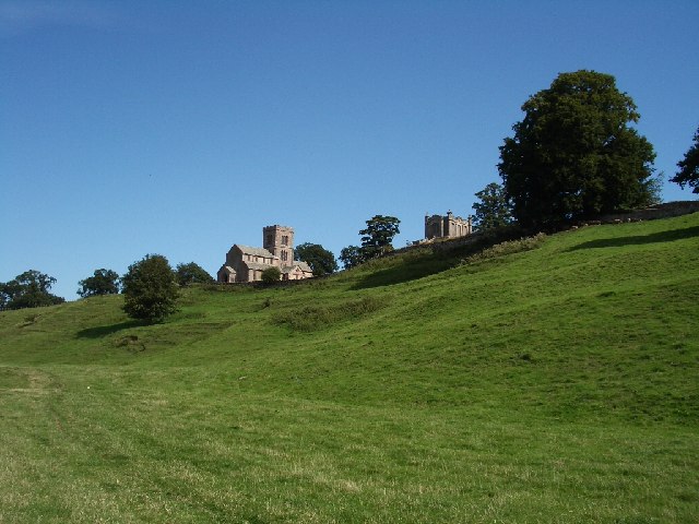
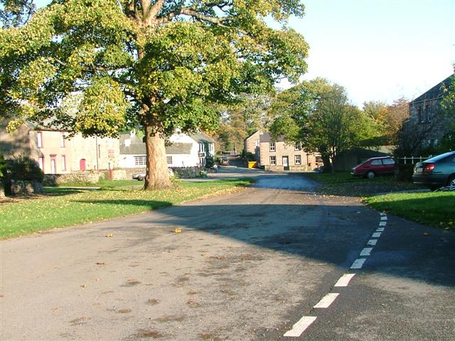
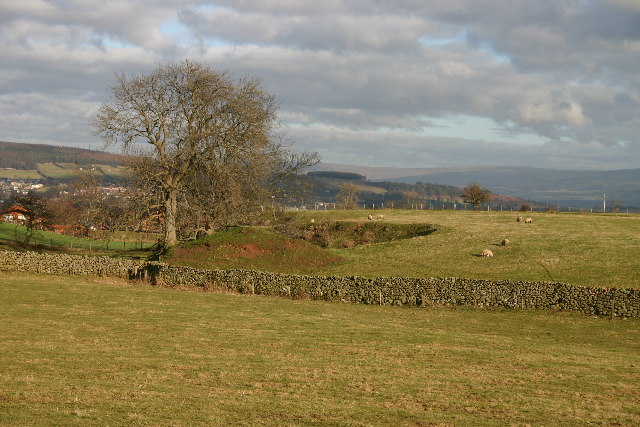
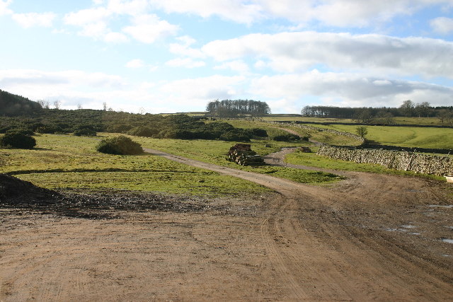
Heining Wood is a picturesque forest located in the county of Westmorland, England. Covering an area of approximately 50 acres, it is a popular destination for nature enthusiasts and outdoor lovers alike. The wood is situated near the village of Heining, which gives it its name, and is surrounded by rolling hills and serene countryside.

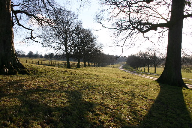
The woodland is characterized by a diverse range of tree species, including oak, beech, ash, and birch. These majestic trees create a dense canopy, providing shade and shelter for a variety of wildlife. Visitors can expect to see an array of bird species, such as woodpeckers, thrushes, and owls, as well as small mammals like squirrels and rabbits.

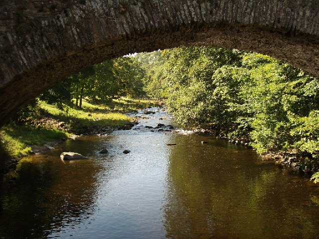
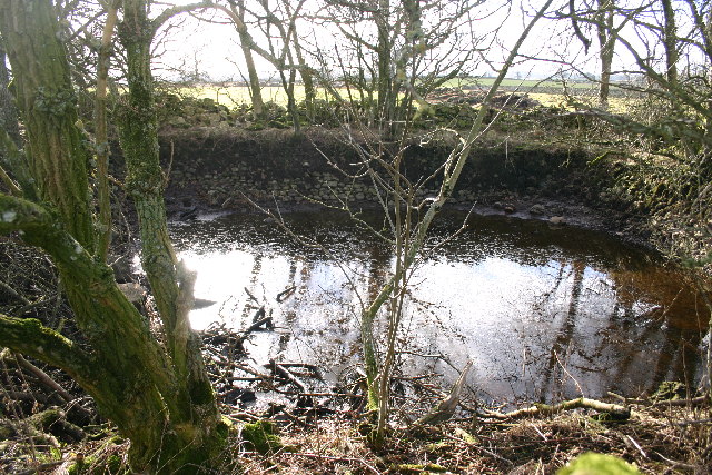
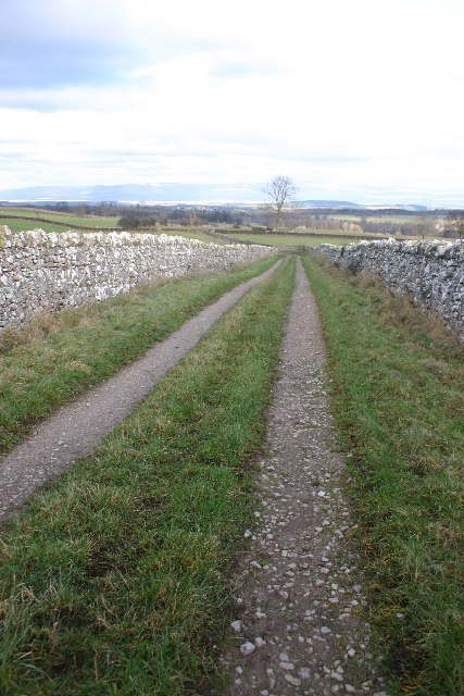
A network of well-maintained walking trails winds through Heining Wood, allowing visitors to explore its natural beauty at their own pace. The paths meander through the forest, crossing babbling brooks and passing by tranquil ponds. Along the way, there are several designated picnic areas where visitors can sit and enjoy the peaceful surroundings.

Heining Wood also holds historical significance, with remnants of old stone walls and ancient boundaries still visible within its boundaries. These remnants offer glimpses into the area's past, adding an extra layer of intrigue to the woodland.

Overall, Heining Wood is a captivating destination that offers a peaceful retreat from the hustle and bustle of everyday life. Its natural beauty, diverse wildlife, and historical elements make it a must-visit for anyone seeking tranquility and a connection with nature.

If you have any feedback on the listing, please let us know in the comments section below.

Heining Wood Images

Images are sourced within 2km of 54.616069/-2.7488 or Grid Reference NY5124. Thanks to Geograph Open Source API. All images are credited.

Lowther Park Shot when taking a lovely walk along the side of the river Lowther
Lowther Park
Shot when taking a lovely walk along the side of the river Lowther
River Lowther under Low Gardens Bridge
Upper Green, Askham Askham is noted for its large expanse of greens.  They are divided by the road from Penrith to Bampton, and the upper green is smaller and probably less well-known than the lower green, which is by the road leading to the church and Lowther.
Upper Green, Askham
Askham is noted for its large expanse of greens. They are divided by the road from Penrith to Bampton, and the upper green is smaller and probably less well-known than the lower green, which is by the road leading to the church and Lowther.
Newtown, Lowther These estate houses were built next to the Home Farm to replace the old village that was demolished in 1685.  However the 17C houses had hipped roofs, so the terraces in this picture are probably later (19C?).
Newtown, Lowther
These estate houses were built next to the Home Farm to replace the old village that was demolished in 1685. However the 17C houses had hipped roofs, so the terraces in this picture are probably later (19C?).
Askham View East From Upper Green
Lowther Castle, Cumbria The most significant feature in this grid square has been the family seat of the Earls of Lonsdale from time immemorial. After the death of the fifth Earl the Castle was abandoned, the interior was dismantled and only the walls left standing as a memorial to past glories.
<span class="nowrap"><a title="http://www.visitcumbria.com/pen/lowthcas.htm" rel="nofollow ugc noopener" href="http://www.visitcumbria.com/pen/lowthcas.htm">Link</a><img style="margin-left:2px;" alt="External link" title="External link - shift click to open in new window" src="https://s1.geograph.org.uk/img/external.png" width="10" height="10"/></span>
Lowther Castle, Cumbria
The most significant feature in this grid square has been the family seat of the Earls of Lonsdale from time immemorial. After the death of the fifth Earl the Castle was abandoned, the interior was dismantled and only the walls left standing as a memorial to past glories. LinkExternal link
Small Quarry in Farmland The area is dotted with these small excavations - usually for stone or clay.
Small Quarry in Farmland
The area is dotted with these small excavations - usually for stone or clay.
Mini Reservoir Not on the scale of Kielder Water, this one measures about 10m across and still holds water, even though long disused.
Mini Reservoir
Not on the scale of Kielder Water, this one measures about 10m across and still holds water, even though long disused.
Stubble Field The Ullswater Fells are in the far distance.
Stubble Field
The Ullswater Fells are in the far distance.
Path Meeting above Askham The bridleway to the right leads onto Askham Fell.
Path Meeting above Askham
The bridleway to the right leads onto Askham Fell.
Bridleway Looking over the Eden Valley towards the Pennines and Cross Fell
Bridleway
Looking over the Eden Valley towards the Pennines and Cross Fell
Private Drive in Lowther Park Only estate workers allowed here, so very quiet and tranquil.
Private Drive in Lowther Park
Only estate workers allowed here, so very quiet and tranquil.
The Hag This odd-shaped plantation shows clearly on map and ground. Deciduous trees on left, coniferous on right with the odd one ....
The Hag
This odd-shaped plantation shows clearly on map and ground. Deciduous trees on left, coniferous on right with the odd one ....
Standing Stones Located in Lowther Estates, and about 200m from the M6, the backdrop of the Pennines is breathtaking. Great Dun Fell with its "Golfball" on the summit lies between the two stones.
Standing Stones
Located in Lowther Estates, and about 200m from the M6, the backdrop of the Pennines is breathtaking. Great Dun Fell with its "Golfball" on the summit lies between the two stones.
Buckholme Lodge On the Lowther Estate, reached only by a private drive.
Buckholme Lodge
On the Lowther Estate, reached only by a private drive.
Parkland Part of the Lowther Estate
Parkland
Part of the Lowther Estate
Modern Bridge Over River Lowther Just a few metres from the old bridge.
Modern Bridge Over River Lowther
Just a few metres from the old bridge.
Old (Low Gardens) Bridge Over River Lowther Just a few metres from the new bridge.
Old (Low Gardens) Bridge Over River Lowther
Just a few metres from the new bridge.
Show me another place!

Heining Wood is located at Grid Ref: NY5124 (Lat: 54.616069, Lng: -2.7488)

Administrative County: Cumbria

District: Eden

Police Authority: Cumbria

What 3 Words

///outnumber.shows.goods. Near Penrith, Cumbria

Related Wikis

Lowther Castle Stead

Lowther Castle Stead is a medieval site in Cumbria, possibly a ringwork castle. Lancaster University Archaeology Unit carried out a survey of the earthworks...

Askham Hall

Askham Hall is a country house near Askham in Cumbria. It is a Grade I listed building. == History == A peel tower was built on the site during the 14th...
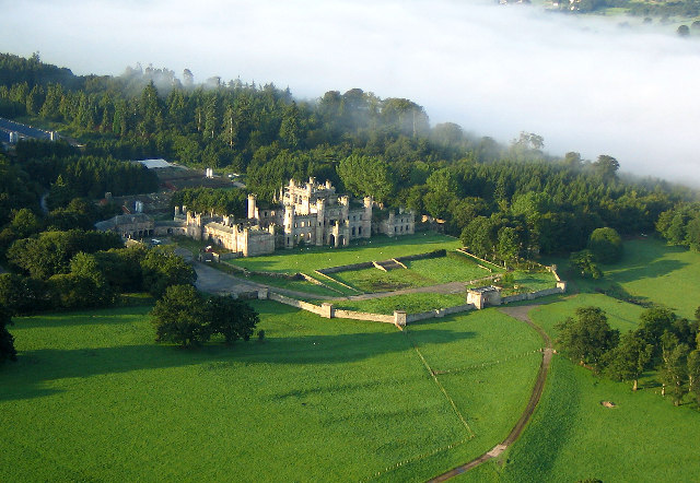
Lowther Castle

Lowther Castle is a country house in the historic county of Westmorland, which now under the current unitary authority of Westmorland and Furness, in the...

Sockbridge and Tirril

Sockbridge and Tirril is a small civil parish in Eden District, Cumbria. It had a population of 397 in 2001, increasing to 415 at the 2011 Census. It comprises...

Askham, Cumbria

Askham is a village and civil parish in the Eden district of Cumbria, England. It is in the historic county of Westmorland. According to the 2001 census...

River Lowther

The River Lowther is a small river which flows through limestone rock in Cumbria, England. It is a tributary of the River Eamont which in turn is a tributary...

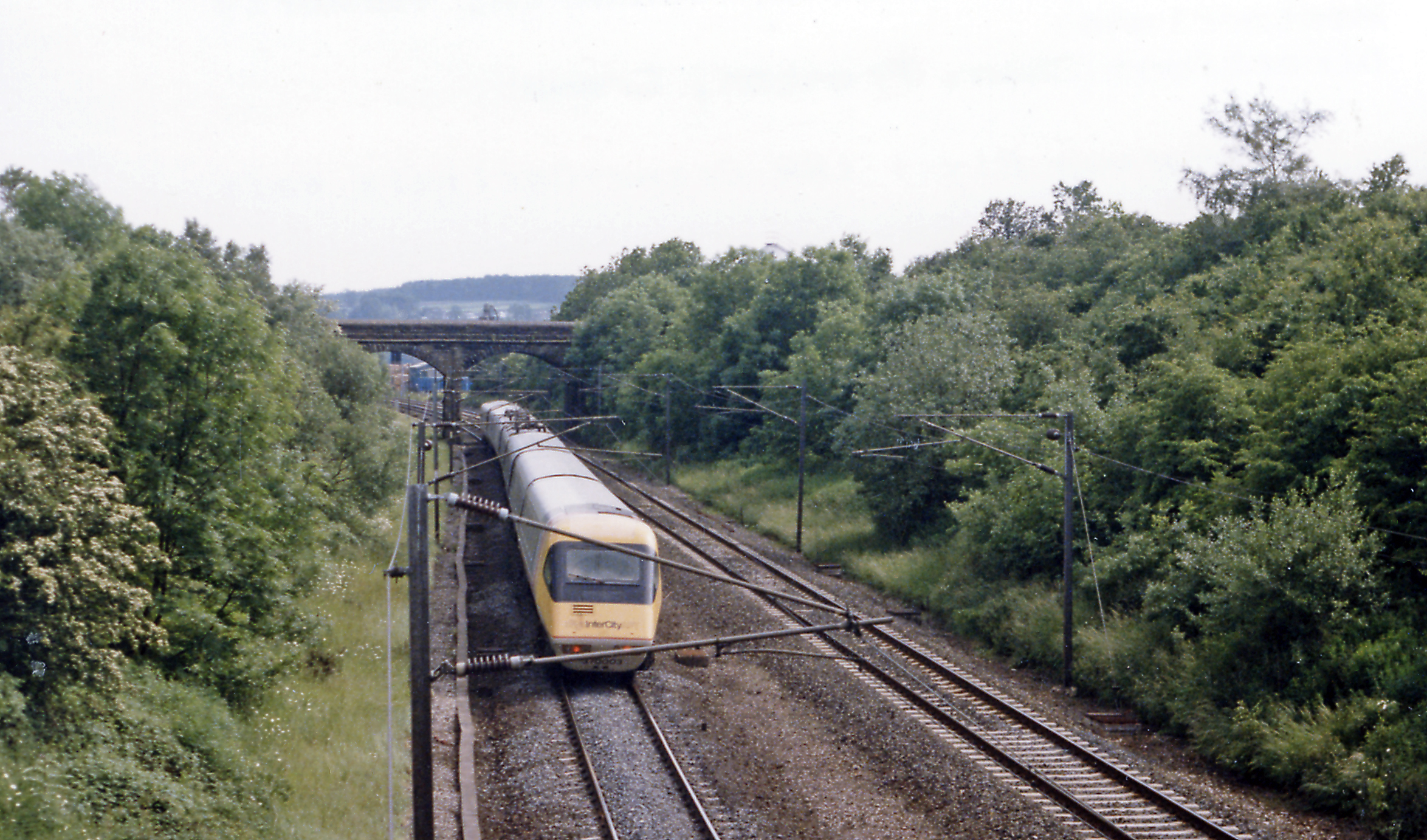
Clifton and Lowther railway station

Clifton & Lowther railway station was a station on the Lancaster and Carlisle Railway (L&CR) south of Penrith near to the village of Clifton. Although...

Clifton Moor Skirmish

The Clifton Moor Skirmish took place on the evening of Wednesday 18 December during the Jacobite rising of 1745. Following the decision to retreat from...

Nearby Amenities

Located within 500m of 54.616069,-2.7488
Castlesteads
Historic: archaeological_site
Source: OS 1:25k
Lat/Long: 54.619659/-2.7470834
Heining Wood
Natural: wood
Lat/Long: 54.6156464/-2.7499783
Heining Bank
Place: locality
Lat/Long: 54.6135464/-2.7499354
Barrier: stile
Stile: ladder
Lat/Long: 54.6132658/-2.7515339
Power: pole
Lat/Long: 54.6195986/-2.7531213
The data included in this document is from www.openstreetmap.org. The data is made available under ODbL.

Have you been to Heining Wood?

Leave your review of Heining Wood below (or comments, questions and feedback).