Winstanley Wood

Wood, Forest in Lancashire

England

Winstanley Wood

A Winter Sunset at Carr Mill Dam Sunset on over the southern end of Carr Mill Dam in January.
A Winter Sunset at Carr Mill Dam Credit: Sue Adair

Winstanley Wood, located in Lancashire, England, is a charming forest area known for its natural beauty and abundance of flora and fauna. Stretching across several hectares, the wood is a popular destination for nature enthusiasts and walkers seeking tranquility and a connection with the outdoors.

The wood boasts a diverse range of tree species, including oak, birch, and beech, which create a dense canopy that provides shade and shelter for the woodland floor. The forest floor is adorned with an array of wildflowers and ferns, creating a delightful tapestry of colors and textures throughout the seasons.

Wildlife thrives in Winstanley Wood, with many species making it their home. Visitors may spot squirrels darting among the branches, while bird watchers can enjoy the melodic songs of various avian species, such as robins, blue tits, and woodpeckers. The wood is also known to provide habitat for deer, foxes, and smaller mammals.

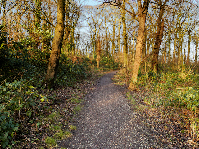
Trails wind through the forest, offering visitors the opportunity to explore the wood at their own pace. These paths offer panoramic views of the surrounding countryside and glimpses of nearby ponds and streams, adding to the area's natural charm.

Winstanley Wood is a cherished local treasure, providing a peaceful retreat for residents and visitors alike. Its rich biodiversity and tranquil atmosphere make it an ideal location for those seeking solace in nature or an escape from the hustle and bustle of everyday life.

If you have any feedback on the listing, please let us know in the comments section below.

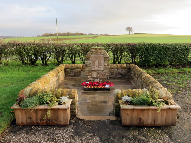
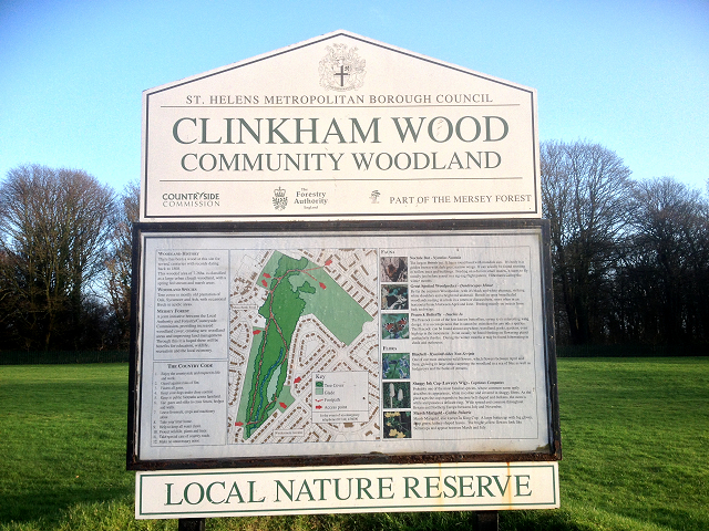
Winstanley Wood Images

Images are sourced within 2km of 53.478924/-2.7383121 or Grid Reference SJ5198. Thanks to Geograph Open Source API. All images are credited.

A Winter Sunset at Carr Mill Dam Sunset on over the southern end of Carr Mill Dam in January.
A Winter Sunset at Carr Mill Dam
Sunset on over the southern end of Carr Mill Dam in January.
Old Milestone by Mansion House Lodge, Victoria Park St Helens Stone in parish of (St Helens District), was located in Parr Street to the east of the George and Dragon Inn (now demolished), now in front of the Mansion House lodge, Victoria Park, St Helens.

Inscription reads:-
: To / Prescot / IV / Liverpool / XII / Miles. : : PARR : : To / Ashton / V / Miles. :

Out of place - in public view

Milestone Society National ID: LA_ASLV05
Old Milestone by Mansion House Lodge, Victoria Park
St Helens Stone in parish of (St Helens District), was located in Parr Street to the east of the George and Dragon Inn (now demolished), now in front of the Mansion House lodge, Victoria Park, St Helens. Inscription reads:- : To / Prescot / IV / Liverpool / XII / Miles. : : PARR : : To / Ashton / V / Miles. : Out of place - in public view Milestone Society National ID: LA_ASLV05
Old Boundary Marker by the B5201, Dagnals Bridge, Rainford Parish Either side of an iron section in the northwest parapet of Dagnals Bridge, Rainford Brook on the B5201 Crank Road. On the former boundary of Windle and Rainford parishes, now the boundary of St Helens metropolitan district and Rainford parish. 
Bridge Marker LA_RAIN04br is inscribed on two pillars either side of a cast iron section of the bridge parapet. On the left hand pillar C C. On the right hand pillar DAGNALS / BRIDGE / No 30 / C.
Outside of the two pillars is inscribed Parish Boundary Marker LA_RAIN03pb. On the left hand side WINDLE and on the right hand side RAINFORD.
See also <a title="https://www.geograph.org.uk/photo/86452" href="https://www.geograph.org.uk/photo/86452">Link</a>.

Milestone Society National IDs: LA_RAIN03pb and LA_RAIN04br
Old Boundary Marker by the B5201, Dagnals Bridge, Rainford Parish
Either side of an iron section in the northwest parapet of Dagnals Bridge, Rainford Brook on the B5201 Crank Road. On the former boundary of Windle and Rainford parishes, now the boundary of St Helens metropolitan district and Rainford parish. Bridge Marker LA_RAIN04br is inscribed on two pillars either side of a cast iron section of the bridge parapet. On the left hand pillar C C. On the right hand pillar DAGNALS / BRIDGE / No 30 / C. Outside of the two pillars is inscribed Parish Boundary Marker LA_RAIN03pb. On the left hand side WINDLE and on the right hand side RAINFORD. See also Link. Milestone Society National IDs: LA_RAIN03pb and LA_RAIN04br
East Lancashire Road, Windle Hall Bridge Bridge carrying The road between Windle Hall Farm and Windlehurst.
East Lancashire Road, Windle Hall Bridge
Bridge carrying The road between Windle Hall Farm and Windlehurst.
St Helens Cemetery
St Helens Cemetery
Windle Hall Bridge over the A580 Abbey Road, leading to Windle Hall Farm
Windle Hall Bridge over the A580
Abbey Road, leading to Windle Hall Farm
Roadworks on the East Lancs Road at Windlehurst Traffic queuing as the road has been temporarily reduced to a single lane approaching the roadworks to improve the Windle Junction ahead.
Roadworks on the East Lancs Road at Windlehurst
Traffic queuing as the road has been temporarily reduced to a single lane approaching the roadworks to improve the Windle Junction ahead.
St Helens Cemetery and Crematorium
The nineteen arch bridge at Carr Mill Dam
View from a Liverpool-Wigan train - Overflow from Carr Mill Dam
House on the corner of Crank Hill
Crank and Kings Moss War Memorial New war memorial for Crank and Kings Moss, dedicated on 19 July 2015.
Crank and Kings Moss War Memorial
New war memorial for Crank and Kings Moss, dedicated on 19 July 2015.
The Approach to Clinkham Wood The path into Clinkham Wood from Lorton Avenue.
The Approach to Clinkham Wood
The path into Clinkham Wood from Lorton Avenue.
Path in Clinkham Wood There has been a wood at this site for several centuries. This wooded area is classified as a large urban clough woodland with a spring-fed stream and marshy areas. Tree cover is mostly old plantation of Oak, Sycamore and Ash, with occasional Birch in more acidic areas.

Part of the Mersey Forest, It is maintained as a joint initiative between the local authority and the Forestry/Countryside Commission.

(adapted from a nearby information board <a href="https://www.geograph.org.uk/photo/4802151">SJ5198 : Clinkham Wood Information Board</a>).
Path in Clinkham Wood
There has been a wood at this site for several centuries. This wooded area is classified as a large urban clough woodland with a spring-fed stream and marshy areas. Tree cover is mostly old plantation of Oak, Sycamore and Ash, with occasional Birch in more acidic areas. Part of the Mersey Forest, It is maintained as a joint initiative between the local authority and the Forestry/Countryside Commission. (adapted from a nearby information board SJ5198 : Clinkham Wood Information Board).
Clinkham Wood Information Board There has been a wood at this site for several centuries. This wooded area is classified as a large urban clough woodland with a spring-fed stream and marshy areas. Tree cover is mostly old plantation of Oak, Sycamore and Ash, with occasional Birch in more acidic areas.

Part of the Mersey Forest, It is maintained as a joint initiative between the local authority and the Forestry/Countryside Commission.

(adapted from a nearby information board <a href="https://www.geograph.org.uk/photo/4802151">SJ5198 : Clinkham Wood Information Board</a>).
Clinkham Wood Information Board
There has been a wood at this site for several centuries. This wooded area is classified as a large urban clough woodland with a spring-fed stream and marshy areas. Tree cover is mostly old plantation of Oak, Sycamore and Ash, with occasional Birch in more acidic areas. Part of the Mersey Forest, It is maintained as a joint initiative between the local authority and the Forestry/Countryside Commission. (adapted from a nearby information board SJ5198 : Clinkham Wood Information Board).
St Patrick's RC Church Clinkham Wood Seen here from across the playing fields, the church was built in 1964 to serve a new housing estate, part of the post-war northern expansion of St Helens.
St Patrick's RC Church Clinkham Wood
Seen here from across the playing fields, the church was built in 1964 to serve a new housing estate, part of the post-war northern expansion of St Helens.
Clinkham Wood Recreation Ground, Elliott's Field
Moss Bank Mission Situated at the corner of Club Street and Moss Bank Road, Moss Bank Mission is the former Moss Bank School which closed as a school in 1978.
Moss Bank Mission
Situated at the corner of Club Street and Moss Bank Road, Moss Bank Mission is the former Moss Bank School which closed as a school in 1978.
Show me another place!

Winstanley Wood is located at Grid Ref: SJ5198 (Lat: 53.478924, Lng: -2.7383121)

Unitary Authority: St. Helens

Police Authority: Merseyside

What 3 Words

///reservoir.thickens.crossing. Near Billinge, Merseyside

Related Wikis

Moss Bank railway station

Moss Bank railway station was on the St Helens to Rainford Junction then Ormskirk line on the northern edge of St Helens, England. It opened on 3 February...

Crank Halt railway station

Crank Halt was a railway station serving the village of Crank, Merseyside, England on the St Helens to Rainford Junction then Ormskirk line. == History... ==

Crank Caverns

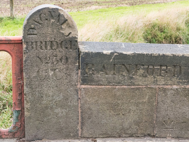
Crank Caverns is the common name of the remains of the Rainford Delph Quarry near Crank in St. Helens, Merseyside, England. It is a vast network of old...
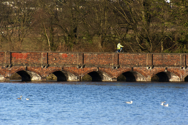
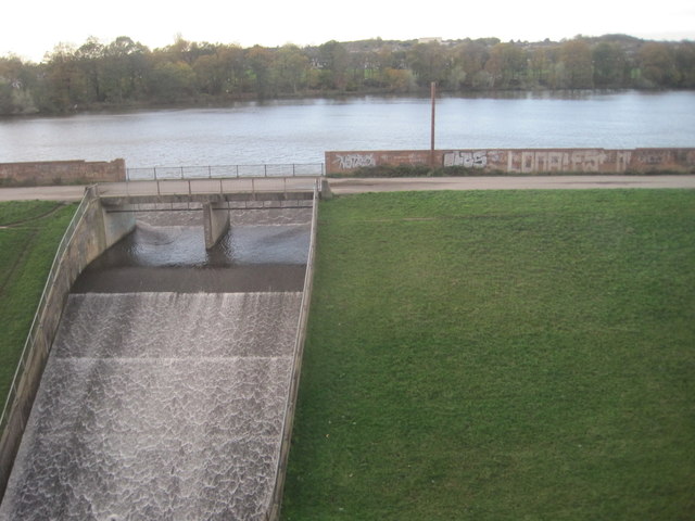
Carr Mill Dam

Carr Mill Dam is situated north of St Helens town centre, on the A571 (Carr Mill Road), in Merseyside. It is the county's largest body of inland water...

Nearby Amenities

Located within 500m of 53.478924,-2.7383121
Moss Bank
Place: village
Source: npe
Lat/Long: 53.4795442/-2.7348427
Traffic Calming: cushion
Lat/Long: 53.4754966/-2.737604
Bus Stop
LORTEN AVENUE/FELL GROVE
Bus: yes
Naptan AtcoCode: 2800S15076A
Naptan Bearing: S
Naptan CommonName: LORTEN AVENUE/FELL GROVE
Naptan Indicator: LORTON AVENUE/MOSS BANK ROAD
Naptan Landmark: OPP FELL GROVE
Naptan NaptanCode: mergjtmd
Naptan Notes: No Notes
Naptan ShortCommonName: Lorton Ave
Naptan Street: LORTON AVENUE
Naptan Verified: no
Public Transport: platform
Source: naptan_import
Lat/Long: 53.4757488/-2.7335402
Bus Stop
LORTON AVE/HILLBRAE AVE
Bus: yes
Naptan AtcoCode: 2800S15077A
Naptan Bearing: SE
Naptan CommonName: LORTON AVE/HILLBRAE AVE
Naptan Indicator: LORTON AVENUE/HILLBRAE AVENUE
Naptan Landmark: O/S 22
Naptan NaptanCode: mergjtmg
Naptan Notes: No Notes
Naptan ShortCommonName: Lorton Ave
Naptan Street: LORTON AVENUE
Naptan Verified: no
Public Transport: platform
Source: naptan_import
Lat/Long: 53.4776524/-2.7338744
Bus Stop
MOSS BANK ROAD/KINGSWAY
Bus: yes
Naptan AtcoCode: 2800S15081A
Naptan Bearing: SW
Naptan CommonName: MOSS BANK ROAD/KINGSWAY
Naptan Indicator: MOSS BANK ROAD/KINGSWAY
Naptan Landmark: O/S 26
Naptan NaptanCode: merajdgt
Naptan Notes: No Notes
Naptan ShortCommonName: Kingsway
Naptan Street: MOSS BANK ROAD
Naptan Verified: no
Public Transport: platform
Source: naptan_import
Lat/Long: 53.4759341/-2.737024
Bus Stop
MOSS BANK ROAD/KINGSWAY
Bus: yes
Naptan AtcoCode: 2800S15081B
Naptan Bearing: NE
Naptan CommonName: MOSS BANK ROAD/KINGSWAY
Naptan Indicator: MOSS BANK ROAD/KINGSWAY
Naptan Landmark: O/S 39
Naptan NaptanCode: merajdgw
Naptan Notes: No Notes
Naptan ShortCommonName: Kingsway
Naptan Street: MOSS BANK ROAD
Naptan Verified: no
Public Transport: platform
Shelter: no
Source: naptan_import
Lat/Long: 53.4759209/-2.7371907
Bus Stop
MOSS BANK RD/MANOR HOUSE CL
Bus: yes
Naptan AtcoCode: 2800S15085A
Naptan Bearing: SW
Naptan CommonName: MOSS BANK RD/MANOR HOUSE CL
Naptan Indicator: MOSS BANK ROAD/LORTON AVENUE
Naptan Landmark: OPP MAR CL OPP 116
Naptan NaptanCode: merajdjg
Naptan Notes: No Notes
Naptan ShortCommonName: Manor Fouse Close
Naptan Street: MOSS BANK ROAD
Naptan Verified: no
Public Transport: platform
Source: naptan_import
Lat/Long: 53.4805081/-2.7313921
Bus Stop
MOSS BANK RD/CHERRY TREE LN
Bus: yes
Naptan AtcoCode: 2800S15085B
Naptan Bearing: NE
Naptan CommonName: MOSS BANK RD/CHERRY TREE LN
Naptan Indicator: MOSS BANK ROAD/LORTON AVENUE
Naptan Landmark: CORNER CHERRY TREE LN OPP 120
Naptan NaptanCode: merajdjm
Naptan Notes: No Notes
Naptan ShortCommonName: Cherry Tree Lane
Naptan Street: MOSS BANK ROAD
Naptan Verified: no
Public Transport: platform
Source: naptan_import
Lat/Long: 53.4806969/-2.7313803
Bus Stop
MOSS BANK RD/BLACK HORSE INN
Bus: yes
Naptan AtcoCode: 2800S15086A
Naptan Bearing: SW
Naptan CommonName: MOSS BANK RD/BLACK HORSE INN
Naptan Indicator: MOSS BANK ROAD/CLUB STREET/BLACK HORSE PH
Naptan Landmark: OPP BLACK HORSE PUB AND 113
Naptan NaptanCode: merajdjp
Naptan Notes: No Notes
Naptan ShortCommonName: Black Horse Inn
Naptan Street: MOSS BANK ROAD
Naptan Verified: no
Public Transport: platform
Shelter: yes
Source: naptan_import
Lat/Long: 53.4789329/-2.7328727
Bus Stop
MOSS BANK RD/BLACK HORSE INN
Bus: yes
Naptan AtcoCode: 2800S15086B
Naptan Bearing: NE
Naptan CommonName: MOSS BANK RD/BLACK HORSE INN
Naptan Indicator: MOSS BANK ROAD/BLACK HORSE PH
Naptan Landmark: NR CORNER CLUB STREET
Naptan NaptanCode: merajdjt
Naptan Notes: No Notes
Naptan ShortCommonName: Black Horse Inn
Naptan Street: MOSS BANK ROAD
Naptan Verified: no
Public Transport: platform
Source: naptan_import
Lat/Long: 53.4791678/-2.7327843
Bus Stop
MOSS BANK ROAD/LORTON AVENUE
Bus: yes
Naptan AtcoCode: 2800S15086C
Naptan Bearing: NE
Naptan CommonName: MOSS BANK ROAD/LORTON AVENUE
Naptan Indicator: MOSS BANK ROAD/LORTON AVENUE
Naptan Landmark: O/S 71
Naptan NaptanCode: merajdjw
Naptan Notes: No Notes
Naptan ShortCommonName: Moss Bank Rd
Naptan Street: MOSS BANK ROAD
Naptan Verified: no
Public Transport: platform
Source: naptan_import
Lat/Long: 53.477861/-2.7350382
Bus Stop
VICTORIA AVENUE/BASSENTHAITE AVE
Bus: yes
Naptan AtcoCode: 2800S15043A
Naptan Bearing: NE
Naptan CommonName: VICTORIA AVENUE/BASSENTHAITE AVE
Naptan Indicator: VICTORIA AVENUE/BASSENTHAITE AVE
Naptan Landmark: NEXT TO LAMPOST 5
Naptan NaptanCode: meragwtg
Naptan Notes: No Notes
Naptan ShortCommonName: Victoria Avenue
Naptan Street: VICTORIA AVENUE
Naptan Verified: no
Public Transport: platform
Shelter: yes
Source: naptan_import
Lat/Long: 53.4746442/-2.7373441
Generator Method: photovoltaic
Generator Output Electricity: yes
Generator Source: solar
Generator Type: solar_photovoltaic_panel
Location: roof
Power: generator
Lat/Long: 53.4759385/-2.7342433
Generator Method: photovoltaic
Generator Output Electricity: yes
Generator Source: solar
Generator Type: solar_photovoltaic_panel
Location: roof
Power: generator
Lat/Long: 53.4759593/-2.7344284
Generator Method: photovoltaic
Generator Output Electricity: yes
Generator Source: solar
Generator Type: solar_photovoltaic_panel
Location: roof
Power: generator
Lat/Long: 53.4760583/-2.7347422
Generator Method: photovoltaic
Generator Output Electricity: yes
Generator Source: solar
Generator Type: solar_photovoltaic_panel
Location: roof
Power: generator
Lat/Long: 53.4756672/-2.7353671
Generator Method: photovoltaic
Generator Output Electricity: yes
Generator Source: solar
Generator Type: solar_photovoltaic_panel
Location: roof
Power: generator
Lat/Long: 53.4746327/-2.7362362
Generator Method: photovoltaic
Generator Output Electricity: yes
Generator Source: solar
Generator Type: solar_photovoltaic_panel
Location: roof
Power: generator
Lat/Long: 53.4749326/-2.7383943
Generator Method: photovoltaic
Generator Output Electricity: yes
Generator Source: solar
Generator Type: solar_photovoltaic_panel
Location: roof
Power: generator
Lat/Long: 53.4766949/-2.734446
Generator Method: photovoltaic
Generator Output Electricity: yes
Generator Source: solar
Generator Type: solar_photovoltaic_panel
Location: roof
Power: generator
Lat/Long: 53.4766007/-2.7342154
Generator Method: photovoltaic
Generator Output Electricity: yes
Generator Source: solar
Generator Type: solar_photovoltaic_panel
Location: roof
Power: generator
Lat/Long: 53.4773239/-2.7330808
Generator Method: photovoltaic
Generator Output Electricity: yes
Generator Source: solar
Generator Type: solar_photovoltaic_panel
Location: roof
Power: generator
Lat/Long: 53.4773127/-2.7331666
Addr Housenumber: 71
Addr Street: Moss Bank Road
Source: NaPTAN
Lat/Long: 53.4780026/-2.7351453
Addr Housenumber: 22
Addr Street: Lorton Avenue
Source: Naptan
Lat/Long: 53.4777381/-2.7337546
Crossing
Crossing: unmarked
Crossing Island: no
Tactile Paving: yes
Lat/Long: 53.4763152/-2.7338636
Give Way
Direction: forward
Lat/Long: 53.4753176/-2.7363415
Give Way
Direction: backward
Lat/Long: 53.4753715/-2.7363287
Traffic Calming: table
Lat/Long: 53.474651/-2.737001
Give Way
Direction: backward
Lat/Long: 53.4746468/-2.7365973
Direction: forward
Traffic Calming: choker
Lat/Long: 53.4792386/-2.7326265
Traffic Calming: cushion
Lat/Long: 53.4792169/-2.7326489
Direction: backward
Traffic Calming: choker
Lat/Long: 53.4788761/-2.732995
Traffic Calming: cushion
Lat/Long: 53.4789008/-2.7329712
Traffic Calming: cushion
Lat/Long: 53.4756853/-2.7373661
Direction: forward
Traffic Calming: choker
Lat/Long: 53.4756993/-2.7373479
Direction: backward
Traffic Calming: choker
Lat/Long: 53.4754789/-2.7376322
Give Way
Direction: forward
Lat/Long: 53.4745804/-2.7397579
Crossing
Crossing: unmarked
Crossing Island: no
Tactile Paving: yes
Lat/Long: 53.4789799/-2.7329772
Winstanley Wood
Natural: wood
Lat/Long: 53.478972/-2.7376041
The data included in this document is from www.openstreetmap.org. The data is made available under ODbL.

Have you been to Winstanley Wood?

Leave your review of Winstanley Wood below (or comments, questions and feedback).