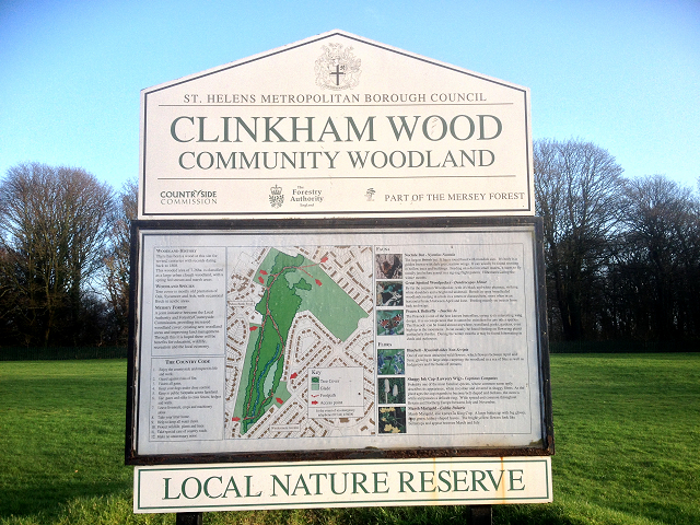
Clinkham Wood

Wood, Forest in Lancashire

England

Clinkham Wood

Modern Canal Milestone, Sankey Canal On the towpath at the junction of the Merton Bank arm.

Milestone Society National ID: SAN-11R
Modern Canal Milestone, Sankey Canal Credit: Barrie Pennington

Clinkham Wood is a picturesque woodland located in Lancashire, England. Situated in the county's rural district, this tranquil forest covers an area of approximately 100 hectares. It is known for its diverse ecosystem, featuring a variety of tree species, wildlife, and flora.

The wood is primarily composed of broadleaf trees, including oak, beech, birch, and ash. These magnificent trees create a dense canopy, providing shelter and shade for the many species that call this woodland their home. The forest floor is carpeted with lush vegetation, including bluebells, ferns, and mosses, adding to the wood's enchanting atmosphere.

Clinkham Wood offers a haven for wildlife enthusiasts and nature lovers. The forest is home to a myriad of bird species, including woodpeckers, owls, and thrushes, making it a haven for birdwatchers. Additionally, the wood provides a habitat for various mammals, such as badgers, foxes, and deer, which can often be spotted roaming through the undergrowth.

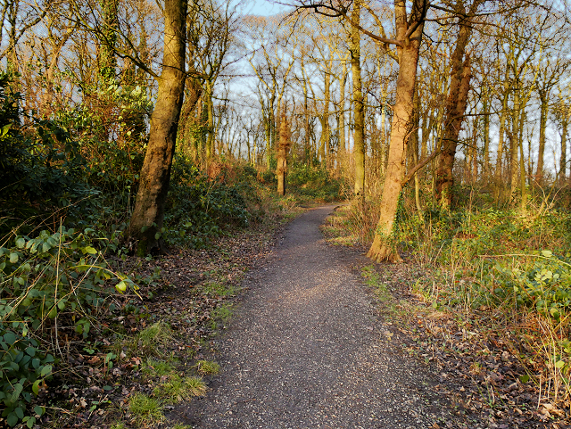
The wood has a network of well-maintained footpaths and trails, allowing visitors to explore its natural beauty. Walking through the wood, visitors can enjoy the peaceful ambiance while immersing themselves in the sights and sounds of nature. The wood is also a popular spot for picnics and family outings, offering a serene environment for relaxation and recreation.

Clinkham Wood is a cherished natural treasure in Lancashire, offering a glimpse into the region's rich biodiversity and providing a tranquil escape from the hustle and bustle of everyday life.

If you have any feedback on the listing, please let us know in the comments section below.

Clinkham Wood Images

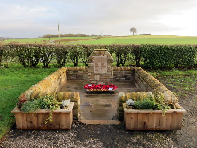
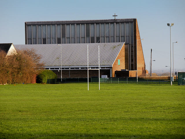
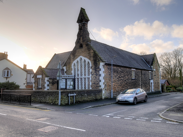
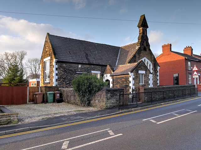
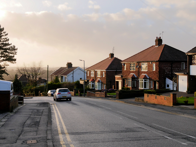
Images are sourced within 2km of 53.478393/-2.7310251 or Grid Reference SJ5198. Thanks to Geograph Open Source API. All images are credited.

Modern Canal Milestone, Sankey Canal On the towpath at the junction of the Merton Bank arm.

Milestone Society National ID: SAN-11R
Modern Canal Milestone, Sankey Canal
On the towpath at the junction of the Merton Bank arm. Milestone Society National ID: SAN-11R
A Winter Sunset at Carr Mill Dam Sunset on over the southern end of Carr Mill Dam in January.
A Winter Sunset at Carr Mill Dam
Sunset on over the southern end of Carr Mill Dam in January.
Old Boundary Marker by the B5201, Dagnals Bridge, Rainford Parish Either side of an iron section in the northwest parapet of Dagnals Bridge, Rainford Brook on the B5201 Crank Road. On the former boundary of Windle and Rainford parishes, now the boundary of St Helens metropolitan district and Rainford parish. 
Bridge Marker LA_RAIN04br is inscribed on two pillars either side of a cast iron section of the bridge parapet. On the left hand pillar C C. On the right hand pillar DAGNALS / BRIDGE / No 30 / C.
Outside of the two pillars is inscribed Parish Boundary Marker LA_RAIN03pb. On the left hand side WINDLE and on the right hand side RAINFORD.
See also <a title="https://www.geograph.org.uk/photo/86452" href="https://www.geograph.org.uk/photo/86452">Link</a>.

Milestone Society National IDs: LA_RAIN03pb and LA_RAIN04br
Old Boundary Marker by the B5201, Dagnals Bridge, Rainford Parish
Either side of an iron section in the northwest parapet of Dagnals Bridge, Rainford Brook on the B5201 Crank Road. On the former boundary of Windle and Rainford parishes, now the boundary of St Helens metropolitan district and Rainford parish. Bridge Marker LA_RAIN04br is inscribed on two pillars either side of a cast iron section of the bridge parapet. On the left hand pillar C C. On the right hand pillar DAGNALS / BRIDGE / No 30 / C. Outside of the two pillars is inscribed Parish Boundary Marker LA_RAIN03pb. On the left hand side WINDLE and on the right hand side RAINFORD. See also Link. Milestone Society National IDs: LA_RAIN03pb and LA_RAIN04br
East Lancashire Road, Windle Hall Bridge Bridge carrying The road between Windle Hall Farm and Windlehurst.
East Lancashire Road, Windle Hall Bridge
Bridge carrying The road between Windle Hall Farm and Windlehurst.
Windle Hall Bridge over the A580 Abbey Road, leading to Windle Hall Farm
Windle Hall Bridge over the A580
Abbey Road, leading to Windle Hall Farm
The nineteen arch bridge at Carr Mill Dam
View from a Liverpool-Wigan train - Overflow from Carr Mill Dam
House on the corner of Crank Hill
Crank and Kings Moss War Memorial New war memorial for Crank and Kings Moss, dedicated on 19 July 2015.
Crank and Kings Moss War Memorial
New war memorial for Crank and Kings Moss, dedicated on 19 July 2015.
The Approach to Clinkham Wood The path into Clinkham Wood from Lorton Avenue.
The Approach to Clinkham Wood
The path into Clinkham Wood from Lorton Avenue.
Path in Clinkham Wood There has been a wood at this site for several centuries. This wooded area is classified as a large urban clough woodland with a spring-fed stream and marshy areas. Tree cover is mostly old plantation of Oak, Sycamore and Ash, with occasional Birch in more acidic areas.

Part of the Mersey Forest, It is maintained as a joint initiative between the local authority and the Forestry/Countryside Commission.

(adapted from a nearby information board <a href="https://www.geograph.org.uk/photo/4802151">SJ5198 : Clinkham Wood Information Board</a>).
Path in Clinkham Wood
There has been a wood at this site for several centuries. This wooded area is classified as a large urban clough woodland with a spring-fed stream and marshy areas. Tree cover is mostly old plantation of Oak, Sycamore and Ash, with occasional Birch in more acidic areas. Part of the Mersey Forest, It is maintained as a joint initiative between the local authority and the Forestry/Countryside Commission. (adapted from a nearby information board SJ5198 : Clinkham Wood Information Board).
Clinkham Wood Information Board There has been a wood at this site for several centuries. This wooded area is classified as a large urban clough woodland with a spring-fed stream and marshy areas. Tree cover is mostly old plantation of Oak, Sycamore and Ash, with occasional Birch in more acidic areas.

Part of the Mersey Forest, It is maintained as a joint initiative between the local authority and the Forestry/Countryside Commission.

(adapted from a nearby information board <a href="https://www.geograph.org.uk/photo/4802151">SJ5198 : Clinkham Wood Information Board</a>).
Clinkham Wood Information Board
There has been a wood at this site for several centuries. This wooded area is classified as a large urban clough woodland with a spring-fed stream and marshy areas. Tree cover is mostly old plantation of Oak, Sycamore and Ash, with occasional Birch in more acidic areas. Part of the Mersey Forest, It is maintained as a joint initiative between the local authority and the Forestry/Countryside Commission. (adapted from a nearby information board SJ5198 : Clinkham Wood Information Board).
St Patrick's RC Church Clinkham Wood Seen here from across the playing fields, the church was built in 1964 to serve a new housing estate, part of the post-war northern expansion of St Helens.
St Patrick's RC Church Clinkham Wood
Seen here from across the playing fields, the church was built in 1964 to serve a new housing estate, part of the post-war northern expansion of St Helens.
Clinkham Wood Recreation Ground, Elliott's Field
Moss Bank Mission Situated at the corner of Club Street and Moss Bank Road, Moss Bank Mission is the former Moss Bank School which closed as a school in 1978.
Moss Bank Mission
Situated at the corner of Club Street and Moss Bank Road, Moss Bank Mission is the former Moss Bank School which closed as a school in 1978.
Moss Bank Mission, Clinkham Wood Situated at the corner of Club Street and Moss Bank Road, Moss Bank Mission is the former Moss Bank School which closed as a school in 1978.
Moss Bank Mission, Clinkham Wood
Situated at the corner of Club Street and Moss Bank Road, Moss Bank Mission is the former Moss Bank School which closed as a school in 1978.
Moss Bank Road, Clinkham Wood
Carr Mill Viaduct
Carr Mill Viaduct
Show me another place!

Clinkham Wood is located at Grid Ref: SJ5198 (Lat: 53.478393, Lng: -2.7310251)

Unitary Authority: St. Helens

Police Authority: Merseyside

What 3 Words

///figs.sisters.resembles. Near Billinge, Merseyside

Related Wikis

Moss Bank railway station

Moss Bank railway station was on the St Helens to Rainford Junction then Ormskirk line on the northern edge of St Helens, England. It opened on 3 February...
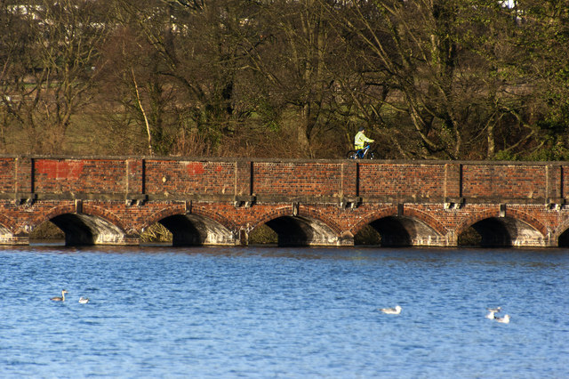
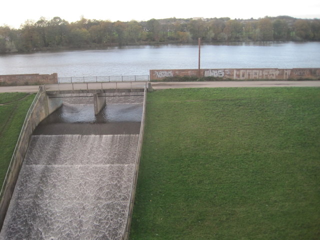
Carr Mill Dam

Carr Mill Dam is situated north of St Helens town centre, on the A571 (Carr Mill Road), in Merseyside. It is the county's largest body of inland water...

Carr Mill railway station

Carr Mill railway station was on the Lancashire Union Railway in the Carr Mill area of St Helens, England. It opened on 1 January 1896 and closed on 1...

St Helens North (UK Parliament constituency)

St. Helens North is a constituency created in 1983 represented in the House of Commons of the UK Parliament since 2015 by the Labour Party's Conor McGinn...

Nearby Amenities

Located within 500m of 53.478393,-2.7310251
Moss Bank
Place: village
Source: npe
Lat/Long: 53.4795442/-2.7348427
Traffic Calming: table
Lat/Long: 53.4792777/-2.7263161
Bus Stop
LORTEN AVENUE/FELL GROVE
Bus: yes
Naptan AtcoCode: 2800S15076A
Naptan Bearing: S
Naptan CommonName: LORTEN AVENUE/FELL GROVE
Naptan Indicator: LORTON AVENUE/MOSS BANK ROAD
Naptan Landmark: OPP FELL GROVE
Naptan NaptanCode: mergjtmd
Naptan Notes: No Notes
Naptan ShortCommonName: Lorton Ave
Naptan Street: LORTON AVENUE
Naptan Verified: no
Public Transport: platform
Source: naptan_import
Lat/Long: 53.4757488/-2.7335402
Bus Stop
LORTON AVE/HILLBRAE AVE
Bus: yes
Naptan AtcoCode: 2800S15077A
Naptan Bearing: SE
Naptan CommonName: LORTON AVE/HILLBRAE AVE
Naptan Indicator: LORTON AVENUE/HILLBRAE AVENUE
Naptan Landmark: O/S 22
Naptan NaptanCode: mergjtmg
Naptan Notes: No Notes
Naptan ShortCommonName: Lorton Ave
Naptan Street: LORTON AVENUE
Naptan Verified: no
Public Transport: platform
Source: naptan_import
Lat/Long: 53.4776524/-2.7338744
Bus Stop
MOSS BANK ROAD/KINGSWAY
Bus: yes
Naptan AtcoCode: 2800S15081A
Naptan Bearing: SW
Naptan CommonName: MOSS BANK ROAD/KINGSWAY
Naptan Indicator: MOSS BANK ROAD/KINGSWAY
Naptan Landmark: O/S 26
Naptan NaptanCode: merajdgt
Naptan Notes: No Notes
Naptan ShortCommonName: Kingsway
Naptan Street: MOSS BANK ROAD
Naptan Verified: no
Public Transport: platform
Source: naptan_import
Lat/Long: 53.4759341/-2.737024
Bus Stop
MOSS BANK ROAD/KINGSWAY
Bus: yes
Naptan AtcoCode: 2800S15081B
Naptan Bearing: NE
Naptan CommonName: MOSS BANK ROAD/KINGSWAY
Naptan Indicator: MOSS BANK ROAD/KINGSWAY
Naptan Landmark: O/S 39
Naptan NaptanCode: merajdgw
Naptan Notes: No Notes
Naptan ShortCommonName: Kingsway
Naptan Street: MOSS BANK ROAD
Naptan Verified: no
Public Transport: platform
Shelter: no
Source: naptan_import
Lat/Long: 53.4759209/-2.7371907
Bus Stop
MOSS BANK ROAD/BROAD LANE
Bus: yes
Naptan AtcoCode: 2800S15084A
Naptan Bearing: SW
Naptan CommonName: MOSS BANK ROAD/BROAD LANE
Naptan Indicator: MOSS BANK ROAD/BROAD LANE
Naptan Landmark: O/S 150
Naptan NaptanCode: merajdja
Naptan Notes: No Notes
Naptan ShortCommonName: Moss Bank Rd/Brd Ln
Naptan Street: MOSS BANK ROAD
Naptan Verified: no
Public Transport: platform
Shelter: no
Source: naptan_import
Lat/Long: 53.4821012/-2.7294643
Bus Stop
MOSS BANK RD/MANOR HOUSE CL
Bus: yes
Naptan AtcoCode: 2800S15085A
Naptan Bearing: SW
Naptan CommonName: MOSS BANK RD/MANOR HOUSE CL
Naptan Indicator: MOSS BANK ROAD/LORTON AVENUE
Naptan Landmark: OPP MAR CL OPP 116
Naptan NaptanCode: merajdjg
Naptan Notes: No Notes
Naptan ShortCommonName: Manor Fouse Close
Naptan Street: MOSS BANK ROAD
Naptan Verified: no
Public Transport: platform
Source: naptan_import
Lat/Long: 53.4805081/-2.7313921
Bus Stop
MOSS BANK RD/CHERRY TREE LN
Bus: yes
Naptan AtcoCode: 2800S15085B
Naptan Bearing: NE
Naptan CommonName: MOSS BANK RD/CHERRY TREE LN
Naptan Indicator: MOSS BANK ROAD/LORTON AVENUE
Naptan Landmark: CORNER CHERRY TREE LN OPP 120
Naptan NaptanCode: merajdjm
Naptan Notes: No Notes
Naptan ShortCommonName: Cherry Tree Lane
Naptan Street: MOSS BANK ROAD
Naptan Verified: no
Public Transport: platform
Source: naptan_import
Lat/Long: 53.4806969/-2.7313803
Bus Stop
MOSS BANK RD/BLACK HORSE INN
Bus: yes
Naptan AtcoCode: 2800S15086A
Naptan Bearing: SW
Naptan CommonName: MOSS BANK RD/BLACK HORSE INN
Naptan Indicator: MOSS BANK ROAD/CLUB STREET/BLACK HORSE PH
Naptan Landmark: OPP BLACK HORSE PUB AND 113
Naptan NaptanCode: merajdjp
Naptan Notes: No Notes
Naptan ShortCommonName: Black Horse Inn
Naptan Street: MOSS BANK ROAD
Naptan Verified: no
Public Transport: platform
Shelter: yes
Source: naptan_import
Lat/Long: 53.4789329/-2.7328727
Bus Stop
MOSS BANK RD/BLACK HORSE INN
Bus: yes
Naptan AtcoCode: 2800S15086B
Naptan Bearing: NE
Naptan CommonName: MOSS BANK RD/BLACK HORSE INN
Naptan Indicator: MOSS BANK ROAD/BLACK HORSE PH
Naptan Landmark: NR CORNER CLUB STREET
Naptan NaptanCode: merajdjt
Naptan Notes: No Notes
Naptan ShortCommonName: Black Horse Inn
Naptan Street: MOSS BANK ROAD
Naptan Verified: no
Public Transport: platform
Source: naptan_import
Lat/Long: 53.4791678/-2.7327843
Bus Stop
MOSS BANK ROAD/LORTON AVENUE
Bus: yes
Naptan AtcoCode: 2800S15086C
Naptan Bearing: NE
Naptan CommonName: MOSS BANK ROAD/LORTON AVENUE
Naptan Indicator: MOSS BANK ROAD/LORTON AVENUE
Naptan Landmark: O/S 71
Naptan NaptanCode: merajdjw
Naptan Notes: No Notes
Naptan ShortCommonName: Moss Bank Rd
Naptan Street: MOSS BANK ROAD
Naptan Verified: no
Public Transport: platform
Source: naptan_import
Lat/Long: 53.477861/-2.7350382
Bus Stop
BROAD LANE/MOSEDALE AVENUE
Bus: yes
Naptan AtcoCode: 2800S15123A
Naptan Bearing: E
Naptan CommonName: BROAD LANE/MOSEDALE AVENUE
Naptan Indicator: BROAD LANE OPP MOSEDALE AVENUE
Naptan Landmark: O/S 24/26 BOTH DIRECTIONS
Naptan NaptanCode: mergjtpa
Naptan Notes: No Notes
Naptan ShortCommonName: Broad Lane
Naptan Street: BROAD LANE
Naptan Verified: no
Public Transport: platform
Source: naptan_import
Lat/Long: 53.4808423/-2.7267113
Bus Stop
DALEHEAD PLACE (TERMINUS)
Bus: yes
Naptan AtcoCode: 2800S15036A
Naptan Bearing: SE
Naptan CommonName: DALEHEAD PLACE (TERMINUS)
Naptan Indicator: DALEHEAD PLACE (TERMINUS)
Naptan Landmark: ON ISLAND OPP SHOPS
Naptan NaptanCode: meragwmj
Naptan Notes: No Notes
Naptan ShortCommonName: Dalehead Place
Naptan Street: DALEHEAD PLACE
Naptan Verified: no
Public Transport: platform
Shelter: yes
Source: naptan_import
Lat/Long: 53.4789944/-2.7265089
Bus Stop
LOUGHRIGG AVENUE/YEWDALE AVE
Bus: yes
Naptan AtcoCode: 2800S15037A
Naptan Bearing: SW
Naptan CommonName: LOUGHRIGG AVENUE/YEWDALE AVE
Naptan Indicator: LOUGHRIGG AVENUE/YEWDALE AVENUE
Naptan Landmark: OPP 1
Naptan NaptanCode: meragwmp
Naptan Notes: No Notes
Naptan ShortCommonName: Loughrigg Avenue
Naptan Street: LOUGHRIGG AVENUE
Naptan Verified: no
Public Transport: platform
Shelter: yes
Source: naptan_import
Lat/Long: 53.4773333/-2.7262463
Bus Stop
LOUGHRIGG AVE CLOSE/YEWDALE AVE
Bus: yes
Naptan AtcoCode: 2800S15037B
Naptan Bearing: NE
Naptan CommonName: LOUGHRIGG AVE CLOSE/YEWDALE AVE
Naptan Indicator: LOUGHRIGG AVENUE CLOSE/YEWDALE AVENUE
Naptan Landmark: O/S 7
Naptan NaptanCode: meragwmt
Naptan Notes: No Notes
Naptan ShortCommonName: Loughrigg Avenue
Naptan Street: LOUGHRIGG AVENUE CLOSE
Naptan Verified: no
Public Transport: platform
Shelter: no
Source: naptan_import
Lat/Long: 53.4774889/-2.726184
Bus Stop
BOWNESS AVENUE/WYTHBURN CRESCENT
Bus: yes
Naptan AtcoCode: 2800S15039A
Naptan Bearing: SE
Naptan CommonName: BOWNESS AVENUE/WYTHBURN CRESCENT
Naptan Indicator: BOWNESS AVENUE
Naptan Landmark: CORNER WASDALE AVENUE O/S 25
Naptan NaptanCode: meragwpa
Naptan Notes: No Notes
Naptan ShortCommonName: Bowness Avenue
Naptan Street: BOWNESS AVENUE
Naptan Verified: no
Public Transport: platform
Source: naptan_import
Lat/Long: 53.4751742/-2.7260721
Bus Stop
WINDERMERE AVE/BOWNESS AVE
Bus: yes
Naptan AtcoCode: 2800S15040A
Naptan Bearing: SW
Naptan CommonName: WINDERMERE AVE/BOWNESS AVE
Naptan Indicator: WINDERMERE AVENUE/BOWNESS AVENUE
Naptan Landmark: O/S 88
Naptan NaptanCode: meragwpg
Naptan Notes: No Notes
Naptan ShortCommonName: Windermere Avenue
Naptan Street: WINDERMERE AVENUE
Naptan Verified: no
Public Transport: platform
Shelter: yes
Source: naptan_import
Lat/Long: 53.4759977/-2.7284898
Bus Stop
WINDEREMERE AVE/ENNERDALE AVE
Bus: yes
Naptan AtcoCode: 2800S15040B
Naptan Bearing: SE
Naptan CommonName: WINDEREMERE AVE/ENNERDALE AVE
Naptan Indicator: WINDERMERE AVENUE/ENNERDALE AVENUE
Naptan Landmark: O/S 3
Naptan NaptanCode: meragwpj
Naptan Notes: No Notes
Naptan ShortCommonName: Windermere Avenue
Naptan Street: WINDERMERE AVENUE
Naptan Verified: no
Public Transport: platform
Source: naptan_import
Lat/Long: 53.4760614/-2.7279857
Bus Stop
WINDERMERE AVENUE/ENNERDALE AVENUE
Bus: yes
Naptan AtcoCode: 2800S15040C
Naptan Bearing: NE
Naptan CommonName: WINDERMERE AVENUE/ENNERDALE AVENUE
Naptan Indicator: WINDERMERE AVENUE/ENNERDALE AVENUE
Naptan Landmark: O/S 71
Naptan NaptanCode: meragwpm
Naptan Notes: No Notes
Naptan ShortCommonName: Ennerdale Avenue
Naptan Street: WINDERMERE AVENUE
Naptan Verified: no
Public Transport: platform
Shelter: no
Source: naptan_import
Lat/Long: 53.4763573/-2.7281113
Bus Stop
WINDERMERE AVENUE/ESKDALE AVENUE
Bus: yes
Naptan AtcoCode: 2800S15041A
Naptan Bearing: SW
Naptan CommonName: WINDERMERE AVENUE/ESKDALE AVENUE
Naptan Indicator: WINDERMERE AVENUE/ESDALE AVENUE
Naptan Landmark: O/S 52
Naptan NaptanCode: meragwpt
Naptan Notes: No Notes
Naptan ShortCommonName: Eskdale Avenue
Naptan Street: WINDERMERE AVENUE
Naptan Verified: no
Public Transport: platform
Shelter: yes
Source: naptan_import
Lat/Long: 53.4745163/-2.7309347
Bus Stop
WINDERMERE AVE/ENNERDALE AVE
Bus: yes
Naptan AtcoCode: 2800S15041C
Naptan Bearing: NE
Naptan CommonName: WINDERMERE AVE/ENNERDALE AVE
Naptan Indicator: WINDERMERE AVENUE/ENNERDALE AVENUE
Naptan Landmark: O/S 35
Naptan NaptanCode: meragwpw
Naptan Notes: No Notes
Naptan ShortCommonName: Ennerdale Avenue
Naptan Street: WINDERMERE AVENUE
Naptan Verified: no
Public Transport: platform
Source: naptan_import
Lat/Long: 53.4749863/-2.7303479
Generator Method: photovoltaic
Generator Output Electricity: yes
Generator Source: solar
Generator Type: solar_photovoltaic_panel
Location: roof
Power: generator
Lat/Long: 53.4741055/-2.7293534
Generator Method: photovoltaic
Generator Output Electricity: yes
Generator Source: solar
Generator Type: solar_photovoltaic_panel
Location: roof
Power: generator
Lat/Long: 53.4740324/-2.7298825
Generator Method: photovoltaic
Generator Output Electricity: yes
Generator Source: solar
Generator Type: solar_photovoltaic_panel
Location: roof
Power: generator
Lat/Long: 53.4740653/-2.7299402
Generator Method: photovoltaic
Generator Output Electricity: yes
Generator Source: solar
Generator Type: solar_photovoltaic_panel
Location: roof
Power: generator
Lat/Long: 53.4746309/-2.7285536
Generator Method: photovoltaic
Generator Output Electricity: yes
Generator Source: solar
Generator Type: solar_photovoltaic_panel
Location: roof
Power: generator
Lat/Long: 53.4748547/-2.7289773
Generator Method: photovoltaic
Generator Output Electricity: yes
Generator Source: solar
Generator Type: solar_photovoltaic_panel
Location: roof
Power: generator
Lat/Long: 53.4748667/-2.7289071
Generator Method: photovoltaic
Generator Output Electricity: yes
Generator Source: solar
Generator Type: solar_photovoltaic_panel
Location: roof
Power: generator
Lat/Long: 53.4749012/-2.7287403
Generator Method: photovoltaic
Generator Output Electricity: yes
Generator Source: solar
Generator Type: solar_photovoltaic_panel
Location: roof
Power: generator
Lat/Long: 53.4748005/-2.7291515
Generator Method: photovoltaic
Generator Output Electricity: yes
Generator Source: solar
Generator Type: solar_photovoltaic_panel
Location: roof
Power: generator
Lat/Long: 53.4746865/-2.7294925
Generator Method: photovoltaic
Generator Output Electricity: yes
Generator Source: solar
Generator Type: solar_photovoltaic_panel
Location: roof
Power: generator
Lat/Long: 53.4747104/-2.729426
Generator Method: photovoltaic
Generator Output Electricity: yes
Generator Source: solar
Generator Type: solar_photovoltaic_panel
Location: roof
Power: generator
Lat/Long: 53.4744866/-2.729167
Generator Method: photovoltaic
Generator Output Electricity: yes
Generator Source: solar
Generator Type: solar_photovoltaic_panel
Location: roof
Power: generator
Lat/Long: 53.4744658/-2.729226
Generator Method: photovoltaic
Generator Output Electricity: yes
Generator Source: solar
Generator Type: solar_photovoltaic_panel
Location: roof
Power: generator
Lat/Long: 53.4746175/-2.7296833
Generator Method: photovoltaic
Generator Output Electricity: yes
Generator Source: solar
Generator Type: solar_photovoltaic_panel
Location: roof
Power: generator
Lat/Long: 53.4749434/-2.7300273
Generator Method: photovoltaic
Generator Output Electricity: yes
Generator Source: solar
Generator Type: solar_photovoltaic_panel
Location: roof
Power: generator
Lat/Long: 53.47502/-2.7298852
Generator Method: photovoltaic
Generator Output Electricity: yes
Generator Source: solar
Generator Type: solar_photovoltaic_panel
Location: roof
Power: generator
Lat/Long: 53.4751605/-2.7296303
Generator Method: photovoltaic
Generator Output Electricity: yes
Generator Source: solar
Generator Type: solar_photovoltaic_panel
Location: roof
Power: generator
Lat/Long: 53.4752806/-2.7294075
Generator Method: photovoltaic
Generator Output Electricity: yes
Generator Source: solar
Generator Type: solar_photovoltaic_panel
Location: roof
Power: generator
Lat/Long: 53.4754779/-2.7291105
Generator Method: photovoltaic
Generator Output Electricity: yes
Generator Source: solar
Generator Type: solar_photovoltaic_panel
Location: roof
Power: generator
Lat/Long: 53.4755625/-2.7289683
Generator Method: photovoltaic
Generator Output Electricity: yes
Generator Source: solar
Generator Type: solar_photovoltaic_panel
Location: roof
Power: generator
Lat/Long: 53.4758451/-2.7285284
Generator Method: photovoltaic
Generator Output Electricity: yes
Generator Source: solar
Generator Type: solar_photovoltaic_panel
Location: roof
Power: generator
Lat/Long: 53.4757124/-2.7287453
Generator Method: photovoltaic
Generator Output Electricity: yes
Generator Source: solar
Generator Type: solar_photovoltaic_panel
Location: roof
Power: generator
Lat/Long: 53.4764928/-2.7286098
Generator Method: photovoltaic
Generator Output Electricity: yes
Generator Source: solar
Generator Type: solar_photovoltaic_panel
Location: roof
Power: generator
Lat/Long: 53.4764356/-2.7285052
Generator Method: photovoltaic
Generator Output Electricity: yes
Generator Source: solar
Generator Type: solar_photovoltaic_panel
Location: roof
Power: generator
Lat/Long: 53.4765053/-2.7281538
Generator Method: photovoltaic
Generator Output Electricity: yes
Generator Source: solar
Generator Type: solar_photovoltaic_panel
Location: roof
Power: generator
Lat/Long: 53.4762961/-2.7277647
Generator Method: photovoltaic
Generator Output Electricity: yes
Generator Source: solar
Generator Type: solar_photovoltaic_panel
Location: roof
Power: generator
Lat/Long: 53.4760446/-2.7268526
Generator Method: photovoltaic
Generator Output Electricity: yes
Generator Source: solar
Generator Type: solar_photovoltaic_panel
Location: roof
Power: generator
Lat/Long: 53.4759948/-2.725907
Generator Method: photovoltaic
Generator Output Electricity: yes
Generator Source: solar
Generator Type: solar_photovoltaic_panel
Location: roof
Power: generator
Lat/Long: 53.4759525/-2.725861
Generator Method: photovoltaic
Generator Output Electricity: yes
Generator Source: solar
Generator Type: solar_photovoltaic_panel
Location: roof
Power: generator
Lat/Long: 53.4761467/-2.7260116
Generator Method: photovoltaic
Generator Output Electricity: yes
Generator Source: solar
Generator Type: solar_photovoltaic_panel
Location: roof
Power: generator
Lat/Long: 53.4762065/-2.7260074
Generator Method: photovoltaic
Generator Output Electricity: yes
Generator Source: solar
Generator Type: solar_photovoltaic_panel
Location: roof
Power: generator
Lat/Long: 53.4764654/-2.7263672
Generator Method: photovoltaic
Generator Output Electricity: yes
Generator Source: solar
Generator Type: solar_photovoltaic_panel
Location: roof
Power: generator
Lat/Long: 53.4763733/-2.7261371
Generator Method: photovoltaic
Generator Output Electricity: yes
Generator Source: solar
Generator Type: solar_photovoltaic_panel
Location: roof
Power: generator
Lat/Long: 53.4763908/-2.7266349
Generator Method: photovoltaic
Generator Output Electricity: yes
Generator Source: solar
Generator Type: solar_photovoltaic_panel
Location: roof
Power: generator
Lat/Long: 53.4763573/-2.7267073
Generator Method: photovoltaic
Generator Output Electricity: yes
Generator Source: solar
Generator Type: solar_photovoltaic_panel
Location: roof
Power: generator
Lat/Long: 53.4768234/-2.7262835
Generator Method: photovoltaic
Generator Output Electricity: yes
Generator Source: solar
Generator Type: solar_photovoltaic_panel
Location: roof
Power: generator
Lat/Long: 53.4768027/-2.7261548
Generator Method: photovoltaic
Generator Output Electricity: yes
Generator Source: solar
Generator Type: solar_photovoltaic_panel
Location: roof
Power: generator
Lat/Long: 53.4760237/-2.7252884
Generator Method: photovoltaic
Generator Output Electricity: yes
Generator Source: solar
Generator Type: solar_photovoltaic_panel
Location: roof
Power: generator
Lat/Long: 53.475971/-2.7254574
Generator Method: photovoltaic
Generator Output Electricity: yes
Generator Source: solar
Generator Type: solar_photovoltaic_panel
Location: roof
Power: generator
Lat/Long: 53.475773/-2.7250229
Generator Method: photovoltaic
Generator Output Electricity: yes
Generator Source: solar
Generator Type: solar_photovoltaic_panel
Location: roof
Power: generator
Lat/Long: 53.4757459/-2.7250819
Generator Method: photovoltaic
Generator Output Electricity: yes
Generator Source: solar
Generator Type: solar_photovoltaic_panel
Location: roof
Power: generator
Lat/Long: 53.4756964/-2.7252777
Generator Method: photovoltaic
Generator Output Electricity: yes
Generator Source: solar
Generator Type: solar_photovoltaic_panel
Location: roof
Power: generator
Lat/Long: 53.4756756/-2.7253448
Generator Method: photovoltaic
Generator Output Electricity: yes
Generator Source: solar
Generator Type: solar_photovoltaic_panel
Location: roof
Power: generator
Lat/Long: 53.4756054/-2.7255164
Generator Method: photovoltaic
Generator Output Electricity: yes
Generator Source: solar
Generator Type: solar_photovoltaic_panel
Location: roof
Power: generator
Lat/Long: 53.4751276/-2.7340314
Generator Method: photovoltaic
Generator Output Electricity: yes
Generator Source: solar
Generator Type: solar_photovoltaic_panel
Location: roof
Power: generator
Lat/Long: 53.4759385/-2.7342433
Generator Method: photovoltaic
Generator Output Electricity: yes
Generator Source: solar
Generator Type: solar_photovoltaic_panel
Location: roof
Power: generator
Lat/Long: 53.4759593/-2.7344284
Generator Method: photovoltaic
Generator Output Electricity: yes
Generator Source: solar
Generator Type: solar_photovoltaic_panel
Location: roof
Power: generator
Lat/Long: 53.4760583/-2.7347422
Generator Method: photovoltaic
Generator Output Electricity: yes
Generator Source: solar
Generator Type: solar_photovoltaic_panel
Location: roof
Power: generator
Lat/Long: 53.4756672/-2.7353671
Generator Method: photovoltaic
Generator Output Electricity: yes
Generator Source: solar
Generator Type: solar_photovoltaic_panel
Location: roof
Power: generator
Lat/Long: 53.4766949/-2.734446
Generator Method: photovoltaic
Generator Output Electricity: yes
Generator Source: solar
Generator Type: solar_photovoltaic_panel
Location: roof
Power: generator
Lat/Long: 53.4766007/-2.7342154
Generator Method: photovoltaic
Generator Output Electricity: yes
Generator Source: solar
Generator Type: solar_photovoltaic_panel
Location: roof
Power: generator
Lat/Long: 53.4773239/-2.7330808
Generator Method: photovoltaic
Generator Output Electricity: yes
Generator Source: solar
Generator Type: solar_photovoltaic_panel
Location: roof
Power: generator
Lat/Long: 53.4773127/-2.7331666
Generator Method: photovoltaic
Generator Output Electricity: yes
Generator Source: solar
Generator Type: solar_photovoltaic_panel
Location: roof
Power: generator
Lat/Long: 53.4748349/-2.7266067
Generator Method: photovoltaic
Generator Output Electricity: yes
Generator Source: solar
Generator Type: solar_photovoltaic_panel
Location: roof
Power: generator
Lat/Long: 53.4748573/-2.7266818
Generator Method: photovoltaic
Generator Output Electricity: yes
Generator Source: solar
Generator Type: solar_photovoltaic_panel
Location: roof
Power: generator
Lat/Long: 53.4749068/-2.7268776
Generator Method: photovoltaic
Generator Output Electricity: yes
Generator Source: solar
Generator Type: solar_photovoltaic_panel
Location: roof
Power: generator
Lat/Long: 53.4749227/-2.7269875
Generator Method: photovoltaic
Generator Output Electricity: yes
Generator Source: solar
Generator Type: solar_photovoltaic_panel
Location: roof
Power: generator
Lat/Long: 53.4749738/-2.7272638
Generator Method: photovoltaic
Generator Output Electricity: yes
Generator Source: solar
Generator Type: solar_photovoltaic_panel
Location: roof
Power: generator
Lat/Long: 53.4746833/-2.7272236
Generator Method: photovoltaic
Generator Output Electricity: yes
Generator Source: solar
Generator Type: solar_photovoltaic_panel
Location: roof
Power: generator
Lat/Long: 53.4746769/-2.7271619
Generator Method: photovoltaic
Generator Output Electricity: yes
Generator Source: solar
Generator Type: solar_photovoltaic_panel
Location: roof
Power: generator
Lat/Long: 53.4747024/-2.7275428
Generator Method: photovoltaic
Generator Output Electricity: yes
Generator Source: solar
Generator Type: solar_photovoltaic_panel
Location: roof
Power: generator
Lat/Long: 53.4746881/-2.7276071
Generator Method: photovoltaic
Generator Output Electricity: yes
Generator Source: solar
Generator Type: solar_photovoltaic_panel
Location: roof
Power: generator
Lat/Long: 53.4746083/-2.7277842
Generator Method: photovoltaic
Generator Output Electricity: yes
Generator Source: solar
Generator Type: solar_photovoltaic_panel
Location: roof
Power: generator
Lat/Long: 53.4745859/-2.7278512
Generator Method: photovoltaic
Generator Output Electricity: yes
Generator Source: solar
Generator Type: solar_photovoltaic_panel
Location: roof
Power: generator
Lat/Long: 53.4749946/-2.7274811
Generator Method: photovoltaic
Generator Output Electricity: yes
Generator Source: solar
Generator Type: solar_photovoltaic_panel
Location: roof
Power: generator
Lat/Long: 53.4750057/-2.7275648
Generator Method: photovoltaic
Generator Output Electricity: yes
Generator Source: solar
Generator Type: solar_photovoltaic_panel
Location: roof
Power: generator
Lat/Long: 53.4754304/-2.7279699
Generator Method: photovoltaic
Generator Output Electricity: yes
Generator Source: solar
Generator Type: solar_photovoltaic_panel
Location: roof
Power: generator
Lat/Long: 53.4754272/-2.728053
Generator Method: photovoltaic
Generator Output Electricity: yes
Generator Source: solar
Generator Type: solar_photovoltaic_panel
Location: roof
Power: generator
Lat/Long: 53.4753234/-2.7278411
Generator Method: photovoltaic
Generator Output Electricity: yes
Generator Source: solar
Generator Type: solar_photovoltaic_panel
Location: roof
Power: generator
Lat/Long: 53.4752771/-2.7278331
Generator Method: photovoltaic
Generator Output Electricity: yes
Generator Source: solar
Generator Type: solar_photovoltaic_panel
Location: roof
Power: generator
Lat/Long: 53.4751462/-2.727825
Generator Method: photovoltaic
Generator Output Electricity: yes
Generator Source: solar
Generator Type: solar_photovoltaic_panel
Location: roof
Power: generator
Lat/Long: 53.4751015/-2.7278089
Generator Method: photovoltaic
Generator Output Electricity: yes
Generator Source: solar
Generator Type: solar_photovoltaic_panel
Location: roof
Power: generator
Lat/Long: 53.4750536/-2.7284151
Generator Method: photovoltaic
Generator Output Electricity: yes
Generator Source: solar
Generator Type: solar_photovoltaic_panel
Location: roof
Power: generator
Lat/Long: 53.4751143/-2.7284258
Generator Method: photovoltaic
Generator Output Electricity: yes
Generator Source: solar
Generator Type: solar_photovoltaic_panel
Location: roof
Power: generator
Lat/Long: 53.4752516/-2.7284366
Generator Method: photovoltaic
Generator Output Electricity: yes
Generator Source: solar
Generator Type: solar_photovoltaic_panel
Location: roof
Power: generator
Lat/Long: 53.4752979/-2.7284446
Generator Method: photovoltaic
Generator Output Electricity: yes
Generator Source: solar
Generator Type: solar_photovoltaic_panel
Location: roof
Power: generator
Lat/Long: 53.4754224/-2.7283615
Generator Method: photovoltaic
Generator Output Electricity: yes
Generator Source: solar
Generator Type: solar_photovoltaic_panel
Location: roof
Power: generator
Lat/Long: 53.4754208/-2.7282516
Generator Method: photovoltaic
Generator Output Electricity: yes
Generator Source: solar
Generator Type: solar_photovoltaic_panel
Location: roof
Power: generator
Lat/Long: 53.4768692/-2.7291766
Generator Method: photovoltaic
Generator Output Electricity: yes
Generator Source: solar
Generator Type: solar_photovoltaic_panel
Location: roof
Power: generator
Lat/Long: 53.477056/-2.7294877
Generator Method: photovoltaic
Generator Output Electricity: yes
Generator Source: solar
Generator Type: solar_photovoltaic_panel
Location: roof
Power: generator
Lat/Long: 53.4771166/-2.729587
Generator Method: photovoltaic
Generator Output Electricity: yes
Generator Source: solar
Generator Type: solar_photovoltaic_panel
Location: roof
Power: generator
Lat/Long: 53.477305/-2.7298659
Generator Method: photovoltaic
Generator Output Electricity: yes
Generator Source: solar
Generator Type: solar_photovoltaic_panel
Location: roof
Power: generator
Lat/Long: 53.4767144/-2.7288708
Generator Method: photovoltaic
Generator Output Electricity: yes
Generator Source: solar
Generator Type: solar_photovoltaic_panel
Location: roof
Power: generator
Lat/Long: 53.4766393/-2.7287609
Generator Method: photovoltaic
Generator Output Electricity: yes
Generator Source: solar
Generator Type: solar_photovoltaic_panel
Location: roof
Power: generator
Lat/Long: 53.4763696/-2.7295494
Addr Housenumber: 71
Addr Street: Moss Bank Road
Source: NaPTAN
Lat/Long: 53.4780026/-2.7351453
Addr Housenumber: 22
Addr Street: Lorton Avenue
Source: Naptan
Lat/Long: 53.4777381/-2.7337546
Give Way
Direction: backward
Lat/Long: 53.4743236/-2.7299507
Give Way
Direction: forward
Lat/Long: 53.474278/-2.7300299
Give Way
Direction: backward
Lat/Long: 53.4747491/-2.73075
Give Way
Direction: backward
Lat/Long: 53.4747017/-2.7306631
Crossing
Crossing: unmarked
Crossing Island: no
Tactile Paving: yes
Lat/Long: 53.4763152/-2.7338636
Give Way
Direction: forward
Lat/Long: 53.4753176/-2.7363415
Give Way
Direction: backward
Lat/Long: 53.4753715/-2.7363287
Give Way
Direction: forward
Lat/Long: 53.4752708/-2.7263523
Crossing
Crossing: unmarked
Crossing Island: no
Tactile Paving: yes
Lat/Long: 53.4752919/-2.7263289
Give Way
Direction: backward
Lat/Long: 53.4793426/-2.7270613
Give Way
Direction: backward
Lat/Long: 53.4792894/-2.7270003
Direction: forward
Traffic Calming: choker
Lat/Long: 53.4792386/-2.7326265
Traffic Calming: cushion
Lat/Long: 53.4792169/-2.7326489
Direction: backward
Traffic Calming: choker
Lat/Long: 53.4788761/-2.732995
Traffic Calming: cushion
Lat/Long: 53.4789008/-2.7329712
Crossing
Crossing: unmarked
Crossing Island: no
Tactile Paving: yes
Lat/Long: 53.4789799/-2.7329772
Give Way
Direction: backward
Lat/Long: 53.4761445/-2.7282856
Give Way
Direction: forward
Lat/Long: 53.4761974/-2.7283727
Crossing
Crossing: unmarked
Crossing Island: no
Tactile Paving: yes
Lat/Long: 53.4789038/-2.7265625
Crossing
Crossing: unmarked
Crossing Island: no
Tactile Paving: yes
Lat/Long: 53.4789174/-2.7262607
Crossing
Crossing: unmarked
Crossing Island: no
Tactile Paving: yes
Lat/Long: 53.4790702/-2.7267572
Crossing
Crossing: unmarked
Crossing Island: no
Tactile Paving: yes
Lat/Long: 53.4792239/-2.7262547
Winstanley Wood
Natural: wood
Lat/Long: 53.478972/-2.7376041
The data included in this document is from www.openstreetmap.org. The data is made available under ODbL.

Have you been to Clinkham Wood?

Leave your review of Clinkham Wood below (or comments, questions and feedback).