Horse Moors

Wood, Forest in Shropshire

England

Horse Moors

View to the Breidden Hills Looking across fields to the west of Shrawardine Castle.
View to the Breidden Hills Credit: Jonathan Billinger

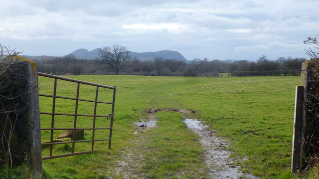
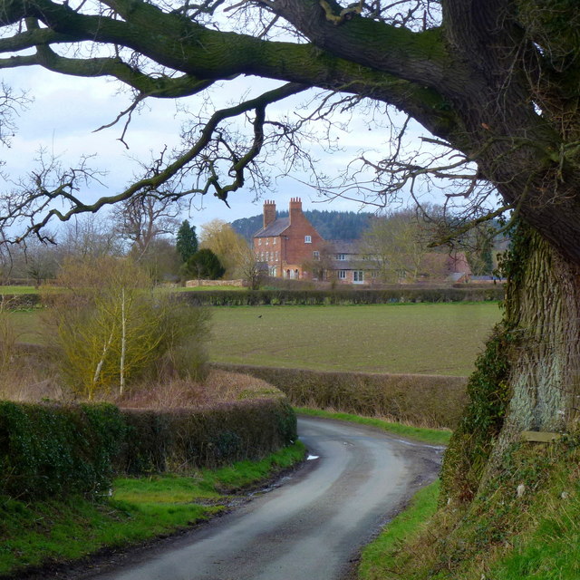
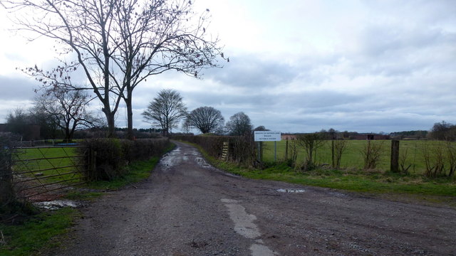
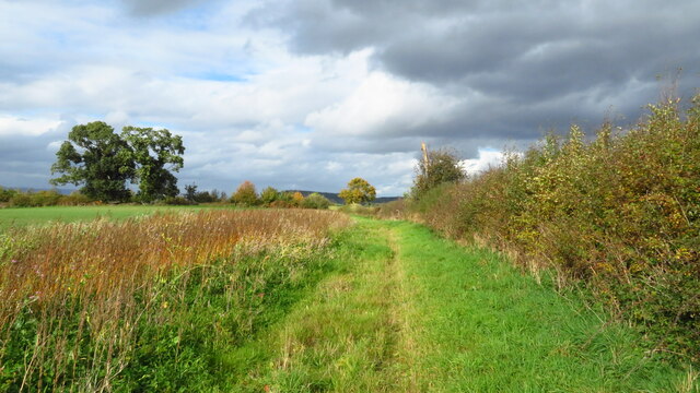
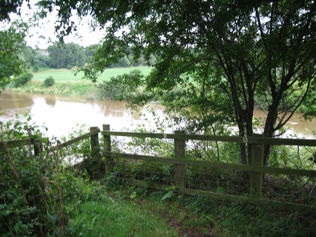
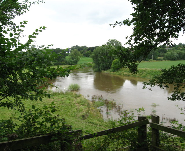
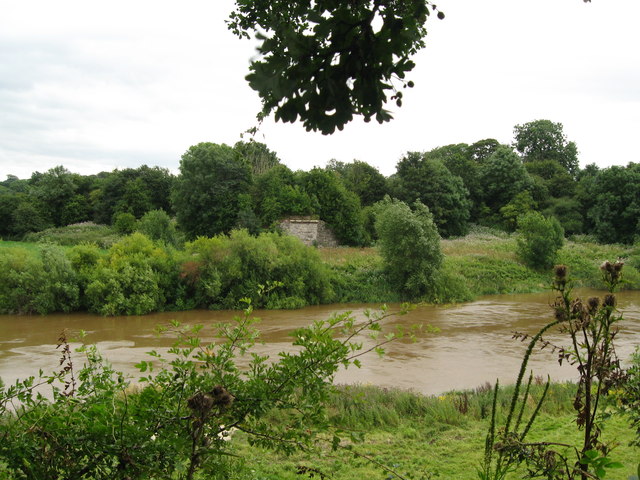
Horse Moors, located in Shropshire, England, is a picturesque woodland area that spans over a vast expanse of approximately 200 acres. This enchanting forest is renowned for its natural beauty, comprising a diverse range of flora and fauna that inhabit its lush surroundings.

The woodland is primarily dominated by a variety of deciduous trees, including oak, birch, and beech, which create a breathtaking canopy that provides shade and shelter for the numerous animals that call this place home. The forest floor is adorned with a rich carpet of wildflowers, such as bluebells, primroses, and wood sorrel, adding vibrant splashes of color to the landscape.

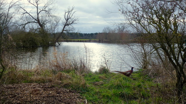
Horse Moors serves as an important habitat for a wide array of wildlife species. Visitors may spot various mammals, including deer, badgers, and foxes, as they roam freely through the forest. The area is also a haven for birdwatchers, with the likes of woodpeckers, owls, and buzzards soaring through the treetops. As for smaller creatures, the woodland is teeming with butterflies, beetles, and other insects, contributing to the overall ecological balance.

The forest offers several walking trails that allow visitors to explore its natural wonders at their own pace. These paths meander through the woodland, offering glimpses of secluded glades, babbling streams, and tranquil ponds. Horse Moors is a popular destination for nature enthusiasts, photographers, and those seeking solace in the great outdoors, providing a peaceful retreat away from the hustle and bustle of everyday life.

If you have any feedback on the listing, please let us know in the comments section below.
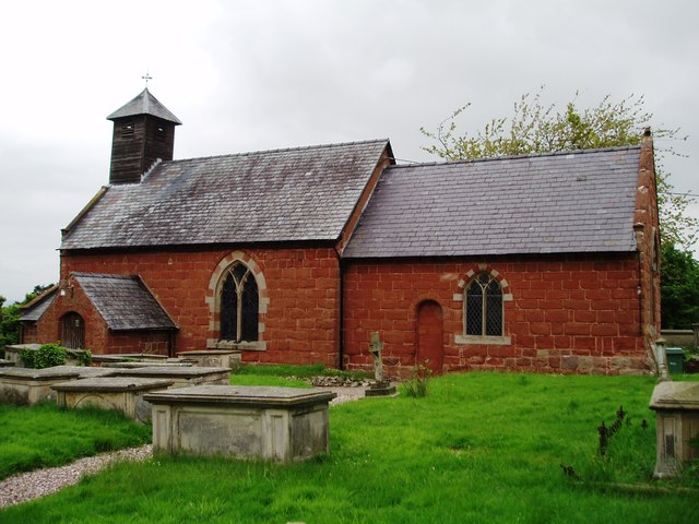
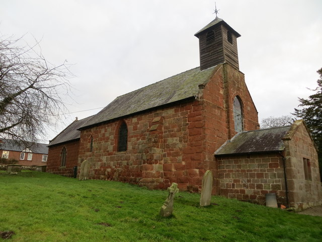
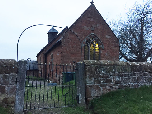
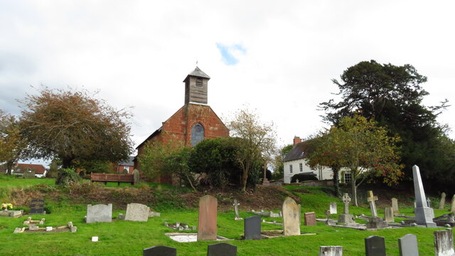
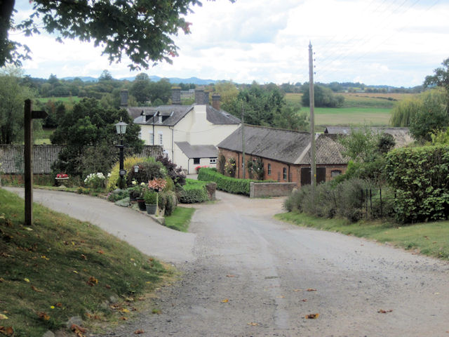
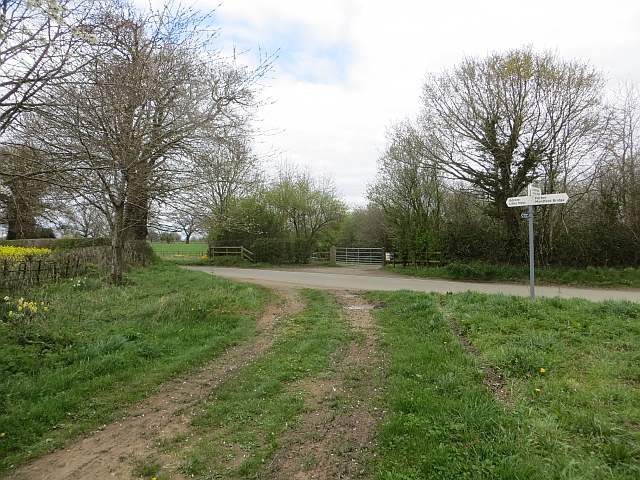
Horse Moors Images

Images are sourced within 2km of 52.737408/-2.8836167 or Grid Reference SJ4015. Thanks to Geograph Open Source API. All images are credited.

View to the Breidden Hills Looking across fields to the west of Shrawardine Castle.
View to the Breidden Hills
Looking across fields to the west of Shrawardine Castle.
A glimpse of Folly Farm Framed by the shape of a fine old oak tree by the lane next to Folly Pool.
A glimpse of Folly Farm
Framed by the shape of a fine old oak tree by the lane next to Folly Pool.
Folly Pool Late afternoon and a pheasant surveys his territory.
Folly Pool
Late afternoon and a pheasant surveys his territory.
Nesscliffe Training Area Photo taken from the end of the public road by what used to be Shrawardine Station on the dismantled Shropshire and Montgomeryshire Railway which closed in 1960.
The training area is used for helicopter work as was evidenced by my ears but not my eyes at this point.
Nesscliffe Training Area
Photo taken from the end of the public road by what used to be Shrawardine Station on the dismantled Shropshire and Montgomeryshire Railway which closed in 1960. The training area is used for helicopter work as was evidenced by my ears but not my eyes at this point.
The Church of St Mary the Virgin, Shrawardine
Ordnance Survey Cut Mark This can be found on the roadside boundary wall of St Mary's Church in Shrawardine.
For more detail see : <span class="nowrap"><a title="http://www.bench-marks.org.uk/bm81104" rel="nofollow ugc noopener" href="http://www.bench-marks.org.uk/bm81104">Link</a><img style="margin-left:2px;" alt="External link" title="External link - shift click to open in new window" src="https://s1.geograph.org.uk/img/external.png" width="10" height="10"/></span>
Ordnance Survey Cut Mark
This can be found on the roadside boundary wall of St Mary's Church in Shrawardine. For more detail see : LinkExternal link
The Church of St Mary at Shrawardine Viewed from the north.
The Church of St Mary at Shrawardine
Viewed from the north.
OS Cut Mark: Shrawardine, St Mary's Church CUT MARK: WALL 0.9M S PRODN S FACE CH SW SIDE RD (ODN 87.7865m, AGL 0.5m).
OS Cut Mark: Shrawardine, St Mary's Church
CUT MARK: WALL 0.9M S PRODN S FACE CH SW SIDE RD (ODN 87.7865m, AGL 0.5m).
Shrawardine, St Mary's Church Cut mark also showing on roadside wall
Shrawardine, St Mary's Church
Cut mark also showing on roadside wall
Shrawardine - St Mary the Virgin Church
On the Shropshire Way heading towards Felton Butler from Shrawardine
Severn viewpoint 1 - Shrawardine, Shropshire A public footpath from Shrawardine - 'Shraden' to the locals - ends here at the site of a now-vanished railway bridge of the Shropshire & Montgomeryshire Railway. A bench here gives a pleasant spot for a break. Taken at 11.26 am BST (British Summer Time).

<a href="https://www.geograph.org.uk/photo/3606817">SJ3915 : Severn viewpoint 2 - Shrawardine, Shropshire</a> <a href="https://www.geograph.org.uk/photo/3606822">SJ3915 : Severn viewpoint 3 - Shrawardine, Shropshire</a> <a href="https://www.geograph.org.uk/photo/3606838">SJ3915 : Severn viewpoint 4 - Shrawardine, Shropshire</a>
Severn viewpoint 1 - Shrawardine, Shropshire
A public footpath from Shrawardine - 'Shraden' to the locals - ends here at the site of a now-vanished railway bridge of the Shropshire & Montgomeryshire Railway. A bench here gives a pleasant spot for a break. Taken at 11.26 am BST (British Summer Time). SJ3915 : Severn viewpoint 2 - Shrawardine, Shropshire SJ3915 : Severn viewpoint 3 - Shrawardine, Shropshire SJ3915 : Severn viewpoint 4 - Shrawardine, Shropshire
Severn viewpoint 2 - Shrawardine, Shropshire A public footpath from Shrawardine - 'Shraden' to the locals - ends here at the site of a one time railway bridge over the Severn. The bridge, which was demolished in 1962, was on the route of the Shropshire & Montgomeryshire Railway, which had a chequered history in at times private and military ownership. Taken at 11.26 am BST (British Summer Time).

<a href="https://www.geograph.org.uk/photo/3606802">SJ3915 : Severn viewpoint 1 - Shrawardine, Shropshire</a> <a href="https://www.geograph.org.uk/photo/3606822">SJ3915 : Severn viewpoint 3 - Shrawardine, Shropshire</a> <a href="https://www.geograph.org.uk/photo/3606838">SJ3915 : Severn viewpoint 4 - Shrawardine, Shropshire</a>
Severn viewpoint 2 - Shrawardine, Shropshire
A public footpath from Shrawardine - 'Shraden' to the locals - ends here at the site of a one time railway bridge over the Severn. The bridge, which was demolished in 1962, was on the route of the Shropshire & Montgomeryshire Railway, which had a chequered history in at times private and military ownership. Taken at 11.26 am BST (British Summer Time). SJ3915 : Severn viewpoint 1 - Shrawardine, Shropshire SJ3915 : Severn viewpoint 3 - Shrawardine, Shropshire SJ3915 : Severn viewpoint 4 - Shrawardine, Shropshire
Severn viewpoint 3 - Shrawardine, Shropshire Reached by a public footpath from Shrawardine - 'Shraden'  to the locals - across the river from this viewpoint can be seen the opposite abutment of a Shropshire & Montgomeryshire Railway bridge which crossed the Severn at this point. The bridge was demolished in 1962, after serving a line which had a very chequered history. Taken at 11.28 am BST (British Summer Time).

<a href="https://www.geograph.org.uk/photo/3606802">SJ3915 : Severn viewpoint 1 - Shrawardine, Shropshire</a> <a href="https://www.geograph.org.uk/photo/3606817">SJ3915 : Severn viewpoint 2 - Shrawardine, Shropshire</a> <a href="https://www.geograph.org.uk/photo/3606838">SJ3915 : Severn viewpoint 4 - Shrawardine, Shropshire</a>
Severn viewpoint 3 - Shrawardine, Shropshire
Reached by a public footpath from Shrawardine - 'Shraden' to the locals - across the river from this viewpoint can be seen the opposite abutment of a Shropshire & Montgomeryshire Railway bridge which crossed the Severn at this point. The bridge was demolished in 1962, after serving a line which had a very chequered history. Taken at 11.28 am BST (British Summer Time). SJ3915 : Severn viewpoint 1 - Shrawardine, Shropshire SJ3915 : Severn viewpoint 2 - Shrawardine, Shropshire SJ3915 : Severn viewpoint 4 - Shrawardine, Shropshire
Severn viewpoint 4 - Shrawardine, Shropshire This viewpoint, with a bench, stands above the Severn at the end of a public footpath from the village of Shrawardine - 'Shraden' to the locals - on the site of a now-disappeared bridge of the Shropshire & Montgomeryshire Railway. The site is on the edge of the extensive Nesscliffe Military Training Area, to which there is most emphatically no public access. Taken at 11.30 am BST (British Summer Time).

<a href="https://www.geograph.org.uk/photo/3606802">SJ3915 : Severn viewpoint 1 - Shrawardine, Shropshire</a> <a href="https://www.geograph.org.uk/photo/3606817">SJ3915 : Severn viewpoint 2 - Shrawardine, Shropshire</a> <a href="https://www.geograph.org.uk/photo/3606822">SJ3915 : Severn viewpoint 3 - Shrawardine, Shropshire</a>
Severn viewpoint 4 - Shrawardine, Shropshire
This viewpoint, with a bench, stands above the Severn at the end of a public footpath from the village of Shrawardine - 'Shraden' to the locals - on the site of a now-disappeared bridge of the Shropshire & Montgomeryshire Railway. The site is on the edge of the extensive Nesscliffe Military Training Area, to which there is most emphatically no public access. Taken at 11.30 am BST (British Summer Time). SJ3915 : Severn viewpoint 1 - Shrawardine, Shropshire SJ3915 : Severn viewpoint 2 - Shrawardine, Shropshire SJ3915 : Severn viewpoint 3 - Shrawardine, Shropshire
Field, Felton Butler A short distance from the A5.
Field, Felton Butler
A short distance from the A5.
Barred entrance to military training area near Shrawardine This was a well used training area by American forces in the Second World War. The OS map still has “America” printed to describe the area. It still is used periodically by UK territorial units.
Barred entrance to military training area near Shrawardine
This was a well used training area by American forces in the Second World War. The OS map still has “America” printed to describe the area. It still is used periodically by UK territorial units.
Information board at Shrawardine castle The castle was attacked by the Welsh under Llywelyn in 1215.  It was also a site of conflict in the English Civil War in 1645. 

Nice board. Great work. Lovely use of texture.
Information board at Shrawardine castle
The castle was attacked by the Welsh under Llywelyn in 1215. It was also a site of conflict in the English Civil War in 1645. Nice board. Great work. Lovely use of texture.
Show me another place!

Horse Moors is located at Grid Ref: SJ4015 (Lat: 52.737408, Lng: -2.8836167)

Unitary Authority: Shropshire

Police Authority: West Mercia

What 3 Words

///fittingly.snatched.crunching. Near Ford, Shropshire

Related Wikis

Shrawardine

Shrawardine is a small village and former civil parish, now in the parish of Montford, in the Shropshire district, in the ceremonial county of Shropshire...

Shrawardine railway station

Shrawardine railway station was a station in Shrawardine, Shropshire, England. The station was opened in 1866 and closed in 1933. == References == ��2...

Montford, Shropshire

Montford is a small village and parish in Shropshire, England. The village lies near the A5 road, on the north bank of the River Severn and is 3 miles...

Ford, Shropshire

Ford is a village and civil parish in Shropshire, England. The civil parish population at the 2011 census was 890.Ford lies west of the county town of...

Ford and Crossgates railway station

Ford and Crossgates railway station was a station in Ford, Shropshire, England. The station was opened in 1866 and closed in 1933. == References == �...

Broomfields

Broomfields is a hamlet in Shropshire, England. It is located north of Montford Bridge and near to the hamlets of Forton Heath and Grafton. It is in the...

Alberbury with Cardeston

Alberbury with Cardeston is a civil parish in Shropshire, England. According to the 2001 census it had a population of 645 (though in 2005 the parish expanded...

RAF Montford Bridge

Royal Air Force Montford Bridge, or more simply RAF Montford Bridge, is a former Royal Air Force satellite station, located near Shrewsbury, Shropshire...

Nearby Amenities

Located within 500m of 52.737408,-2.8836167
Generator Method: photovoltaic
Generator Output Electricity: yes
Generator Source: solar
Generator Type: solar_photovoltaic_panel
Location: roof
Power: generator
Lat/Long: 52.7358873/-2.8799683
Barrier: stile
Lat/Long: 52.7350159/-2.8839163
The data included in this document is from www.openstreetmap.org. The data is made available under ODbL.

Have you been to Horse Moors?

Leave your review of Horse Moors below (or comments, questions and feedback).