Callow Hill Wood

Wood, Forest in Herefordshire

England

Callow Hill Wood

Edge of Paradise Wood Evocatively-named mixed woodland to the west of Pontrilas.
Edge of Paradise Wood Credit: Jonathan Billinger

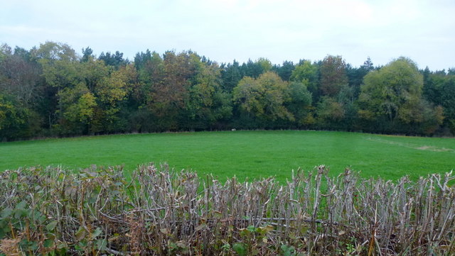
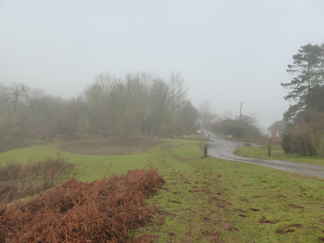
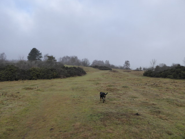
Callow Hill Wood is a picturesque woodland located in Herefordshire, England. Spanning over a vast area of approximately 100 acres, this charming forest is renowned for its natural beauty and diverse ecosystem.

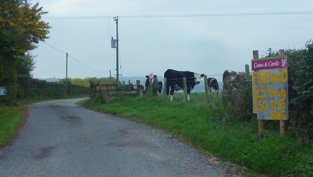
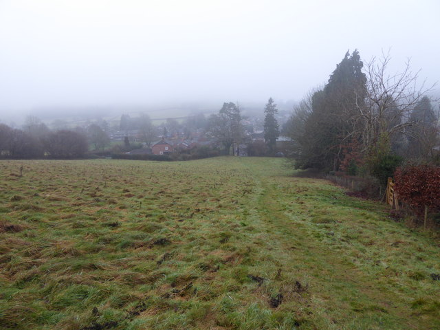
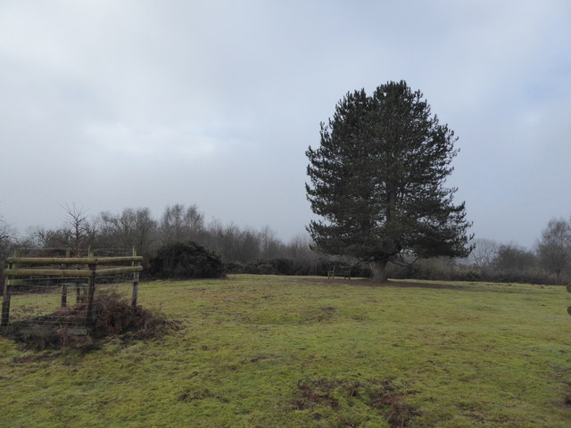
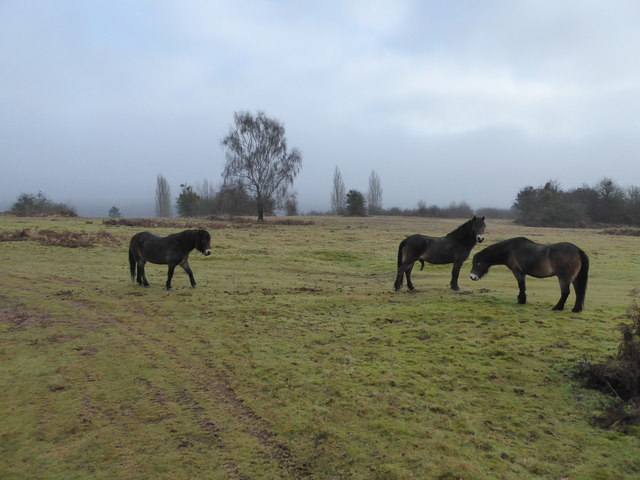
Situated on the slopes of Callow Hill, the wood boasts a wide range of both deciduous and coniferous trees, creating a stunning tapestry of colors throughout the seasons. Visitors to the wood can expect to find a variety of trees including oak, beech, birch, and pine, among others. These trees provide a habitat for numerous species of wildlife, making it a haven for nature enthusiasts and birdwatchers.

The forest floor is adorned with a rich carpet of wildflowers, ferns, and mosses, adding to the enchanting ambiance of the woodland. Explorers can also stumble upon several natural springs and streams, which further enhance the tranquility of the area.

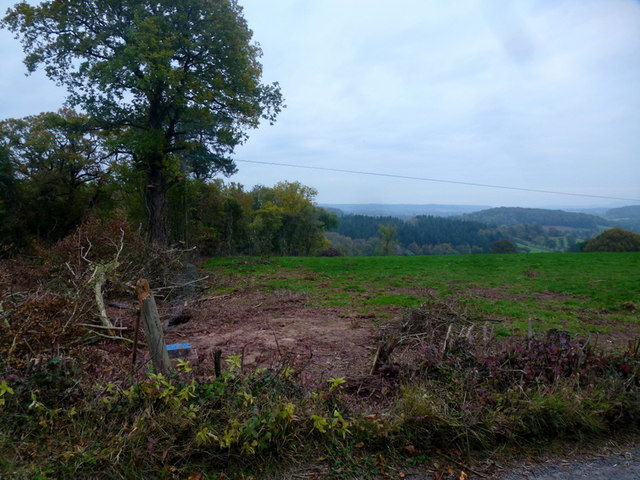
Callow Hill Wood is a popular destination for outdoor activities such as walking, hiking, and picnicking. The wood is crisscrossed with well-maintained footpaths and trails, allowing visitors to immerse themselves in the serene surroundings. The elevated location of the wood provides breathtaking views of the surrounding countryside, offering a sense of escapism and peace.

With its diverse vegetation, abundant wildlife, and stunning vistas, Callow Hill Wood is a true gem in Herefordshire. Whether one seeks solitude, a family outing, or a chance to connect with nature, this woodland offers a captivating experience for all who venture within its borders.

If you have any feedback on the listing, please let us know in the comments section below.

Callow Hill Wood Images

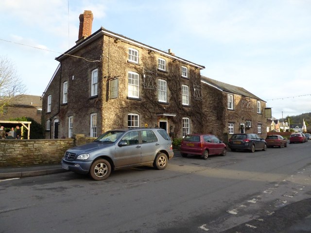
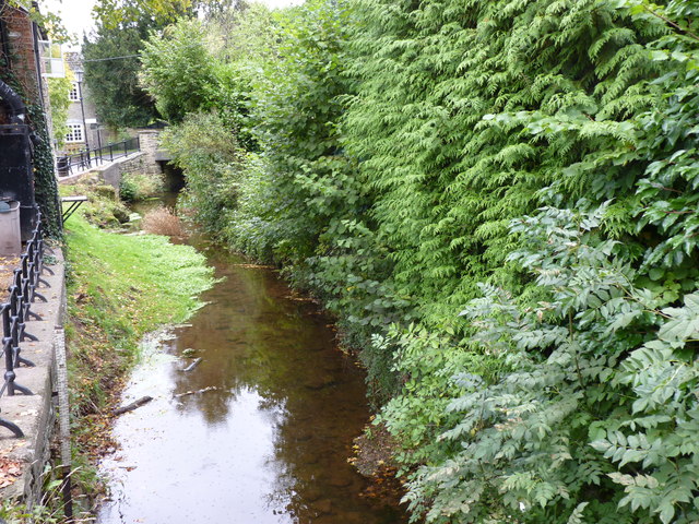
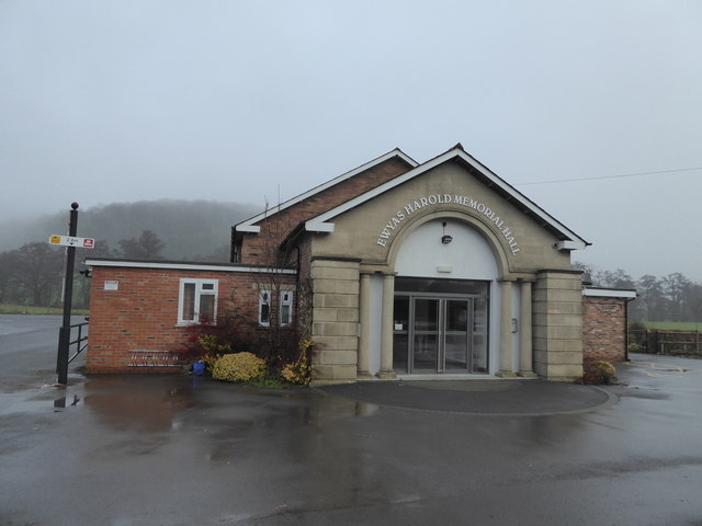
Images are sourced within 2km of 51.947885/-2.8801308 or Grid Reference SO3928. Thanks to Geograph Open Source API. All images are credited.

Edge of Paradise Wood Evocatively-named mixed woodland to the west of Pontrilas.
Edge of Paradise Wood
Evocatively-named mixed woodland to the west of Pontrilas.
Track to Rowlestone Park Farm Complete with bovine welcoming committee.
Interesting re-use of some old BT signage too.
Track to Rowlestone Park Farm
Complete with bovine welcoming committee. Interesting re-use of some old BT signage too.
Ty Gwyn Cider Shop A recently built outlet for a local cider maker at Pen-y-lan Farm.
See; <span class="nowrap"><a title="http://www.tygwyncider.co.uk/index.html" rel="nofollow ugc noopener" href="http://www.tygwyncider.co.uk/index.html">Link</a><img style="margin-left:2px;" alt="External link" title="External link - shift click to open in new window" src="https://s1.geograph.org.uk/img/external.png" width="10" height="10"/></span>
Ty Gwyn Cider Shop
A recently built outlet for a local cider maker at Pen-y-lan Farm. See; LinkExternal link
New infrastructure Well, it looks like a new water supply adjacent to a lane in West Herefordshire.
A few scrubby trees have made way and someone's left their shovel here too.
New infrastructure
Well, it looks like a new water supply adjacent to a lane in West Herefordshire. A few scrubby trees have made way and someone's left their shovel here too.
The Temple Bar Inn, Ewyas Harold Photographed just after having a bar lunch here.
The Temple Bar Inn, Ewyas Harold
Photographed just after having a bar lunch here.
The Dog Inn, Ewyas Harold, Herefordshire
Dulas Brook, Ewyas Harold, Herefordshire As it passes behind The Old Stables Fish and Chip Shop.
Dulas Brook, Ewyas Harold, Herefordshire
As it passes behind The Old Stables Fish and Chip Shop.
Ewyas Harold Memorial Hall, Herefordshire Nice building.
Ewyas Harold Memorial Hall, Herefordshire
Nice building.
Field edge path in Ewyas Harold, Herefordshire Steepish field on the village edge.
Field edge path in Ewyas Harold, Herefordshire
Steepish field on the village edge.
Gate below an Oak tree near Ewyas Harold After ascending a steep field the path flattens a little here.
Gate below an Oak tree near Ewyas Harold
After ascending a steep field the path flattens a little here.
Pond near Ewyas Harold Common Bit low on water in Jan 2017.
Pond near Ewyas Harold Common
Bit low on water in Jan 2017.
Information board on Ewyas Harold Common I always pause and read these - amazing what you can learn, benefit from and remember with these.
Information board on Ewyas Harold Common
I always pause and read these - amazing what you can learn, benefit from and remember with these.
Pigs near Ewyas Harold Common in winter Eight pigs enjoy a field here. Their proud owner chatted about them. What a life for all concerned.
Pigs near Ewyas Harold Common in winter
Eight pigs enjoy a field here. Their proud owner chatted about them. What a life for all concerned.
Pigs in mud Happy porkers. Not for eating pets.
Pigs in mud
Happy porkers. Not for eating pets.
On Ewyas Harold Common Ideal for dog walking. Here a young Rottweiler enjoys a stroll.
On Ewyas Harold Common
Ideal for dog walking. Here a young Rottweiler enjoys a stroll.
Memorial bench on Ewyas Harold Common On this elevated viewpoint, a domed hill a few benches have been thoughtfully sited.
Memorial bench on Ewyas Harold Common
On this elevated viewpoint, a domed hill a few benches have been thoughtfully sited.
Memorial bench on Ewyas Harold Common Nice bench. Always thought provoking and poignant.
Memorial bench on Ewyas Harold Common
Nice bench. Always thought provoking and poignant.
Exmoor Ponies on Ewyas Harold Common in winter These hardy ponies must love this mild weather today.
Exmoor Ponies on Ewyas Harold Common in winter
These hardy ponies must love this mild weather today.
Show me another place!

Callow Hill Wood is located at Grid Ref: SO3928 (Lat: 51.947885, Lng: -2.8801308)

Unitary Authority: County of Herefordshire

Police Authority: West Mercia

What 3 Words

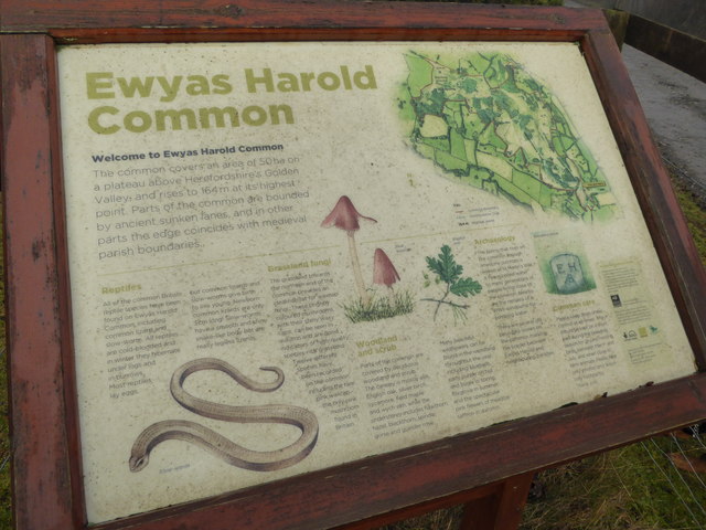
///raven.rationing.twin. Near Ewyas Harold, Herefordshire

Related Wikis

Pontrilas railway station

Pontrilas railway station is a former station which served the Herefordshire villages of Pontrilas and Ewyas Harold, and was a little distance from Grosmont...

Pontrilas

Pontrilas (English: Bridge over Three Rivers) is a village in south Herefordshire, England, half a mile from the border with Wales. It is in the parish...

Pontrilas Court

Pontrilas Court situated at the west end of the village Pontrilas in Herefordshire is a large stone Grade II* listed mansion and is marked on the 1904...

Kenderchurch

Kenderchurch is a village and former civil parish, now in the parish of Kilpeck, in the county of Herefordshire, England. In 2001 the parish had a population...

Nearby Amenities

Located within 500m of 51.947885,-2.8801308
Bus Stop
Elmdale Housing Estate
Naptan AtcoCode: 2090A077900
Naptan Bearing: W
Naptan BusStopType: CUS
Naptan CommonName: Elmdale Housing Estate
Naptan Indicator: adj Callowside
Naptan Landmark: Jc Callowside
Naptan NaptanCode: heradjmd
Naptan Street: Elmdale
Naptan Verified: no
Source: naptan_import
Lat/Long: 51.9513316/-2.8841692
Bus Stop
Telephone Exchange
Naptan AtcoCode: 2090A18597
Naptan Bearing: NE
Naptan CommonName: Telephone Exchange
Naptan Indicator: adj
Naptan Landmark: Coles Shop
Naptan NaptanCode: heragwmd
Naptan Street: B4347
Shelter: yes
Source: naptan_import
Lat/Long: 51.9438434/-2.8777993
Bus Stop
Telephone Exchange
Naptan AtcoCode: 2090A18599
Naptan Bearing: SW
Naptan CommonName: Telephone Exchange
Naptan Indicator: opp
Naptan Landmark: Coles Shop
Naptan NaptanCode: heragwmg
Naptan Street: B4347
Naptan Verified: no
Source: naptan_import
Lat/Long: 51.9436075/-2.8782415
Bus Stop
Elmdale Housing Estate
Naptan AtcoCode: 2090A19061
Naptan Bearing: E
Naptan BusStopType: CUS
Naptan CommonName: Elmdale Housing Estate
Naptan Indicator: adj Elmdale
Naptan Landmark: Jc Callowside
Naptan NaptanCode: herajpdt
Naptan Street: Elmdale
Naptan Verified: no
Source: naptan_import
Lat/Long: 51.951436/-2.8828217
Bus Stop
Post Office
Naptan AtcoCode: 2090A19858
Naptan Bearing: NE
Naptan CommonName: Post Office
Naptan Indicator: adj
Naptan Landmark: Railway signal box
Naptan NaptanCode: herampjd
Naptan Street: N/K
Naptan Verified: no
Source: naptan_import
Lat/Long: 51.9444795/-2.8758434
Bus Stop
Post Office
Naptan AtcoCode: 2090A19860
Naptan Bearing: SW
Naptan BusStopType: CUS
Naptan CommonName: Post Office
Naptan Indicator: opp
Naptan Landmark: Railway signal box
Naptan NaptanCode: herampjg
Naptan Street: N/K
Naptan Verified: no
Source: naptan_import
Lat/Long: 51.9443449/-2.8758117
Pontrilas
Place: village
Wikidata: Q645197
Lat/Long: 51.9442213/-2.8778574
Post Office
Pontrilas Post Office
Addr City: Hereford
Addr Country: GB
Addr Postcode: HR2 0BA
Addr Village: Pontrilas
Brand: Post Office
Brand Wikidata: Q1783168
Opening Hours: Mo-Fr 07:45-18:00; Sa 07:45-14:30; Su 08:30-14:30
Ref Pol Id: 8174
Website: https://www.postoffice.co.uk/branch-finder/2196182/pontrilas
Lat/Long: 51.9448633/-2.8751864
Power: pole
Lat/Long: 51.947495/-2.8751035
Power: pole
Lat/Long: 51.9466209/-2.8749284
Man Made: mast
Tower Type: communication
Lat/Long: 51.9517971/-2.8803733
Generator Method: photovoltaic
Generator Output Electricity: yes
Generator Source: solar
Generator Type: solar_photovoltaic_panel
Power: generator
Lat/Long: 51.9457876/-2.8859121
Generator Method: photovoltaic
Generator Output Electricity: yes
Generator Source: solar
Generator Type: solar_photovoltaic_panel
Power: generator
Lat/Long: 51.945533/-2.8862125
Man Made: street_cabinet
Source: survey
Street Cabinet: telecom
Lat/Long: 51.9438648/-2.8777313
Man Made: street_cabinet
Source: survey
Street Cabinet: telecom
Lat/Long: 51.9438772/-2.8776924
Defibrillator
Booth: KX100
Covered: booth
Defibrillator Location: inside modern phone box next to telephone exchange in Pontrilas
Disused Amenity: telephone
Emergency: defibrillator
Man Made: telephone_box
Operator: Kentchurch Parish Council
Source: survey
Lat/Long: 51.9438201/-2.8778882
Barrier: stile
Source: survey
Lat/Long: 51.9478497/-2.8865538
Generator Method: photovoltaic
Generator Output Electricity: yes
Generator Source: solar
Generator Type: solar_photovoltaic_panel
Location: roof
Power: generator
Lat/Long: 51.9520368/-2.8812906
Generator Method: photovoltaic
Generator Output Electricity: yes
Generator Source: solar
Generator Type: solar_photovoltaic_panel
Location: roof
Power: generator
Lat/Long: 51.9521128/-2.8823742
Generator Method: photovoltaic
Generator Output Electricity: yes
Generator Source: solar
Generator Type: solar_photovoltaic_panel
Location: roof
Power: generator
Lat/Long: 51.9515607/-2.882798
Generator Method: photovoltaic
Generator Output Electricity: yes
Generator Source: solar
Generator Type: solar_photovoltaic_panel
Location: roof
Power: generator
Lat/Long: 51.9508862/-2.8847319
Generator Method: photovoltaic
Generator Output Electricity: yes
Generator Source: solar
Generator Type: solar_photovoltaic_panel
Location: roof
Power: generator
Lat/Long: 51.9508796/-2.8846622
Power: pole
Lat/Long: 51.9487978/-2.8755989
Power: pole
Lat/Long: 51.9470008/-2.8755266
Power: pole
Lat/Long: 51.9482936/-2.8752261
Power: pole
Lat/Long: 51.9518678/-2.8774523
Power: pole
Lat/Long: 51.9492955/-2.8759583
Power: pole
Lat/Long: 51.9457119/-2.874765
Power: pole
Lat/Long: 51.9509238/-2.8771438
Power: pole
Lat/Long: 51.9462369/-2.8764144
Power: pole
Lat/Long: 51.9465741/-2.8740031
Cafe
GV Cafe and fitness centre
Lat/Long: 51.9450808/-2.8751867
Blandford Commercial Repairs
Shop: car_repair
Lat/Long: 51.9453287/-2.87452
Post Box
Operator: Royal Mail
Post Box Type: lamp
Ref: HR2 482
Royal Cypher: EIIR
Royal Cypher Wikidata: Q33102113
Lat/Long: 51.944716/-2.8752832
Barrier: cycle_barrier
Lat/Long: 51.9515289/-2.8812616
The data included in this document is from www.openstreetmap.org. The data is made available under ODbL.

Have you been to Callow Hill Wood?

Leave your review of Callow Hill Wood below (or comments, questions and feedback).