Thompson Wood

Wood, Forest in Lancashire South Lakeland

England

Thompson Wood

Whitestone Enclosure
Whitestone Enclosure Credit: Eirian Evans

Thompson Wood is a picturesque forest located in the county of Lancashire, England. Covering an area of approximately 100 acres, it is known for its stunning natural beauty and diverse wildlife. The woodland is situated on the outskirts of a small village, providing a tranquil escape from urban life.

The wood is predominantly made up of mature deciduous trees, including oak, beech, and ash, which create a dense canopy and provide shelter for a variety of flora and fauna. The forest floor is adorned with a carpet of bluebells in the spring, adding a burst of color to the landscape.

Thompson Wood is a haven for wildlife enthusiasts, offering sightings of numerous bird species, such as woodpeckers, owls, and jays. The forest is also home to mammals like foxes, rabbits, and squirrels, which can often be spotted darting between the trees. Additionally, the wood provides a habitat for various insect species, including butterflies and beetles.

The area is well-maintained, with designated pathways and trails allowing visitors to explore the wood at their own pace. These pathways wind through the forest, leading to secluded clearings and viewpoints that offer breathtaking vistas of the surrounding countryside.

Thompson Wood is a popular destination for outdoor activities such as hiking, nature walks, and photography. It provides a peaceful retreat for those seeking solace in nature, as well as an educational opportunity for schools and wildlife organizations.

Overall, Thompson Wood is a true gem in Lancashire's natural landscape, offering a serene and enchanting experience for all who visit.

If you have any feedback on the listing, please let us know in the comments section below.

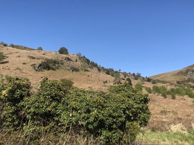
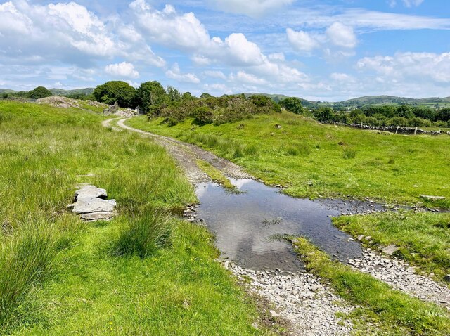
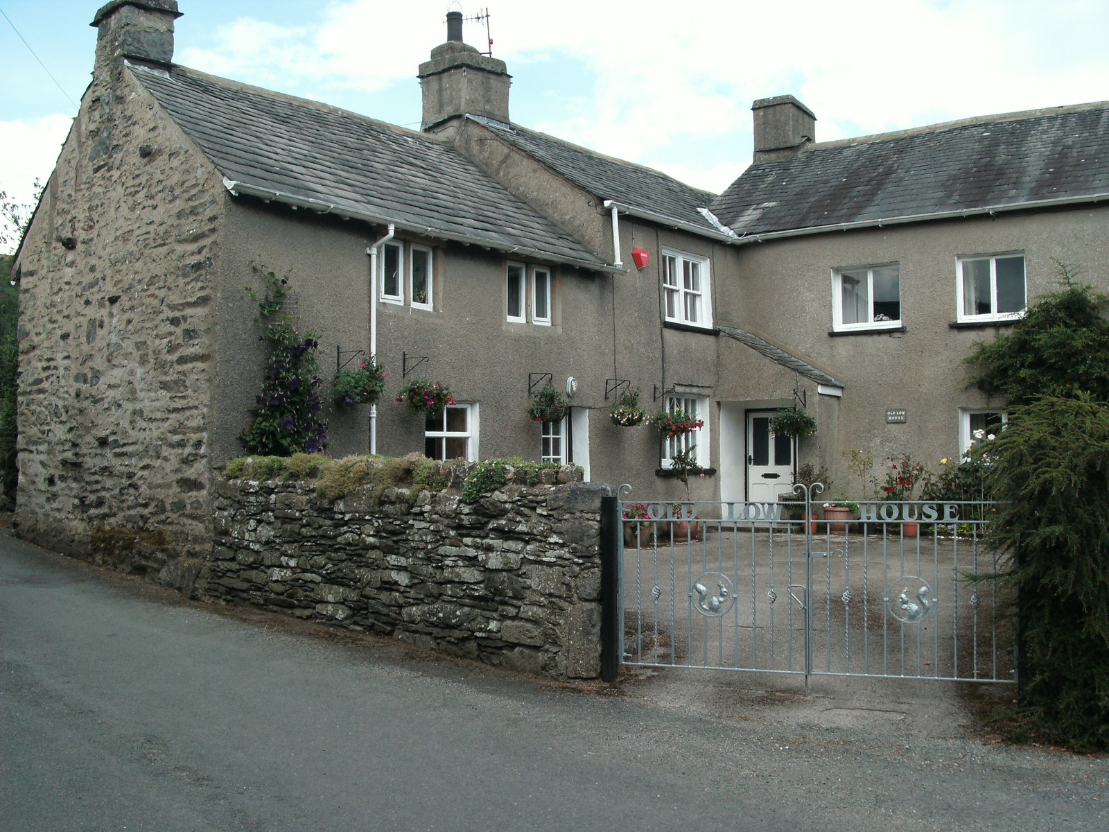
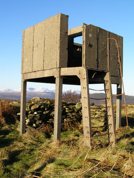
Thompson Wood Images

Images are sourced within 2km of 54.247199/-2.9499426 or Grid Reference SD3883. Thanks to Geograph Open Source API. All images are credited.

Whitestone Enclosure
High and Low Newton By-pass The A590 north of Grange-Over-Sands
High and Low Newton By-pass
The A590 north of Grange-Over-Sands
Lane near High Cark This old lane, too narrow for modern vehicles links High Cark to Seatle.  It has fallen into disuse and on the central section the western boundary has largely been lost except for a few bushes and the bottom of the dyke.
The lane is a public footpath.
Lane near High Cark
This old lane, too narrow for modern vehicles links High Cark to Seatle. It has fallen into disuse and on the central section the western boundary has largely been lost except for a few bushes and the bottom of the dyke. The lane is a public footpath.
Ford near High Cark Hall Crossed by a public bridleway, a small stone clapper bridge is provided for pedestrians.
Ford near High Cark Hall
Crossed by a public bridleway, a small stone clapper bridge is provided for pedestrians.
Felled area of Chapel House Wood With Rosebay Willowherb tacking advantage.
Felled area of Chapel House Wood
With Rosebay Willowherb tacking advantage.
Bigland Hall Trout Fishery
Newby Bridge Motor Services Newby Bridge Services on A590 near the A592 Roundabout, taken on 30th December 2005
Newby Bridge Motor Services
Newby Bridge Services on A590 near the A592 Roundabout, taken on 30th December 2005
Farm Building at Hazelrigg
Monkey Puzzle Tree Ayside Not a native to South lakes the Chilean Pine popular with the Victorians pops up unexpectedly in Ayside.
Monkey Puzzle Tree Ayside
Not a native to South lakes the Chilean Pine popular with the Victorians pops up unexpectedly in Ayside.
White Stone Attractive Crag in view from the main road at Staveley in Cartmel. A cheery sight for the frustrated Fellwalker whose work forces him to drive up and down the A590 repeatedly.
White Stone
Attractive Crag in view from the main road at Staveley in Cartmel. A cheery sight for the frustrated Fellwalker whose work forces him to drive up and down the A590 repeatedly.
Chapel House Plantation Near Staveley in Cartmel
Chapel House Plantation
Near Staveley in Cartmel
Ponies Seatle Seatle South Cumbria not North America
Ponies Seatle
Seatle South Cumbria not North America
Stile near Seatle Public Footpath which heads towards Ayside.Newton Fell on the horizon
Stile near Seatle
Public Footpath which heads towards Ayside.Newton Fell on the horizon
Whitestone Caravan Park On the A. 590
Whitestone Caravan Park
On the A. 590
Near High Cark On the road out of Barber Green
Near High Cark
On the road out of Barber Green
Chapel House Plantation Don't worry you didn't miss a Nuclear War. Forestry near Bog End Moss
Chapel House Plantation
Don't worry you didn't miss a Nuclear War. Forestry near Bog End Moss
Communications Masts Barrow Banks In Chapel House Plantation
Communications Masts Barrow Banks
In Chapel House Plantation
From Barrow Banks Looking towards Newby Bridge from the forest road on Barrow Banks
From Barrow Banks
Looking towards Newby Bridge from the forest road on Barrow Banks
Show me another place!

Thompson Wood is located at Grid Ref: SD3883 (Lat: 54.247199, Lng: -2.9499426)

Administrative County: Cumbria

District: South Lakeland

Police Authority: Cumbria

What 3 Words

///overt.export.habits. Near Grange-over-Sands, Cumbria

Related Wikis

Ayside

Ayside is a hamlet on the A590 road, in the South Lakeland district, in the county of Cumbria, England. == References == Philip's Street Atlas Cumbria...

Bigland Barrow

Bigland Barrow is a hill in the English Lake District, near Backbarrow, Cumbria. It is the subject of a chapter of Wainwright's book The Outlying Fells...

St Mary's Church, Staveley

St Mary's Church is in the village of Staveley-in-Cartmel, Cumbria, England. It is an active Anglican parish church in the deanery of Windermere, the archdeaconry...

St Peter's Church, Field Broughton

St Peter's Church is in the village of Field Broughton, Cumbria, England. It is an active Anglican parish church in the deanery of Windermere, the archdeaconry...

Nearby Amenities

Located within 500m of 54.247199,-2.9499426
Barrier: stile
Lat/Long: 54.2482893/-2.9476463
Barrier: stile
Lat/Long: 54.2485654/-2.9455589
Barrier: stile
Lat/Long: 54.2487597/-2.9442505
Barrier: stile
Lat/Long: 54.2475474/-2.9525026
Barrier: stile
Lat/Long: 54.2466096/-2.9545271
Barrier: stile
Lat/Long: 54.2482993/-2.9475546
Barrier: stile
Lat/Long: 54.2464876/-2.956304
Power: pole
Lat/Long: 54.2511546/-2.9486511
Power: pole
Lat/Long: 54.2504446/-2.9485534
Power: pole
Lat/Long: 54.2496847/-2.9484581
Power: pole
Lat/Long: 54.2488517/-2.948388
Power: pole
Lat/Long: 54.2476659/-2.9482401
Power: pole
Lat/Long: 54.2469909/-2.9470524
Power: pole
Lat/Long: 54.2463087/-2.9458923
Power: pole
Lat/Long: 54.245603/-2.9447296
Power: pole
Lat/Long: 54.244906/-2.9435118
The data included in this document is from www.openstreetmap.org. The data is made available under ODbL.

Have you been to Thompson Wood?

Leave your review of Thompson Wood below (or comments, questions and feedback).