Slack Wood

Wood, Forest in Lancashire South Lakeland

England

Slack Wood

Path on Latterbarrow This is the path from Claife Heights, leading up the south ridge towards the summit of Latterbarrow.
Path on Latterbarrow Credit: Adrian Taylor

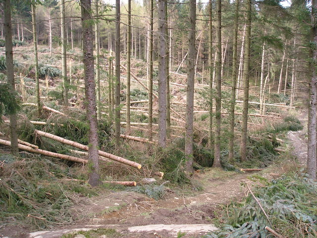
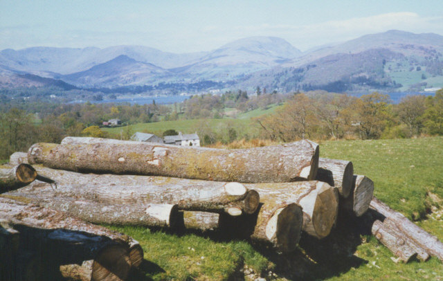
Slack Wood is a picturesque woodland area located in Lancashire, England. It covers an area of approximately 50 acres and is situated near the village of Wood. The wood is an important natural habitat and is renowned for its diverse range of flora and fauna.

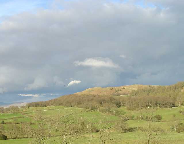
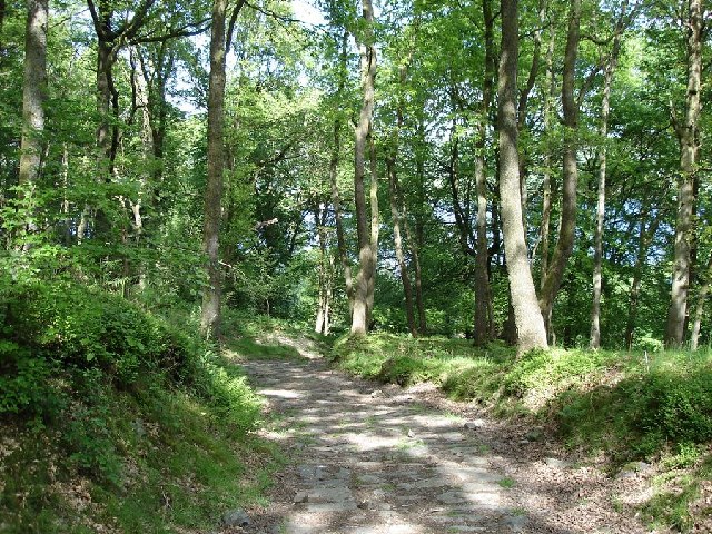
The woodland is predominantly composed of broadleaf trees, including oak, beech, and birch. These trees create a dense canopy, providing shelter for a variety of wildlife. Visitors to Slack Wood can expect to see a plethora of bird species, such as woodpeckers, owls, and various songbirds. Small mammals, including squirrels and rabbits, also call this woodland their home.

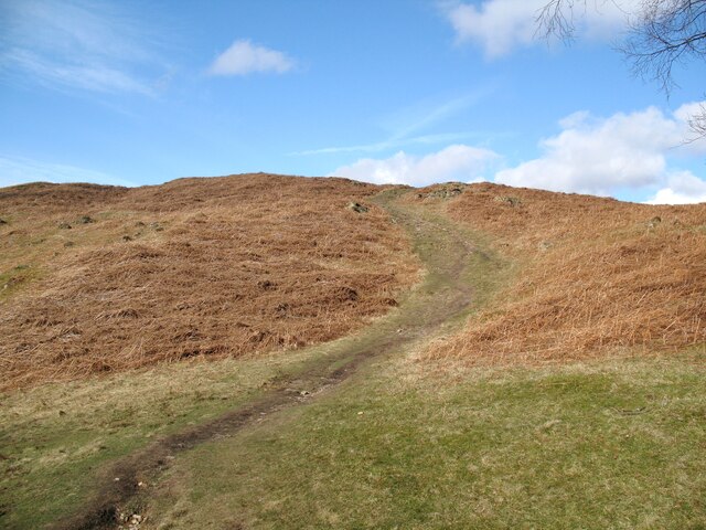
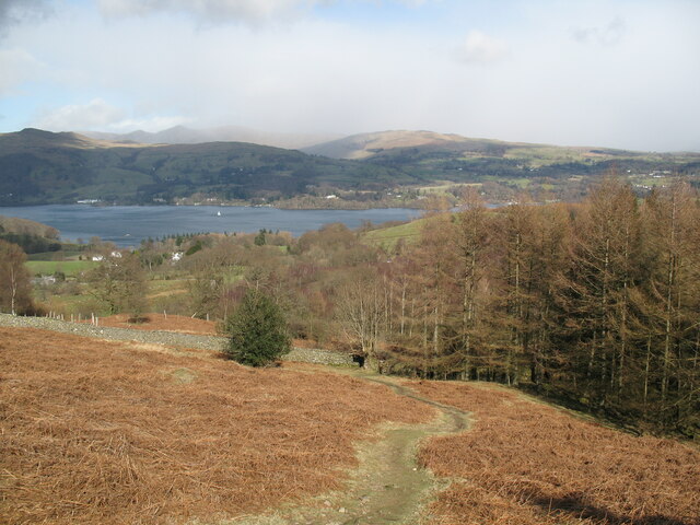
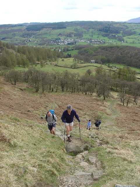
The wood itself is crisscrossed with a network of footpaths, making it an ideal destination for nature lovers and walkers alike. These paths wind their way through the trees, offering visitors the opportunity to explore the wood's natural beauty at their own pace. In spring, the woodland floor is carpeted with bluebells, creating a breathtaking sight.

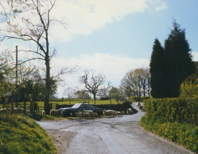
Slack Wood is managed by the local council, which ensures the preservation of its natural ecosystem. The wood is open to the public year-round, with no admission fees. It is a popular destination for families, dog walkers, and nature enthusiasts who seek solace in its tranquil atmosphere.

Overall, Slack Wood in Lancashire is a treasure trove of natural beauty. Its diverse vegetation, wildlife, and well-maintained footpaths make it the perfect place to escape the hustle and bustle of everyday life and immerse oneself in the wonders of nature.

If you have any feedback on the listing, please let us know in the comments section below.
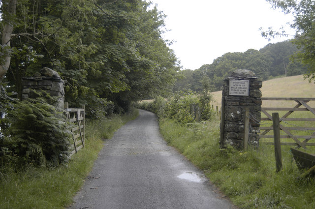
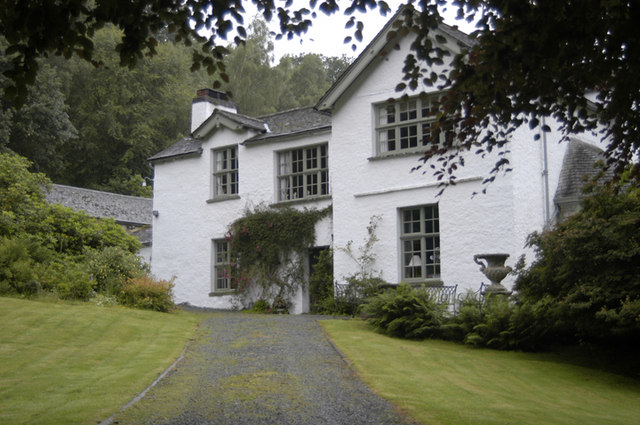
Slack Wood Images

Images are sourced within 2km of 54.391481/-2.9595415 or Grid Reference SD3799. Thanks to Geograph Open Source API. All images are credited.

Path on Latterbarrow This is the path from Claife Heights, leading up the south ridge towards the summit of Latterbarrow.
Path on Latterbarrow
This is the path from Claife Heights, leading up the south ridge towards the summit of Latterbarrow.
OS Cut Mark - High Wray, Beyond Fields Fm, Outbuilding <span class="nowrap"><a title="https://www.bench-marks.org.uk/bm56690" rel="nofollow ugc noopener" href="https://www.bench-marks.org.uk/bm56690">Link</a><img style="margin-left:2px;" alt="External link" title="External link - shift click to open in new window" src="https://s1.geograph.org.uk/img/external.png" width="10" height="10"/></span>
OS Cut Mark - High Wray, Beyond Fields Fm, Outbuilding
Path above Waterson Intake The path is the public footpath from Latterbarrow to High Wray.
Windermere is in the middle distance and there is a snow shower over the Kentmere Fells.
Path above Waterson Intake
The path is the public footpath from Latterbarrow to High Wray. Windermere is in the middle distance and there is a snow shower over the Kentmere Fells.
Wall and fields above Blelham Tarn
Dinner time! An evening meal for these sheep near Outgate.
Dinner time!
An evening meal for these sheep near Outgate.
Western Slopes of Latterbarrow, Near Hawkshead, Cumbria This grid square is dominated by the small hill of Latterbarrow. The photo shows a group of walkers ascending Latterbarrow from the west.
In the background, the small town of Hawkshead can be seen.
Western Slopes of Latterbarrow, Near Hawkshead, Cumbria
This grid square is dominated by the small hill of Latterbarrow. The photo shows a group of walkers ascending Latterbarrow from the west. In the background, the small town of Hawkshead can be seen.
Latterbarrow. View from Hawkshead Latterbarrow is a local viewpoint for the village of Hawkshead. Accessible by foot after a short walk, the views from the top are excellent in almost 360 degrees. On a good day the Howgills can be seen.
Latterbarrow. View from Hawkshead
Latterbarrow is a local viewpoint for the village of Hawkshead. Accessible by foot after a short walk, the views from the top are excellent in almost 360 degrees. On a good day the Howgills can be seen.
View over Windermere from Red Nab This photograph was taken from the car-park at the end of the unclassified road that leads down to the west shore of Windermere from High Wray.
View over Windermere from Red Nab
This photograph was taken from the car-park at the end of the unclassified road that leads down to the west shore of Windermere from High Wray.
Woodland to the west of Belle Grange
Summit of Latterbarrow
Storm damage
Storm damage
On Lake Windermere Just passing Meregarth landings on the east bank. On M.V. Swan en route for Bowness.
On Lake Windermere
Just passing Meregarth landings on the east bank. On M.V. Swan en route for Bowness.
log pile near High Wray A pile of logs left just below the woodland above High Wray, view towards the north end of Windermere.
log pile near High Wray
A pile of logs left just below the woodland above High Wray, view towards the north end of Windermere.
Forestry - Highs Moss One of the paths through the forest. The paths are often not obvious and it can be difficult to navigate in places.
Forestry - Highs Moss
One of the paths through the forest. The paths are often not obvious and it can be difficult to navigate in places.
Sheep herding, High Wray
Undulating Wall
Undulating Wall
Access road and gate to Belle Grange
Belle Grange House Sir Henry Segrave was taken here after his fateful attempt to break the water speed record
Belle Grange House
Sir Henry Segrave was taken here after his fateful attempt to break the water speed record
Show me another place!

Slack Wood is located at Grid Ref: SD3799 (Lat: 54.391481, Lng: -2.9595415)

Administrative County: Cumbria

District: South Lakeland

Police Authority: Cumbria

What 3 Words

///formal.opened.comforted. Near Windermere, Cumbria

Related Wikis

RMS Wray Castle

RMS Wray Castle was a training college for Merchant Navy radio officers based at Wray Castle in the Lake District, from 1958 to 1998.At 11:40 p.m., on...
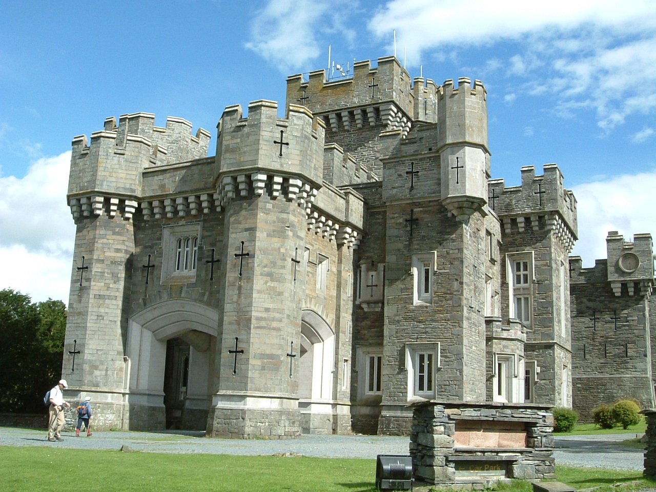
Wray Castle

Wray Castle is a Victorian neo-gothic building at Claife in Cumbria within the boundaries of the historic county of Lancashire. The house and grounds have...
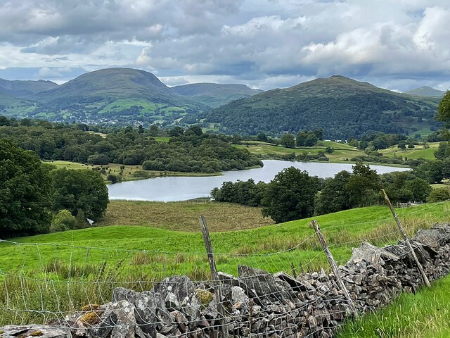
Blelham Tarn

Blelham Tarn is a large valley tarn in the Lake District of England, to the north of the hill Latterbarrow. The settlements of Outgate, Low Wray and High...

Latterbarrow

Latterbarrow is a hill in the English Lake District, east of Hawkshead, Cumbria. It is the subject of a chapter of Wainwright's book The Outlying Fells...

Brockhole

The Brockhole Lake District Visitor Centre, also known as the Brockhole National Park Visitor Centre, is a visitor centre and tourist attraction managed...

Langdale Chase

Langdale Chase, Windermere is a house of historical significance and is listed on the English heritage register. It consists of six acres of landscaped...

Claife

Claife is a civil parish in the South Lakeland district of Cumbria, England. It is situated west of Windermere, and east of Esthwaite Water and the village...

The Lakes School

The Lakes School is a coeducational secondary school and sixth form located in Troutbeck Bridge, Windermere, in the English county of Cumbria.It is a comprehensive...

Nearby Amenities

Located within 500m of 54.391481,-2.9595415
Source: Landsat photo
Lat/Long: 54.3921883/-2.9561663
Source: Landsat photo
Lat/Long: 54.392638/-2.9572606
Source: Landsat photo
Lat/Long: 54.3928629/-2.9576039
Source: Landsat photo
Lat/Long: 54.3930753/-2.9579902
Source: Landsat photo
Lat/Long: 54.3936125/-2.9590977
Source: Landsat photo
Lat/Long: 54.3939342/-2.9598547
Source: Landsat photo
Lat/Long: 54.3942912/-2.9596625
Source: Landsat photo
Lat/Long: 54.3946605/-2.9596304
Source: Landsat photo
Lat/Long: 54.3951263/-2.9606593
Source: Landsat photo
Lat/Long: 54.3952827/-2.9622333
Source: Landsat photo
Lat/Long: 54.3904891/-2.9525828
Source: Landsat photo
Lat/Long: 54.3908015/-2.9533553
Source: Landsat photo
Lat/Long: 54.3913387/-2.9546213
Source: Landsat photo
Lat/Long: 54.391776/-2.9550719
Source: Landsat photo
Lat/Long: 54.3919759/-2.9555655
High Wray
Is In Country Code: GB
Is In County: Cumbria
Is In National Park: Lake District National Park
Place: hamlet
Source: npe
Lat/Long: 54.391273/-2.9667043
Bench
Lat/Long: 54.3953434/-2.9624682
Bench
Lat/Long: 54.3934801/-2.9592396
Balla Wray
Is In Country Code: GB
Is In County: Cumbria
Is In National Park: Lake District National Park
Place: locality
Lat/Long: 54.3908349/-2.9583651
High Wray Bay
Natural: bay
Source: OS_OpenData_StreetView
Lat/Long: 54.3956876/-2.9614927
Barrier: kissing_gate
Lat/Long: 54.3951391/-2.9623603
Bench
Lat/Long: 54.3905512/-2.9532188
Post Box
Post Box Type: lamp
Ref: LA22 149
Royal Cypher: EIIR
Lat/Long: 54.3916157/-2.9668308
Barrier: stile
Lat/Long: 54.3919828/-2.9661132
Ford: yes
Lat/Long: 54.3932812/-2.9585225
Entrance: yes
Lat/Long: 54.3915704/-2.9669092
Power: pole
Lat/Long: 54.3902184/-2.9668235
Power: pole
Lat/Long: 54.3903564/-2.9653992
Power: pole
Lat/Long: 54.3904851/-2.9642191
Power: pole
Lat/Long: 54.390346/-2.9633064
Power: pole
Lat/Long: 54.3901281/-2.9619623
Power: pole
Lat/Long: 54.3900129/-2.9611084
Power: pole
Lat/Long: 54.3898748/-2.9601066
Power: pole
Lat/Long: 54.3897378/-2.959668
Power: pole
Lat/Long: 54.3895094/-2.9589728
Power: pole
Lat/Long: 54.3892686/-2.9582277
Power: pole
Lat/Long: 54.3889988/-2.9574059
Power: pole
Lat/Long: 54.3886697/-2.9563577
Power: pole
Lat/Long: 54.388404/-2.9555359
The data included in this document is from www.openstreetmap.org. The data is made available under ODbL.

Have you been to Slack Wood?

Leave your review of Slack Wood below (or comments, questions and feedback).