Old Wood

Wood, Forest in Somerset South Somerset

England

Old Wood

Fingerpost, Cricket Sᵀ Thomas In the junction with A30 a sign indicating the private road to the Hotel and church etc.

Inscription: Cricket Sᵀ Thomas / (Private Road)

Milestone Society National ID: SO_ST3608
Fingerpost, Cricket Sᵀ Thomas Credit: Mr Red

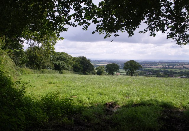
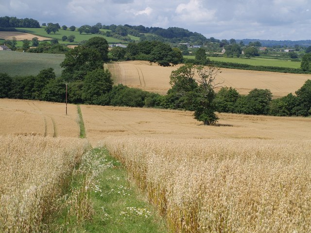
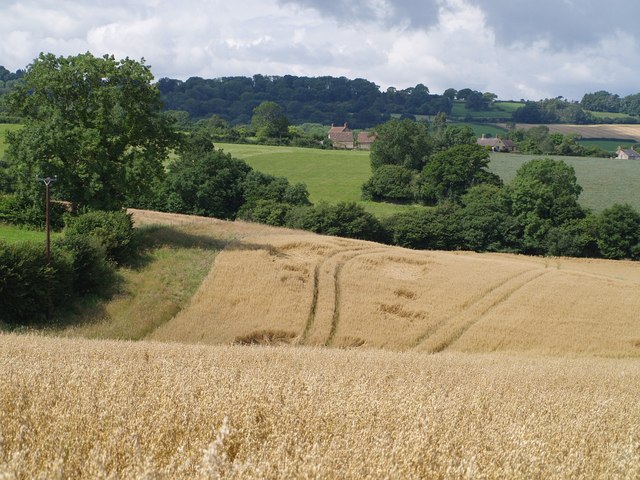
Old Wood, Somerset is a beautiful and historic woodland located in the county of Somerset, England. Covering an area of approximately 500 acres, this ancient forest is renowned for its rich biodiversity and tranquil atmosphere.

The wood is primarily composed of native broadleaf trees, including oak, ash, beech, and birch, which have been growing undisturbed for centuries. The dense canopy created by these towering trees provides a haven for a wide variety of flora and fauna. Bluebells, primroses, and wild garlic carpet the forest floor during spring, creating a stunning display of colors and scents.

In addition to its natural beauty, Old Wood holds great historical significance. It has been documented in the Domesday Book of 1086, making it one of the oldest recorded woodlands in the region. The wood has also played a role in local folklore and legends, with tales of mythical creatures and hidden treasures passed down through generations.

Walking trails wind their way through the wood, allowing visitors to explore and appreciate its natural wonders. The peaceful ambiance and the singing of birds make it an ideal place for nature lovers, hikers, and photographers.

Old Wood is also actively managed by local conservation organizations to ensure its preservation and the protection of its wildlife. This includes regular tree planting and the removal of invasive species, promoting the continued health and vitality of the woodland ecosystem.

Overall, Old Wood, Somerset is a treasured natural gem, offering a glimpse into the region's ancient past and providing a peaceful retreat for all who venture into its enchanting embrace.

If you have any feedback on the listing, please let us know in the comments section below.
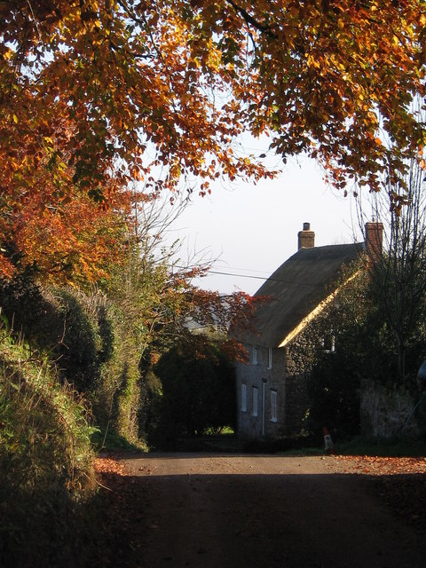
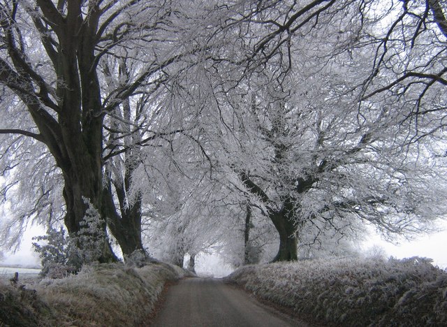
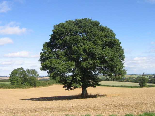
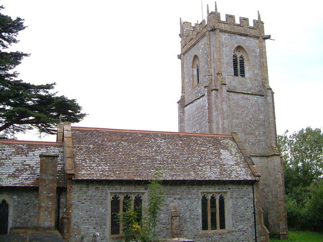
Old Wood Images

Images are sourced within 2km of 50.884914/-2.89102 or Grid Reference ST3709. Thanks to Geograph Open Source API. All images are credited.

Fingerpost, Cricket Sᵀ Thomas In the junction with A30 a sign indicating the private road to the Hotel and church etc.

Inscription: Cricket Sᵀ Thomas / (Private Road)

Milestone Society National ID: SO_ST3608
Fingerpost, Cricket Sᵀ Thomas
In the junction with A30 a sign indicating the private road to the Hotel and church etc. Inscription: Cricket Sᵀ Thomas / (Private Road) Milestone Society National ID: SO_ST3608
St. Thomas', Cricket St. Thomas, Somerset West wall, Porch and Tower. The original was built in the 14th Century but was almost completely rebuilt for Lord Bridport in 1819-1820.
St. Thomas', Cricket St. Thomas, Somerset
West wall, Porch and Tower. The original was built in the 14th Century but was almost completely rebuilt for Lord Bridport in 1819-1820.
St. Thomas', Cricket St. Thomas, Somerset Originally from the 14th Century but almost completely rebuilt for Lord Bridport in 1819-1820.
St. Thomas', Cricket St. Thomas, Somerset
Originally from the 14th Century but almost completely rebuilt for Lord Bridport in 1819-1820.
St. Thomas', Cricket St. Thomas, Somerset South-East corner.
St. Thomas', Cricket St. Thomas, Somerset
South-East corner.
St. Thomas', Cricket St. Thomas, Somerset All 19th Century Nave.
St. Thomas', Cricket St. Thomas, Somerset
All 19th Century Nave.
St. Thomas', Cricket St. Thomas, Somerset The Font.
St. Thomas', Cricket St. Thomas, Somerset
The Font.
Cudworth: parish church of St. Michael
View above Cudworth Taken from a gateway on the lane down from the Windwhistle Ridge to Cudworth; the lane continues behind the hedge on the left. The two darker trees formed part of a vanished field boundary.
View above Cudworth
Taken from a gateway on the lane down from the Windwhistle Ridge to Cudworth; the lane continues behind the hedge on the left. The two darker trees formed part of a vanished field boundary.
Field near Higher Farm Taken from the double bend on the lane between Cudworth and Dowlish Wake; the trees to the right are following a stream that flows between the two villages.
Field near Higher Farm
Taken from the double bend on the lane between Cudworth and Dowlish Wake; the trees to the right are following a stream that flows between the two villages.
St. James Church, Chillington A modest bell-cote for this little church, originally C13, built with attractive golden Ham stone in a hamlet in the southeast corner of the square. Details at <span class="nowrap"><a title="http://webapp1.somerset.gov.uk/her/details.asp?prn=58931" rel="nofollow ugc noopener" href="http://webapp1.somerset.gov.uk/her/details.asp?prn=58931">Link</a><img style="margin-left:2px;" alt="External link" title="External link - shift click to open in new window" src="https://s1.geograph.org.uk/img/external.png" width="10" height="10"/></span> .
St. James Church, Chillington
A modest bell-cote for this little church, originally C13, built with attractive golden Ham stone in a hamlet in the southeast corner of the square. Details at LinkExternal link .
Across Stretford Water Footpath CH6/16 crosses a field of oats and descends, dividing as it does so, to cross the stream. Both branches lead to Cudworth; the nearer buildings in the photo are part of the hamlet at the east end of the village centred around Ware Farm and the former school. The two pairs of trees in the middle of the green field on the far hillside to the left are the field boundary remnants mentioned in <a href="https://www.geograph.org.uk/photo/507996">ST3610 : View above Cudworth</a>.
Across Stretford Water
Footpath CH6/16 crosses a field of oats and descends, dividing as it does so, to cross the stream. Both branches lead to Cudworth; the nearer buildings in the photo are part of the hamlet at the east end of the village centred around Ware Farm and the former school. The two pairs of trees in the middle of the green field on the far hillside to the left are the field boundary remnants mentioned in ST3610 : View above Cudworth.
View northwest from Heber's Lane Heber's Lane climbs Windwhistle Ridge, giving good views over the Somerset countryside. This view is from the start of footpath CH6/10, looking down across Fisherway Lane which connects the two parts of Chillington - the lower hamlet is just to the left of the large tree. Some way beyond is Dowlish Wake, to the left of the row of poplars.
View northwest from Heber's Lane
Heber's Lane climbs Windwhistle Ridge, giving good views over the Somerset countryside. This view is from the start of footpath CH6/10, looking down across Fisherway Lane which connects the two parts of Chillington - the lower hamlet is just to the left of the large tree. Some way beyond is Dowlish Wake, to the left of the row of poplars.
Junction at Chillington Beneath this oak tree in the centre of the junction, seats have been fashioned out of large logs. On the left is Lambert Lane, which leads to Higher Chillington, while the lane to the right leads to Dowlish Wake.
Junction at Chillington
Beneath this oak tree in the centre of the junction, seats have been fashioned out of large logs. On the left is Lambert Lane, which leads to Higher Chillington, while the lane to the right leads to Dowlish Wake.
Cudworth from the east A view towards Cudworth from roughly the same spot as <a href="https://www.geograph.org.uk/photo/508131">ST3810 : Across Stretford Water</a>, looking further south.
Cudworth from the east
A view towards Cudworth from roughly the same spot as ST3810 : Across Stretford Water, looking further south.
Autumn leaves A pretty autumn view looking down lane towards Dowlish Wake. West farm and turning for Cudworth on the right.
Autumn leaves
A pretty autumn view looking down lane towards Dowlish Wake. West farm and turning for Cudworth on the right.
Frosty morning Looking up Sprays Hill towards Windwhistle on the first day of 2009
Frosty morning
Looking up Sprays Hill towards Windwhistle on the first day of 2009
After the harvest A favourite view towards Chillington after the corn was harvested.
After the harvest
A favourite view towards Chillington after the corn was harvested.
Wet October morning View looking Southwest towards Cudworth from outside Higher farm after a heavy rainfall
Wet October morning
View looking Southwest towards Cudworth from outside Higher farm after a heavy rainfall
Show me another place!

Old Wood is located at Grid Ref: ST3709 (Lat: 50.884914, Lng: -2.89102)

Administrative County: Somerset

District: South Somerset

Police Authority: Avon and Somerset

What 3 Words

///universal.flopped.curbed. Near Ilminster, Somerset

Related Wikis

Cudworth, Somerset

Cudworth (English: ) is a village and parish in Somerset, England, situated 5 miles (8.0 km) north east of Chard in the South Somerset district. The village...

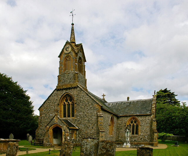
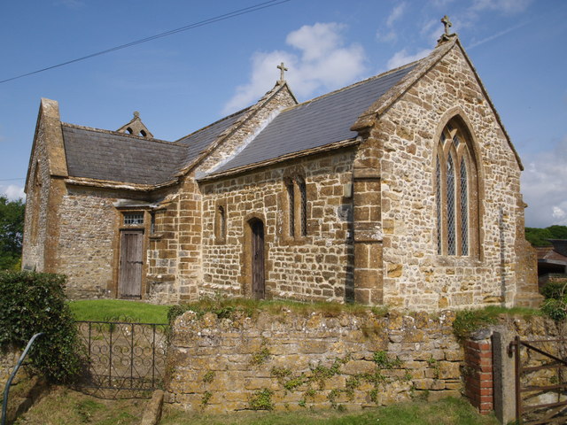
Church of St Michael, Cudworth

The Anglican Church of St Michael in Cudworth, Somerset, England was built in the 12th century. It is a Grade II* listed building. == History == The church...

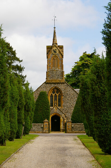
Church of St Thomas, Cricket St Thomas

The Church of St Thomas in Cricket St Thomas, Somerset, England was built in the 14th century and rebuilt in 1868. It is a Grade II* listed building....
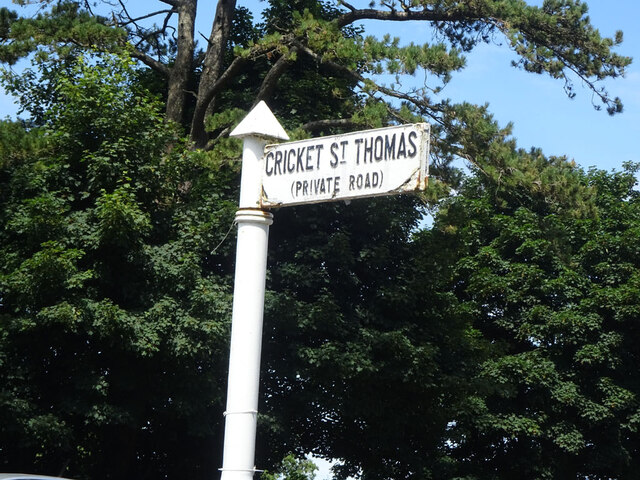
Cricket St Thomas

Cricket St Thomas is a parish in Somerset, England, situated in a valley between Chard and Crewkerne within the South Somerset administrative district...

Chillington, Somerset

Chillington is a village and parish in Somerset, England, situated 3 miles (5 km) west of Crewkerne and 5 miles (8 km) east of Chard in the South Somerset...

Church of St Michael and All Angels, Chaffcombe

The Anglican Church of St Michael and All Angels in Chaffcombe, Somerset, England was built in the 15th century. It is a Grade II* listed building. �...

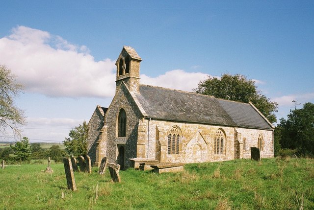
Church of St Mary Magdalene, Cricket Malherbie

The Anglican Church of St Mary Magdalene in Cricket Malherbie, Somerset, England was built in the 12th century and rebuilt in 1855. It is a Grade II* listed...

Chaffcombe

Chaffcombe is a village and civil parish in Somerset, England, situated 2 miles (3.2 km) north east of Chard in the South Somerset district. The village...

Have you been to Old Wood?

Leave your review of Old Wood below (or comments, questions and feedback).