Windwhistle

Settlement in Somerset South Somerset

England

Windwhistle

Fingerpost, Cricket Sᵀ Thomas In the junction with A30 a sign indicating the private road to the Hotel and church etc.

Inscription: Cricket Sᵀ Thomas / (Private Road)

Milestone Society National ID: SO_ST3608
Fingerpost, Cricket Sᵀ Thomas Credit: Mr Red

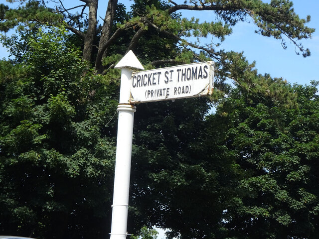
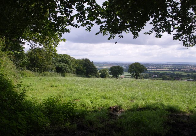
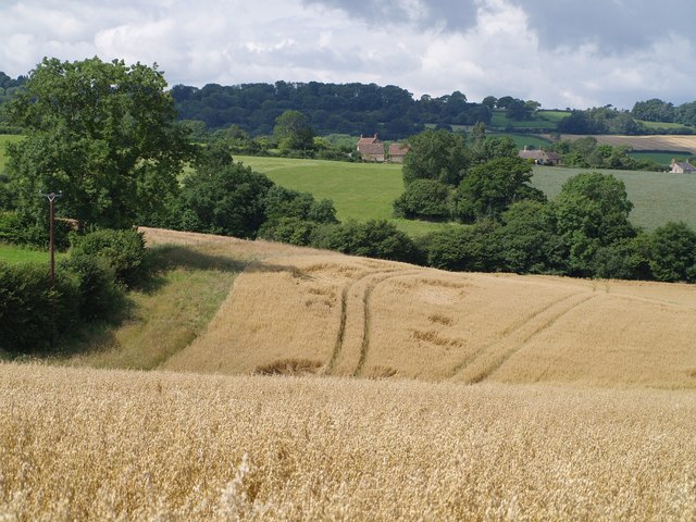
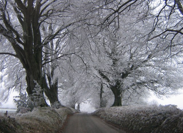
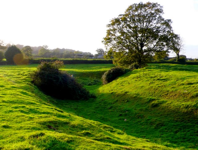
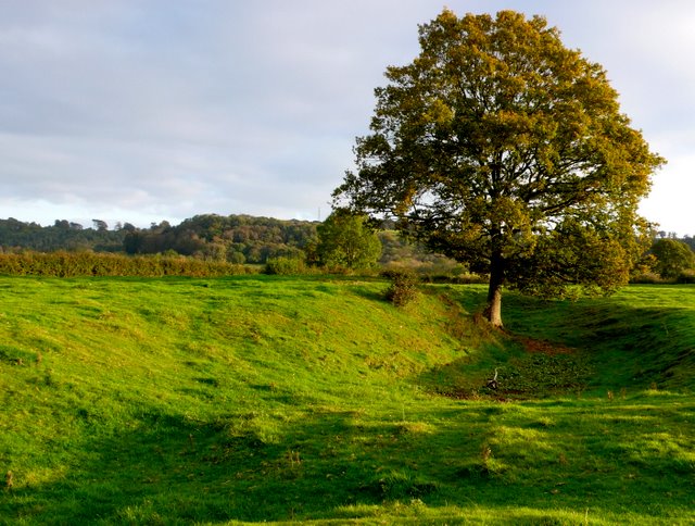
Windwhistle is a small village located in the county of Somerset, England. Situated approximately 7 miles southwest of the town of Yeovil, Windwhistle is nestled in a picturesque rural setting, surrounded by rolling hills and charming countryside.

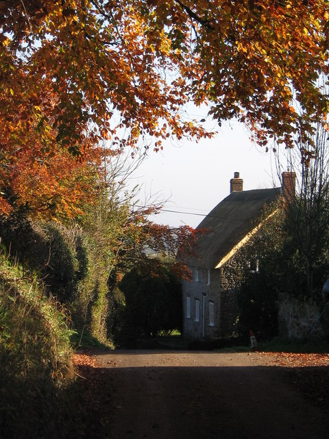
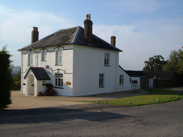
The village is home to a close-knit community and offers a peaceful and tranquil atmosphere for its residents. The architecture in Windwhistle predominantly consists of traditional stone cottages and farmhouses, giving the village a quintessentially English feel.

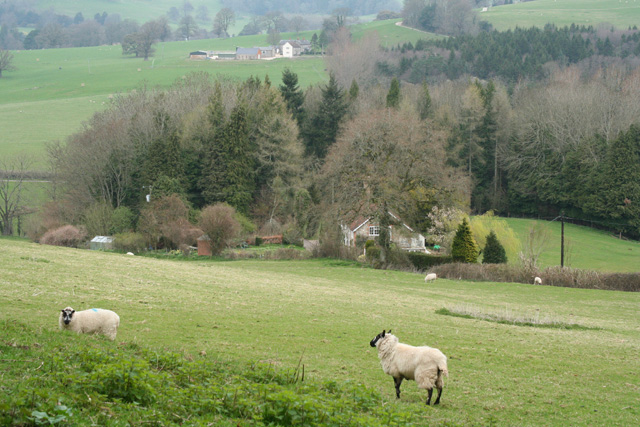
Despite its small size, Windwhistle has a rich history dating back centuries. The village was mentioned in the Domesday Book of 1086, a testament to its long-standing presence in the region. In the past, Windwhistle was primarily an agricultural community, with farming being the main source of livelihood for its inhabitants.

Today, Windwhistle is known for its scenic beauty and serves as a popular destination for those seeking a peaceful retreat or a base for exploring the surrounding countryside. The village offers numerous walking and cycling routes, allowing visitors to immerse themselves in the natural beauty of the area.

A notable feature of Windwhistle is its proximity to the Dorset border, making it an ideal starting point for exploring both Somerset and its neighboring county. Additionally, the village benefits from its close proximity to the A303 road, providing easy access to larger towns and cities in the region.

In summary, Windwhistle is a charming and idyllic village in Somerset, offering a serene and picturesque retreat for residents and visitors alike.

If you have any feedback on the listing, please let us know in the comments section below.

Windwhistle Images

Images are sourced within 2km of 50.877046/-2.8968112 or Grid Reference ST3709. Thanks to Geograph Open Source API. All images are credited.

Fingerpost, Cricket Sᵀ Thomas In the junction with A30 a sign indicating the private road to the Hotel and church etc.

Inscription: Cricket Sᵀ Thomas / (Private Road)

Milestone Society National ID: SO_ST3608
Fingerpost, Cricket Sᵀ Thomas
In the junction with A30 a sign indicating the private road to the Hotel and church etc. Inscription: Cricket Sᵀ Thomas / (Private Road) Milestone Society National ID: SO_ST3608
St. Thomas', Cricket St. Thomas, Somerset West wall, Porch and Tower. The original was built in the 14th Century but was almost completely rebuilt for Lord Bridport in 1819-1820.
St. Thomas', Cricket St. Thomas, Somerset
West wall, Porch and Tower. The original was built in the 14th Century but was almost completely rebuilt for Lord Bridport in 1819-1820.
St. Thomas', Cricket St. Thomas, Somerset Originally from the 14th Century but almost completely rebuilt for Lord Bridport in 1819-1820.
St. Thomas', Cricket St. Thomas, Somerset
Originally from the 14th Century but almost completely rebuilt for Lord Bridport in 1819-1820.
St. Thomas', Cricket St. Thomas, Somerset South-East corner.
St. Thomas', Cricket St. Thomas, Somerset
South-East corner.
St. Thomas', Cricket St. Thomas, Somerset All 19th Century Nave.
St. Thomas', Cricket St. Thomas, Somerset
All 19th Century Nave.
St. Thomas', Cricket St. Thomas, Somerset The Font.
St. Thomas', Cricket St. Thomas, Somerset
The Font.
Church of St Michael and All Angels, Chaffcombe Plenty of C15 work still in evidence in this church in a charming village.  <span class="nowrap"><a title="http://webapp1.somerset.gov.uk/her/details.asp?prn=57202" rel="nofollow ugc noopener" href="http://webapp1.somerset.gov.uk/her/details.asp?prn=57202">Link</a><img style="margin-left:2px;" alt="External link" title="External link - shift click to open in new window" src="https://s1.geograph.org.uk/img/external.png" width="10" height="10"/></span> 
Taken from a corner of the churchyard.
Church of St Michael and All Angels, Chaffcombe
Plenty of C15 work still in evidence in this church in a charming village. LinkExternal link Taken from a corner of the churchyard.
Cudworth: parish church of St. Michael
View above Cudworth Taken from a gateway on the lane down from the Windwhistle Ridge to Cudworth; the lane continues behind the hedge on the left. The two darker trees formed part of a vanished field boundary.
View above Cudworth
Taken from a gateway on the lane down from the Windwhistle Ridge to Cudworth; the lane continues behind the hedge on the left. The two darker trees formed part of a vanished field boundary.
Cudworth from the east A view towards Cudworth from roughly the same spot as <a href="https://www.geograph.org.uk/photo/508131">ST3810 : Across Stretford Water</a>, looking further south.
Cudworth from the east
A view towards Cudworth from roughly the same spot as ST3810 : Across Stretford Water, looking further south.
Autumn leaves A pretty autumn view looking down lane towards Dowlish Wake. West farm and turning for Cudworth on the right.
Autumn leaves
A pretty autumn view looking down lane towards Dowlish Wake. West farm and turning for Cudworth on the right.
Frosty morning Looking up Sprays Hill towards Windwhistle on the first day of 2009
Frosty morning
Looking up Sprays Hill towards Windwhistle on the first day of 2009
Moat near Cudworth This moat just to the south of the church at Cudworth  is probably the remains of a fortified manor house although there is very little in the way of remains inside the moat. The moat is approximately circular and is approximately 75m to 80m in diameter. The interior is slightly higher than the surrounding field. This is the west side of the moat looking north west from just outside the moat on the southern side. There are the remains of fishponds in the adjacent field. Further details can be found here <span class="nowrap"><a title="http://www.gatehouse-gazetteer.info/English%20sites/3867.html" rel="nofollow ugc noopener" href="http://www.gatehouse-gazetteer.info/English%20sites/3867.html">Link</a><img style="margin-left:2px;" alt="External link" title="External link - shift click to open in new window" src="https://s1.geograph.org.uk/img/external.png" width="10" height="10"/></span>
Moat near Cudworth
This moat just to the south of the church at Cudworth is probably the remains of a fortified manor house although there is very little in the way of remains inside the moat. The moat is approximately circular and is approximately 75m to 80m in diameter. The interior is slightly higher than the surrounding field. This is the west side of the moat looking north west from just outside the moat on the southern side. There are the remains of fishponds in the adjacent field. Further details can be found here LinkExternal link
Cudworth Moat A view of the western side of the moat looking south, showing in the foreground the earthwork in the moat where the entrance point may have been.
Cudworth Moat
A view of the western side of the moat looking south, showing in the foreground the earthwork in the moat where the entrance point may have been.
Cricket St Thomas, wildlife park Flamingoes in the landscaped grounds of the Cricket St Thomas estate in Somerset
Cricket St Thomas, wildlife park
Flamingoes in the landscaped grounds of the Cricket St Thomas estate in Somerset
Winsham: north from Limekiln Lane Looking towards Chalkway and Puthill
Winsham: north from Limekiln Lane
Looking towards Chalkway and Puthill
The Old Happy This Victorian building was an inn until 1966, since when it has been a private house. The A30 must have run past its door until the road was realigned - it is now 25 yards away. The road in the foreground is a lane running north from the A30 to Chaffcombe.
The Old Happy
This Victorian building was an inn until 1966, since when it has been a private house. The A30 must have run past its door until the road was realigned - it is now 25 yards away. The road in the foreground is a lane running north from the A30 to Chaffcombe.
Avishays <span class="nowrap"><a title="http://webapp1.somerset.gov.uk/her/details.asp?prn=57206" rel="nofollow ugc noopener" href="http://webapp1.somerset.gov.uk/her/details.asp?prn=57206">Link</a><img style="margin-left:2px;" alt="External link" title="External link - shift click to open in new window" src="https://s1.geograph.org.uk/img/external.png" width="10" height="10"/></span> suggests that there has been a house here since at least the early C14, but this building is C17 and later. Seen from the footpath that follows the drive.
Avishays
LinkExternal link suggests that there has been a house here since at least the early C14, but this building is C17 and later. Seen from the footpath that follows the drive.
Show me another place!

Windwhistle is located at Grid Ref: ST3709 (Lat: 50.877046, Lng: -2.8968112)

Administrative County: Somerset

District: South Somerset

Police Authority: Avon and Somerset

What 3 Words

///donates.digit.riskiest. Near Chard, Somerset

Related Wikis

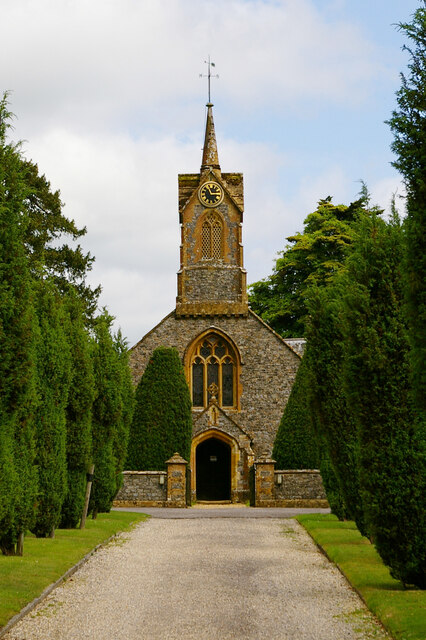
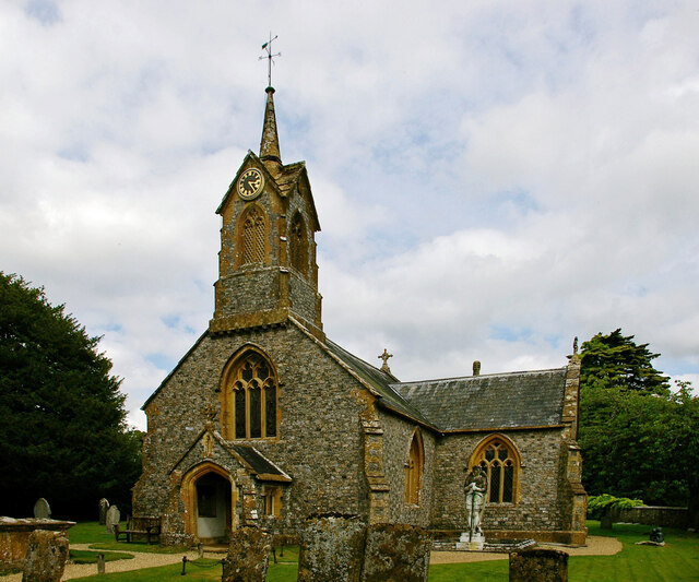
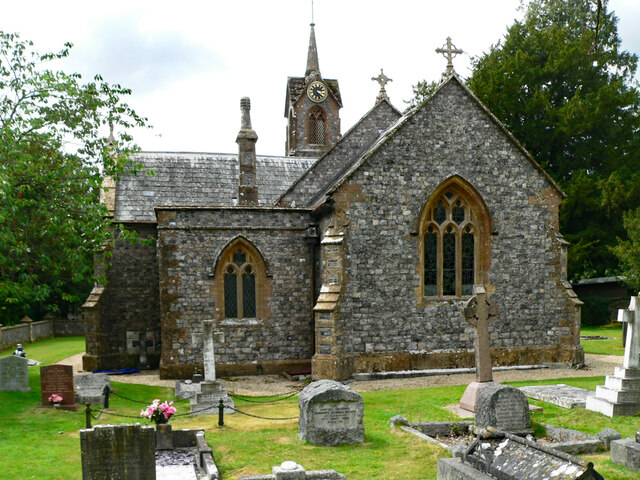
Church of St Thomas, Cricket St Thomas

The Church of St Thomas in Cricket St Thomas, Somerset, England was built in the 14th century and rebuilt in 1868. It is a Grade II* listed building....

Cricket St Thomas

Cricket St Thomas is a parish in Somerset, England, situated in a valley between Chard and Crewkerne within the South Somerset administrative district...

Cudworth, Somerset

Cudworth (English: ) is a village and parish in Somerset, England, situated 5 miles (8.0 km) north east of Chard in the South Somerset district. The village...

Church of St Michael, Cudworth

The Anglican Church of St Michael in Cudworth, Somerset, England was built in the 12th century. It is a Grade II* listed building. == History == The church...

Church of St Michael and All Angels, Chaffcombe

The Anglican Church of St Michael and All Angels in Chaffcombe, Somerset, England was built in the 15th century. It is a Grade II* listed building. �...

Chaffcombe

Chaffcombe is a village and civil parish in Somerset, England, situated 2 miles (3.2 km) north east of Chard in the South Somerset district. The village...

Winsham

Winsham is a village and civil parish 4 miles (6 km) south-east of Chard and 6 miles (10 km) from Crewkerne, in the South Somerset district of Somerset...

Church of St Mary Magdalene, Cricket Malherbie

The Anglican Church of St Mary Magdalene in Cricket Malherbie, Somerset, England was built in the 12th century and rebuilt in 1855. It is a Grade II* listed...

Nearby Amenities

Located within 500m of 50.877046,-2.8968112
Cricket St. Thomas Hotel
Tourism: hotel
Lat/Long: 50.8738422/-2.8922259
Turning Circle
Lat/Long: 50.8729189/-2.8947484
Power: pole
Source: bing
Lat/Long: 50.8750124/-2.8916466
Power: pole
Source: bing
Lat/Long: 50.8786876/-2.8936261
Power: pole
Source: bing
Lat/Long: 50.8782831/-2.8933981
Power: pole
Source: bing
Lat/Long: 50.8757292/-2.8920034
Power: pole
Source: bing
Lat/Long: 50.8763554/-2.8923735
Power: pole
Source: bing
Lat/Long: 50.8775638/-2.8930092
The data included in this document is from www.openstreetmap.org. The data is made available under ODbL.

Have you been to Windwhistle?

Leave your review of Windwhistle below (or comments, questions and feedback).