Middle Wood

Wood, Forest in Somerset South Somerset

England

Middle Wood

Fingerpost, Cricket Sᵀ Thomas In the junction with A30 a sign indicating the private road to the Hotel and church etc.

Inscription: Cricket Sᵀ Thomas / (Private Road)

Milestone Society National ID: SO_ST3608
Fingerpost, Cricket Sᵀ Thomas Credit: Mr Red

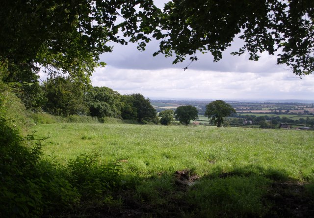
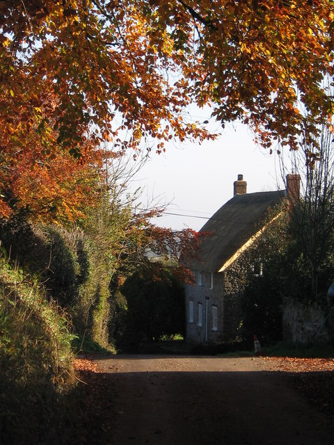
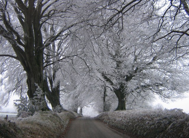
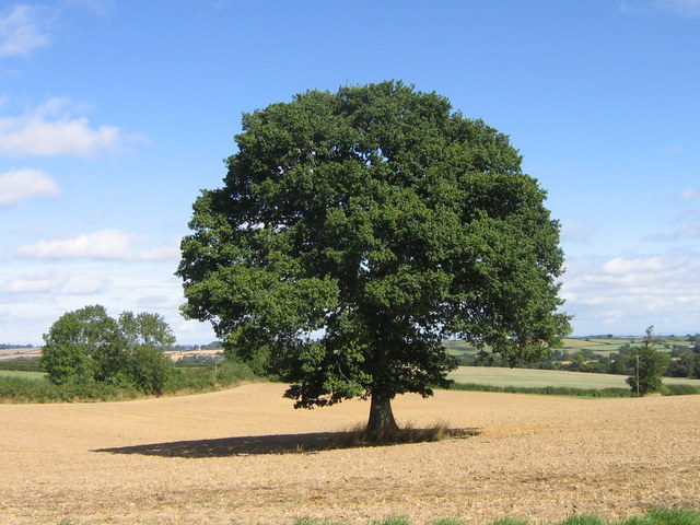
Middle Wood is a picturesque woodland located in Somerset, England. Spread across an area of approximately 100 acres, it is nestled in the heart of the county, providing a serene and natural environment for visitors to explore. The wood is predominantly made up of native tree species such as oak, beech, and ash, which create a dense and diverse canopy, offering shade and shelter to a wide range of flora and fauna.

The woodland is a popular destination for nature enthusiasts, offering numerous walking trails that wind through the trees, providing opportunities to observe the local wildlife. From deer and badgers to a variety of bird species, Middle Wood is a haven for wildlife, attracting both birdwatchers and animal lovers alike.

In addition to its natural beauty, the woodland also boasts a range of recreational facilities. These include picnic areas, camping spots, and even a small visitor center where visitors can obtain information about the woodland and its inhabitants. The wood also hosts educational programs and events throughout the year, engaging visitors of all ages in the wonders of nature.

Middle Wood is well-maintained, with clear pathways and signposts ensuring that visitors can explore the wood with ease. The tranquil atmosphere and stunning scenery make it an ideal destination for hikers, families, and nature enthusiasts seeking an escape from the hustle and bustle of everyday life.

Overall, Middle Wood in Somerset provides a scenic and peaceful retreat, offering a chance to immerse oneself in the beauty of nature and enjoy the tranquility of the British countryside.

If you have any feedback on the listing, please let us know in the comments section below.

Middle Wood Images

Images are sourced within 2km of 50.885664/-2.8952139 or Grid Reference ST3709. Thanks to Geograph Open Source API. All images are credited.

Fingerpost, Cricket Sᵀ Thomas In the junction with A30 a sign indicating the private road to the Hotel and church etc.

Inscription: Cricket Sᵀ Thomas / (Private Road)

Milestone Society National ID: SO_ST3608
Fingerpost, Cricket Sᵀ Thomas
In the junction with A30 a sign indicating the private road to the Hotel and church etc. Inscription: Cricket Sᵀ Thomas / (Private Road) Milestone Society National ID: SO_ST3608
St. Thomas', Cricket St. Thomas, Somerset West wall, Porch and Tower. The original was built in the 14th Century but was almost completely rebuilt for Lord Bridport in 1819-1820.
St. Thomas', Cricket St. Thomas, Somerset
West wall, Porch and Tower. The original was built in the 14th Century but was almost completely rebuilt for Lord Bridport in 1819-1820.
St. Thomas', Cricket St. Thomas, Somerset Originally from the 14th Century but almost completely rebuilt for Lord Bridport in 1819-1820.
St. Thomas', Cricket St. Thomas, Somerset
Originally from the 14th Century but almost completely rebuilt for Lord Bridport in 1819-1820.
St. Thomas', Cricket St. Thomas, Somerset South-East corner.
St. Thomas', Cricket St. Thomas, Somerset
South-East corner.
St. Thomas', Cricket St. Thomas, Somerset All 19th Century Nave.
St. Thomas', Cricket St. Thomas, Somerset
All 19th Century Nave.
St. Thomas', Cricket St. Thomas, Somerset The Font.
St. Thomas', Cricket St. Thomas, Somerset
The Font.
Church of St Michael and All Angels, Chaffcombe Plenty of C15 work still in evidence in this church in a charming village.  <span class="nowrap"><a title="http://webapp1.somerset.gov.uk/her/details.asp?prn=57202" rel="nofollow ugc noopener" href="http://webapp1.somerset.gov.uk/her/details.asp?prn=57202">Link</a><img style="margin-left:2px;" alt="External link" title="External link - shift click to open in new window" src="https://s1.geograph.org.uk/img/external.png" width="10" height="10"/></span> 
Taken from a corner of the churchyard.
Church of St Michael and All Angels, Chaffcombe
Plenty of C15 work still in evidence in this church in a charming village. LinkExternal link Taken from a corner of the churchyard.
C18 screen wall, Cricket Malherbie <span class="nowrap"><a title="http://webapp1.somerset.gov.uk/her/details.asp?prn=57263" rel="nofollow ugc noopener" href="http://webapp1.somerset.gov.uk/her/details.asp?prn=57263">Link</a><img style="margin-left:2px;" alt="External link" title="External link - shift click to open in new window" src="https://s1.geograph.org.uk/img/external.png" width="10" height="10"/></span> . Impressive finials and brickwork for a farm wall. The Manor Farm is opposite St Mary Magdalene church.
C18 screen wall, Cricket Malherbie
LinkExternal link . Impressive finials and brickwork for a farm wall. The Manor Farm is opposite St Mary Magdalene church.
Cudworth: parish church of St. Michael
View above Cudworth Taken from a gateway on the lane down from the Windwhistle Ridge to Cudworth; the lane continues behind the hedge on the left. The two darker trees formed part of a vanished field boundary.
View above Cudworth
Taken from a gateway on the lane down from the Windwhistle Ridge to Cudworth; the lane continues behind the hedge on the left. The two darker trees formed part of a vanished field boundary.
Field near Higher Farm Taken from the double bend on the lane between Cudworth and Dowlish Wake; the trees to the right are following a stream that flows between the two villages.
Field near Higher Farm
Taken from the double bend on the lane between Cudworth and Dowlish Wake; the trees to the right are following a stream that flows between the two villages.
Across Stretford Water Footpath CH6/16 crosses a field of oats and descends, dividing as it does so, to cross the stream. Both branches lead to Cudworth; the nearer buildings in the photo are part of the hamlet at the east end of the village centred around Ware Farm and the former school. The two pairs of trees in the middle of the green field on the far hillside to the left are the field boundary remnants mentioned in <a href="https://www.geograph.org.uk/photo/507996">ST3610 : View above Cudworth</a>.
Across Stretford Water
Footpath CH6/16 crosses a field of oats and descends, dividing as it does so, to cross the stream. Both branches lead to Cudworth; the nearer buildings in the photo are part of the hamlet at the east end of the village centred around Ware Farm and the former school. The two pairs of trees in the middle of the green field on the far hillside to the left are the field boundary remnants mentioned in ST3610 : View above Cudworth.
Cudworth from the east A view towards Cudworth from roughly the same spot as <a href="https://www.geograph.org.uk/photo/508131">ST3810 : Across Stretford Water</a>, looking further south.
Cudworth from the east
A view towards Cudworth from roughly the same spot as ST3810 : Across Stretford Water, looking further south.
Autumn leaves A pretty autumn view looking down lane towards Dowlish Wake. West farm and turning for Cudworth on the right.
Autumn leaves
A pretty autumn view looking down lane towards Dowlish Wake. West farm and turning for Cudworth on the right.
Frosty morning Looking up Sprays Hill towards Windwhistle on the first day of 2009
Frosty morning
Looking up Sprays Hill towards Windwhistle on the first day of 2009
Winter scene St Mary Magdalene church in the village of Cricket Malherbie
Winter scene
St Mary Magdalene church in the village of Cricket Malherbie
After the harvest A favourite view towards Chillington after the corn was harvested.
After the harvest
A favourite view towards Chillington after the corn was harvested.
Wet October morning View looking Southwest towards Cudworth from outside Higher farm after a heavy rainfall
Wet October morning
View looking Southwest towards Cudworth from outside Higher farm after a heavy rainfall
Show me another place!

Middle Wood is located at Grid Ref: ST3709 (Lat: 50.885664, Lng: -2.8952139)

Administrative County: Somerset

District: South Somerset

Police Authority: Avon and Somerset

What 3 Words

///decades.saved.remove. Near Ilminster, Somerset

Related Wikis

Cudworth, Somerset

Cudworth (English: ) is a village and parish in Somerset, England, situated 5 miles (8.0 km) north east of Chard in the South Somerset district. The village...

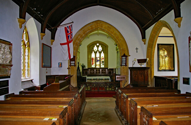
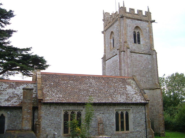
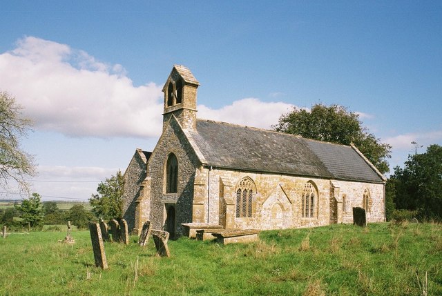
Church of St Michael, Cudworth

The Anglican Church of St Michael in Cudworth, Somerset, England was built in the 12th century. It is a Grade II* listed building. == History == The church...

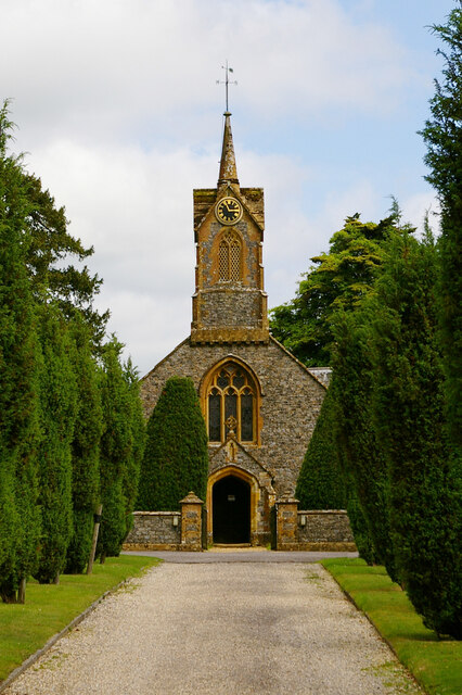
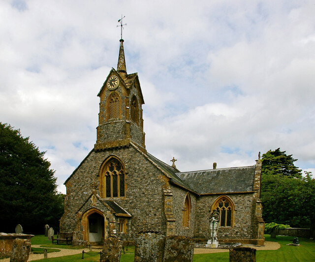
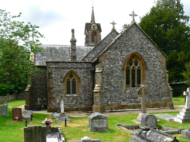
Church of St Thomas, Cricket St Thomas

The Church of St Thomas in Cricket St Thomas, Somerset, England was built in the 14th century and rebuilt in 1868. It is a Grade II* listed building....
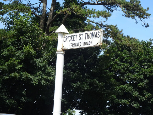
Cricket St Thomas

Cricket St Thomas is a parish in Somerset, England, situated in a valley between Chard and Crewkerne within the South Somerset administrative district...

Church of St Michael and All Angels, Chaffcombe

The Anglican Church of St Michael and All Angels in Chaffcombe, Somerset, England was built in the 15th century. It is a Grade II* listed building. �...

Church of St Mary Magdalene, Cricket Malherbie

The Anglican Church of St Mary Magdalene in Cricket Malherbie, Somerset, England was built in the 12th century and rebuilt in 1855. It is a Grade II* listed...

Chaffcombe

Chaffcombe is a village and civil parish in Somerset, England, situated 2 miles (3.2 km) north east of Chard in the South Somerset district. The village...

Chillington, Somerset

Chillington is a village and parish in Somerset, England, situated 3 miles (5 km) west of Crewkerne and 5 miles (8 km) east of Chard in the South Somerset...

Nearby Amenities

Located within 500m of 50.885664,-2.8952139
Power: pole
Lat/Long: 50.884608/-2.9009486
Power: pole
Lat/Long: 50.8856275/-2.901155
Power: pole
Lat/Long: 50.8866089/-2.9006843
Power: pole
Lat/Long: 50.8873957/-2.9002994
Power: pole
Lat/Long: 50.8891758/-2.8994358
Power: pole
Source: bing
Lat/Long: 50.8882807/-2.899881
The data included in this document is from www.openstreetmap.org. The data is made available under ODbL.

Have you been to Middle Wood?

Leave your review of Middle Wood below (or comments, questions and feedback).