Partway Coppice
Wood, Forest in Dorset
England
Partway Coppice
Partway Coppice is a picturesque woodland located in the county of Dorset, England. Situated near the town of Dorchester, this woodland covers an area of approximately 50 acres and is part of the larger Dorset AONB (Area of Outstanding Natural Beauty).
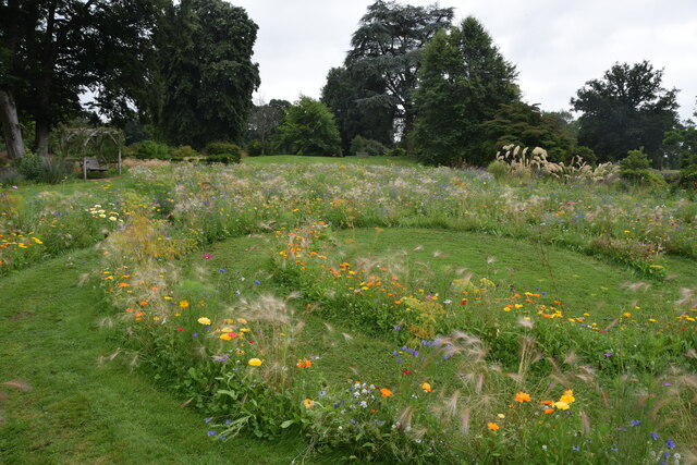
The coppice is primarily composed of native broadleaf trees, such as oak, ash, beech, and hazel, which create a diverse and vibrant habitat. The woodland floor is adorned with a colorful carpet of wildflowers during the spring and summer months, including bluebells, primroses, and wood anemones. The dense canopy provides shelter and nesting sites for a variety of bird species, including woodpeckers, tawny owls, and chiffchaffs.
Partway Coppice is intersected by several well-maintained footpaths, making it a popular destination for nature enthusiasts, walkers, and dog owners. These paths allow visitors to explore the woodland and discover its hidden treasures. In addition to the natural beauty, there are also several picnic areas and benches scattered throughout the woods, providing a perfect spot for visitors to relax and enjoy the peaceful surroundings.
The management of Partway Coppice is overseen by the local authorities, who ensure the conservation of the woodland's biodiversity and natural features. Regular conservation work, such as tree planting and removal of invasive species, is carried out to maintain the health of the woodland ecosystem.
Overall, Partway Coppice offers a tranquil escape from the hustle and bustle of everyday life, providing a haven for wildlife and a place for people to connect with nature.
If you have any feedback on the listing, please let us know in the comments section below.
Partway Coppice Images
Images are sourced within 2km of 50.832317/-2.9141579 or Grid Reference ST3504. Thanks to Geograph Open Source API. All images are credited.
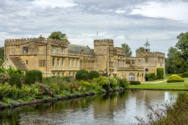

![Forde Abbey and Gardens [1] The entrance avenue, looking out towards the entrance gate.
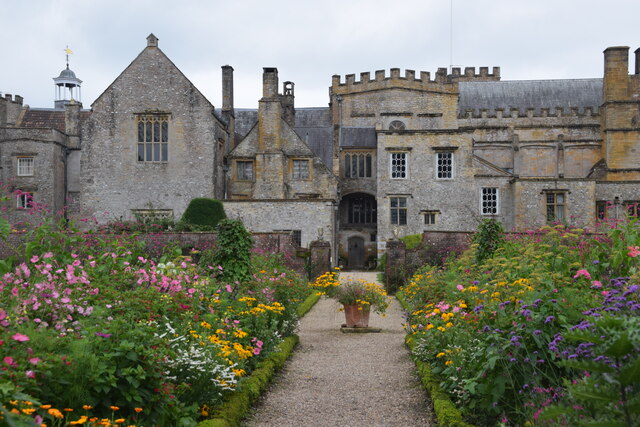
Forde Abbey and Gardens is situated in Dorset, on the south bank of the River Axe, some 5½ miles northeast of Axminster and about 3 miles southeast of Chard. A Cistercian Abbey was founded in 1136, and after dissolution in 1539, it was partly converted into a Country House. Parts of the monastic buildings of the 12th, 13th, 15th and 16th centuries survive with alterations, extensions and restorations in the 17th, 19th and 20th centuries. The house is constructed of rubble stone with Ham stone ashlar and dressings under roofs of slate and lead. The house is listed, grade I, with details at: <span class="nowrap"><a title="https://historicengland.org.uk/listing/the-list/list-entry/1153362" rel="nofollow ugc noopener" href="https://historicengland.org.uk/listing/the-list/list-entry/1153362">Link</a><img style="margin-left:2px;" alt="External link" title="External link - shift click to open in new window" src="https://s1.geograph.org.uk/img/external.png" width="10" height="10"/></span> Part of the gardens, in which the abbey church and northern cloister survive as buried structures, are a Scheduled Ancient Monument with details at: <span class="nowrap"><a title="https://historicengland.org.uk/listing/the-list/list-entry/1002347" rel="nofollow ugc noopener" href="https://historicengland.org.uk/listing/the-list/list-entry/1002347">Link</a><img style="margin-left:2px;" alt="External link" title="External link - shift click to open in new window" src="https://s1.geograph.org.uk/img/external.png" width="10" height="10"/></span> The site has some 15 acres of formal gardens and pleasure grounds, and about 65 acres of parkland. The grounds are on the Register of Historic Parks and Gardens, grade II*, with details at: <span class="nowrap"><a title="https://historicengland.org.uk/listing/the-list/list-entry/1000717" rel="nofollow ugc noopener" href="https://historicengland.org.uk/listing/the-list/list-entry/1000717">Link</a><img style="margin-left:2px;" alt="External link" title="External link - shift click to open in new window" src="https://s1.geograph.org.uk/img/external.png" width="10" height="10"/></span>](https://s0.geograph.org.uk/geophotos/07/56/74/7567492_92989d94.jpg)
![Forde Abbey and Gardens [2] The seven bays of arches are the north alley of the former cloister.
Forde Abbey and Gardens is situated in Dorset, on the south bank of the River Axe, some 5½ miles northeast of Axminster and about 3 miles southeast of Chard. A Cistercian Abbey was founded in 1136, and after dissolution in 1539, it was partly converted into a Country House. Parts of the monastic buildings of the 12th, 13th, 15th and 16th centuries survive with alterations, extensions and restorations in the 17th, 19th and 20th centuries. The house is constructed of rubble stone with Ham stone ashlar and dressings under roofs of slate and lead. The house is listed, grade I, with details at: <span class="nowrap"><a title="https://historicengland.org.uk/listing/the-list/list-entry/1153362" rel="nofollow ugc noopener" href="https://historicengland.org.uk/listing/the-list/list-entry/1153362">Link</a><img style="margin-left:2px;" alt="External link" title="External link - shift click to open in new window" src="https://s1.geograph.org.uk/img/external.png" width="10" height="10"/></span> Part of the gardens, in which the abbey church and northern cloister survive as buried structures, are a Scheduled Ancient Monument with details at: <span class="nowrap"><a title="https://historicengland.org.uk/listing/the-list/list-entry/1002347" rel="nofollow ugc noopener" href="https://historicengland.org.uk/listing/the-list/list-entry/1002347">Link</a><img style="margin-left:2px;" alt="External link" title="External link - shift click to open in new window" src="https://s1.geograph.org.uk/img/external.png" width="10" height="10"/></span> The site has some 15 acres of formal gardens and pleasure grounds, and about 65 acres of parkland. The grounds are on the Register of Historic Parks and Gardens, grade II*, with details at: <span class="nowrap"><a title="https://historicengland.org.uk/listing/the-list/list-entry/1000717" rel="nofollow ugc noopener" href="https://historicengland.org.uk/listing/the-list/list-entry/1000717">Link</a><img style="margin-left:2px;" alt="External link" title="External link - shift click to open in new window" src="https://s1.geograph.org.uk/img/external.png" width="10" height="10"/></span>](https://s1.geograph.org.uk/geophotos/07/56/74/7567497_3e4cc0be.jpg)
![Forde Abbey and Gardens [3] The Dorter range with the Chapter House. The 13 bay Dorter range is 13th century. The Chapter House (now the chapel) is mid 12th century, the upper part was rebuilt in the 16th century and altered in the late 17th century.
Forde Abbey and Gardens is situated in Dorset, on the south bank of the River Axe, some 5½ miles northeast of Axminster and about 3 miles southeast of Chard. A Cistercian Abbey was founded in 1136, and after dissolution in 1539, it was partly converted into a Country House. Parts of the monastic buildings of the 12th, 13th, 15th and 16th centuries survive with alterations, extensions and restorations in the 17th, 19th and 20th centuries. The house is constructed of rubble stone with Ham stone ashlar and dressings under roofs of slate and lead. The house is listed, grade I, with details at: <span class="nowrap"><a title="https://historicengland.org.uk/listing/the-list/list-entry/1153362" rel="nofollow ugc noopener" href="https://historicengland.org.uk/listing/the-list/list-entry/1153362">Link</a><img style="margin-left:2px;" alt="External link" title="External link - shift click to open in new window" src="https://s1.geograph.org.uk/img/external.png" width="10" height="10"/></span> Part of the gardens, in which the abbey church and northern cloister survive as buried structures, are a Scheduled Ancient Monument with details at: <span class="nowrap"><a title="https://historicengland.org.uk/listing/the-list/list-entry/1002347" rel="nofollow ugc noopener" href="https://historicengland.org.uk/listing/the-list/list-entry/1002347">Link</a><img style="margin-left:2px;" alt="External link" title="External link - shift click to open in new window" src="https://s1.geograph.org.uk/img/external.png" width="10" height="10"/></span> The site has some 15 acres of formal gardens and pleasure grounds, and about 65 acres of parkland. The grounds are on the Register of Historic Parks and Gardens, grade II*, with details at: <span class="nowrap"><a title="https://historicengland.org.uk/listing/the-list/list-entry/1000717" rel="nofollow ugc noopener" href="https://historicengland.org.uk/listing/the-list/list-entry/1000717">Link</a><img style="margin-left:2px;" alt="External link" title="External link - shift click to open in new window" src="https://s1.geograph.org.uk/img/external.png" width="10" height="10"/></span>](https://s2.geograph.org.uk/geophotos/07/56/75/7567502_6b6fd65a.jpg)
![Forde Abbey and Gardens [4] The Chapter House is now the chapel. Built in the 12th century, the upper part was rebuilt in the 16th century and altered in the late 17th century. The east window is early 16th century.
Forde Abbey and Gardens is situated in Dorset, on the south bank of the River Axe, some 5½ miles northeast of Axminster and about 3 miles southeast of Chard. A Cistercian Abbey was founded in 1136, and after dissolution in 1539, it was partly converted into a Country House. Parts of the monastic buildings of the 12th, 13th, 15th and 16th centuries survive with alterations, extensions and restorations in the 17th, 19th and 20th centuries. The house is constructed of rubble stone with Ham stone ashlar and dressings under roofs of slate and lead. The house is listed, grade I, with details at: <span class="nowrap"><a title="https://historicengland.org.uk/listing/the-list/list-entry/1153362" rel="nofollow ugc noopener" href="https://historicengland.org.uk/listing/the-list/list-entry/1153362">Link</a><img style="margin-left:2px;" alt="External link" title="External link - shift click to open in new window" src="https://s1.geograph.org.uk/img/external.png" width="10" height="10"/></span> Part of the gardens, in which the abbey church and northern cloister survive as buried structures, are a Scheduled Ancient Monument with details at: <span class="nowrap"><a title="https://historicengland.org.uk/listing/the-list/list-entry/1002347" rel="nofollow ugc noopener" href="https://historicengland.org.uk/listing/the-list/list-entry/1002347">Link</a><img style="margin-left:2px;" alt="External link" title="External link - shift click to open in new window" src="https://s1.geograph.org.uk/img/external.png" width="10" height="10"/></span> The site has some 15 acres of formal gardens and pleasure grounds, and about 65 acres of parkland. The grounds are on the Register of Historic Parks and Gardens, grade II*, with details at: <span class="nowrap"><a title="https://historicengland.org.uk/listing/the-list/list-entry/1000717" rel="nofollow ugc noopener" href="https://historicengland.org.uk/listing/the-list/list-entry/1000717">Link</a><img style="margin-left:2px;" alt="External link" title="External link - shift click to open in new window" src="https://s1.geograph.org.uk/img/external.png" width="10" height="10"/></span>](https://s2.geograph.org.uk/geophotos/07/56/75/7567506_62eed627.jpg)
![Forde Abbey and Gardens [5] A mounting block at the corner of the Chapter House.
Forde Abbey and Gardens is situated in Dorset, on the south bank of the River Axe, some 5½ miles northeast of Axminster and about 3 miles southeast of Chard. A Cistercian Abbey was founded in 1136, and after dissolution in 1539, it was partly converted into a Country House. Parts of the monastic buildings of the 12th, 13th, 15th and 16th centuries survive with alterations, extensions and restorations in the 17th, 19th and 20th centuries. The house is constructed of rubble stone with Ham stone ashlar and dressings under roofs of slate and lead. The house is listed, grade I, with details at: <span class="nowrap"><a title="https://historicengland.org.uk/listing/the-list/list-entry/1153362" rel="nofollow ugc noopener" href="https://historicengland.org.uk/listing/the-list/list-entry/1153362">Link</a><img style="margin-left:2px;" alt="External link" title="External link - shift click to open in new window" src="https://s1.geograph.org.uk/img/external.png" width="10" height="10"/></span> Part of the gardens, in which the abbey church and northern cloister survive as buried structures, are a Scheduled Ancient Monument with details at: <span class="nowrap"><a title="https://historicengland.org.uk/listing/the-list/list-entry/1002347" rel="nofollow ugc noopener" href="https://historicengland.org.uk/listing/the-list/list-entry/1002347">Link</a><img style="margin-left:2px;" alt="External link" title="External link - shift click to open in new window" src="https://s1.geograph.org.uk/img/external.png" width="10" height="10"/></span> The site has some 15 acres of formal gardens and pleasure grounds, and about 65 acres of parkland. The grounds are on the Register of Historic Parks and Gardens, grade II*, with details at: <span class="nowrap"><a title="https://historicengland.org.uk/listing/the-list/list-entry/1000717" rel="nofollow ugc noopener" href="https://historicengland.org.uk/listing/the-list/list-entry/1000717">Link</a><img style="margin-left:2px;" alt="External link" title="External link - shift click to open in new window" src="https://s1.geograph.org.uk/img/external.png" width="10" height="10"/></span>](https://s1.geograph.org.uk/geophotos/07/56/75/7567509_e58ef41d.jpg)
![Forde Abbey and Gardens [6] An information board about the chapel within the former Chapter House.
Forde Abbey and Gardens is situated in Dorset, on the south bank of the River Axe, some 5½ miles northeast of Axminster and about 3 miles southeast of Chard. A Cistercian Abbey was founded in 1136, and after dissolution in 1539, it was partly converted into a Country House. Parts of the monastic buildings of the 12th, 13th, 15th and 16th centuries survive with alterations, extensions and restorations in the 17th, 19th and 20th centuries. The house is constructed of rubble stone with Ham stone ashlar and dressings under roofs of slate and lead. The house is listed, grade I, with details at: <span class="nowrap"><a title="https://historicengland.org.uk/listing/the-list/list-entry/1153362" rel="nofollow ugc noopener" href="https://historicengland.org.uk/listing/the-list/list-entry/1153362">Link</a><img style="margin-left:2px;" alt="External link" title="External link - shift click to open in new window" src="https://s1.geograph.org.uk/img/external.png" width="10" height="10"/></span> Part of the gardens, in which the abbey church and northern cloister survive as buried structures, are a Scheduled Ancient Monument with details at: <span class="nowrap"><a title="https://historicengland.org.uk/listing/the-list/list-entry/1002347" rel="nofollow ugc noopener" href="https://historicengland.org.uk/listing/the-list/list-entry/1002347">Link</a><img style="margin-left:2px;" alt="External link" title="External link - shift click to open in new window" src="https://s1.geograph.org.uk/img/external.png" width="10" height="10"/></span> The site has some 15 acres of formal gardens and pleasure grounds, and about 65 acres of parkland. The grounds are on the Register of Historic Parks and Gardens, grade II*, with details at: <span class="nowrap"><a title="https://historicengland.org.uk/listing/the-list/list-entry/1000717" rel="nofollow ugc noopener" href="https://historicengland.org.uk/listing/the-list/list-entry/1000717">Link</a><img style="margin-left:2px;" alt="External link" title="External link - shift click to open in new window" src="https://s1.geograph.org.uk/img/external.png" width="10" height="10"/></span>](https://s3.geograph.org.uk/geophotos/07/56/75/7567511_46e2e0d3.jpg)
Partway Coppice is located at Grid Ref: ST3504 (Lat: 50.832317, Lng: -2.9141579)
Unitary Authority: Dorset
Police Authority: Dorset
What 3 Words
///roost.customers.rank. Near Chard, Somerset
Nearby Locations
Related Wikis

Forde Abbey
Forde Abbey is a privately owned former Cistercian monastery in Dorset, England, with a postal address in Chard, Somerset. The house and gardens are run...

Chard Junction railway station
Chard Junction railway station was situated on the London and South Western Railway’s West of England Main Line about 1 mile (1.6 km) southeast of the...
Thorncombe
Thorncombe is a village and civil parish in the English county of Dorset. It was historically, until 1844, an exclave of Devon. It lies five miles (8...

Leigh House
Leigh House is 16th- or 17th-century house in Winsham, Somerset, England. It is a Grade II* listed building.The site was previously part of the Forde Abbey...

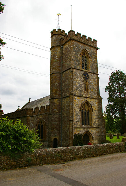
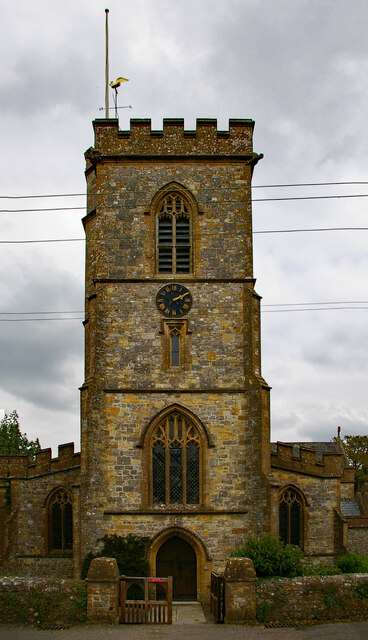
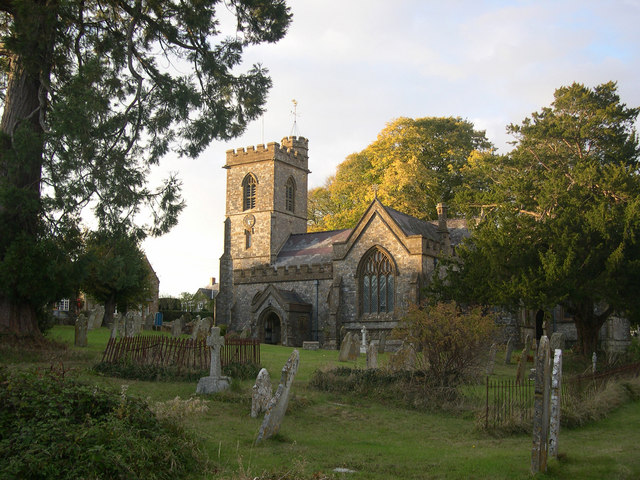
Church of St Stephen, Winsham
The Anglican Church of St Stephen in Winsham, Somerset, England, was built in the 13th century. It is a Grade II* listed building. == History == The church...

Winsham
Winsham is a village and civil parish 4 miles (6 km) south-east of Chard and 6 miles (10 km) from Crewkerne, in the South Somerset district of Somerset...

Stowell Meadow
Stowell Meadow (grid reference ST333062) is a 2.8 hectare (6.9 acre) biological Site of Special Scientific Interest near Tatworth in Somerset, notified...
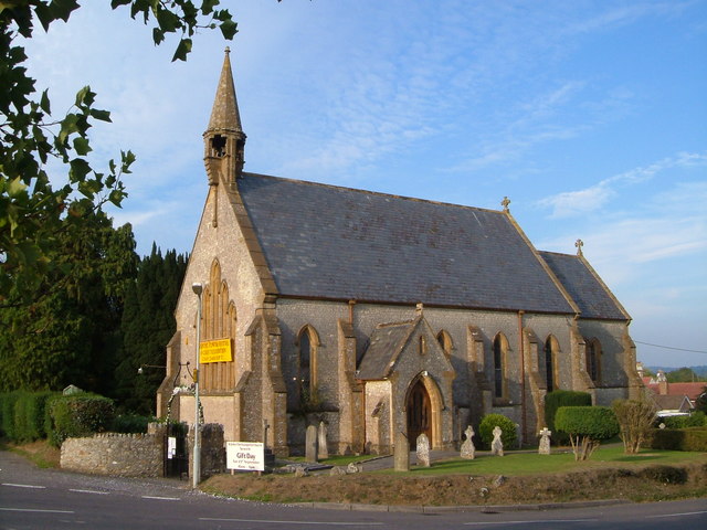
Church of St John the Evangelist, Tatworth
The Church of St John the Evangelist is a Church of England parish church in Tatworth, Somerset, England. It was built in 1850–51 to the design of Charles...
Nearby Amenities
Located within 500m of 50.832317,-2.9141579Have you been to Partway Coppice?
Leave your review of Partway Coppice below (or comments, questions and feedback).