Town End Wood
Wood, Forest in Lancashire South Lakeland
England
Town End Wood
![Boat on the River Leven Heading upstream [locally north] towards Fell Foot and Lakeside.](https://s2.geograph.org.uk/geophotos/06/91/69/6916926_036d6930.jpg)
Town End Wood is a picturesque woodland located in Lancashire, England. Covering an area of approximately 50 acres, it is a popular destination for nature enthusiasts and outdoor enthusiasts alike.
The wood is characterized by its diverse range of tree species, including oak, beech, and birch. These trees create a dense canopy, providing shade and shelter for a variety of wildlife. The forest floor is covered with a blanket of wildflowers, adding bursts of color to the tranquil setting.
Visitors to Town End Wood can explore its network of well-maintained trails, which wind their way through the woods. These trails are suitable for walkers of all abilities and provide opportunities to observe the local flora and fauna. The wood is also home to a variety of bird species, making it a haven for birdwatchers.
In addition to its natural beauty, Town End Wood has historical significance. It is believed that the wood has been in existence since medieval times, serving as a source of timber for the local community. Today, remnants of the past can still be seen, including the remains of an old charcoal kiln.
Town End Wood is easily accessible, with parking facilities available nearby. It is a peaceful escape from the hustle and bustle of everyday life, offering visitors a chance to reconnect with nature in a tranquil and serene setting. Whether it's a leisurely stroll or a more adventurous hike, Town End Wood offers something for everyone.
If you have any feedback on the listing, please let us know in the comments section below.
Town End Wood Images
Images are sourced within 2km of 54.272242/-2.9885714 or Grid Reference SD3586. Thanks to Geograph Open Source API. All images are credited.


Town End Wood is located at Grid Ref: SD3586 (Lat: 54.272242, Lng: -2.9885714)
Administrative County: Cumbria
District: South Lakeland
Police Authority: Cumbria
What 3 Words
///bolt.sweetened.brighter. Near Grange-over-Sands, Cumbria
Nearby Locations
Related Wikis
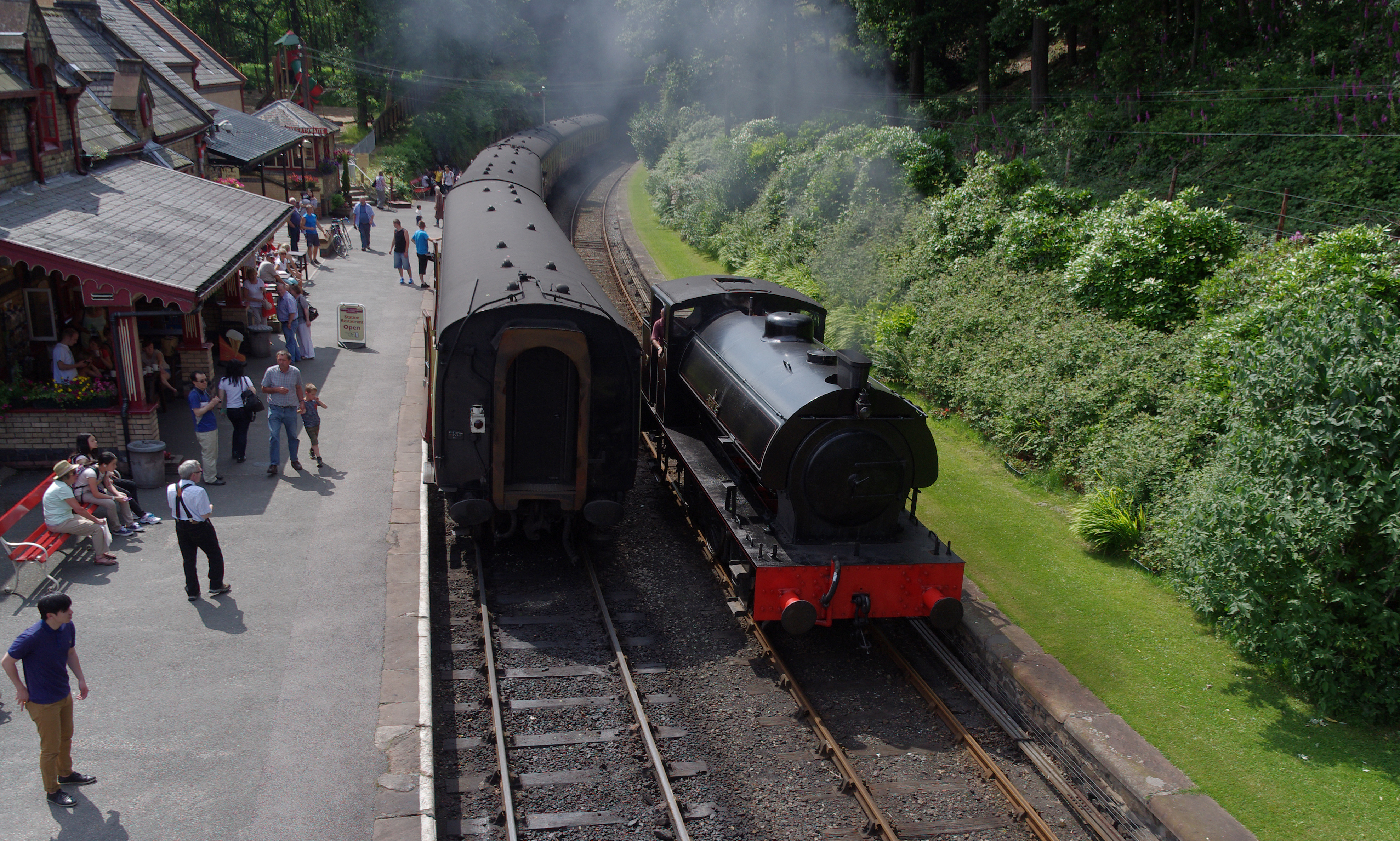
Lakeside and Haverthwaite Railway
The Lakeside and Haverthwaite Railway (L&HR) is a 3.2-mile-long (5.1 km) heritage railway in Cumbria, England. == Location == The L&HR runs from Haverthwaite...

Newby Bridge Halt railway station
Newby Bridge Halt (also known, historically, as Newby Bridge Platform) is a railway station on the Lakeside and Haverthwaite heritage railway. It serves...
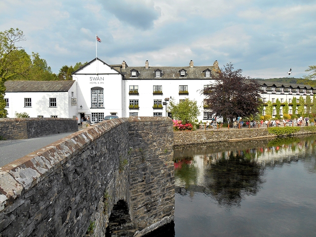
Newby Bridge
Newby Bridge is a small hamlet in the Lake District, Cumbria, England. Historically in Lancashire, it is located several miles west of Grange-over-Sands...
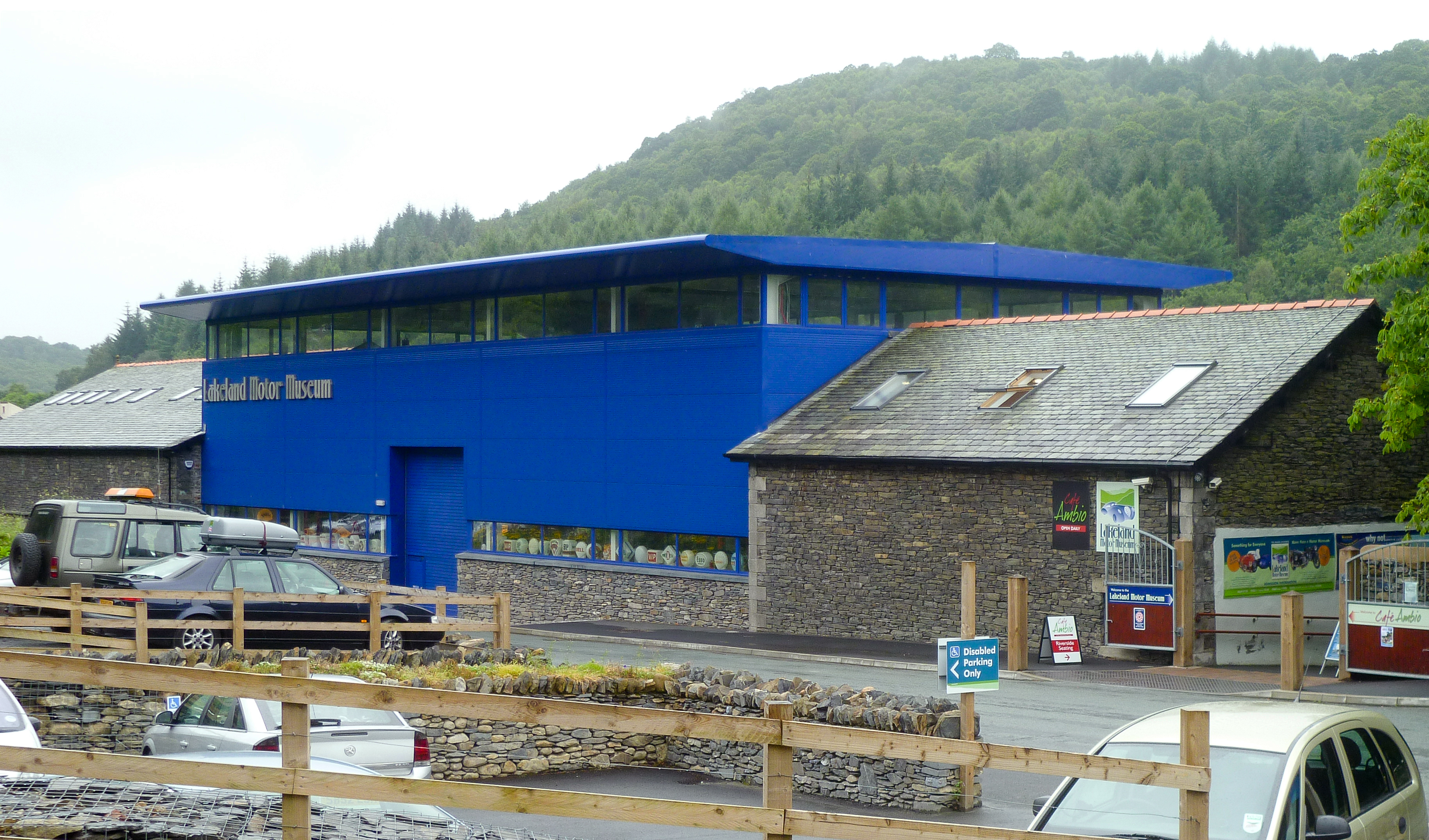
Lakeland Motor Museum
The Lakeland Motor Museum is a museum now located at Backbarrow, Cumbria, England which houses a collection of classic cars, motorcycles, bicycles, pedal...

Finsthwaite
Finsthwaite is a small village in the South Lakeland district, in the county of Cumbria, England. It is located near the Furness Fells and Windermere....
St Peter's Church, Finsthwaite
St Peter's Church is in the village of Finsthwaite, Cumbria, England. It is an active Anglican parish church in the deanery of Windermere, the archdeaconry...
Finsthwaite Heights
Finsthwaite Heights is an upland area in the English Lake District, above Finsthwaite, Cumbria. It is the subject of a chapter of Wainwright's book The...

Backbarrow
Backbarrow is a village in the Lake District National Park in England. It lies on the River Leven about 5 miles (8 km) northeast of Ulverston in Furness...
Nearby Amenities
Located within 500m of 54.272242,-2.9885714Have you been to Town End Wood?
Leave your review of Town End Wood below (or comments, questions and feedback).