Crag House Wood

Wood, Forest in Lancashire South Lakeland

England

Crag House Wood

Sheep grazing near Tarn Hows Woods
Sheep grazing near Tarn Hows Woods Credit: Eirian Evans

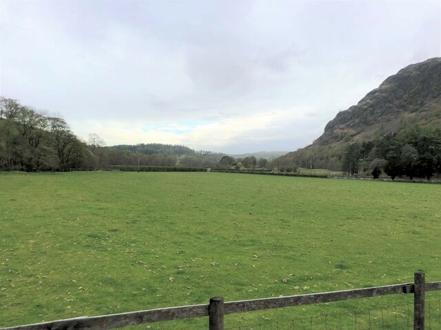
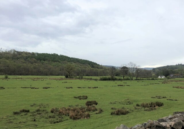
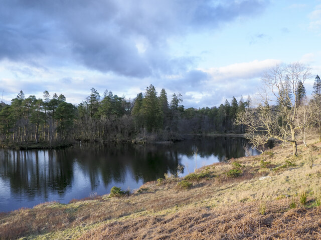
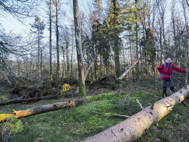
Crag House Wood is a picturesque woodland located in Lancashire, England. Covering an area of approximately 20 acres, it is nestled within the Rossendale Valley, offering visitors a tranquil and scenic escape from the bustling urban areas nearby. The woodland is managed by the Woodland Trust, ensuring its conservation and protection.

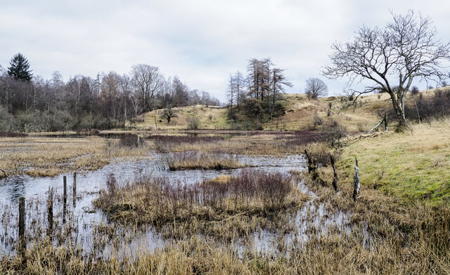
The wood features a diverse range of tree species, including oak, birch, beech, and sycamore, creating a rich and varied ecosystem. This variety of trees provides a habitat for many woodland creatures, such as birds, squirrels, and deer, making it an ideal spot for wildlife enthusiasts and nature lovers.

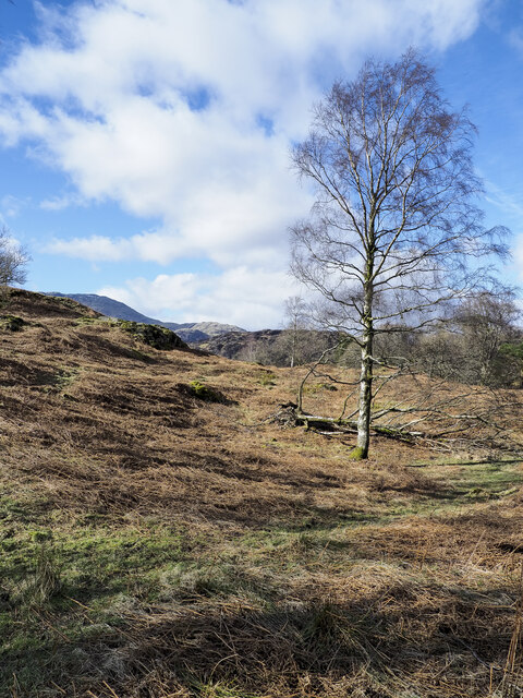
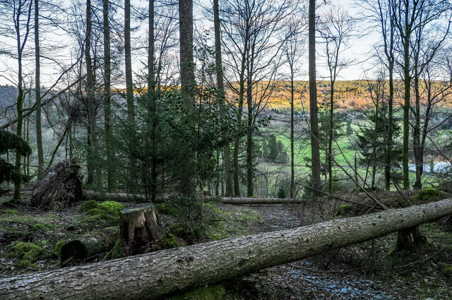
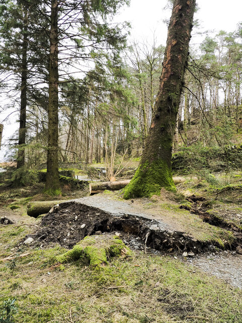
A network of footpaths and trails winds through Crag House Wood, allowing visitors to explore and immerse themselves in the natural beauty. These paths lead to stunning viewpoints, where one can admire the panoramic views of the surrounding countryside, including the nearby hills and valleys.

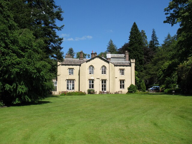
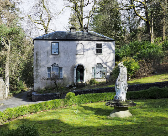
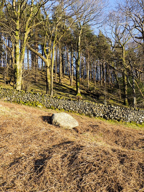
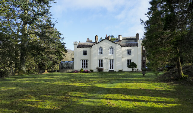
In addition to its natural beauty, Crag House Wood also has historical significance. It is home to the ruins of an ancient farmhouse, which adds a touch of mystery and intrigue to the woodland. The remnants of the farmhouse serve as a reminder of the area's past and provide an interesting glimpse into Lancashire's history.

Overall, Crag House Wood is a haven of tranquility and natural beauty. Its combination of diverse flora and fauna, scenic views, and historical ruins make it a popular destination for both locals and tourists seeking a peaceful retreat in the heart of Lancashire.

If you have any feedback on the listing, please let us know in the comments section below.

Crag House Wood Images

Images are sourced within 2km of 54.390504/-3.0560949 or Grid Reference SD3199. Thanks to Geograph Open Source API. All images are credited.

Sheep grazing near Tarn Hows Woods
Yewdale Valley Yewdale Crag to the right
Yewdale Valley
Yewdale Crag to the right
Yewdale Valley Poor grazing land here
Yewdale Valley
Poor grazing land here
Monk Coniston Hall Monk Coniston Hall is a National Trust property privately leased to HF Holidays as one of their Country Houses.
Monk Coniston Hall
Monk Coniston Hall is a National Trust property privately leased to HF Holidays as one of their Country Houses.
Counting House at Monk Coniston Monk Coniston is a National Trust Property leased by HF Holidays and operated as a country house hotel. There are several buildings on the site; this is the Counting House.
Counting House at Monk Coniston
Monk Coniston is a National Trust Property leased by HF Holidays and operated as a country house hotel. There are several buildings on the site; this is the Counting House.
Eastern side of Tarn Hows Tarn Hows is an archetypal Lake District location close to the village of Coniston. It's partly an artificial creation, the result of damming one of three tarns to create a larger feature.
Eastern side of Tarn Hows
Tarn Hows is an archetypal Lake District location close to the village of Coniston. It's partly an artificial creation, the result of damming one of three tarns to create a larger feature.
Birch tree on bracken-strewn slope The tree is on a hill slope south-west of Tarn Hows. The bracken is of course dead, the residue of the previous year's growth.
Wetherlam just shows above knolls at the left side horizon.
Birch tree on bracken-strewn slope
The tree is on a hill slope south-west of Tarn Hows. The bracken is of course dead, the residue of the previous year's growth. Wetherlam just shows above knolls at the left side horizon.
Wharton Tarn The tarn is a small area of water lying just over a kilometre south of Tarn Hows. It appears to be infilling with vegetation.
Wharton Tarn
The tarn is a small area of water lying just over a kilometre south of Tarn Hows. It appears to be infilling with vegetation.
Guards Wood Most of the trees seen here in the wood remain standing but over the summit area of the hill devastation was caused by Storm Arwen at the end of November 2021 and probably by subsequent winter storms. Ramorum disease had already affected trees there which were being removed by the National Trust.
Guards Wood
Most of the trees seen here in the wood remain standing but over the summit area of the hill devastation was caused by Storm Arwen at the end of November 2021 and probably by subsequent winter storms. Ramorum disease had already affected trees there which were being removed by the National Trust.
Damage to trees  at summit of High Guards High Guards is a low, wooded hill close to Coniston. The hillwalker is at its summit which was devastated by Storm Arwen at the end of November 2021 and probably by subsequent winter storms. A path crosses the hill going close to the summit but its route is blocked by many windthrown trees; much detouring and clambering is required to make the crossing.
Damage to trees at summit of High Guards
High Guards is a low, wooded hill close to Coniston. The hillwalker is at its summit which was devastated by Storm Arwen at the end of November 2021 and probably by subsequent winter storms. A path crosses the hill going close to the summit but its route is blocked by many windthrown trees; much detouring and clambering is required to make the crossing.
Obstructions to path descending through Guards Wood Much damage was caused in Guards Wood by Storm Arwen at the end of November 2021 and probably by subsequent winter storms. The summit area of High Guards, the hill on which the wood grows, was badly affected and difficult to access - <a title="https://www.geograph.org.uk/photo/7115398" href="https://www.geograph.org.uk/photo/7115398">Link</a> . The path crossing the hill was equally affected by windthrown trees. The awkwardness caused by the two trees across the path in this image was trivial by comparison.
Obstructions to path descending through Guards Wood
Much damage was caused in Guards Wood by Storm Arwen at the end of November 2021 and probably by subsequent winter storms. The summit area of High Guards, the hill on which the wood grows, was badly affected and difficult to access - Link . The path crossing the hill was equally affected by windthrown trees. The awkwardness caused by the two trees across the path in this image was trivial by comparison.
Monk Coniston The south-west face of the large house at Monk Coniston which, with land was owned by Beatrix Potter who left it to the National Trust; the Trust still has it. Currently, it's leased by HF holidays who operate it as a country house hotel.
Monk Coniston
The south-west face of the large house at Monk Coniston which, with land was owned by Beatrix Potter who left it to the National Trust; the Trust still has it. Currently, it's leased by HF holidays who operate it as a country house hotel.
Damage to woodland path adjacent to road Along this path close to Tarn Hows there are many fallen trees brought down by the storms  of winter 2021-2022. The foreground tree has almost gone and has prised away the path surface passing its base. Sawn tree trunks can be seen beyond and there were many more but not all are victims of those storms. Some felling of trees has been going on because of infection with the Phytophthora ramorum disease.
Damage to woodland path adjacent to road
Along this path close to Tarn Hows there are many fallen trees brought down by the storms of winter 2021-2022. The foreground tree has almost gone and has prised away the path surface passing its base. Sawn tree trunks can be seen beyond and there were many more but not all are victims of those storms. Some felling of trees has been going on because of infection with the Phytophthora ramorum disease.
The western end of Tarn Hows A beautiful place when there is bracken and snow on the hills. The Langdale Pikes are on the skyline.
The western end of Tarn Hows
A beautiful place when there is bracken and snow on the hills. The Langdale Pikes are on the skyline.
Moorland beside Tarn Hows If my memory serves me correct (over 50 years ago) this area was National Trust Land immediately adjacent to Tarn Hows.  Looking at current images and mapping, the location appears to be tree covered. No doubt a Lakeland connoisseur could put me right. At any rate I was circumnavigating Tarn Hows when the image was taken. I believe it is the Coniston Fells snow-covered beyond.
Moorland beside Tarn Hows
If my memory serves me correct (over 50 years ago) this area was National Trust Land immediately adjacent to Tarn Hows. Looking at current images and mapping, the location appears to be tree covered. No doubt a Lakeland connoisseur could put me right. At any rate I was circumnavigating Tarn Hows when the image was taken. I believe it is the Coniston Fells snow-covered beyond.
Tarn Hows, April 1970 A beautiful place before it was sanitised by the National Trust and overwhelmed by visitors.
Tarn Hows, April 1970
A beautiful place before it was sanitised by the National Trust and overwhelmed by visitors.
A593 between Coniston and Ambleside
Looking down on Tarn Hows An interesting comparison with Peter Trimming's May 2013 image  <a href="https://www.geograph.org.uk/photo/3477734">SD3399 : A Quiet day at Tarn Hows</a> but taken in winter 40 years earlier.
Looking down on Tarn Hows
An interesting comparison with Peter Trimming's May 2013 image SD3399 : A Quiet day at Tarn Hows but taken in winter 40 years earlier.
Show me another place!

Crag House Wood is located at Grid Ref: SD3199 (Lat: 54.390504, Lng: -3.0560949)

Administrative County: Cumbria

District: South Lakeland

Police Authority: Cumbria

What 3 Words

///coast.reason.interests. Near Ambleside, Cumbria

Related Wikis

Holme Fell

Holme Fell or Holm Fell is a fell in the Lake District in Cumbria, England. It is located between Coniston Water and Little Langdale, almost isolated from...

Yew Tree Tarn

Yew Tree Tarn is a small lake in the English Lake District situated in between the towns of Ambleside and Coniston. The tarn was formed when the local...

Tarn Hows

Tarn Hows is an area of the Lake District National Park in North West England, It contains a picturesque tarn, approximately 2 miles (3.2 km) northeast...

Ruskin Museum

The Ruskin Museum is a small local museum in Coniston, Cumbria, northern England. It was established in 1901 by W. G. Collingwood, an artist and antiquarian...

Nearby Amenities

Located within 500m of 54.390504,-3.0560949
Cafe
Yew Tree Farm
Note: Cafe closed 2010 and 2011
Lat/Long: 54.3894964/-3.0496034
Barrier: kissing_gate
Lat/Long: 54.3891508/-3.0487619
Barrier: kissing_gate
Lat/Long: 54.3908377/-3.0488569
High Yewdale Farm
Agricultural: farm
Source: survey
Lat/Long: 54.3884939/-3.0564914
Barrier: kissing_gate
Source: GPS Survey
Lat/Long: 54.3862969/-3.0567535
Calf Crag
Place: locality
Lat/Long: 54.3931964/-3.0553185
Long Crag
Place: locality
Lat/Long: 54.3942622/-3.0519374
Raven Crag
Place: locality
Lat/Long: 54.3929001/-3.0613571
Hiking: yes
Information: guidepost
Tourism: information
Lat/Long: 54.3891243/-3.0489112
Hiking: yes
Information: guidepost
Tourism: information
Lat/Long: 54.3894886/-3.048804
Hiking: yes
Information: guidepost
Source: GPS Survey
Tourism: information
Lat/Long: 54.3896846/-3.0574621
Hiking: yes
Information: guidepost
Source: GPS Survey
Tourism: information
Lat/Long: 54.3881759/-3.0565871
Barrier: kissing_gate
Source: GPS Survey
Lat/Long: 54.3881814/-3.0566043
Barrier: cattle_grid
Lat/Long: 54.3910225/-3.0615974
Grit Bin
Lat/Long: 54.3918905/-3.0626777
Power: pole
Lat/Long: 54.3863734/-3.0537591
Power: pole
Lat/Long: 54.3865866/-3.0543032
Power: pole
Lat/Long: 54.3867355/-3.055735
The data included in this document is from www.openstreetmap.org. The data is made available under ODbL.

Have you been to Crag House Wood?

Leave your review of Crag House Wood below (or comments, questions and feedback).