Yewdale

Valley in Lancashire South Lakeland

England

Yewdale

Roughly grassed field at Dixon Ground Dixon Ground is an area of land lying west of Coniston. The view here is from the publicly accessible part of the Walna Scar Road which has risen from the village.
The steep, broken slope beyond lies across Church Beck and rises ultimately to Wetherlam.
Roughly grassed field at Dixon Ground Credit: Trevor Littlewood

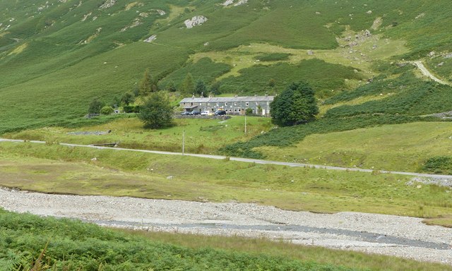
Yewdale, Lancashire, also known as Yewdale Valley, is a picturesque area located in the southern part of the Lake District National Park in England. Situated in the county of Cumbria, Yewdale Valley is a popular destination for tourists and nature enthusiasts alike.

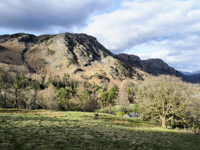
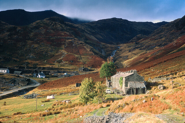
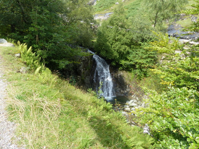
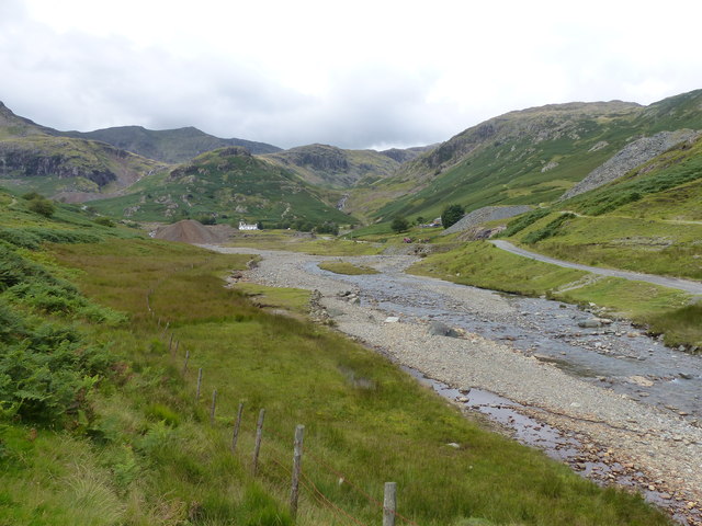
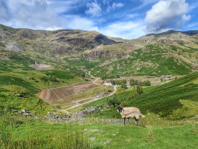
The valley is characterized by its stunning natural beauty, with rolling hills, lush green meadows, and dense woodlands. The area is crisscrossed by several streams and rivers, including the Yewdale Beck, which adds to the charm of the landscape. Yewdale Valley is also home to a wide variety of flora and fauna, making it a haven for wildlife.

The village of Yewdale is nestled within the valley and provides a peaceful and tranquil atmosphere for residents and visitors. The village retains much of its traditional charm, with several old stone cottages and buildings dotting its streets. The local community is warm and welcoming, often organizing events and activities that celebrate the cultural heritage of the area.

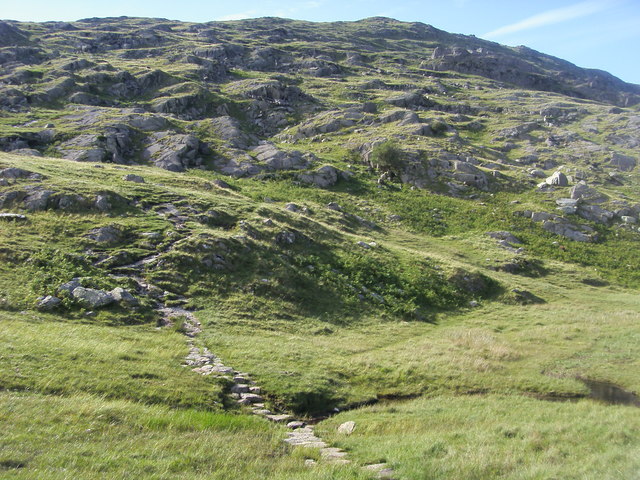
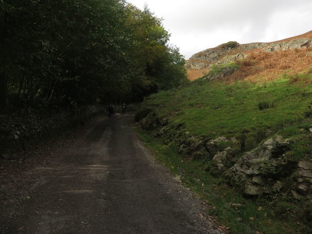
Outdoor activities are abundant in Yewdale Valley, attracting hikers, cyclists, and nature lovers year-round. The area offers numerous walking trails that provide breathtaking views of the surrounding countryside, as well as opportunities to spot wildlife such as red deer, birds of prey, and rare plant species.

Yewdale, Lancashire, is a hidden gem within the Lake District National Park, offering a serene and idyllic setting for those seeking a retreat in the heart of nature.

If you have any feedback on the listing, please let us know in the comments section below.

Yewdale Images

Images are sourced within 2km of 54.382811/-3.0632266 or Grid Reference SD3199. Thanks to Geograph Open Source API. All images are credited.

Roughly grassed field at Dixon Ground Dixon Ground is an area of land lying west of Coniston. The view here is from the publicly accessible part of the Walna Scar Road which has risen from the village.
The steep, broken slope beyond lies across Church Beck and rises ultimately to Wetherlam.
Roughly grassed field at Dixon Ground
Dixon Ground is an area of land lying west of Coniston. The view here is from the publicly accessible part of the Walna Scar Road which has risen from the village. The steep, broken slope beyond lies across Church Beck and rises ultimately to Wetherlam.
Irish Cottages, Coppermines Valley Irish Cottages in the valley of Church Beck is a terrace of houses above Coniston; two of them together form a climbing hut of the Yorkshire Mountaineering Club. The gravel flats through the centre of the image are where the Church Beck flows and winds.
Irish Cottages, Coppermines Valley
Irish Cottages in the valley of Church Beck is a terrace of houses above Coniston; two of them together form a climbing hut of the Yorkshire Mountaineering Club. The gravel flats through the centre of the image are where the Church Beck flows and winds.
Road heading for Coppermines Valley The valley is actually that of Church Beck but is popularly known as the Coppermines Valley because of the extensive disused mine workings there. The road is private but is used to access accommodation in the valley including houses, a youth hostel and two climbing club huts. The road is also a public footpath.
Coniston Old Man is the mountain seen against the sky.
Road heading for Coppermines Valley
The valley is actually that of Church Beck but is popularly known as the Coppermines Valley because of the extensive disused mine workings there. The road is private but is used to access accommodation in the valley including houses, a youth hostel and two climbing club huts. The road is also a public footpath. Coniston Old Man is the mountain seen against the sky.
Slope with minor rock outcrops The near slope is close to the feature named on OS maps as Flat Bield and is separated from the camera location by a steep stream groove. The valley beyond it is Red Dell.
The sunlit rockface at the centre of the image and beyond Red Dell is Kennel Crag, sometimes known as Kernel Crag.
Slope with minor rock outcrops
The near slope is close to the feature named on OS maps as Flat Bield and is separated from the camera location by a steep stream groove. The valley beyond it is Red Dell. The sunlit rockface at the centre of the image and beyond Red Dell is Kennel Crag, sometimes known as Kernel Crag.
Irish Cottages, Coppermine Valley In 2022, the foreground buildings, Irish Cottages,  were the property of the Yorkshire Mountaineering Club. I am unsure of their status in January 1973 when this image was taken. Mine workings can be seen in the background.
Irish Cottages, Coppermine Valley
In 2022, the foreground buildings, Irish Cottages, were the property of the Yorkshire Mountaineering Club. I am unsure of their status in January 1973 when this image was taken. Mine workings can be seen in the background.
Waterfall on Church Beck
Coppermines Valley, Coniston
Irish Row, Coppermines Valley
Coppermines Valley
Coppermines Valley
Coppermines Cottages Coppermines Cottages seen across Levers Water Beck.
Coppermines Cottages
Coppermines Cottages seen across Levers Water Beck.
Coppermines Cottages Coppermines Cottages (on the left of the photo) seen across Levers Water Beck.
Coppermines Cottages
Coppermines Cottages (on the left of the photo) seen across Levers Water Beck.
Church Beck Church Beck with Coppermines Youth Hostel in the left background and  Coppermines Cottages on the right.
Church Beck
Church Beck with Coppermines Youth Hostel in the left background and Coppermines Cottages on the right.
Coniston Waterfall Waterfall on Church Beck.
Coniston Waterfall
Waterfall on Church Beck.
Dixon Ground Cottages and workshops on the outskirts of Coniston.  The low cottage on the right goes under the name "Bend or Bump" - see <a href="https://www.geograph.org.uk/photo/4700054">SD2997 : Bend or Bump</a>.
Dixon Ground
Cottages and workshops on the outskirts of Coniston. The low cottage on the right goes under the name "Bend or Bump" - see SD2997 : Bend or Bump.
Bend or Bump Cottage in Dixon Ground (see <a href="https://www.geograph.org.uk/photo/4700037">SD2997 : Dixon Ground</a>) with very low door - hence the name.
Bend or Bump
Cottage in Dixon Ground (see SD2997 : Dixon Ground) with very low door - hence the name.
Path heading up to Wetherlam From Hole Rake the path heading up to Wetherlam
Path heading up to Wetherlam
From Hole Rake the path heading up to Wetherlam
Miners Bridge Miners Bridge over Church Beck
Miners Bridge
Miners Bridge over Church Beck
Track to Coppermines Valley Looking along the track which connects Coniston village with the Coppermines Valley. The track is a popular route for walkers heading to the nearby Coniston fells.
Track to Coppermines Valley
Looking along the track which connects Coniston village with the Coppermines Valley. The track is a popular route for walkers heading to the nearby Coniston fells.
Show me another place!

Yewdale is located at Grid Ref: SD3199 (Lat: 54.382811, Lng: -3.0632266)

Administrative County: Cumbria

District: South Lakeland

Police Authority: Cumbria

What 3 Words

///moisture.including.panic. Near Ambleside, Cumbria

Related Wikis

Holme Fell

Holme Fell or Holm Fell is a fell in the Lake District in Cumbria, England. It is located between Coniston Water and Little Langdale, almost isolated from...

Ruskin Museum

The Ruskin Museum is a small local museum in Coniston, Cumbria, northern England. It was established in 1901 by W. G. Collingwood, an artist and antiquarian...

Coniston, Cumbria

Coniston is a village and civil parish in the Westmorland and Furness district of Cumbria, England. In the 2001 census the parish had a population of 1...

Yew Tree Tarn

Yew Tree Tarn is a small lake in the English Lake District situated in between the towns of Ambleside and Coniston. The tarn was formed when the local...

John Ruskin School

John Ruskin School (JRS) is an 11–16 school on Lake Road in Coniston, Cumbria. The school is part of the Rural Academy, a group of nine small schools in...

SY Gondola

The steam yacht Gondola is a rebuilt Victorian, screw-propelled, steam-powered passenger vessel on Coniston Water, England. Originally launched in 1859...

Tarn Hows

Tarn Hows is an area of the Lake District National Park in North West England, It contains a picturesque tarn, approximately 2 miles (3.2 km) northeast...

Coniston railway station (England)

Coniston railway station was the northern terminus of the Coniston branch line in the village of Coniston, Lancashire, England (now in Cumbria). ��2�...

Nearby Amenities

Located within 500m of 54.382811,-3.0632266
Barrier: kissing_gate
Lat/Long: 54.3827609/-3.0591261
Barrier: kissing_gate
Lat/Long: 54.3823686/-3.0609394
Yewdale Crag
Place: locality
Lat/Long: 54.383495/-3.0680647
Ford: yes
Lat/Long: 54.380113/-3.0675851
Yewdale
Place: locality
Lat/Long: 54.3795658/-3.0629066
Yewdale
Place: locality
Lat/Long: 54.3839048/-3.0613998
Hiking: yes
Information: guidepost
Source: GPS Survey
Tourism: information
Lat/Long: 54.3833909/-3.0629338
Hiking: yes
Information: guidepost
Source: GPS Survey
Tourism: information
Lat/Long: 54.3833425/-3.0628131
Hiking: yes
Information: guidepost
Source: GPS Survey
Tourism: information
Lat/Long: 54.3825373/-3.0614224
Hiking: yes
Information: guidepost
Source: GPS Survey
Tourism: information
Lat/Long: 54.3803668/-3.0599619
Hiking: yes
Information: guidepost
Source: GPS Survey
Tourism: information
Lat/Long: 54.3865617/-3.0609423
Abandoned: yes
Historic: lime_kiln
Lat/Long: 54.3802587/-3.0650974
Power: pole
Lat/Long: 54.3825273/-3.0593901
Power: pole
Lat/Long: 54.3829763/-3.058752
Power: pole
Lat/Long: 54.3836577/-3.0577906
Power: pole
Lat/Long: 54.384314/-3.0568047
The data included in this document is from www.openstreetmap.org. The data is made available under ODbL.

Have you been to Yewdale?

Leave your review of Yewdale below (or comments, questions and feedback).