Habs Cleuch

Valley in Peeblesshire

Scotland

Habs Cleuch

Lee Pen in sight The conical summit of Lee Pen (502m) marks the end of the ridge running SE between the Leithen Water and the Tweed. This view from Clog Knowe is across the intervening top of Black Knowe.
Lee Pen in sight Credit: Jim Barton

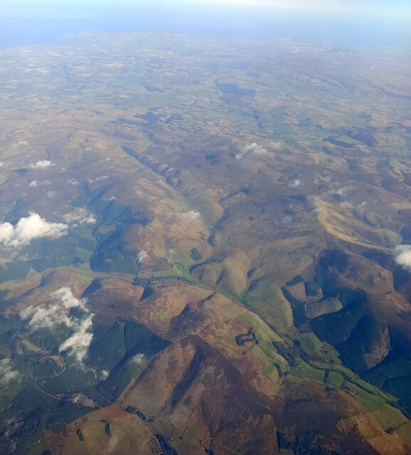
Habs Cleuch is a picturesque valley located in Peeblesshire, Scotland. Nestled amidst the rolling hills of the Scottish Borders, this valley is known for its stunning natural beauty and rich history.

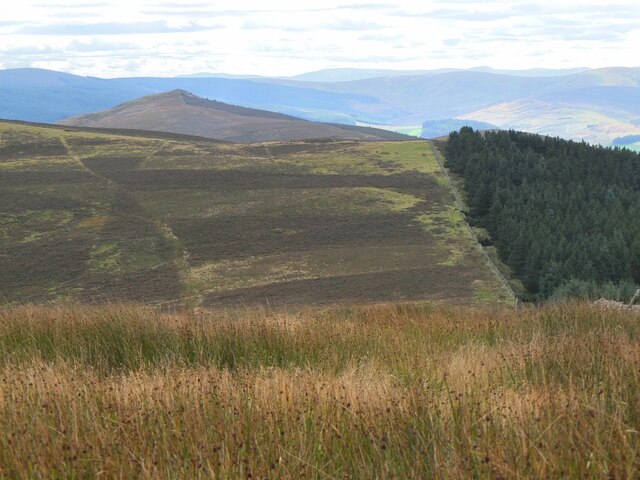
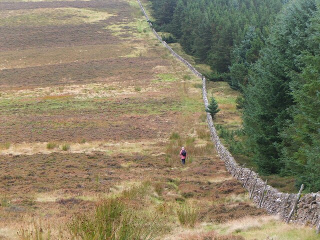
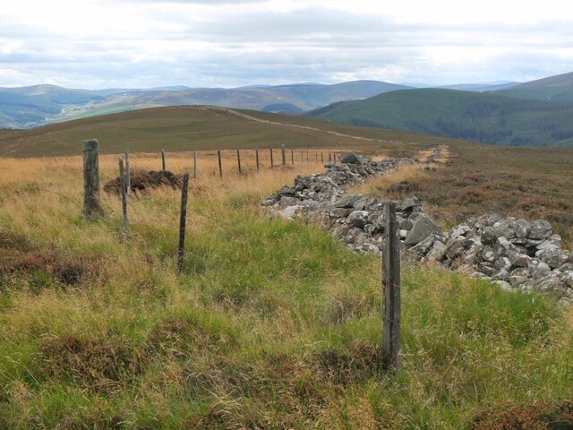
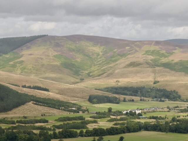
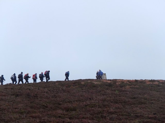
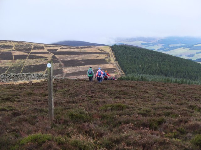
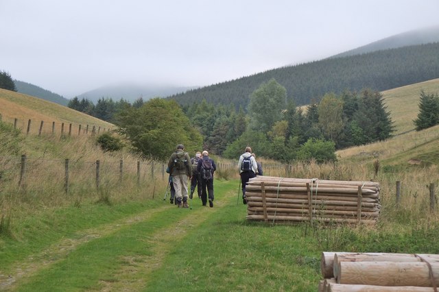
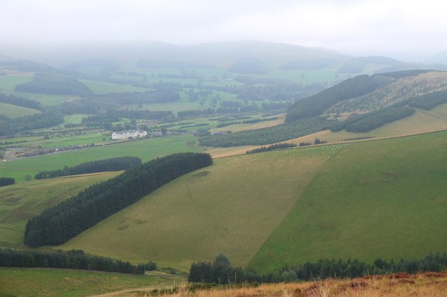
The valley is characterized by its lush greenery, with meandering streams and a variety of flora and fauna. It is a haven for nature enthusiasts, offering numerous walking trails and paths that allow visitors to explore its scenic landscapes. The valley is particularly popular among hikers and birdwatchers, as it is home to a diverse range of bird species and provides breathtaking views from its elevated points.

Habs Cleuch holds great historical significance as well. The valley was once a hub of textile manufacturing, with several mills operating along the riverbanks. These mills played a vital role in the local economy during the 19th century. While the mills are no longer in operation, remnants of their existence can still be seen, adding an intriguing touch of history to the area.

Visitors to Habs Cleuch can also enjoy its tranquil ambiance and escape the hustle and bustle of city life. The valley offers a sense of serenity and peace, making it an ideal destination for those seeking relaxation and rejuvenation.

In summary, Habs Cleuch is a stunning valley in Peeblesshire that combines natural beauty with a rich historical heritage. Whether it's exploring the scenic landscapes, immersing oneself in nature, or learning about the valley's industrial past, Habs Cleuch offers a captivating experience for all who visit.

If you have any feedback on the listing, please let us know in the comments section below.

Habs Cleuch Images

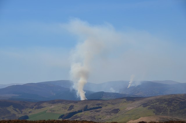
Images are sourced within 2km of 55.652677/-3.0972226 or Grid Reference NT3140. Thanks to Geograph Open Source API. All images are credited.

Lee Pen in sight The conical summit of Lee Pen (502m) marks the end of the ridge running SE between the Leithen Water and the Tweed. This view from Clog Knowe is across the intervening top of Black Knowe.
Lee Pen in sight
The conical summit of Lee Pen (502m) marks the end of the ridge running SE between the Leithen Water and the Tweed. This view from Clog Knowe is across the intervening top of Black Knowe.
Col below Clog Knowe The ridge between Clog Knowe and Black Knowe on the walk from Dunslair Heights to Lee Pen and Innerleithen. The plantation is part of Glentress Forest.
Col below Clog Knowe
The ridge between Clog Knowe and Black Knowe on the walk from Dunslair Heights to Lee Pen and Innerleithen. The plantation is part of Glentress Forest.
Stile on Black Knowe Junction of a wire fence and the ridge wall at the summit.
Stile on Black Knowe
Junction of a wire fence and the ridge wall at the summit.
Angle in the wall, Mill Rig On the ridge with Lee Burn Head in view.
Angle in the wall, Mill Rig
On the ridge with Lee Burn Head in view.
Black Knowe Hill above the Cardrona Hotel.
Black Knowe
Hill above the Cardrona Hotel.
Mouse Dean Head from the air The course of Leithen Water can be clearly seen in the foreground. East Lothian, the Firth of Forth and the North Sea are in the distance.

Taken by mobile phone, from a Prague bound flight from Edinburgh.
Mouse Dean Head from the air
The course of Leithen Water can be clearly seen in the foreground. East Lothian, the Firth of Forth and the North Sea are in the distance. Taken by mobile phone, from a Prague bound flight from Edinburgh.
Approaching the summit, Black Law Taken on a post-New-Year walk from Peebles to Innerleithen, following the undulating heathery ridge from Glentress. The summit trig point is at 538m.
Approaching the summit, Black Law
Taken on a post-New-Year walk from Peebles to Innerleithen, following the undulating heathery ridge from Glentress. The summit trig point is at 538m.
Horsburgh Heights trail on Clog Knowe The distinctively patterned hillside is showing the heather management areas on Black Knowe.
Horsburgh Heights trail on Clog Knowe
The distinctively patterned hillside is showing the heather management areas on Black Knowe.
Patterned hillside on Black Knowe Blocks of heather on a moorland that is managed to promote grouse habitat - see also <a href="https://www.geograph.org.uk/photo/1960396">NT3141 : A chequerboard hillside, Clog Knowe</a> for a view of the opposite hillside of Clog Knowe.
Patterned hillside on Black Knowe
Blocks of heather on a moorland that is managed to promote grouse habitat - see also NT3141 : A chequerboard hillside, Clog Knowe for a view of the opposite hillside of Clog Knowe.
Walkers on Black Knowe The ridge from Glentress on a post-New-Year walk to Innerleithen. There seems to be a difference of opinion as to which side of the wall is best, but we reunited further along. The flat top in the middle distance is Mill Rig with Lee Burn Head (R) and the final summit, Lee Pen, to the left.
Walkers on Black Knowe
The ridge from Glentress on a post-New-Year walk to Innerleithen. There seems to be a difference of opinion as to which side of the wall is best, but we reunited further along. The flat top in the middle distance is Mill Rig with Lee Burn Head (R) and the final summit, Lee Pen, to the left.
Walkers on Clog Knowe Tweeddale Ramblers hold an annual walk on the ridge from Peebles to Innerleithen, a fine high level route given reasonable weather.
Walkers on Clog Knowe
Tweeddale Ramblers hold an annual walk on the ridge from Peebles to Innerleithen, a fine high level route given reasonable weather.
On the ridge to Innerleithen Walkers descending Clog Knowe towards Black Knowe, the next top on the high-level route to Innerleithen. In the distance is the triangular peak of Lee Pen, the last summit before descent to Innerleithen.
On the ridge to Innerleithen
Walkers descending Clog Knowe towards Black Knowe, the next top on the high-level route to Innerleithen. In the distance is the triangular peak of Lee Pen, the last summit before descent to Innerleithen.
Muirburn smoke plumes Plumes from four different sites of heather burning on the hills between the Leithen Water and the Tweed, the nearest just over the ridge around Mill Rig, north of Lee Pen.
Muirburn smoke plumes
Plumes from four different sites of heather burning on the hills between the Leithen Water and the Tweed, the nearest just over the ridge around Mill Rig, north of Lee Pen.
Muirburn smoke near Mill Rig A plume of smoke from heather burning on the far side of the ridge running S towards Lee Pen. The viewpoint is across the valley on the ridge between Eastside Heights and Windlestraw Law. Compare with <a href="https://www.geograph.org.uk/photo/3937826">NT3140 : Muirburn smoke plumes</a>.
Muirburn smoke near Mill Rig
A plume of smoke from heather burning on the far side of the ridge running S towards Lee Pen. The viewpoint is across the valley on the ridge between Eastside Heights and Windlestraw Law. Compare with NT3140 : Muirburn smoke plumes.
Track by the Hope Burn Bundles of fence posts by the track on the way up by Hope Burn towards the plantations of Glentress Forest.
Track by the Hope Burn
Bundles of fence posts by the track on the way up by Hope Burn towards the plantations of Glentress Forest.
Bught Hill from Habs Cleuch Shank Much of the land in the middle foreground will be planted by the Forestry Commission over the next few years. The white building in the valley is the Macdonald Cardrona Hotel.
Bught Hill from Habs Cleuch Shank
Much of the land in the middle foreground will be planted by the Forestry Commission over the next few years. The white building in the valley is the Macdonald Cardrona Hotel.
Glentress from the air Mousedean is in the foreground, Glentress is surrounded by a ring of clouds.
Glentress from the air
Mousedean is in the foreground, Glentress is surrounded by a ring of clouds.
Mousedean Head Looking down the hillside at Mousedean Head to the Leithen Water valley and the B709 with Lee farm right of centre.
Mousedean Head
Looking down the hillside at Mousedean Head to the Leithen Water valley and the B709 with Lee farm right of centre.
Show me another place!

Habs Cleuch is located at Grid Ref: NT3140 (Lat: 55.652677, Lng: -3.0972226)

Unitary Authority: The Scottish Borders

Police Authority: The Lothians and Scottish Borders

What 3 Words

///encrusted.digress.tools. Near Innerleithen, Scottish Borders

Related Wikis

Nether Horsburgh Castle

Nether Horsburgh Castle is a ruined tower house near Cardrona, in the Scottish Borders, in the former county of Peebleshire. It is situated at the back...

Cardrona, Scottish Borders

Cardrona is a village on the A72 and B7062, between Peebles and Innerleithen, in the Scottish Borders area of Scotland. Places nearby include Glentress...

Cardrona railway station

Cardrona railway station served the village of Cardrona, Scottish Borders, Scotland from 1864 to 1962 on the Peebles Railway. == History == The station...

Kirkburn, Scottish Borders

Kirkburn is a village on the B7062, close to Peebles and the River Tweed, in the Scottish Borders area of Scotland, at the edge of the Cardrona Forest...

Have you been to Habs Cleuch?

Leave your review of Habs Cleuch below (or comments, questions and feedback).