Yewdale Fell Side

Downs, Moorland in Lancashire South Lakeland

England

Yewdale Fell Side

Slope with minor rock outcrops The near slope is close to the feature named on OS maps as Flat Bield and is separated from the camera location by a steep stream groove. The valley beyond it is Red Dell.
The sunlit rockface at the centre of the image and beyond Red Dell is Kennel Crag, sometimes known as Kernel Crag.
Slope with minor rock outcrops Credit: Trevor Littlewood

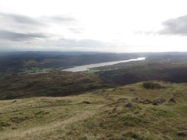
Yewdale Fell Side is a picturesque area located in Lancashire, England. Situated in the northern part of the county, it encompasses a diverse landscape of downs and moorland. The area is characterized by rolling hills, vast open spaces, and stunning panoramic views, making it a popular destination for nature lovers and outdoor enthusiasts.

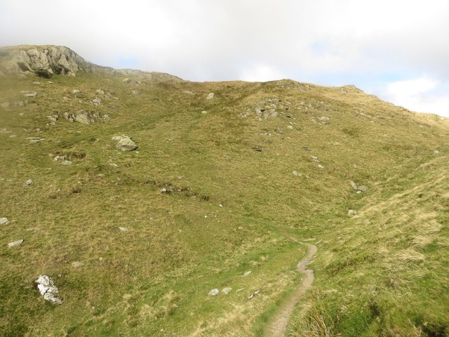
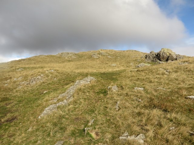
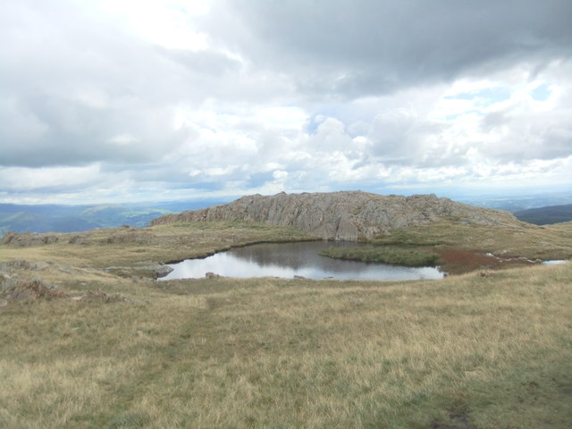
The downs of Yewdale Fell Side are marked by gentle slopes and grassy meadows, providing ample opportunities for walking, picnicking, and enjoying the peaceful surroundings. The area is home to a variety of plant and animal species, including heather, gorse, and numerous bird species, making it an ideal location for birdwatching and nature photography.

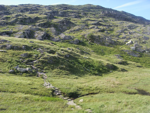
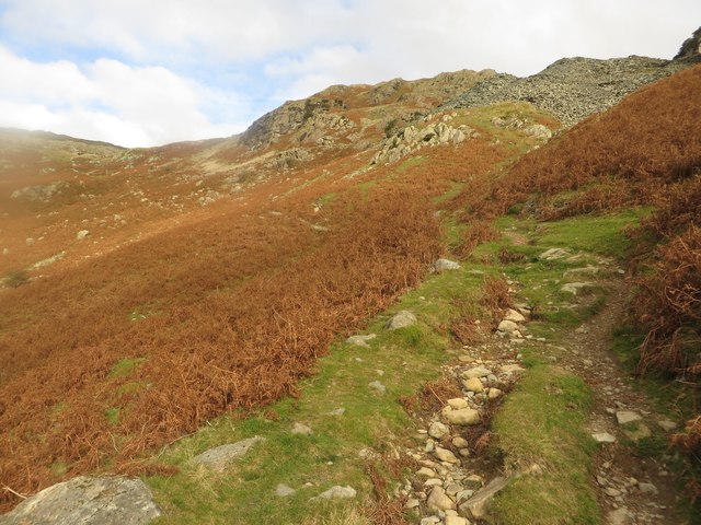
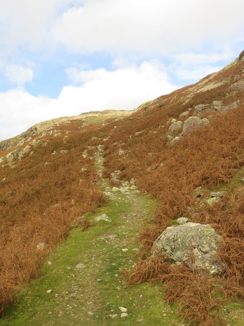
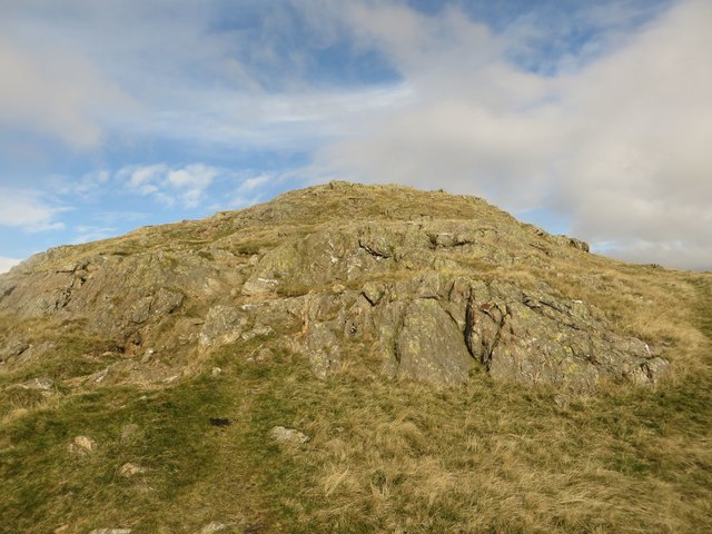
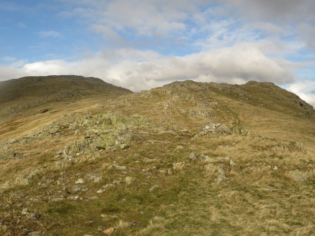
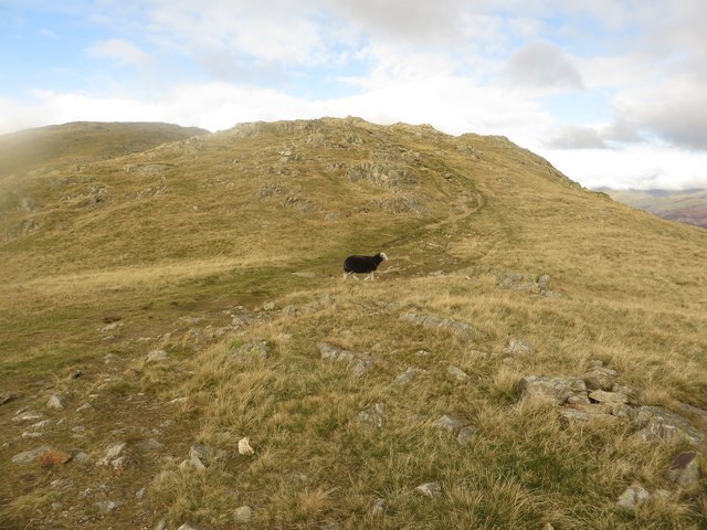
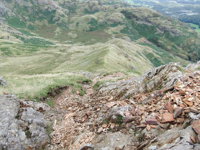
On the other hand, the moorland of Yewdale Fell Side offers a more rugged and wild terrain. Here, visitors can explore vast expanses of heather-covered hills, interspersed with rocky outcrops and peat bogs. The moorland is a haven for wildlife, with sightings of red grouse, curlews, and hares being common.

Yewdale Fell Side also boasts several walking trails and footpaths, allowing visitors to fully immerse themselves in the natural beauty of the area. These trails range from easy strolls suitable for families to more challenging hikes for experienced walkers, offering something for everyone.

In addition to its natural beauty, Yewdale Fell Side is also steeped in history. The area is dotted with ancient ruins, including stone circles and burial mounds, providing a glimpse into its rich past.

Overall, Yewdale Fell Side in Lancashire is a stunning area that combines the tranquility of the downs with the ruggedness of the moorland, offering visitors a unique and memorable experience in the heart of nature.

If you have any feedback on the listing, please let us know in the comments section below.

Yewdale Fell Side Images

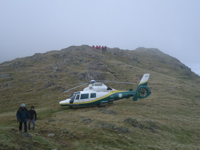
Images are sourced within 2km of 54.387532/-3.0639338 or Grid Reference SD3199. Thanks to Geograph Open Source API. All images are credited.

Slope with minor rock outcrops The near slope is close to the feature named on OS maps as Flat Bield and is separated from the camera location by a steep stream groove. The valley beyond it is Red Dell.
The sunlit rockface at the centre of the image and beyond Red Dell is Kennel Crag, sometimes known as Kernel Crag.
Slope with minor rock outcrops
The near slope is close to the feature named on OS maps as Flat Bield and is separated from the camera location by a steep stream groove. The valley beyond it is Red Dell. The sunlit rockface at the centre of the image and beyond Red Dell is Kennel Crag, sometimes known as Kernel Crag.
Shallow pool on ridge rising to Wetherlam A broad, lengthy ridge which in its higher reach is fairly featureless rises generally northwards to the Wetherlam summit. There are minor knolls and a tarn or two; this is the more attractive of them.
Helvellyn and Fairfield and their satellite mountains are in the distance.
Shallow pool on ridge rising to Wetherlam
A broad, lengthy ridge which in its higher reach is fairly featureless rises generally northwards to the Wetherlam summit. There are minor knolls and a tarn or two; this is the more attractive of them. Helvellyn and Fairfield and their satellite mountains are in the distance.
The Air Ambulance on Wetherlam The Coniston Mountain Rescue Team (MRT) were training at base when the call came for a fell-runner who had slipped on descent, injured his ankle, and could no longer stand. The team attended and carried him down below the cloud. Fortunately a helicopter was available to transport the casualty to Furness General Hospital.
The Air Ambulance on Wetherlam
The Coniston Mountain Rescue Team (MRT) were training at base when the call came for a fell-runner who had slipped on descent, injured his ankle, and could no longer stand. The team attended and carried him down below the cloud. Fortunately a helicopter was available to transport the casualty to Furness General Hospital.
Path heading up to Wetherlam From Hole Rake the path heading up to Wetherlam
Path heading up to Wetherlam
From Hole Rake the path heading up to Wetherlam
Footpath to Hole Rake Looking along the footpath which leads from Coppermines Valley up the fellside and to Hole Rake.
Footpath to Hole Rake
Looking along the footpath which leads from Coppermines Valley up the fellside and to Hole Rake.
Footpath above Coppermines Valley One of the paths which climbs the hillside on eastern side of the Coppermines Valley.
Footpath above Coppermines Valley
One of the paths which climbs the hillside on eastern side of the Coppermines Valley.
Depression at Hole Rake A footpath crosses the depression at Hole rake before carrying on upwards towards the top of Wetherlam. The depression looks very much like a former stream bed.
Depression at Hole Rake
A footpath crosses the depression at Hole rake before carrying on upwards towards the top of Wetherlam. The depression looks very much like a former stream bed.
Footpath towards Red Gill Head Moss Looking up a grassy slope to the south of Red Gill Head Moss.
Footpath towards Red Gill Head Moss
Looking up a grassy slope to the south of Red Gill Head Moss.
View towards Coniston Water Looking back down the fell from the approach to Red Gill Head Moss with Coniston Water in the distance.
View towards Coniston Water
Looking back down the fell from the approach to Red Gill Head Moss with Coniston Water in the distance.
Outcrop at Red Gill Head Moss An outcrop of rock to be negotiated on the approach to Red Gill Head Moss and Wetherlam from Hole Rake.
Outcrop at Red Gill Head Moss
An outcrop of rock to be negotiated on the approach to Red Gill Head Moss and Wetherlam from Hole Rake.
The way ahead to Wetherlam Looking along the route ahead from Red Gill Head Moss to Wetherlam.
The way ahead to Wetherlam
Looking along the route ahead from Red Gill Head Moss to Wetherlam.
The path to Wetherlam Looking along the footpath which joins Red Gill Head Moss to the top of Wetherlam.
The path to Wetherlam
Looking along the footpath which joins Red Gill Head Moss to the top of Wetherlam.
Abandoned quarry workings Old workings at Low Blue Quarry (disused).
Abandoned quarry workings
Old workings at Low Blue Quarry (disused).
Wetherlam Tarn At the top of Steel Edge.
Wetherlam Tarn
At the top of Steel Edge.
Looking Down Steel Edge Easier to ascend than descend!
Looking Down Steel Edge
Easier to ascend than descend!
Path heading down to Hole Rake From Wetherlam the path heading down to Hole Rake
Path heading down to Hole Rake
From Wetherlam the path heading down to Hole Rake
Footpath above Lad Stones Looking along the footpath above Lad Stones on its way to the top of Wetherlam.
Footpath above Lad Stones
Looking along the footpath above Lad Stones on its way to the top of Wetherlam.
Small tarn below Wetherlam The 1st of 3 small tarns passed on the path leading across the top of Lad Stones to Wetherlam. This one nestles in a depression between craggy lumps on the fellside.
Small tarn below Wetherlam
The 1st of 3 small tarns passed on the path leading across the top of Lad Stones to Wetherlam. This one nestles in a depression between craggy lumps on the fellside.
Show me another place!

Yewdale Fell Side is located at Grid Ref: SD3199 (Lat: 54.387532, Lng: -3.0639338)

Administrative County: Cumbria

District: South Lakeland

Police Authority: Cumbria

What 3 Words

///subtitle.moats.overhear. Near Ambleside, Cumbria

Related Wikis

Holme Fell

Holme Fell or Holm Fell is a fell in the Lake District in Cumbria, England. It is located between Coniston Water and Little Langdale, almost isolated from...

Yew Tree Tarn

Yew Tree Tarn is a small lake in the English Lake District situated in between the towns of Ambleside and Coniston. The tarn was formed when the local...

Tarn Hows

Tarn Hows is an area of the Lake District National Park in North West England, It contains a picturesque tarn, approximately 2 miles (3.2 km) northeast...

Ruskin Museum

The Ruskin Museum is a small local museum in Coniston, Cumbria, northern England. It was established in 1901 by W. G. Collingwood, an artist and antiquarian...

Nearby Amenities

Located within 500m of 54.387532,-3.0639338
High Yewdale Farm
Agricultural: farm
Source: survey
Lat/Long: 54.3884939/-3.0564914
Barrier: kissing_gate
Source: GPS Survey
Lat/Long: 54.3862969/-3.0567535
Yewdale
Place: locality
Lat/Long: 54.3839048/-3.0613998
Hiking: yes
Information: guidepost
Source: GPS Survey
Tourism: information
Lat/Long: 54.3896846/-3.0574621
Hiking: yes
Information: guidepost
Source: GPS Survey
Tourism: information
Lat/Long: 54.3881759/-3.0565871
Barrier: kissing_gate
Source: GPS Survey
Lat/Long: 54.3881814/-3.0566043
Hiking: yes
Information: guidepost
Source: GPS Survey
Tourism: information
Lat/Long: 54.3833909/-3.0629338
Hiking: yes
Information: guidepost
Source: GPS Survey
Tourism: information
Lat/Long: 54.3833425/-3.0628131
Hiking: yes
Information: guidepost
Source: GPS Survey
Tourism: information
Lat/Long: 54.3865617/-3.0609423
Barrier: cattle_grid
Lat/Long: 54.3910225/-3.0615974
Grit Bin
Lat/Long: 54.3918905/-3.0626777
The data included in this document is from www.openstreetmap.org. The data is made available under ODbL.

Have you been to Yewdale Fell Side?

Leave your review of Yewdale Fell Side below (or comments, questions and feedback).