High Wood

Wood, Forest in Lancashire South Lakeland

England

High Wood

Bridgefield Farm Across the River Crake from Lowick.
Bridgefield Farm Credit: Eirian Evans

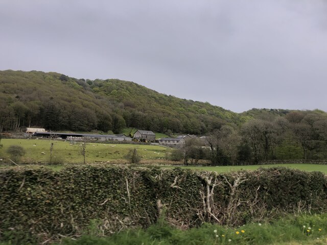
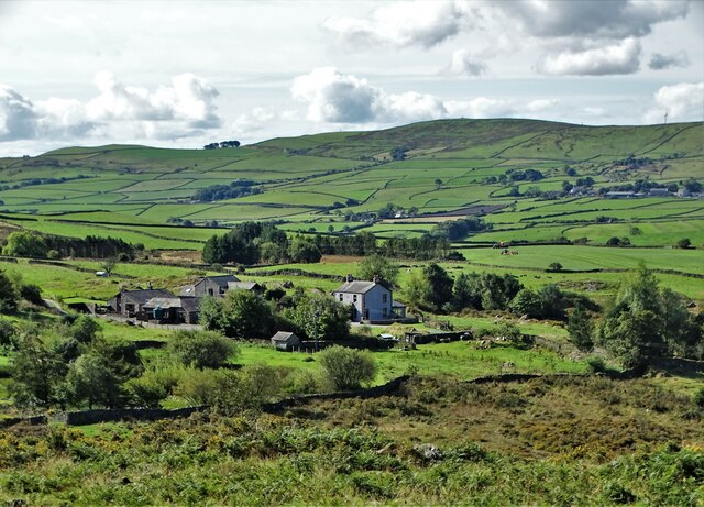
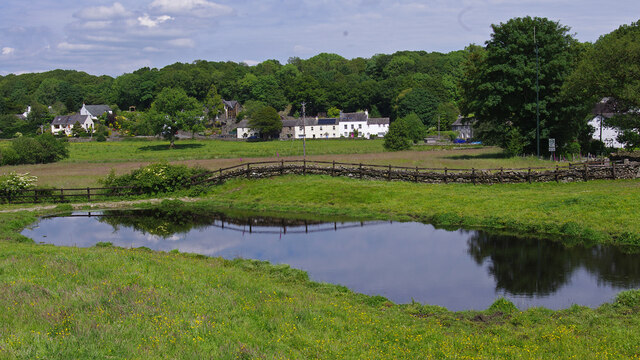
High Wood is a small village located in the county of Lancashire, England. Nestled amidst the picturesque landscape, it is surrounded by dense woodlands, earning it the name High Wood or High Forest. The village is situated in the northern region of Lancashire, approximately 8 miles northeast of the city of Lancaster.

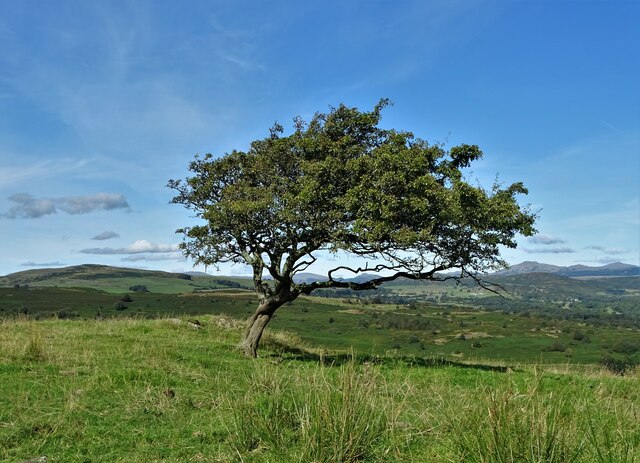
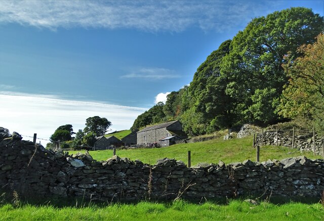
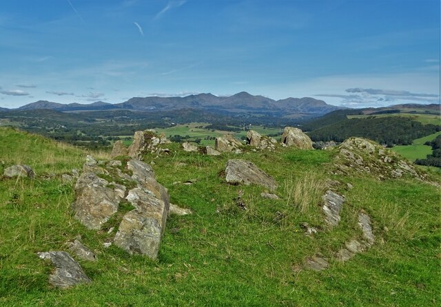
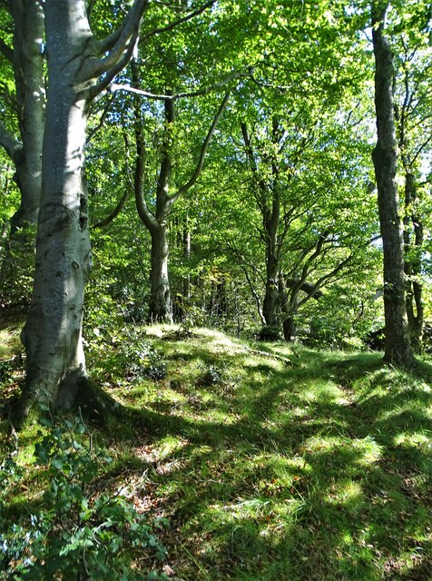
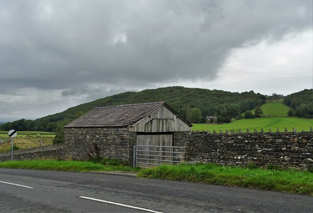
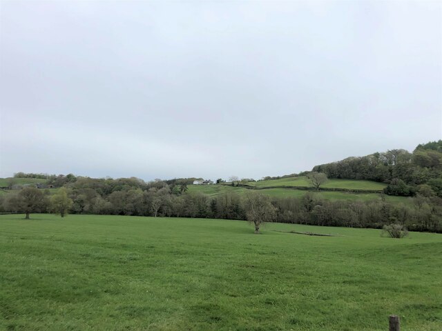
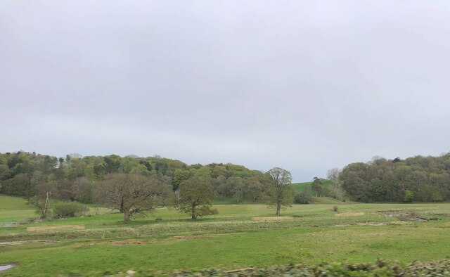
High Wood is known for its stunning natural beauty and tranquil atmosphere. The area is abundant with tall, majestic trees that create a dense forest environment, providing a haven for various wildlife. The woodlands are home to a diverse range of flora and fauna, including oak, beech, and birch trees, as well as deer, squirrels, and a variety of bird species.

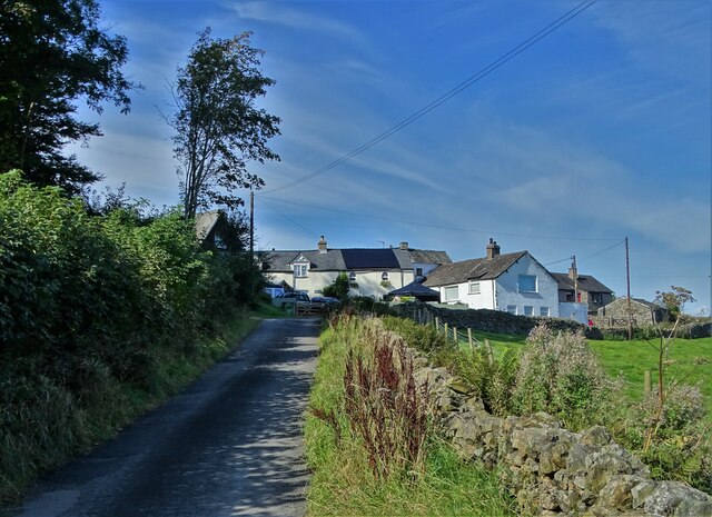
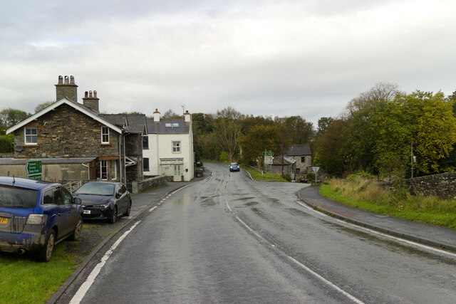
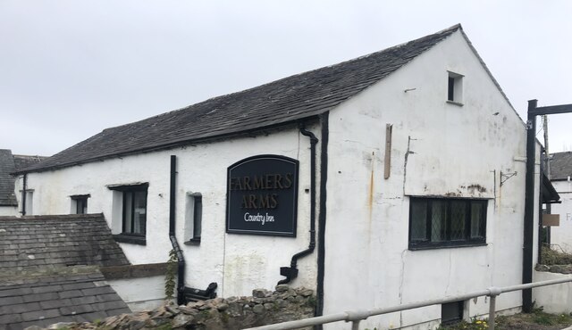
The village itself is a close-knit community, with a small population of residents who primarily work in nearby towns or engage in agriculture. The village is characterized by charming cottages, some of which date back several centuries, giving visitors a glimpse into the region's rich history.

High Wood offers numerous opportunities for outdoor activities, such as hiking, birdwatching, and nature photography. The woodlands provide a peaceful retreat for those seeking solace in nature, with several well-marked trails and picnic areas for visitors to enjoy.

Overall, High Wood, Lancashire, is a hidden gem that showcases the beauty of England's woodlands. Its serene atmosphere, rich biodiversity, and historical charm make it a must-visit destination for nature enthusiasts and those seeking a peaceful getaway.

If you have any feedback on the listing, please let us know in the comments section below.
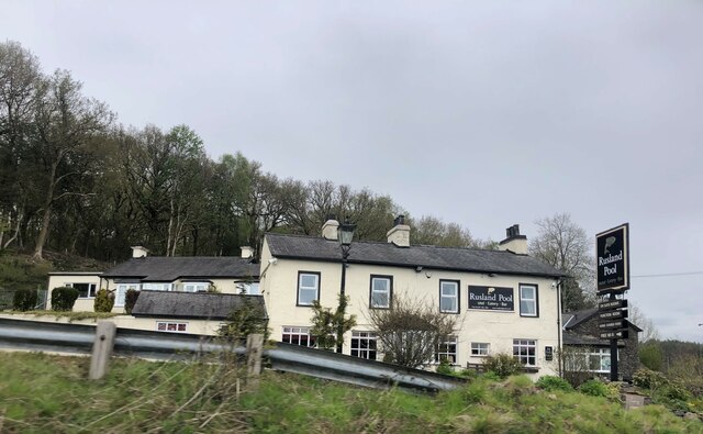
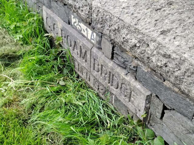
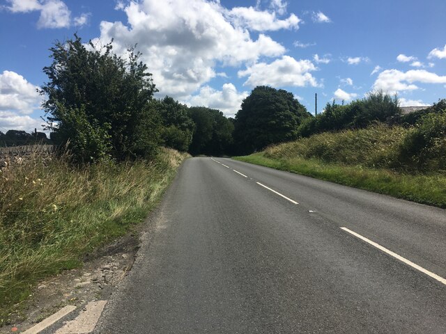
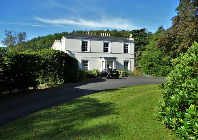
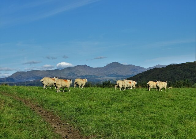
High Wood Images

Images are sourced within 2km of 54.253912/-3.061918 or Grid Reference SD3084. Thanks to Geograph Open Source API. All images are credited.

Bridgefield Farm Across the River Crake from Lowick.
Bridgefield Farm
Across the River Crake from Lowick.
The hamlet of Wood End
Bent hawthorn tree at Lads Head
A view of Cold Yeat Farm
High Scathwaite Farm
At Lads Head looking north to The Lake District hills
A Sunny September Morning Entering Lads Head Plantation
A Sunny September Morning
Entering Lads Head Plantation
Farm building at Lowick Green
The Farmer's Arms Wayside public house at Spark Bridge
The Farmer's Arms
Wayside public house at Spark Bridge
Pasture south of Spark Bridge The River Crake runs left to right with trees along its bank at the far side of this field.
Pasture south of Spark Bridge
The River Crake runs left to right with trees along its bank at the far side of this field.
Farmland at Penny Bridge The River Crake runs across this farmland short of its confluence with the River Leven
Farmland at Penny Bridge
The River Crake runs across this farmland short of its confluence with the River Leven
Rusland Pool Hotel Just above the A590, west of Haverthwaite
Rusland Pool Hotel
Just above the A590, west of Haverthwaite
Old Bridge Marker on Roam Bridge, Colton Bridge Marker set in the north parapet of Roam Bridge, Colton Beck, on the A590. Colton parish. Inscribed C C ROAM BRIDGE / WIDENED 1936.

Milestone Society National ID: LA_COLTON02br
Old Bridge Marker on Roam Bridge, Colton
Bridge Marker set in the north parapet of Roam Bridge, Colton Beck, on the A590. Colton parish. Inscribed C C ROAM BRIDGE / WIDENED 1936. Milestone Society National ID: LA_COLTON02br
Pond at Old Hall Farm Compare with a 2006 view <a href="https://www.geograph.org.uk/photo/267837">SD3285 : Bouth</a>
Pond at Old Hall Farm
Compare with a 2006 view SD3285 : Bouth
A5092 near Lowick Green
Summer Hill A Georgian mansion near Spark Bridge, Cumbria
Summer Hill
A Georgian mansion near Spark Bridge, Cumbria
Sheep pasture near Wood End
Show me another place!

High Wood is located at Grid Ref: SD3084 (Lat: 54.253912, Lng: -3.061918)

Administrative County: Cumbria

District: South Lakeland

Police Authority: Cumbria

What 3 Words

///slant.starring.genius. Near Ulverston, Cumbria

Related Wikis

Spark Bridge

Spark Bridge is a former mill village in Cumbria, England, within the Lake District National Park, and within the historic boundaries of Lancashire. The...

Colton, Cumbria

Colton is a village and civil parish in the South Lakeland district of Cumbria, England. In the 2001 census the parish had a population of 765, decreasing...

Holy Trinity Church, Colton

Holy Trinity Church is located to the east of the village of Colton, Cumbria, England. It is an active Anglican parish church in the deanery of Furness...

Lowick, Cumbria

Lowick is a village and civil parish in the South Lakeland district of the English county of Cumbria. Prior to 1 April 1974 it was part of Lancashire,...

Nearby Amenities

Located within 500m of 54.253912,-3.061918
Spark Bridge
Place: village
Source: npe
Wikidata: Q7573625
Lat/Long: 54.2549619/-3.0674055
Bus Stop
Spark Bridge (S bound)
Naptan AtcoCode: 090079211115
Naptan Bearing: S
Naptan CommonName: Mill View (S bound)
Naptan Indicator: opp
Naptan Landmark: Mill View
Naptan NaptanCode: cumdgwpa
Naptan Street: No name
Naptan Verified: no
Shelter: yes
Source: naptan_import
Lat/Long: 54.254801/-3.0662268
Bus Stop
Spark Bridge (N bound)
Local Ref: AT
Naptan AtcoCode: 090079213506
Naptan Bearing: N
Naptan BusStopType: CUS
Naptan CommonName: Mill View (N bound)
Naptan Indicator: at
Naptan Landmark: Mill View
Naptan NaptanCode: cumdgwtd
Naptan Street: No name
Naptan Verified: no
Source: naptan_import
Lat/Long: 54.2549396/-3.066339
Telephone
Defibrillator
Booth: KX100
Covered: booth
Defibrillator Location: inside phone box in Spark Bridge
Emergency: defibrillator
Man Made: telephone_box
Lat/Long: 54.2549553/-3.0668823
Post Box
Collection Times: Mo-Fr 12:00; Sa 09:00
Operator: Royal Mail
Ref: LA12 63
Royal Cypher: EIIR
Royal Cypher Wikidata: Q33102113
Lat/Long: 54.2549433/-3.0669126
Place: locality
Whitewater: egress
Lat/Long: 54.2548749/-3.0659431
Generator Method: photovoltaic
Generator Output Electricity: yes
Generator Source: solar
Generator Type: solar_photovoltaic_panel
Location: roof
Power: generator
Lat/Long: 54.2547674/-3.0679009
Generator Method: photovoltaic
Generator Output Electricity: yes
Generator Source: solar
Generator Type: solar_photovoltaic_panel
Location: roof
Power: generator
Lat/Long: 54.2547909/-3.0680538
Generator Method: photovoltaic
Generator Output Electricity: yes
Generator Source: solar
Generator Type: solar_photovoltaic_panel
Location: roof
Power: generator
Lat/Long: 54.2541313/-3.0664472
Generator Method: photovoltaic
Generator Output Electricity: yes
Generator Source: solar
Generator Type: solar_photovoltaic_panel
Location: roof
Power: generator
Lat/Long: 54.2542347/-3.0666483
Generator Method: photovoltaic
Generator Output Electricity: yes
Generator Source: solar
Generator Type: solar_photovoltaic_panel
Location: roof
Power: generator
Lat/Long: 54.2542958/-3.0666564
Power: pole
Lat/Long: 54.2547404/-3.0559846
Power: pole
Lat/Long: 54.2548473/-3.0578766
Power: pole
Lat/Long: 54.2549361/-3.0594809
Power: pole
Lat/Long: 54.2550056/-3.0609522
Power: pole
Lat/Long: 54.2550764/-3.0620883
Power: pole
Lat/Long: 54.2551277/-3.0630557
Power: pole
Lat/Long: 54.256369/-3.0647718
Power: pole
Lat/Long: 54.2565398/-3.0657011
Power: pole
Lat/Long: 54.2568869/-3.0659935
Power: pole
Lat/Long: 54.2572604/-3.0662715
Power: pole
Lat/Long: 54.254764/-3.0581
Power: pole
Lat/Long: 54.2542322/-3.0595142
Power: pole
Lat/Long: 54.2513328/-3.0571635
Power: pole
Lat/Long: 54.2522632/-3.0576151
Power: pole
Lat/Long: 54.253399/-3.0581356
Power: pole
Lat/Long: 54.2560747/-3.0652079
Power: pole
Lat/Long: 54.2569022/-3.0639363
Power: pole
Lat/Long: 54.2577477/-3.0626457
Power: pole
Lat/Long: 54.2584017/-3.0616712
The data included in this document is from www.openstreetmap.org. The data is made available under ODbL.

Have you been to High Wood?

Leave your review of High Wood below (or comments, questions and feedback).