Spark Bridge

Settlement in Lancashire South Lakeland

England

Spark Bridge

Bridgefield Farm Across the River Crake from Lowick.
Bridgefield Farm Credit: Eirian Evans

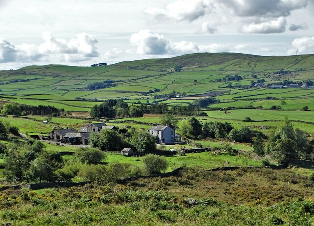
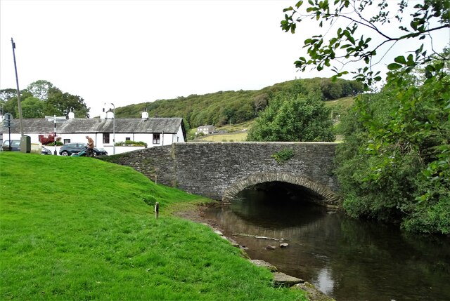
Spark Bridge is a small village located in the county of Lancashire, England. Situated in the southern part of the Lake District National Park, it lies within the Lake District Peninsula, approximately six miles north of Ulverston. The village is nestled on the banks of the River Crake, which adds to its picturesque charm.

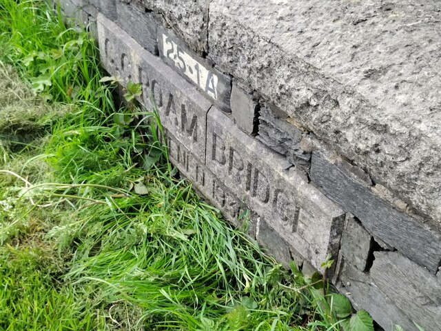
Spark Bridge is known for its historic significance, as it was once an important crossing point over the River Crake. The village derives its name from a stone bridge that was built in the 18th century, replacing an earlier wooden construction. Today, the bridge remains a focal point, showcasing the village's rich heritage.

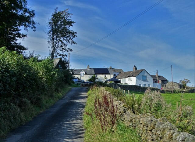
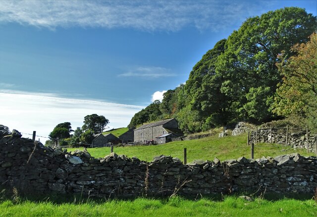
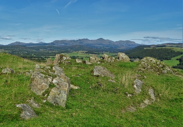
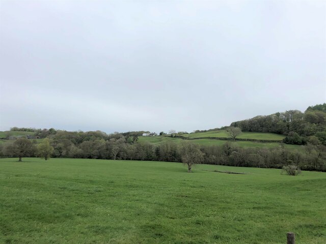
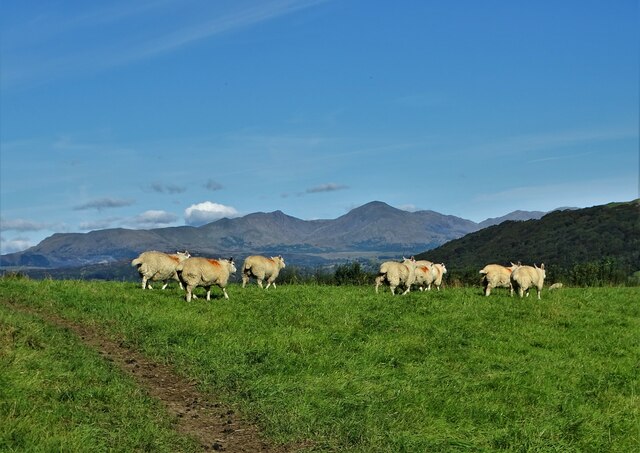
The village itself is relatively small, with a population of around 300 residents. It primarily consists of traditional stone cottages, giving it a quintessentially English village feel. The surrounding landscape is characterized by rolling hills, lush green fields, and a backdrop of the Lake District fells.

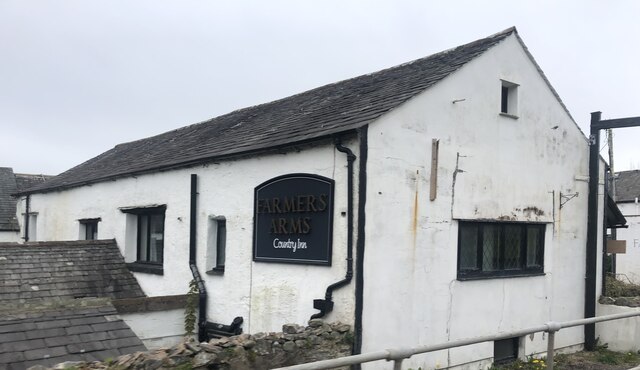
Despite its size, Spark Bridge offers a range of amenities for its residents and visitors. There is a local pub, The Royal Oak, which dates back to the 18th century and serves as a hub for the community. The village also has a convenience store, a post office, and a primary school.

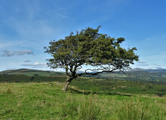
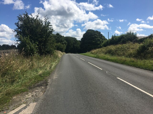
Spark Bridge's location within the Lake District National Park makes it a popular destination for outdoor enthusiasts. It provides easy access to hiking trails, cycling routes, and water activities on nearby Coniston Water. The village's tranquil setting and natural beauty make it an ideal place for those seeking a peaceful retreat in the heart of the Lake District.

If you have any feedback on the listing, please let us know in the comments section below.
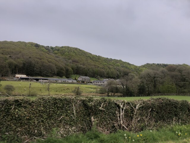
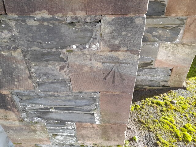
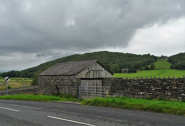
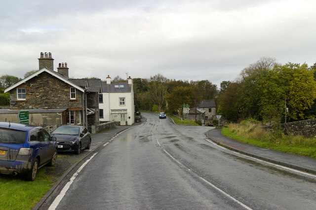
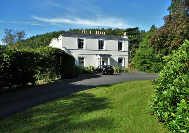
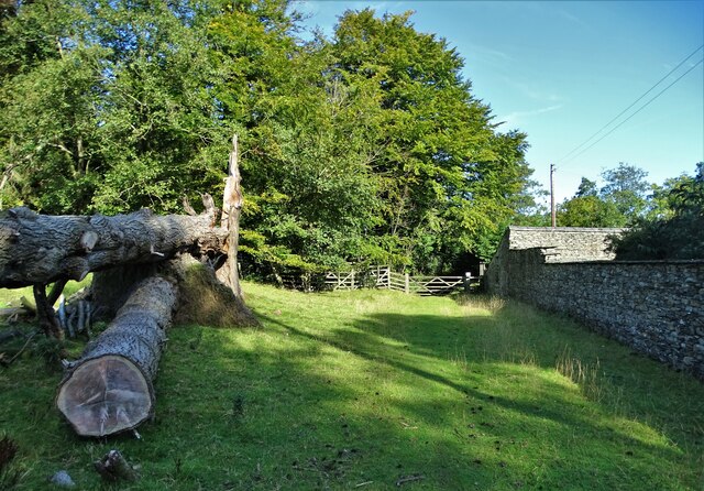
Spark Bridge Images

Images are sourced within 2km of 54.254311/-3.069826 or Grid Reference SD3084. Thanks to Geograph Open Source API. All images are credited.

Bridgefield Farm Across the River Crake from Lowick.
Bridgefield Farm
Across the River Crake from Lowick.
Ordnance Survey Cut Mark This OS cut mark can be found on the south angle of St Luke's Church. It marks a point 54.979m above mean sea level.
Ordnance Survey Cut Mark
This OS cut mark can be found on the south angle of St Luke's Church. It marks a point 54.979m above mean sea level.
The hamlet of Wood End
Bent hawthorn tree at Lads Head
A view of Cold Yeat Farm
High Scathwaite Farm
At Lads Head looking north to The Lake District hills
A Sunny September Morning Entering Lads Head Plantation
A Sunny September Morning
Entering Lads Head Plantation
Farm building at Lowick Green
The Farmer's Arms Wayside public house at Spark Bridge
The Farmer's Arms
Wayside public house at Spark Bridge
Pasture south of Spark Bridge The River Crake runs left to right with trees along its bank at the far side of this field.
Pasture south of Spark Bridge
The River Crake runs left to right with trees along its bank at the far side of this field.
Old Bridge Marker on Roam Bridge, Colton Bridge Marker set in the north parapet of Roam Bridge, Colton Beck, on the A590. Colton parish. Inscribed C C ROAM BRIDGE / WIDENED 1936.

Milestone Society National ID: LA_COLTON02br
Old Bridge Marker on Roam Bridge, Colton
Bridge Marker set in the north parapet of Roam Bridge, Colton Beck, on the A590. Colton parish. Inscribed C C ROAM BRIDGE / WIDENED 1936. Milestone Society National ID: LA_COLTON02br
A5092 near Lowick Green
Summer Hill A Georgian mansion near Spark Bridge, Cumbria
Summer Hill
A Georgian mansion near Spark Bridge, Cumbria
Sheep pasture near Wood End
Footpath at Summer Hill Passing west of the small estate with its Georgian country house
Footpath at Summer Hill
Passing west of the small estate with its Georgian country house
Spark Bridge The old bridge carries traffic over the River Crake.
Spark Bridge
The old bridge carries traffic over the River Crake.
Show me another place!

Spark Bridge is located at Grid Ref: SD3084 (Lat: 54.254311, Lng: -3.069826)

Administrative County: Cumbria

District: South Lakeland

Police Authority: Cumbria

What 3 Words

///prestige.sculpting.poetic. Near Ulverston, Cumbria

Related Wikis

Spark Bridge

Spark Bridge is a former mill village in Cumbria, England, within the Lake District National Park, and within the historic boundaries of Lancashire. The...

Colton, Cumbria

Colton is a village and civil parish in the South Lakeland district of Cumbria, England. In the 2001 census the parish had a population of 765, decreasing...

Lowick, Cumbria

Lowick is a village and civil parish in the South Lakeland district of the English county of Cumbria. Prior to 1 April 1974 it was part of Lancashire,...

Holy Trinity Church, Colton

Holy Trinity Church is located to the east of the village of Colton, Cumbria, England. It is an active Anglican parish church in the deanery of Furness...

Nearby Amenities

Located within 500m of 54.254311,-3.069826
Spark Bridge
Place: village
Source: npe
Wikidata: Q7573625
Lat/Long: 54.2549619/-3.0674055
Bus Stop
Spark Bridge (S bound)
Naptan AtcoCode: 090079211115
Naptan Bearing: S
Naptan CommonName: Mill View (S bound)
Naptan Indicator: opp
Naptan Landmark: Mill View
Naptan NaptanCode: cumdgwpa
Naptan Street: No name
Naptan Verified: no
Shelter: yes
Source: naptan_import
Lat/Long: 54.254801/-3.0662268
Bus Stop
Spark Bridge (N bound)
Local Ref: AT
Naptan AtcoCode: 090079213506
Naptan Bearing: N
Naptan BusStopType: CUS
Naptan CommonName: Mill View (N bound)
Naptan Indicator: at
Naptan Landmark: Mill View
Naptan NaptanCode: cumdgwtd
Naptan Street: No name
Naptan Verified: no
Source: naptan_import
Lat/Long: 54.2549396/-3.066339
Telephone
Defibrillator
Booth: KX100
Covered: booth
Defibrillator Location: inside phone box in Spark Bridge
Emergency: defibrillator
Man Made: telephone_box
Lat/Long: 54.2549553/-3.0668823
Post Box
Collection Times: Mo-Fr 12:00; Sa 09:00
Operator: Royal Mail
Ref: LA12 63
Royal Cypher: EIIR
Royal Cypher Wikidata: Q33102113
Lat/Long: 54.2549433/-3.0669126
Place: locality
Whitewater: egress
Lat/Long: 54.2548749/-3.0659431
Generator Method: photovoltaic
Generator Output Electricity: yes
Generator Source: solar
Generator Type: solar_photovoltaic_panel
Location: roof
Power: generator
Lat/Long: 54.2555376/-3.0702586
Generator Method: photovoltaic
Generator Output Electricity: yes
Generator Source: solar
Generator Type: solar_photovoltaic_panel
Location: roof
Power: generator
Lat/Long: 54.2555039/-3.0703028
Generator Method: photovoltaic
Generator Output Electricity: yes
Generator Source: solar
Generator Type: solar_photovoltaic_panel
Location: roof
Power: generator
Lat/Long: 54.2554686/-3.0703672
Generator Method: photovoltaic
Generator Output Electricity: yes
Generator Source: solar
Generator Type: solar_photovoltaic_panel
Location: roof
Power: generator
Lat/Long: 54.2547674/-3.0679009
Generator Method: photovoltaic
Generator Output Electricity: yes
Generator Source: solar
Generator Type: solar_photovoltaic_panel
Location: roof
Power: generator
Lat/Long: 54.2547909/-3.0680538
Generator Method: photovoltaic
Generator Output Electricity: yes
Generator Source: solar
Generator Type: solar_photovoltaic_panel
Location: roof
Power: generator
Lat/Long: 54.2541313/-3.0664472
Generator Method: photovoltaic
Generator Output Electricity: yes
Generator Source: solar
Generator Type: solar_photovoltaic_panel
Location: roof
Power: generator
Lat/Long: 54.2542347/-3.0666483
Generator Method: photovoltaic
Generator Output Electricity: yes
Generator Source: solar
Generator Type: solar_photovoltaic_panel
Location: roof
Power: generator
Lat/Long: 54.2542958/-3.0666564
Defibrillator
Access: yes
Defibrillator Location: On the outside wall of the pub facing the road.
Emergency: defibrillator
Indoor: no
Lat/Long: 54.2551508/-3.0728949
Power: pole
Lat/Long: 54.2551277/-3.0630557
Power: pole
Lat/Long: 54.256369/-3.0647718
Power: pole
Lat/Long: 54.2565398/-3.0657011
Power: pole
Lat/Long: 54.2568869/-3.0659935
Power: pole
Lat/Long: 54.2572604/-3.0662715
Power: pole
Lat/Long: 54.2560747/-3.0652079
Power: pole
Lat/Long: 54.2569022/-3.0639363
Power: pole
Lat/Long: 54.2561642/-3.0757171
Power: pole
Lat/Long: 54.2559893/-3.075332
Power: pole
Lat/Long: 54.2527513/-3.0717454
Power: pole
Lat/Long: 54.2517334/-3.0711892
Power: pole
Lat/Long: 54.2507183/-3.0706212
Power: pole
Lat/Long: 54.2499518/-3.0701862
The data included in this document is from www.openstreetmap.org. The data is made available under ODbL.

Have you been to Spark Bridge?

Leave your review of Spark Bridge below (or comments, questions and feedback).