Hag Wood

Wood, Forest in Westmorland South Lakeland

England

Hag Wood

Blea Tarn on a sunny and calm September afternoon Looking north across Blea Tarn, with the Langdale Pikes in the distance to the left, and Side Pike central.
Although Side Pike appears nearly as high, it is much closer than the Langdales. 

Side Pike (<a href="https://www.geograph.org.uk/gridref/NY2905">NY2905</a>) is just under 1km from the camera, and 224m above sea level, and only 34m above my position on the 190m contour. Pike of Stickle (<a href="https://www.geograph.org.uk/gridref/NY2707">NY2707</a>) on the left is 3.5km distant, and 709m asl, Harrison Stickle (<a href="https://www.geograph.org.uk/gridref/NY2807">NY2807</a>) is 3.3km distant and 736m asl.
Blea Tarn on a sunny and calm September afternoon Credit: Rich Tea

Hag Wood, located in Westmorland, is a picturesque forest known for its natural beauty and diverse ecosystem. Stretching across an area of approximately 500 acres, this wood is a haven for nature enthusiasts and outdoor lovers.

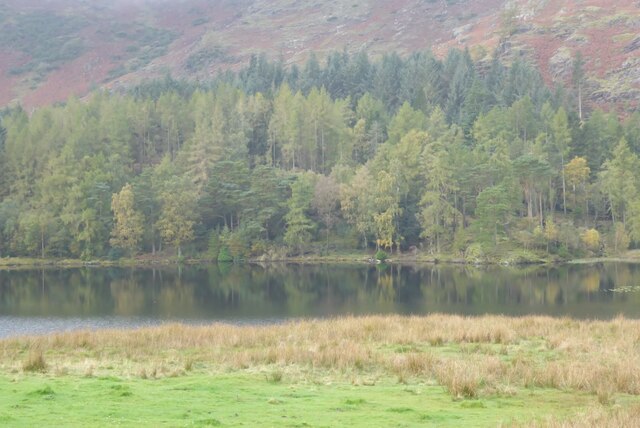
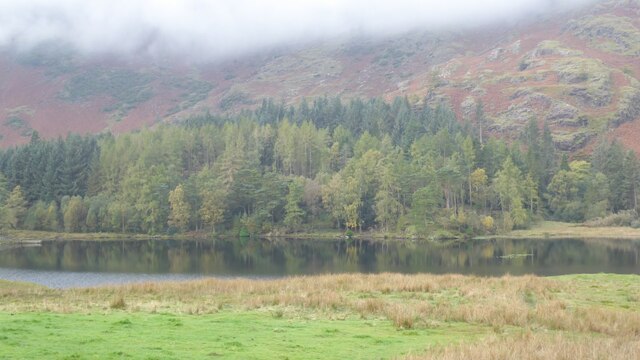
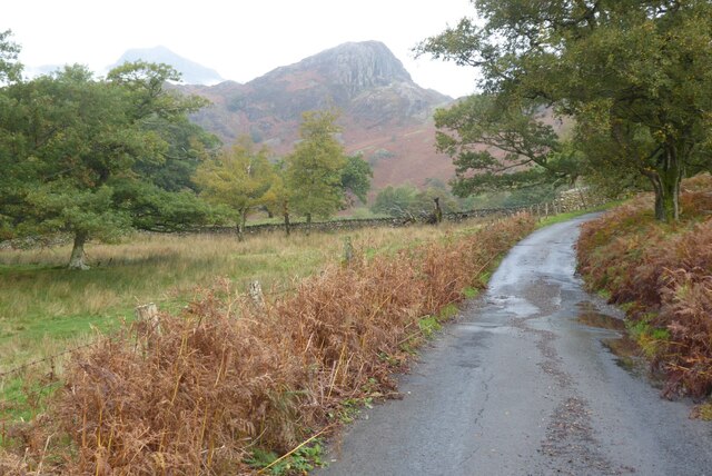
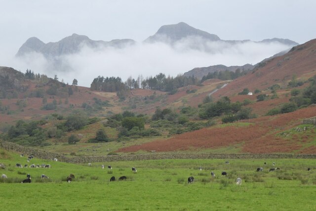
Characterized by its dense woodland, Hag Wood is primarily composed of deciduous trees such as oak, beech, and ash. The forest floor is adorned with a carpet of wildflowers during the spring and summer months, adding a vibrant splash of color to the surroundings. The wood is intersected by a network of well-maintained footpaths, allowing visitors to explore its various nooks and crannies.

Hag Wood is home to a wide range of wildlife species, making it a popular destination for birdwatchers and animal enthusiasts. Visitors may catch glimpses of red deer, badgers, foxes, and numerous species of birds such as woodpeckers, owls, and thrushes. The forest also boasts a diverse insect population, including butterflies and dragonflies, which thrive in its rich and varied habitats.

In addition to its natural beauty, Hag Wood offers recreational activities for visitors of all ages. Picnic areas, equipped with tables and benches, provide a perfect spot for a leisurely lunch amidst the tranquility of the forest. The wood also features a designated camping area, allowing visitors to spend a night under the starry skies and wake up to the soothing sounds of nature.

Overall, Hag Wood in Westmorland is a captivating destination that offers a peaceful retreat from the hustle and bustle of everyday life. Its stunning scenery, diverse flora and fauna, and recreational opportunities make it an ideal spot for nature lovers to immerse themselves in the beauty of the natural world.

If you have any feedback on the listing, please let us know in the comments section below.
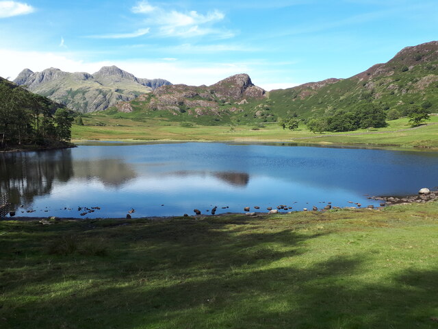
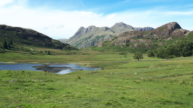
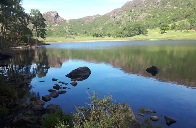
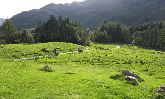
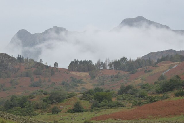
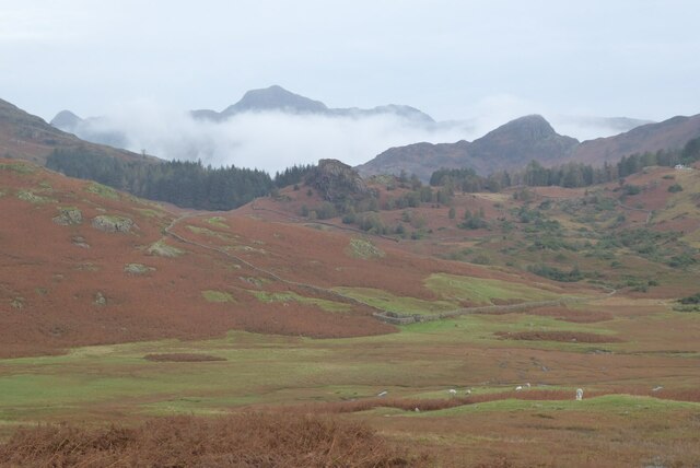
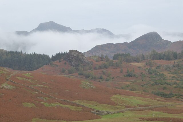
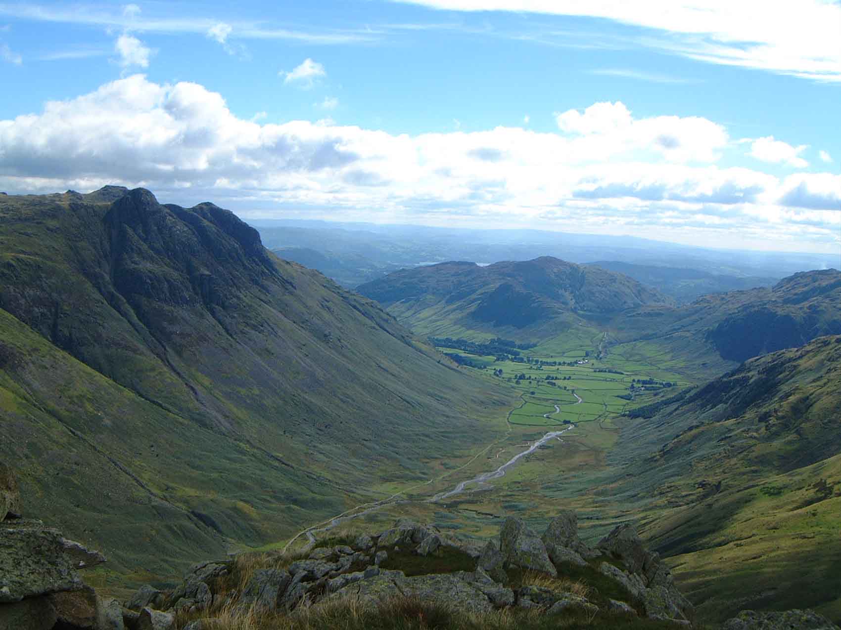
Hag Wood Images

Images are sourced within 2km of 54.435369/-3.0664531 or Grid Reference NY3004. Thanks to Geograph Open Source API. All images are credited.

Blea Tarn on a sunny and calm September afternoon Looking north across Blea Tarn, with the Langdale Pikes in the distance to the left, and Side Pike central.
Although Side Pike appears nearly as high, it is much closer than the Langdales. 

Side Pike (<a href="https://www.geograph.org.uk/gridref/NY2905">NY2905</a>) is just under 1km from the camera, and 224m above sea level, and only 34m above my position on the 190m contour. Pike of Stickle (<a href="https://www.geograph.org.uk/gridref/NY2707">NY2707</a>) on the left is 3.5km distant, and 709m asl, Harrison Stickle (<a href="https://www.geograph.org.uk/gridref/NY2807">NY2807</a>) is 3.3km distant and 736m asl.
Blea Tarn on a sunny and calm September afternoon
Looking north across Blea Tarn, with the Langdale Pikes in the distance to the left, and Side Pike central. Although Side Pike appears nearly as high, it is much closer than the Langdales. Side Pike (NY2905) is just under 1km from the camera, and 224m above sea level, and only 34m above my position on the 190m contour. Pike of Stickle (NY2707) on the left is 3.5km distant, and 709m asl, Harrison Stickle (NY2807) is 3.3km distant and 736m asl.
Blea Tarn and the Langdale Pikes
Blea Tarn, calm September afternoon Looking towards the rocky Side Pike on the left and the rising ground of Lingmoor Fell on the right.
Blea Tarn, calm September afternoon
Looking towards the rocky Side Pike on the left and the rising ground of Lingmoor Fell on the right.
Footpath on the south side of Blea Tarn There's a very clear and easy footpath that takes you from the gate opposite the car park, along the south and west sides of the tarn. Then you can return along the road.
(That's a large white fluffy dog on the path, not a sheep.)
Footpath on the south side of Blea Tarn
There's a very clear and easy footpath that takes you from the gate opposite the car park, along the south and west sides of the tarn. Then you can return along the road. (That's a large white fluffy dog on the path, not a sheep.)
Bleatarn House
Bleatarn House
Side Pike Road over Side Pike.
Side Pike
Road over Side Pike.
Why? In this breathtaking view of unspoiled fells, a boulder becomes the easel for an eye-catching memorial, crafted with red and white plastic flowers.

If their son truly had an affection for the imposing splendour of the Langdales, I have reservations that he would find favour with this abomination.
Why?
In this breathtaking view of unspoiled fells, a boulder becomes the easel for an eye-catching memorial, crafted with red and white plastic flowers. If their son truly had an affection for the imposing splendour of the Langdales, I have reservations that he would find favour with this abomination.
Trees reflected in Blea Tarn Trees reflected in Blea Tarn, viewed from the road between Great Langdale and Little Langdale.
Trees reflected in Blea Tarn
Trees reflected in Blea Tarn, viewed from the road between Great Langdale and Little Langdale.
Blea Tarn Trees reflected in Blea Tarn, viewed from the road between Great Langdale and Little Langdale.
Blea Tarn
Trees reflected in Blea Tarn, viewed from the road between Great Langdale and Little Langdale.
Side Pike The minor road between Little Langdale and Great Langdale.  The prominent peak is Side Pike, with the Langdale Pikes in the background.
Side Pike
The minor road between Little Langdale and Great Langdale. The prominent peak is Side Pike, with the Langdale Pikes in the background.
The Langdale Pikes The Langdale Pikes viewed from near Fell Foot in Little Langdale.
The Langdale Pikes
The Langdale Pikes viewed from near Fell Foot in Little Langdale.
The Langdale Pikes The Langdale Pikes viewed from near Fell Foot in Little Langdale.
The Langdale Pikes
The Langdale Pikes viewed from near Fell Foot in Little Langdale.
View to the Langdale Pikes View to the Langdale Pikes from near The Mound in Little Langdale.
View to the Langdale Pikes
View to the Langdale Pikes from near The Mound in Little Langdale.
View to the Langdale Pikes View to the Langdale Pikes from near The Mound in Little Langdale.
View to the Langdale Pikes
View to the Langdale Pikes from near The Mound in Little Langdale.
Side Pike With Herdwick sheep
Side Pike
With Herdwick sheep
Side Pike Ignimbrite - Fiamme Fiamme is an Italian word describing pumice clasts that have been flattened and morphed. This section is in the middle (and hottest??) part of the ignimbrite (density current - think Montserrat or the cloud that wiped out Pompeii). The geology of Side Pike reflects a subaerial caldera that collapsed in a piecemeal fashion.
Side Pike Ignimbrite - Fiamme
Fiamme is an Italian word describing pumice clasts that have been flattened and morphed. This section is in the middle (and hottest??) part of the ignimbrite (density current - think Montserrat or the cloud that wiped out Pompeii). The geology of Side Pike reflects a subaerial caldera that collapsed in a piecemeal fashion.
Side Pike Ignimbrite - A rootless eruption The ignimbrite has been brecciated whereas laterally it is uniform. This has been interpreted as being the result of a rootless phreatic explosion. Soon after emplacement a small stream (heavy rain?) penetrated the slab of fresh and still very hot ignimbrite. This caused rapid steam formation and a series of explosions breaking the rock into bits.
Side Pike Ignimbrite - A rootless eruption
The ignimbrite has been brecciated whereas laterally it is uniform. This has been interpreted as being the result of a rootless phreatic explosion. Soon after emplacement a small stream (heavy rain?) penetrated the slab of fresh and still very hot ignimbrite. This caused rapid steam formation and a series of explosions breaking the rock into bits.
Path up to Side Pike
Show me another place!

Hag Wood is located at Grid Ref: NY3004 (Lat: 54.435369, Lng: -3.0664531)

Administrative County: Cumbria

District: South Lakeland

Police Authority: Cumbria

What 3 Words

///goose.flute.ideal. Near Ambleside, Cumbria

Related Wikis

Lingmoor Fell

Lingmoor Fell is a fell in the English Lake District, situated eight kilometres (five miles) west of Ambleside. The fell reaches a height of 469 m (1,540...

Chapel Stile

Chapel Stile is a village in Cumbria, England, located approximately 5 miles northwest of Ambleside, within the Langdale valley. It contains a school,...

Langdale axe industry

The Langdale axe industry (or factory) is the name given by archaeologists to a Neolithic centre of specialised stone tool production in the Great Langdale...

Great Langdale

Great Langdale is a valley in the Lake District National Park in North West England, the epithet, "Great" distinguishing it from the neighbouring valley...

Nearby Amenities

Located within 500m of 54.435369,-3.0664531
Passing Place
Lat/Long: 54.4363999/-3.0594884
Hagg Wood
Natural: wood
Lat/Long: 54.4360909/-3.0652339
The data included in this document is from www.openstreetmap.org. The data is made available under ODbL.

Have you been to Hag Wood?

Leave your review of Hag Wood below (or comments, questions and feedback).