Brown Howe

Hill, Mountain in Westmorland South Lakeland

England

Brown Howe

Ordnance Survey Rivet This OS rivet can be found on a rock north side of the road. It marks a point 200.357m above mean sea level.
Ordnance Survey Rivet Credit: Adrian Dust

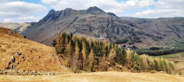
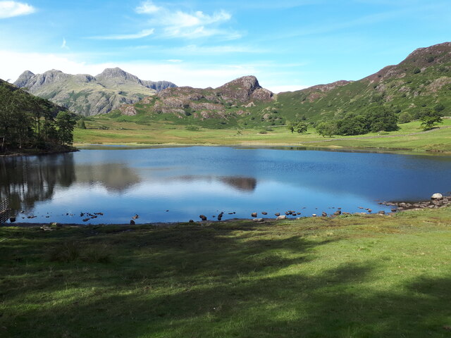
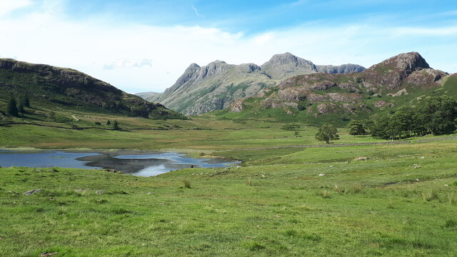
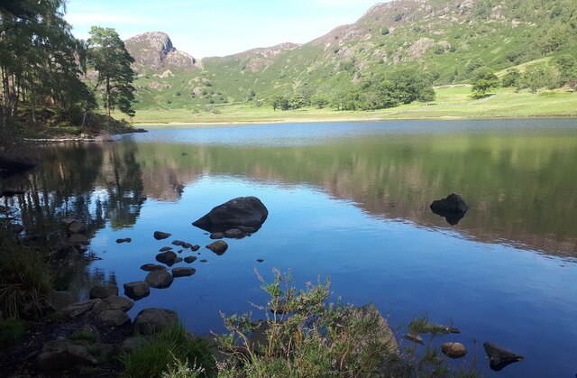
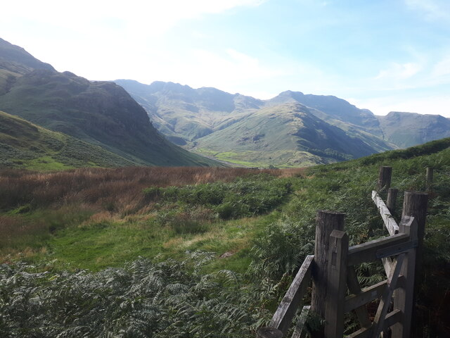
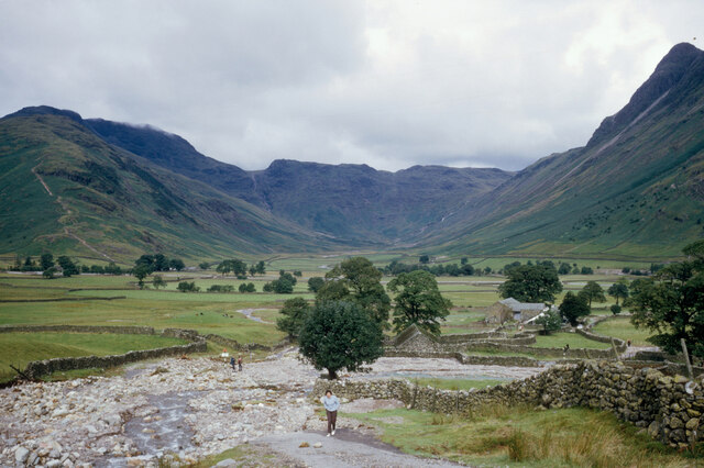
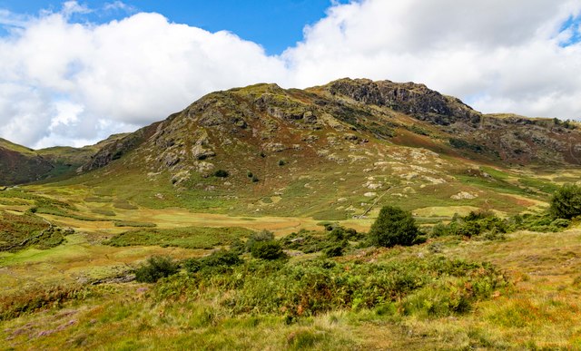
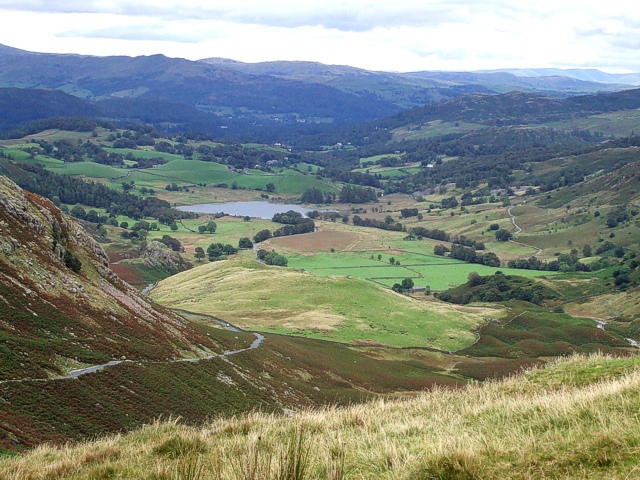
Brown Howe is a hill located in the county of Westmorland, in the northwest region of England. Situated in the Lake District National Park, it forms part of the larger range of fells known as the Coniston Fells. With an elevation of approximately 424 meters (1,391 feet), Brown Howe offers stunning panoramic views of the surrounding landscape.

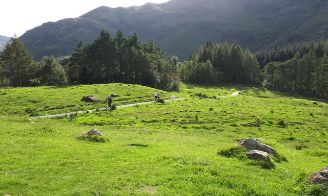
The hill is characterized by its gentle slopes and grassy terrain, making it a relatively easy climb for hikers and outdoor enthusiasts. Its location within the Lake District National Park also means that it is surrounded by a rich and diverse ecosystem, with an abundance of flora and fauna to be discovered.

Brown Howe is a popular destination for walkers and nature lovers, offering a peaceful and tranquil setting away from the more crowded tourist spots. It is often included in longer hiking routes that traverse the Coniston Fells, providing a scenic stop along the way.

At the summit of Brown Howe, visitors are rewarded with breathtaking vistas of the surrounding mountains, lakes, and valleys. On a clear day, it is possible to see the nearby Coniston Water, one of the largest lakes in the Lake District, as well as the iconic Old Man of Coniston, a prominent mountain in the area.

Overall, Brown Howe in Westmorland offers a picturesque and accessible hillwalking experience, allowing visitors to immerse themselves in the natural beauty of the Lake District National Park.

If you have any feedback on the listing, please let us know in the comments section below.
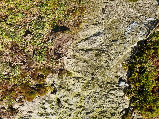
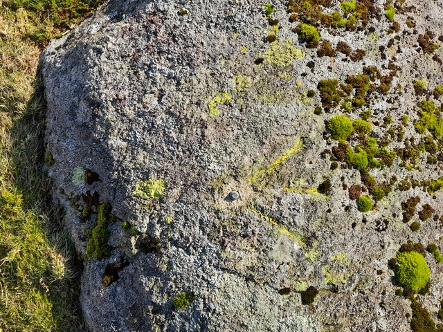
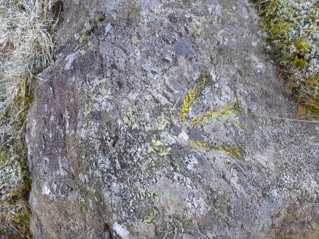
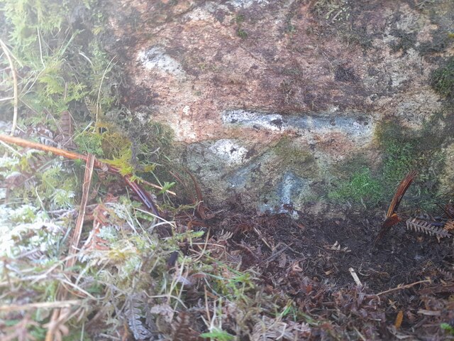
Brown Howe Images

Images are sourced within 2km of 54.432062/-3.0764493 or Grid Reference NY3004. Thanks to Geograph Open Source API. All images are credited.

Ordnance Survey Rivet This OS rivet can be found on a rock north side of the road. It marks a point 200.357m above mean sea level.
Ordnance Survey Rivet
This OS rivet can be found on a rock north side of the road. It marks a point 200.357m above mean sea level.
Ordnance Survey Rivet This OS rivet can be found on a rock north side of the road. It marks a point 186.041m above mean sea level.
Ordnance Survey Rivet
This OS rivet can be found on a rock north side of the road. It marks a point 186.041m above mean sea level.
Ordnance Survey Rivet This OS rivet can be found on a rock south side of the road. It marks a point 167.817m above mean sea level.
Ordnance Survey Rivet
This OS rivet can be found on a rock south side of the road. It marks a point 167.817m above mean sea level.
Ordnance Survey Cut Mark This OS cut mark can be found on a rock south side of the road. It marks a point 149.959m above mean sea level.
Ordnance Survey Cut Mark
This OS cut mark can be found on a rock south side of the road. It marks a point 149.959m above mean sea level.
Plantation on Kettle Crag
Blea Tarn on a sunny and calm September afternoon Looking north across Blea Tarn, with the Langdale Pikes in the distance to the left, and Side Pike central.
Although Side Pike appears nearly as high, it is much closer than the Langdales. 

Side Pike (<a href="https://www.geograph.org.uk/gridref/NY2905">NY2905</a>) is just under 1km from the camera, and 224m above sea level, and only 34m above my position on the 190m contour. Pike of Stickle (<a href="https://www.geograph.org.uk/gridref/NY2707">NY2707</a>) on the left is 3.5km distant, and 709m asl, Harrison Stickle (<a href="https://www.geograph.org.uk/gridref/NY2807">NY2807</a>) is 3.3km distant and 736m asl.
Blea Tarn on a sunny and calm September afternoon
Looking north across Blea Tarn, with the Langdale Pikes in the distance to the left, and Side Pike central. Although Side Pike appears nearly as high, it is much closer than the Langdales. Side Pike (NY2905) is just under 1km from the camera, and 224m above sea level, and only 34m above my position on the 190m contour. Pike of Stickle (NY2707) on the left is 3.5km distant, and 709m asl, Harrison Stickle (NY2807) is 3.3km distant and 736m asl.
Blea Tarn and the Langdale Pikes
Blea Tarn, calm September afternoon Looking towards the rocky Side Pike on the left and the rising ground of Lingmoor Fell on the right.
Blea Tarn, calm September afternoon
Looking towards the rocky Side Pike on the left and the rising ground of Lingmoor Fell on the right.
Footpath through the bracken below Side Pike And just above the road past Blea Tarn. Looking towards the Langdale valley.
Footpath through the bracken below Side Pike
And just above the road past Blea Tarn. Looking towards the Langdale valley.
Footpath on the south side of Blea Tarn There's a very clear and easy footpath that takes you from the gate opposite the car park, along the south and west sides of the tarn. Then you can return along the road.
(That's a large white fluffy dog on the path, not a sheep.)
Footpath on the south side of Blea Tarn
There's a very clear and easy footpath that takes you from the gate opposite the car park, along the south and west sides of the tarn. Then you can return along the road. (That's a large white fluffy dog on the path, not a sheep.)
The Blea Tarn to Langdale Road after the deluge The road approaching Wall End from Blea Tarn was washed away after a major storm in the summer of 1966.  This was the result of 12 hours of rain after which the day was fine!  The Langdale campsite was navigable by canoe.
The Blea Tarn to Langdale Road after the deluge
The road approaching Wall End from Blea Tarn was washed away after a major storm in the summer of 1966. This was the result of 12 hours of rain after which the day was fine! The Langdale campsite was navigable by canoe.
Eastern end of the Wrynose Pass
Bleatarn House
Bleatarn House
Side Pike Road over Side Pike.
Side Pike
Road over Side Pike.
Hollin Crag
Hollin Crag
Why? In this breathtaking view of unspoiled fells, a boulder becomes the easel for an eye-catching memorial, crafted with red and white plastic flowers.

If their son truly had an affection for the imposing splendour of the Langdales, I have reservations that he would find favour with this abomination.
Why?
In this breathtaking view of unspoiled fells, a boulder becomes the easel for an eye-catching memorial, crafted with red and white plastic flowers. If their son truly had an affection for the imposing splendour of the Langdales, I have reservations that he would find favour with this abomination.
Great Langdale Campsite Camping at the National Trust's Great Langdale Campsite.
Great Langdale Campsite
Camping at the National Trust's Great Langdale Campsite.
Show me another place!

Brown Howe is located at Grid Ref: NY3004 (Lat: 54.432062, Lng: -3.0764493)

Administrative County: Cumbria

District: South Lakeland

Police Authority: Cumbria

What 3 Words

///formally.bystander.option. Near Ambleside, Cumbria

Related Wikis

Lingmoor Fell

Lingmoor Fell is a fell in the English Lake District, situated eight kilometres (five miles) west of Ambleside. The fell reaches a height of 469 m (1,540...

Ting Mound

The Ting Mound or Thing Moot at Fellfoot Farm, Little Langdale, Cumbria, England is an Ancient Monument (a 'nationally important' archaeological site)...

Little Langdale

Little Langdale is a valley in the Lake District, England, containing Little Langdale Tarn and a hamlet also called Little Langdale. A second tarn, Blea...

Langdale axe industry

The Langdale axe industry (or factory) is the name given by archaeologists to a Neolithic centre of specialised stone tool production in the Great Langdale...

Related Videos

Lake District Walking Trails - Elterwater

This walk starts in the beautiful lake district village of Elterwater. Along the way, we learn about the local historic industries.

Perfect weather for HIKING the LANGDALES - Bagging 7 more Wainwright’s in the LAKE DISTRICT

This is the second video in my LAKE DISTRICT series. I headed up to the Lakes in the final week of September 2020 with a goal ...

Hiking the Langdalea

Hike from The Dungeon Ghyll Hotel, taking in 5 Wainwrights : Pavey Ark, Thunacar Knott, Pike of Stickle, Loft Cragg & Harrison ...

Lake District Walks | The Langdale Pikes (a 7 Wainwright walk)

In October 2019 Neil and special guest Stuart embarked on an epic walk over the Langdale Pikes in the English Lake District- 7 ...

Nearby Amenities

Located within 500m of 54.432062,-3.0764493
Lingmoor Fell
Description: Lingmoor Fell is a fell in the English Lake District, situated eight kilometres west of Ambleside.
Ele: 469
Natural: peak
Source: npe
Wikidata: Q6553901
Wikipedia: en:Lingmoor Fell
Lat/Long: 54.4320647/-3.0764237
Barrier: stile
Lat/Long: 54.4319918/-3.0763569
Barrier: stile
Lat/Long: 54.4307011/-3.0788261
Brown How
Place: locality
Lat/Long: 54.4312954/-3.0764193
Ford: yes
Lat/Long: 54.428441/-3.0728505
Ford: yes
Lat/Long: 54.4287255/-3.0802811
Ford: yes
Lat/Long: 54.4287113/-3.0729187
The data included in this document is from www.openstreetmap.org. The data is made available under ODbL.

Have you been to Brown Howe?

Leave your review of Brown Howe below (or comments, questions and feedback).