Springs Wood

Wood, Forest in Cumberland Allerdale

England

Springs Wood

Derwent Water and Cat Bells in the Snow The beauty of the snow transformed Keswick on Saturday. Looking across Derwent Water towards Cat Bells in the late afternoon.
Derwent Water and Cat Bells in the Snow Credit: RKL

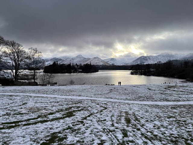
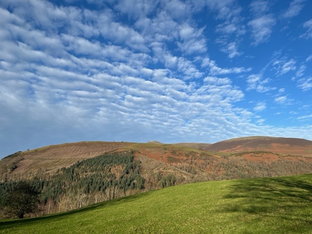
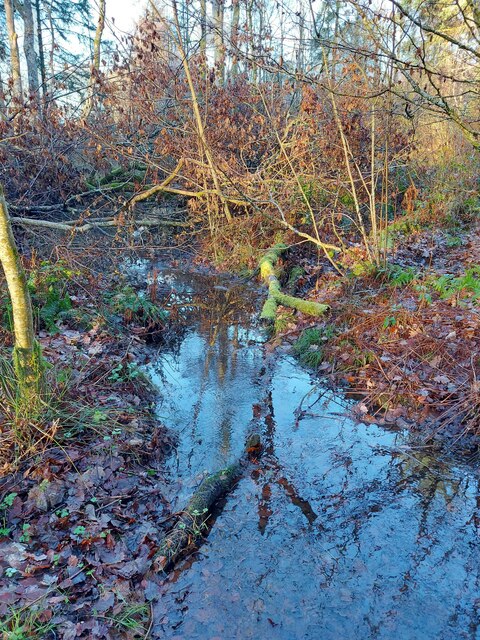
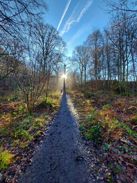
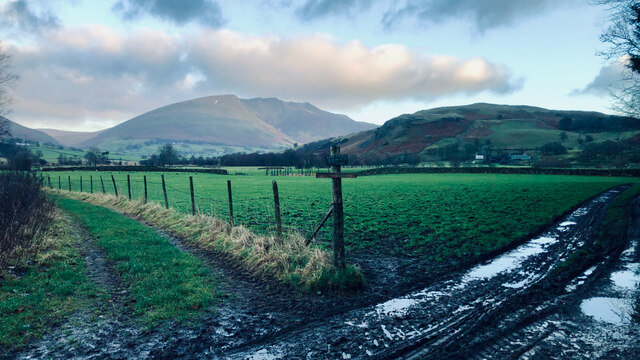
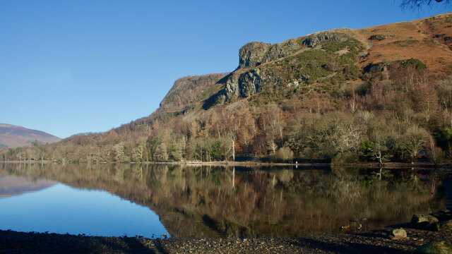
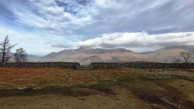
Springs Wood, located in Cumberland, is a breathtaking forest that spans over several acres of land. This woodland is characterized by its diverse array of tree species, including oak, pine, maple, and birch. The forest is known for its vibrant colors throughout the year, with the foliage transforming into a stunning palette of reds, oranges, and yellows during the autumn season.

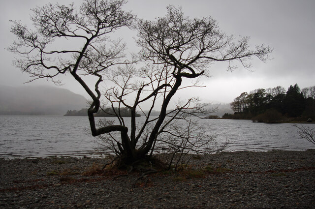
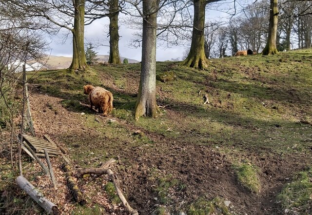
The wood is home to a rich variety of flora and fauna. The forest floor is carpeted with a lush layer of mosses, ferns, and wildflowers, creating a picturesque and serene environment. Squirrels, rabbits, and deer are commonly spotted within the wood, adding to its natural charm.

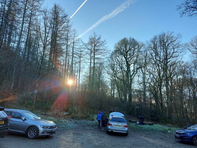
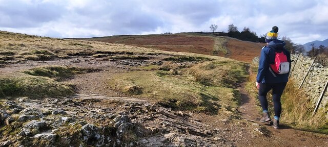
Springs Wood is crisscrossed by several well-maintained trails, making it a popular destination for nature enthusiasts and hikers. These trails wind through the forest, offering visitors the opportunity to explore its beauty up close. Along the way, there are numerous lookout points that provide stunning views of the surrounding countryside, making it an ideal spot for photography and birdwatching.

The wood is also a haven for those seeking tranquility and relaxation. The peaceful atmosphere, coupled with the gentle rustling of leaves and the occasional chirping of birds, creates a soothing ambiance that allows visitors to escape from the hustle and bustle of everyday life.

Overall, Springs Wood in Cumberland is a natural paradise that offers a diverse range of experiences for nature lovers. From its enchanting foliage to its abundant wildlife, this wood is a must-visit destination for anyone seeking solace in the beauty of the great outdoors.

If you have any feedback on the listing, please let us know in the comments section below.

Springs Wood Images

Images are sourced within 2km of 54.592156/-3.1170226 or Grid Reference NY2722. Thanks to Geograph Open Source API. All images are credited.

Derwent Water and Cat Bells in the Snow The beauty of the snow transformed Keswick on Saturday. Looking across Derwent Water towards Cat Bells in the late afternoon.
Derwent Water and Cat Bells in the Snow
The beauty of the snow transformed Keswick on Saturday. Looking across Derwent Water towards Cat Bells in the late afternoon.
View near Castlerigg at Keswick A wonderful view was admired while walking up the lane towards Castlerigg Stone Circle.
View near Castlerigg at Keswick
A wonderful view was admired while walking up the lane towards Castlerigg Stone Circle.
Cat Bells from Friars Crag in Keswick A view of Cat Bells taken on a late winter afternoon from the point at Friars Crag. This is a favourite place to walk in Keswick, just a short distance from the town centre.
Cat Bells from Friars Crag in Keswick
A view of Cat Bells taken on a late winter afternoon from the point at Friars Crag. This is a favourite place to walk in Keswick, just a short distance from the town centre.
Calfclose Bay, Derwent Water The eastern shore of the lake. Rampsholme (front) and St Herbert's Islands are behind the tree. Brandlehow is in the left background. Other fells are hidden by cloud.
Calfclose Bay, Derwent Water
The eastern shore of the lake. Rampsholme (front) and St Herbert's Islands are behind the tree. Brandlehow is in the left background. Other fells are hidden by cloud.
Great Wood Car Park, near Keswick
Stream in Great Wood, near Keswick
Great Woods near Keswick
Derwent Water
Derwent Water
Keswick Market Place The north end of the Market Place on Main Street.
The Cumbria Way long distance footpath from Ulverston to Carlisle runs through the Market Place.
Keswick Market Place
The north end of the Market Place on Main Street. The Cumbria Way long distance footpath from Ulverston to Carlisle runs through the Market Place.
Path junction near Dale Bottom
Walla Crag from Calfclose Bay In the wake of the 1715 Jacobite Rebellion, Lady Derwentwater climbed Walla Crag, after escaping from Lord’s Isle .

With sentries posted on all roads and clasping her jewellery and silver plate, which she hoped she could use to save her husband, she climbed what is today known as Lady’s Rake.

En route, she dropped her white handkerchief which could still be seen, apparently, by Georgian tourists a century later, aided by a touch of white paint.

For source see my blog <span class="nowrap"><a title="http://www.fhithich.uk/?p=27195" rel="nofollow ugc noopener" href="http://www.fhithich.uk/?p=27195">Link</a><img style="margin-left:2px;" alt="External link" title="External link - shift click to open in new window" src="https://s1.geograph.org.uk/img/external.png" width="10" height="10"/></span>
Walla Crag from Calfclose Bay
In the wake of the 1715 Jacobite Rebellion, Lady Derwentwater climbed Walla Crag, after escaping from Lord’s Isle . With sentries posted on all roads and clasping her jewellery and silver plate, which she hoped she could use to save her husband, she climbed what is today known as Lady’s Rake. En route, she dropped her white handkerchief which could still be seen, apparently, by Georgian tourists a century later, aided by a touch of white paint. For source see my blog LinkExternal link
Ambleside Road - Keswick
Footpath to Great Wood near Castlerigg
Highland Cattle in Springs Wood
The Path to Walla Crag
Dry stone wall with pen
View over Great Wood from Walla Crag
Lady's Rake
Lady's Rake
Show me another place!

Springs Wood is located at Grid Ref: NY2722 (Lat: 54.592156, Lng: -3.1170226)

Administrative County: Cumbria

District: Allerdale

Police Authority: Cumbria

What 3 Words

///uncle.suave.consonant. Near Keswick, Cumbria

Related Wikis

Black Sands (album)

Black Sands is the fourth studio album by English producer Bonobo. It was released on 29 March 2010. == Artwork == The cover features a photograph taken...

Castlerigg

Castlerigg is an area of Keswick, Cumbria, England. Castlerigg is named after a hill in the immediate area. Until the early twentieth century much of the...

Chestnut Hill, Cumbria

Chestnut Hill is a suburb of Keswick, England, located along the A591 road. It contains the Nether Place Nursing Home and Claremont House, a 19th-century...

Briery

Briery is a village in Cumbria, England.

Nearby Amenities

Located within 500m of 54.592156,-3.1170226
Barrier: kissing_gate
Material: wood
Width: 0.63
Lat/Long: 54.590727/-3.1140067
Noexit: yes
Lat/Long: 54.5946659/-3.122736
Barrier: lift_gate
Lat/Long: 54.5930945/-3.112618
Traffic Calming: bump
Lat/Long: 54.5931967/-3.1132788
Traffic Calming: bump
Lat/Long: 54.5934173/-3.1136766
Castlerigg Farm
Caravans: yes
Tents: yes
Tourism: camp_site
Lat/Long: 54.5919653/-3.1109818
Cafe
The Hayloft
Lat/Long: 54.5921828/-3.1115182
Bench
Backrest: yes
Lat/Long: 54.5951243/-3.122506
Man Made: tower
Tower Type: communication
Lat/Long: 54.5916444/-3.1176774
Noexit: yes
Lat/Long: 54.5918016/-3.1177145
Campsite Shop
Check Date Opening Hours: 2023-09-10
Opening Hours: Mo-Su 08:00-20:00
Operator: Castlerigg Farm
Payment Cash: yes
Payment Credit Cards: yes
Payment Visa: yes
Shop: convenience
Lat/Long: 54.5917472/-3.1110612
Payment Coins: yes
Self Service: yes
Shop: laundry
Lat/Long: 54.5917936/-3.1106973
Toilets
Access: customers
Female: yes
Wheelchair: limited
Lat/Long: 54.5917597/-3.1108736
Toilets
Access: customers
Male: yes
Wheelchair: limited
Lat/Long: 54.5917597/-3.1108153
Shower
Access: customers
Female: yes
Hot Water: yes
Lat/Long: 54.5917607/-3.110889
Shower
Access: customers
Hot Water: yes
Male: yes
Lat/Long: 54.5917597/-3.1108
Drinking Water
Access: customers
Man Made: water_tap
Lat/Long: 54.5917606/-3.1109338
Generator Method: photovoltaic
Generator Output Electricity: yes
Generator Source: solar
Generator Type: solar_photovoltaic_panel
Location: roof
Power: generator
Lat/Long: 54.5942521/-3.1232844
Generator Method: photovoltaic
Generator Output Electricity: yes
Generator Source: solar
Generator Type: solar_photovoltaic_panel
Location: roof
Power: generator
Lat/Long: 54.5933003/-3.1127793
Generator Method: photovoltaic
Generator Output Electricity: yes
Generator Source: solar
Generator Type: solar_photovoltaic_panel
Location: roof
Power: generator
Lat/Long: 54.5933572/-3.1123123
The data included in this document is from www.openstreetmap.org. The data is made available under ODbL.

Have you been to Springs Wood?

Leave your review of Springs Wood below (or comments, questions and feedback).