Watson's Park

Wood, Forest in Cumberland Allerdale

England

Watson's Park

Gate at High Nest On the path from Latrigg stone circle
Gate at High Nest Credit: Raymond Knapman

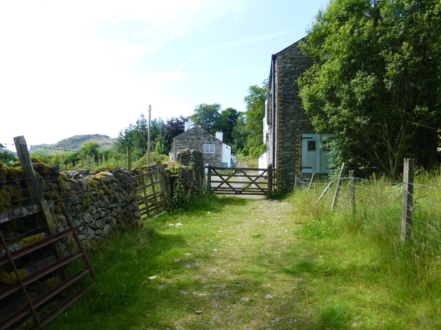
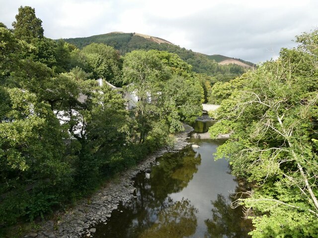
Watson's Park, Cumberland, also known as Wood or Forest, is a picturesque park located in the town of Cumberland, England. Spanning over a vast area, the park is a haven for nature enthusiasts and those seeking tranquility amidst the hustle and bustle of daily life.

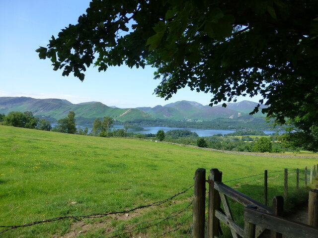
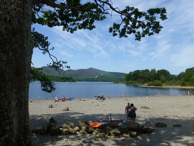
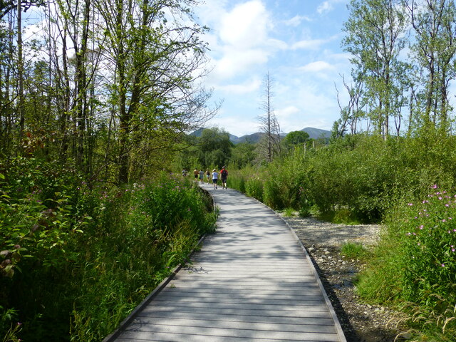
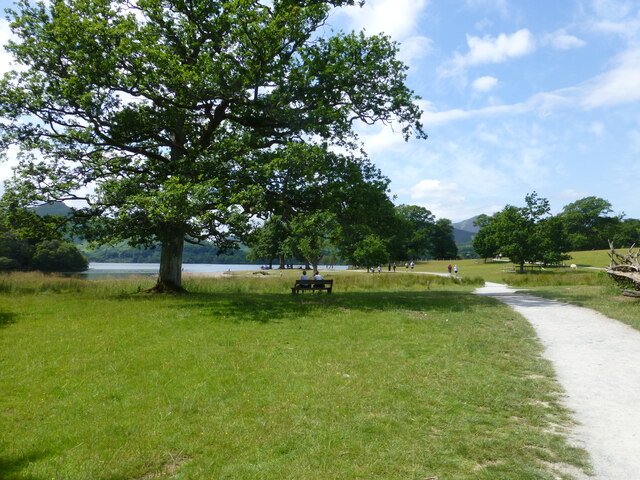
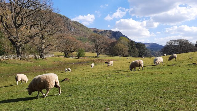
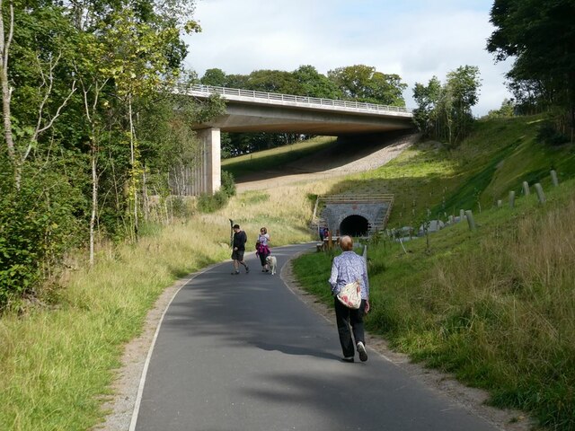
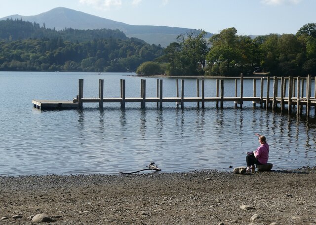
The park is characterized by its lush greenery and dense woodland, providing a serene setting for visitors to explore and enjoy the beauty of nature. Tall, majestic trees tower over the landscape, casting a soothing shade on the well-maintained paths that wind through the park. These paths offer an opportunity for leisurely strolls or invigorating jogs, allowing visitors to immerse themselves in the peaceful ambiance.

Watson's Park is not only a place of natural beauty but also offers amenities to enhance the visitor experience. The park features spacious picnic areas, complete with benches and tables, ideal for family outings or social gatherings. Additionally, there are well-equipped playgrounds for children, providing a safe and fun environment for them to play and explore.

For those with a love for wildlife, the park is home to a variety of fauna. Visitors can spot various species of birds, squirrels, and other small animals as they wander through the forested areas. The park's management has also taken measures to preserve the natural habitat, making it an ideal spot for birdwatchers and nature photographers.

Overall, Watson's Park in Cumberland is a place of natural beauty and tranquility. With its lush woodlands, well-maintained paths, picnic areas, and playgrounds, it offers a perfect escape for individuals and families seeking a peaceful retreat in the heart of nature.

If you have any feedback on the listing, please let us know in the comments section below.

Watson's Park Images

Images are sourced within 2km of 54.588549/-3.123114 or Grid Reference NY2722. Thanks to Geograph Open Source API. All images are credited.

Gate at High Nest On the path from Latrigg stone circle
Gate at High Nest
On the path from Latrigg stone circle
Derwentwater viewed from path at Castlerigg The path leads on through the Great Wood
Derwentwater viewed from path at Castlerigg
The path leads on through the Great Wood
Heatwave at Calfclose Bay Unusual weather at Derwent Water
Heatwave at Calfclose Bay
Unusual weather at Derwent Water
A stream enters Calfclose Bay Catbells seen in background
A stream enters Calfclose Bay
Catbells seen in background
Boardwalk at The Ings
Peaceful scene at Strandshag Bay Path junction for Friars Crag and car park at Cockshot Wood
Peaceful scene at Strandshag Bay
Path junction for Friars Crag and car park at Cockshot Wood
Lunchtime in the Market Square in Keswick Moot Hall seen in background
Lunchtime in the Market Square in Keswick
Moot Hall seen in background
The tunnel under the A66 viaduct near Keswick
Derwent Water from Friar's Crag
Pasture on the south side of Stable Hills Farm The path takes walkers past Stable Hills into this pasture and along the edge of this field near Derwent Water.
Pasture on the south side of Stable Hills Farm
The path takes walkers past Stable Hills into this pasture and along the edge of this field near Derwent Water.
Keswick Leisure Pool Looking very deserted as closed on Mondays.
Keswick Leisure Pool
Looking very deserted as closed on Mondays.
Keswick Station as was The station was formerly a station on the Cockermouth, Keswick and Penrith railway. Much of the station was demolished when the station was closed in 1972; the remainder, a grade II listed structure, is used as the annexe of a hotel. The station stands at one end of a very popular railway path for cyclists and walkers.
Keswick Station as was
The station was formerly a station on the Cockermouth, Keswick and Penrith railway. Much of the station was demolished when the station was closed in 1972; the remainder, a grade II listed structure, is used as the annexe of a hotel. The station stands at one end of a very popular railway path for cyclists and walkers.
Old lamp standard An old lamp standard, possibly a gas light, stands on the platform of the old Keswick Station.
Old lamp standard
An old lamp standard, possibly a gas light, stands on the platform of the old Keswick Station.
River Greta Looking upstream from a bridge on the Keswick to Threlkeld Railway Path. Calvert's Bridge stands a short distance upstream. Latrigg <a href="https://www.geograph.org.uk/gridref/NY2724">NY2724</a> rises in the background.
River Greta
Looking upstream from a bridge on the Keswick to Threlkeld Railway Path. Calvert's Bridge stands a short distance upstream. Latrigg NY2724 rises in the background.
Approach to the Bobbin Mill Tunnel The Bobbin Mill Tunnel was originally one of the two tunnels on the Cockermouth, Keswick and Penrith  railway line. The line was closed in 1972.

The Greta viaduct in the background carries the A66 over the River Greta and was completed in 1977. It was voted "Best Concrete Engineering Structure of the Century" by  "Concrete" magazine.

Subsequently a path was constructed along the line of the old railway line from Keswick as far as Threlkeld. It was thought that the integrity of the tunnel might have been compromised by the viaduct construction and it was sealed off. An alternative route for the path was installed on a wooden walkway round the outside of the spur.

The walkway was destroyed by Storm Desmond in 2015. When the path was reconstructed, it was determined that the tunnel was safe after all and was incorporated into the path.

The path forms part of the C2C cycle route (National Cycle Network route 71) and is very popular with walkers and cyclists.
Approach to the Bobbin Mill Tunnel
The Bobbin Mill Tunnel was originally one of the two tunnels on the Cockermouth, Keswick and Penrith railway line. The line was closed in 1972. The Greta viaduct in the background carries the A66 over the River Greta and was completed in 1977. It was voted "Best Concrete Engineering Structure of the Century" by "Concrete" magazine. Subsequently a path was constructed along the line of the old railway line from Keswick as far as Threlkeld. It was thought that the integrity of the tunnel might have been compromised by the viaduct construction and it was sealed off. An alternative route for the path was installed on a wooden walkway round the outside of the spur. The walkway was destroyed by Storm Desmond in 2015. When the path was reconstructed, it was determined that the tunnel was safe after all and was incorporated into the path. The path forms part of the C2C cycle route (National Cycle Network route 71) and is very popular with walkers and cyclists.
West  portal of the Bobbin Mill Tunnel The Bobbin Mill Tunnel was originally one of the two tunnels on the Cockermouth, Keswick and Penrith  railway line and was dug through a spur on the banks of the river Greta. The line was closed in 1972.

In 1977, the Greta viaduct on the Keswick By-pass was constructed over the River Greta at a higher level, spanning the spur through which the tunnel was built. It was voted "Best Concrete Engineering Structure of the Century" by  "Concrete" magazine.

Subsequently a path was constructed along the line of the old railway line from Keswick as far as Threlkeld. It was thought that the integrity of the tunnel might have been compromised by the viaduct construction and it was sealed off. An alternative route for the path was installed on a wooden walkway round the outside of the spur.

The walkway was destroyed by Storm Desmond in 2015. When the path was reconstructed, it was determined that the tunnel was safe after all and was incorporated into the path.

The path forms part of the C2C cycle route (National Cycle Network route 71) and is very popular with walkers and cyclists.
West portal of the Bobbin Mill Tunnel
The Bobbin Mill Tunnel was originally one of the two tunnels on the Cockermouth, Keswick and Penrith railway line and was dug through a spur on the banks of the river Greta. The line was closed in 1972. In 1977, the Greta viaduct on the Keswick By-pass was constructed over the River Greta at a higher level, spanning the spur through which the tunnel was built. It was voted "Best Concrete Engineering Structure of the Century" by "Concrete" magazine. Subsequently a path was constructed along the line of the old railway line from Keswick as far as Threlkeld. It was thought that the integrity of the tunnel might have been compromised by the viaduct construction and it was sealed off. An alternative route for the path was installed on a wooden walkway round the outside of the spur. The walkway was destroyed by Storm Desmond in 2015. When the path was reconstructed, it was determined that the tunnel was safe after all and was incorporated into the path. The path forms part of the C2C cycle route (National Cycle Network route 71) and is very popular with walkers and cyclists.
Rowing boats, Derwentwater, Keswick On the north east side of the lake, south of Crow Park.
Rowing boats, Derwentwater, Keswick
On the north east side of the lake, south of Crow Park.
Derwentwater, Keswick The woman sitting by the water is watching the low flying jet planes roaring past.
Derwentwater, Keswick
The woman sitting by the water is watching the low flying jet planes roaring past.
Show me another place!

Watson's Park is located at Grid Ref: NY2722 (Lat: 54.588549, Lng: -3.123114)

Administrative County: Cumbria

District: Allerdale

Police Authority: Cumbria

What 3 Words

///jots.amuses.uproot. Near Keswick, Cumbria

Related Wikis

Black Sands (album)

Black Sands is the fourth studio album by English producer Bonobo. It was released on 29 March 2010. == Artwork == The cover features a photograph taken...

Walla Crag

Walla Crag is a fell in the English Lake District, near Keswick. The fell is a short walk from Keswick and overlooks Derwentwater. == Topography == The...

Castlerigg

Castlerigg is an area of Keswick, Cumbria, England. Castlerigg is named after a hill in the immediate area. Until the early twentieth century much of the...

Lord's Island

Lord's Island, which is one of the seven islands on Derwent Water in Keswick, Cumbria, England, got its name from the Earls of Derwentwater who used to...

Castlerigg Manor

Castlerigg Manor is a Catholic Residential Youth Centre - also often referred to as Catholic Youth Retreat Centres - in Keswick, Cumbria, in the north...

Herbert of Derwentwater

Saint Herbert of Derwentwater (died 20 March 687) was an Anglo-Saxon priest and hermit who lived on the small St Herbert's Island in Derwentwater, Cumbria...
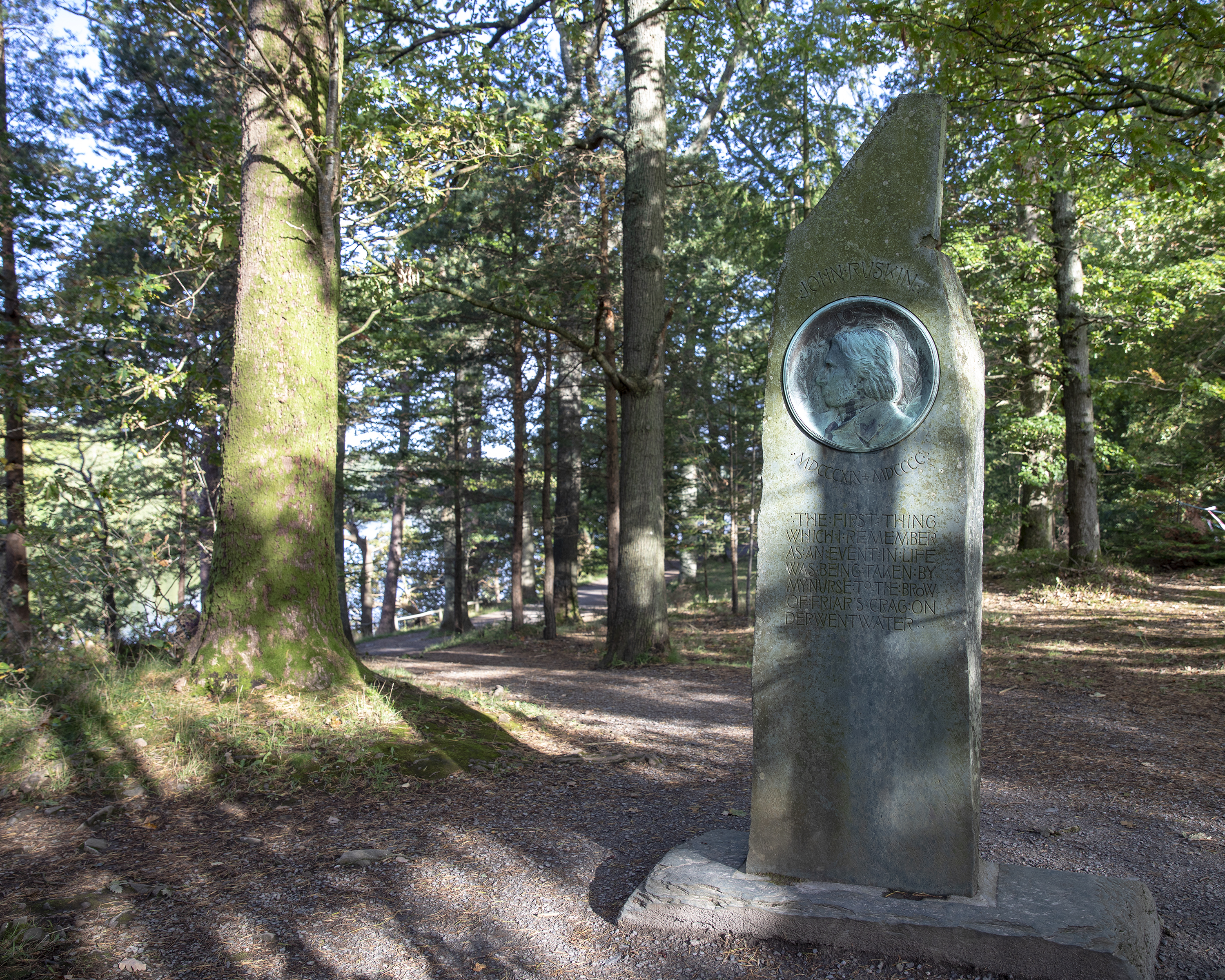
Ruskin Monument

The Ruskin Monument is a memorial to John Ruskin located on the edge of Derwentwater in the English Lakes at Friars' Crag, Keswick, Cumbria. It was erected...

Chestnut Hill, Cumbria

Chestnut Hill is a suburb of Keswick, England, located along the A591 road. It contains the Nether Place Nursing Home and Claremont House, a 19th-century...

Nearby Amenities

Located within 500m of 54.588549,-3.123114
Barrier: stile
Lat/Long: 54.5859932/-3.1285735
Man Made: tower
Tower Type: communication
Lat/Long: 54.5916444/-3.1176774
Watsons Park
Place: locality
Lat/Long: 54.5882934/-3.1247596
Horseclose Wood
Natural: wood
Lat/Long: 54.5877808/-3.1268224
The data included in this document is from www.openstreetmap.org. The data is made available under ODbL.

Have you been to Watson's Park?

Leave your review of Watson's Park below (or comments, questions and feedback).