Parsonage Copse

Wood, Forest in Somerset Somerset West and Taunton

England

Parsonage Copse

Junction on Cold Road Cold Road (foreground and ahead) is followed by the parish boundary between Staple Fitzpaine (left) and Bickenhall. As it passes the junction, it crosses into <a href="https://www.geograph.org.uk/gridref/ST2719">ST2719</a>. The wood is Grughay Close.
Junction on Cold Road Credit: Derek Harper

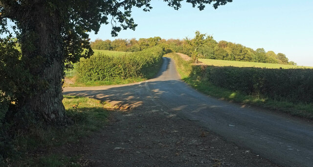
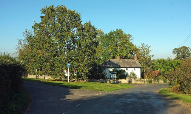
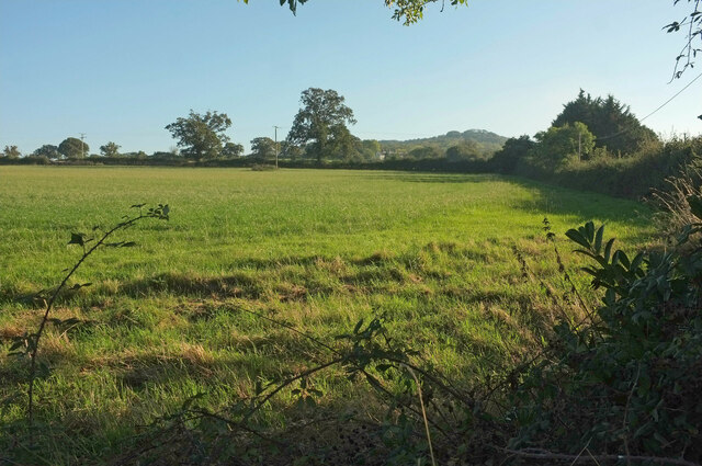
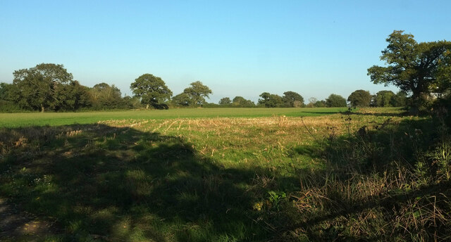
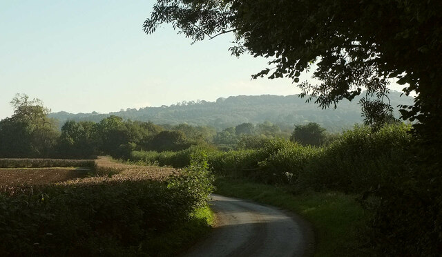
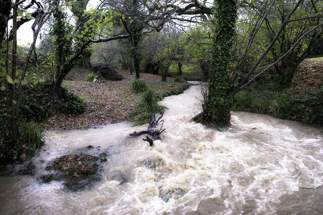
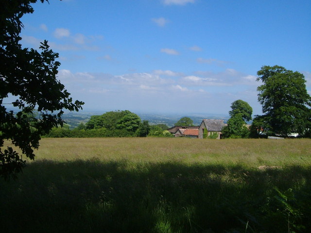
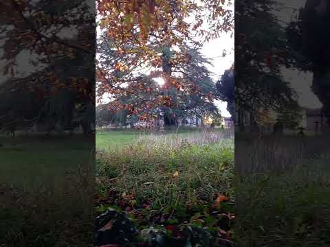
Parsonage Copse is a picturesque woodland located in Somerset, England. Spread over a vast area, it is known for its dense forest cover and diverse range of flora and fauna. The copse is situated near the village of Parsonage, surrounded by rolling hills and meandering streams, creating a serene and tranquil environment.

The woodland is primarily composed of deciduous trees, such as oak, beech, and birch, which provide a stunning display of vibrant colors during the autumn season. The dense canopy formed by the trees allows only dappled sunlight to penetrate through, creating a magical atmosphere within the copse.

Parsonage Copse is a haven for wildlife enthusiasts, as it is home to a variety of animal species. Visitors may spot deer, foxes, badgers, and a plethora of birds, including woodpeckers, owls, and thrushes. The copse also supports a diverse range of insect life, with butterflies and dragonflies being particularly abundant.

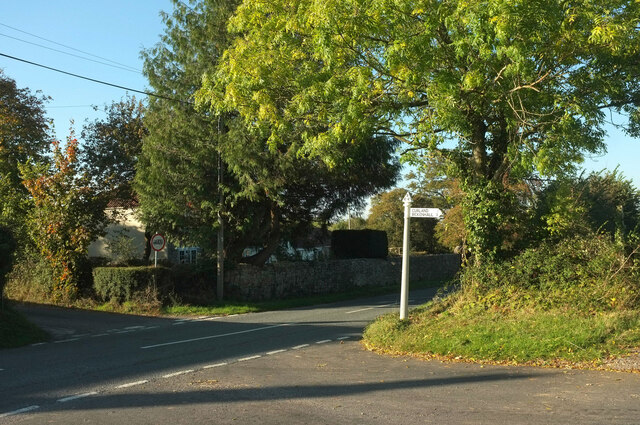
A network of well-maintained footpaths and trails meanders through Parsonage Copse, allowing visitors to explore the woodland at their own pace. These paths lead to hidden glades, babbling brooks, and breathtaking vistas, offering a glimpse into the copse's natural beauty.

The copse is a popular destination for nature lovers, hikers, and picnickers alike. Its peaceful setting and beautiful scenery provide a perfect escape from the hustle and bustle of everyday life. Whether one seeks solitude, connection with nature, or an adventurous hike, Parsonage Copse in Somerset offers a truly enchanting experience.

If you have any feedback on the listing, please let us know in the comments section below.

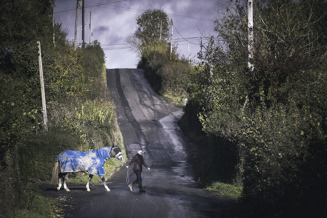
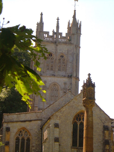
Parsonage Copse Images

Images are sourced within 2km of 50.952367/-3.0460509 or Grid Reference ST2617. Thanks to Geograph Open Source API. All images are credited.

Junction on Cold Road Cold Road (foreground and ahead) is followed by the parish boundary between Staple Fitzpaine (left) and Bickenhall. As it passes the junction, it crosses into <a href="https://www.geograph.org.uk/gridref/ST2719">ST2719</a>. The wood is Grughay Close.
Junction on Cold Road
Cold Road (foreground and ahead) is followed by the parish boundary between Staple Fitzpaine (left) and Bickenhall. As it passes the junction, it crosses into ST2719. The wood is Grughay Close.
Former post office, Curland The scene is shown leafless in <a href="https://www.geograph.org.uk/photo/4336081">ST2717 : Village Green, Curland</a>. As the sign on the left hints, the triangular green is one-way on its north and west sides. Maps from 1903 to 1993 show the building as a post office, the older ones naming it as Stoneleigh.
Former post office, Curland
The scene is shown leafless in ST2717 : Village Green, Curland. As the sign on the left hints, the triangular green is one-way on its north and west sides. Maps from 1903 to 1993 show the building as a post office, the older ones naming it as Stoneleigh.
Field by Bulford crossroads On the southeast side of the junction shown at <a title="https://www.geograph.org.uk/search.php?i=143407630" href="https://www.geograph.org.uk/search.php?i=143407630">Link</a> . In the distance is the hilltop at Castle Neroche.
Field by Bulford crossroads
On the southeast side of the junction shown at Link . In the distance is the hilltop at Castle Neroche.
Field near Bulford From the crossroads shown in <a href="https://www.geograph.org.uk/photo/2354095">ST2617 : Turning for Curland and Bickenhall</a>.
Field near Bulford
From the crossroads shown in ST2617 : Turning for Curland and Bickenhall.
Cold Road Looking in the opposite direction from <a href="https://www.geograph.org.uk/photo/6993743">ST2718 : Junction on Cold Road</a>, so that Staple Fitzpaine is on the right of the parish boundary as it follows the lane, and Bickenhall is on the left.
Cold Road
Looking in the opposite direction from ST2718 : Junction on Cold Road, so that Staple Fitzpaine is on the right of the parish boundary as it follows the lane, and Bickenhall is on the left.
Horseshoe Cottage at Staple Fitzpaine Horseshoe Cottage at Mill Farm in Staple Fitzpaine was originally a stone built cow shed or grain store, associated with the now defunct Staple Mill. In 2019/20, two cottages (Primrose Cottage and Horseshoe Cottage) were converted into one. Therefore, Primrose Cottage no longer exists as an address, despite it still appearing on some maps and databases.
Horseshoe Cottage at Staple Fitzpaine
Horseshoe Cottage at Mill Farm in Staple Fitzpaine was originally a stone built cow shed or grain store, associated with the now defunct Staple Mill. In 2019/20, two cottages (Primrose Cottage and Horseshoe Cottage) were converted into one. Therefore, Primrose Cottage no longer exists as an address, despite it still appearing on some maps and databases.
Park Farm at Bickenhall Park Farm at Bickenhall in Taunton Deane, Somerset.
TA3 6TZ
Park Farm at Bickenhall
Park Farm at Bickenhall in Taunton Deane, Somerset. TA3 6TZ
The Old School in Staple Fitzpaine The Old School is opposite St Peter's Church. It is a private residence.
The Old School in Staple Fitzpaine
The Old School is opposite St Peter's Church. It is a private residence.
The Greyhound Inn Snow on the Greyhound Inn at Staple Fitzpaine in Taunton Deane, Somerset.
The Greyhound Inn
Snow on the Greyhound Inn at Staple Fitzpaine in Taunton Deane, Somerset.
Curland : Road A road off Castlemain.
Curland : Road
A road off Castlemain.
Staple Fitzpaine Millstream The stream in flood (Dec 2023). As seen from private land at Mill Farm.
Staple Fitzpaine Millstream
The stream in flood (Dec 2023). As seen from private land at Mill Farm.
The Bickenhall Road Outside the Mill Equestrian livery yard. On the Bickenhall Road in Taunton Deane, Somerset.
The Bickenhall Road
Outside the Mill Equestrian livery yard. On the Bickenhall Road in Taunton Deane, Somerset.
Mount Fancy Farm This farm is set high amid clearings on the Blackdown Hills, at the end of its own long access road. 2:48 pm.
Mount Fancy Farm
This farm is set high amid clearings on the Blackdown Hills, at the end of its own long access road. 2:48 pm.
St Peter's church, Staple Fitzpaine Seen from the east <span class="nowrap"><a title="http://webapp1.somerset.gov.uk/her/details.asp?prn=41068" rel="nofollow ugc noopener" href="http://webapp1.somerset.gov.uk/her/details.asp?prn=41068">Link</a><img style="margin-left:2px;" alt="External link" title="External link - shift click to open in new window" src="https://s1.geograph.org.uk/img/external.png" width="10" height="10"/></span> . <a href="https://www.geograph.org.uk/photo/3367813">ST2618 : Church, Staple Fitzpaine</a> attempts a straighter version.
St Peter's church, Staple Fitzpaine
Seen from the east LinkExternal link . ST2618 : Church, Staple Fitzpaine attempts a straighter version.
Curland Methodist Chapel The former Wesleyan chapel dates from 1824 with later alterations <span class="nowrap"><a title="http://webapp1.somerset.gov.uk/her/details.asp?prn=18064" rel="nofollow ugc noopener" href="http://webapp1.somerset.gov.uk/her/details.asp?prn=18064">Link</a><img style="margin-left:2px;" alt="External link" title="External link - shift click to open in new window" src="https://s1.geograph.org.uk/img/external.png" width="10" height="10"/></span> . It ceased use as a place of worship around the Millennium. Since this photo was taken, it has been converted.
Curland Methodist Chapel
The former Wesleyan chapel dates from 1824 with later alterations LinkExternal link . It ceased use as a place of worship around the Millennium. Since this photo was taken, it has been converted.
Cottages on Parsonage Lane, Staple Fitzpaine Seen from a footpath which seems to have disappeared.
Cottages on Parsonage Lane, Staple Fitzpaine
Seen from a footpath which seems to have disappeared.
Field near Staple Fitzpaine These oaks give a park-like appearance to this field near Perry Hall.
Field near Staple Fitzpaine
These oaks give a park-like appearance to this field near Perry Hall.
Show me another place!

Parsonage Copse is located at Grid Ref: ST2617 (Lat: 50.952367, Lng: -3.0460509)

Administrative County: Somerset

District: Somerset West and Taunton

Police Authority: Avon and Somerset

What 3 Words

///reservoir.gladiators.situation. Near Taunton, Somerset

Related Wikis

All Saints Church, Curland

All Saints Church is a former Church of England parish church in Curland, Somerset, England. Designed by Benjamin Ferrey, it was built in 1855–56 to replace...

William Portman Almshouses

The William Portman Almshouses in Staple Fitzpaine, Somerset, England was built in 1643. It is a Grade II* listed building. == History == The almshouses...

Curland

Curland is a village and civil parish in Somerset, England, situated 6 miles (9.7 km) south of Taunton. The village has a population of 225. The parish...

Staple Fitzpaine

Staple Fitzpaine is a village and civil parish in Somerset, England, situated 5 miles (8.0 km) south of Taunton. The village has a population of 189 and...

Bickenhall

Bickenhall is a hamlet and parish in Somerset, England, situated 5 miles (8.0 km) south east of Taunton. The parish, which includes the hamlet of Batten...

Castle Neroche

Castle Neroche is a Norman motte-and-bailey castle on the site of an earlier hill fort in the parish of Curland, near Staple Fitzpaine, Somerset, England...

Ruttersleigh

Ruttersleigh (grid reference ST250165) is a 97 hectares (240 acres) biological Site of Special Scientific Interest between Buckland St Mary and Staple...

Staple Hill (Somerset)

Staple Hill is a hill in the English county of Somerset, the highest point in the Blackdown Hills. It is classed as both a Marilyn and a Hardy.This is...

Related Videos

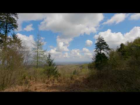
Blackdown Hills, Staple Hill. GoPro Hero 9 (5k)

A test of the Gopro Hero 9 in 5K30 using the linear lens mostly and Hypersmooth 3.0 without the horizon leveling. Staple Hill is a ...

Autumnal churchyard in Somerset ☺ 🍂 #shortsyoutube #shortsvideo #shorts

A little explore of a beautiful Church (St Peter's) in a lovely Somerset village called Staple Fitzpaine.

Why I started a South West of England YouTube Channel | Autumn Channel Chat | October 2022

I am often asked why I started a YouTube channel and what it is about doing it that I enjoy! In this video I touch upon some of my ...

Nearby Amenities

Located within 500m of 50.952367,-3.0460509
Devil's Stone
Archaeological Site: standing_stone
Historic: archaeological_site
Source: OS OpenData StreetView
Lat/Long: 50.9559781/-3.0472697
The data included in this document is from www.openstreetmap.org. The data is made available under ODbL.

Have you been to Parsonage Copse?

Leave your review of Parsonage Copse below (or comments, questions and feedback).