Lowsides Wood

Wood, Forest in Lancashire South Lakeland

England

Lowsides Wood

Remains of wooden ballast bin Only a few rotten pieces of wood remain from this ballast bin beside the former Furness Railway Coniston Branch near Moss Side.  Built from old wooden railway sleepers it is difficult to place an age on this ballast bin, but it is possible it pre-dates the formation of the London Midland and Scottish Railway in 1923 who later introduced concrete bins (see photograph <a href="https://www.geograph.org.uk/photo/6797992">NY2924 : LMS Standard Concrete Ballast Bin</a>).
Positioned approximately every mile, more frequently on curved track, ballast bins were used to store small stone chippings which were used by the railway Lengthsmen to pack and adjust the railway sleepers. Using only a jack and a shovel, an experienced Lengthsman could judge exactly the right quantity of chippings to use to obtain a perfect ‘top’ to the rail and they often took great pride in the quality of their work.
The Coniston Branch closed to passengers in October 1958 and to all traffic with effect from the 30 April 1962 although the last train had run during the preceding week.  The track bed in front of the ballast bin is deep in mud and trampled by cows.
Remains of wooden ballast bin Credit: Adrian Taylor

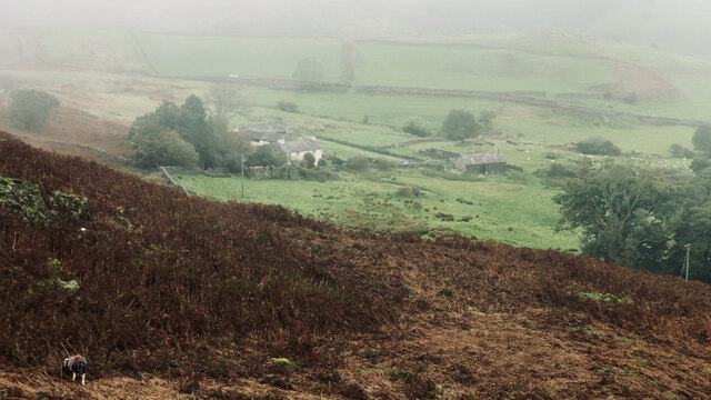
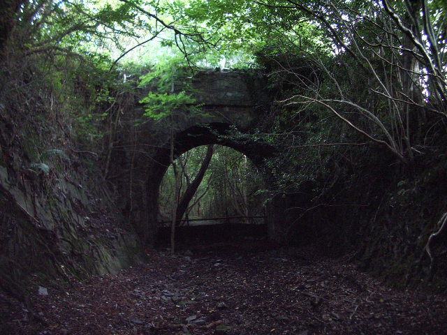
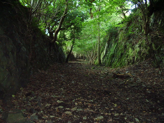
Lowsides Wood, located in Lancashire, England, is a picturesque forest that covers a sprawling area of land. The wood is situated near the town of Chipping and is renowned for its natural beauty and tranquility.

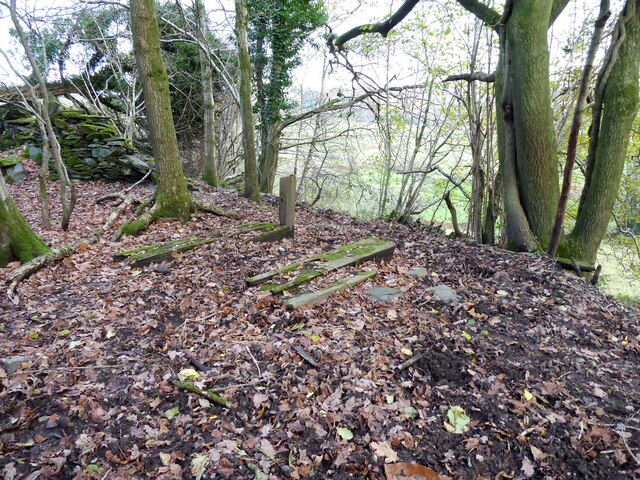
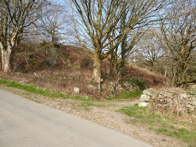
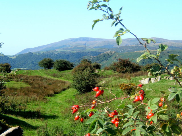
Spanning approximately 200 acres, Lowsides Wood is home to a diverse range of flora and fauna, making it an important ecological site. The forest is primarily composed of deciduous trees, including oak, ash, and birch, which create a stunning canopy during the spring and summer months. In autumn, the wood is transformed into a riot of colors as the leaves change to vibrant shades of red, orange, and gold.

The forest floor of Lowsides Wood is carpeted with a variety of wildflowers, adding bursts of color to the landscape. Bluebells, primroses, and wood anemones are just a few of the species that flourish here. Additionally, the wood provides a habitat for numerous animal species, including deer, badgers, foxes, and a wide array of birdlife.

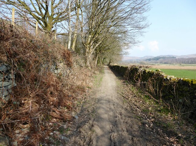
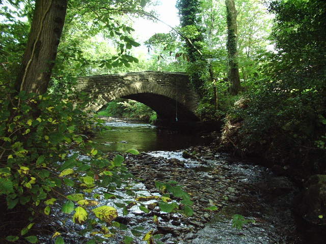
Lowsides Wood is a popular destination for nature enthusiasts and hikers who are drawn to its peaceful atmosphere and scenic trails. The forest offers several well-maintained footpaths, allowing visitors to explore its different areas and discover hidden gems along the way. Nature walks, birdwatching, and photography are common activities enjoyed by visitors to Lowsides Wood.

Overall, Lowsides Wood, Lancashire is a captivating forest that offers a serene escape from the hustle and bustle of everyday life. Its rich biodiversity and stunning landscapes make it a must-visit destination for nature lovers and those seeking solace in the great outdoors.

If you have any feedback on the listing, please let us know in the comments section below.

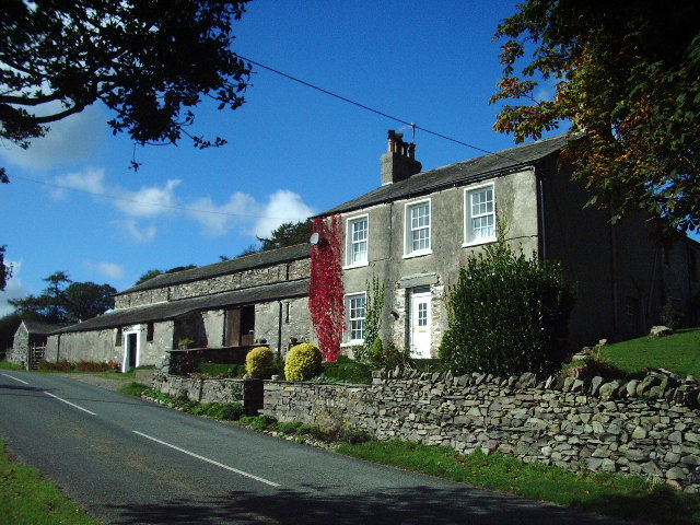
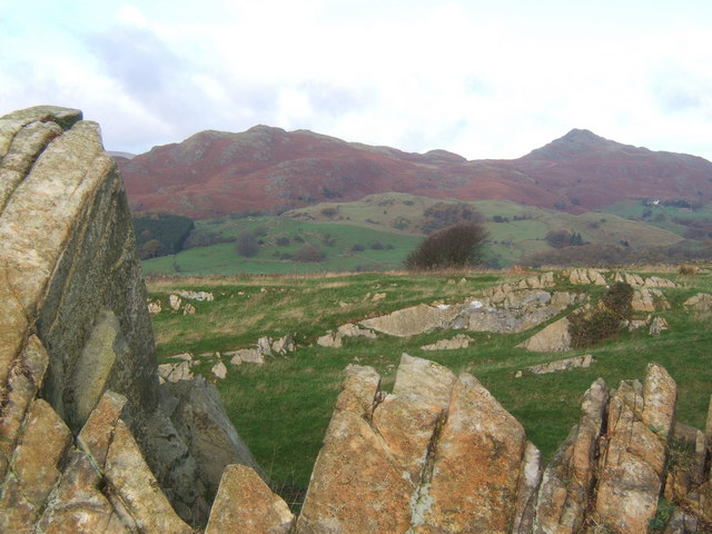
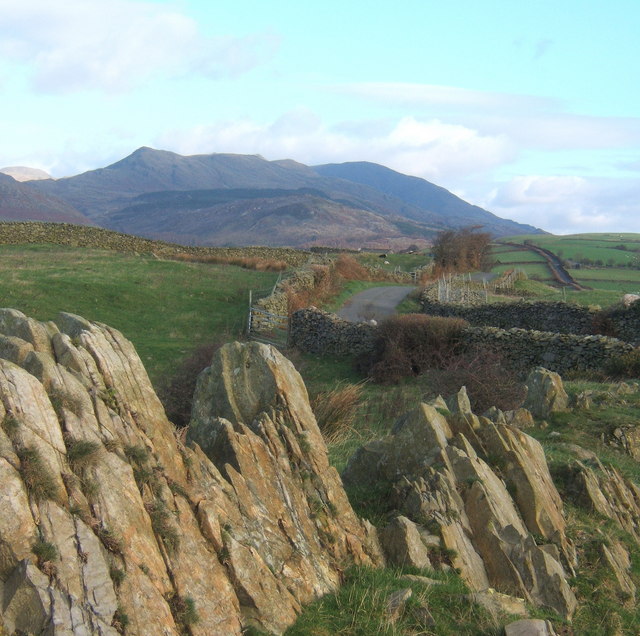
Lowsides Wood Images

Images are sourced within 2km of 54.309092/-3.1886211 or Grid Reference SD2291. Thanks to Geograph Open Source API. All images are credited.

Remains of wooden ballast bin Only a few rotten pieces of wood remain from this ballast bin beside the former Furness Railway Coniston Branch near Moss Side.  Built from old wooden railway sleepers it is difficult to place an age on this ballast bin, but it is possible it pre-dates the formation of the London Midland and Scottish Railway in 1923 who later introduced concrete bins (see photograph <a href="https://www.geograph.org.uk/photo/6797992">NY2924 : LMS Standard Concrete Ballast Bin</a>).
Positioned approximately every mile, more frequently on curved track, ballast bins were used to store small stone chippings which were used by the railway Lengthsmen to pack and adjust the railway sleepers. Using only a jack and a shovel, an experienced Lengthsman could judge exactly the right quantity of chippings to use to obtain a perfect ‘top’ to the rail and they often took great pride in the quality of their work.
The Coniston Branch closed to passengers in October 1958 and to all traffic with effect from the 30 April 1962 although the last train had run during the preceding week.  The track bed in front of the ballast bin is deep in mud and trampled by cows.
Remains of wooden ballast bin
Only a few rotten pieces of wood remain from this ballast bin beside the former Furness Railway Coniston Branch near Moss Side. Built from old wooden railway sleepers it is difficult to place an age on this ballast bin, but it is possible it pre-dates the formation of the London Midland and Scottish Railway in 1923 who later introduced concrete bins (see photograph NY2924 : LMS Standard Concrete Ballast Bin). Positioned approximately every mile, more frequently on curved track, ballast bins were used to store small stone chippings which were used by the railway Lengthsmen to pack and adjust the railway sleepers. Using only a jack and a shovel, an experienced Lengthsman could judge exactly the right quantity of chippings to use to obtain a perfect ‘top’ to the rail and they often took great pride in the quality of their work. The Coniston Branch closed to passengers in October 1958 and to all traffic with effect from the 30 April 1962 although the last train had run during the preceding week. The track bed in front of the ballast bin is deep in mud and trampled by cows.
Kirkby Pool
Kirkby Pool
Lane near Brookside The lane is a public footpath leading to Buttstead Wood.
Lane near Brookside
The lane is a public footpath leading to Buttstead Wood.
Stile beside Buttstead Wood The public footpath from The Hill to Woodland crosses this stile adjacent to Buttstead Wood.
There is an Ordnance Survey rivet benchmark with cut mark on the bottom stone step of the stile (detail photograph <a href="https://www.geograph.org.uk/photo/7259390">SD2389 : Benchmark, Buttstead Wood</a>).
Stile beside Buttstead Wood
The public footpath from The Hill to Woodland crosses this stile adjacent to Buttstead Wood. There is an Ordnance Survey rivet benchmark with cut mark on the bottom stone step of the stile (detail photograph SD2389 : Benchmark, Buttstead Wood).
Benchmark, Buttstead Wood Detail of the Ordnance Survey rivet benchmark with cut mark on the horizontal bottom step of a public footpath stile adjacent to Buttstead Wood.  The benchmark marks a height of 8.6076m above mean sea level (Ordnance Datum Newlyn) last verified in 1954 (location photograph <a href="https://www.geograph.org.uk/photo/7259381">SD2389 : Stile beside Buttstead Wood</a>).
Benchmark, Buttstead Wood
Detail of the Ordnance Survey rivet benchmark with cut mark on the horizontal bottom step of a public footpath stile adjacent to Buttstead Wood. The benchmark marks a height of 8.6076m above mean sea level (Ordnance Datum Newlyn) last verified in 1954 (location photograph SD2389 : Stile beside Buttstead Wood).
Lane entrance near Brookside Leading from the road near Brookside the lane leads to Buttstead Wood and carries a public footpath to Low Rosthwaite.
There is an Ordnance Survey rivet benchmark on the top of the low stone post partially hidden in the brambles to the left of the footpath signpost (photograph <a href="https://www.geograph.org.uk/photo/7260566">SD2389 : Rivet benchmark near Brookside</a>).
Lane entrance near Brookside
Leading from the road near Brookside the lane leads to Buttstead Wood and carries a public footpath to Low Rosthwaite. There is an Ordnance Survey rivet benchmark on the top of the low stone post partially hidden in the brambles to the left of the footpath signpost (photograph SD2389 : Rivet benchmark near Brookside).
Rivet benchmark near Brookside Detail of an Ordnance Survey rivet benchmark on the top of a low stone post near Brookside.  The benchmark marks a height of 11.0246m above mean sea level (Ordnance Datum Newlyn) last verified in 1972 (location photograph <a href="https://www.geograph.org.uk/photo/7260558">SD2389 : Lane entrance near Brookside</a>).
Rivet benchmark near Brookside
Detail of an Ordnance Survey rivet benchmark on the top of a low stone post near Brookside. The benchmark marks a height of 11.0246m above mean sea level (Ordnance Datum Newlyn) last verified in 1972 (location photograph SD2389 : Lane entrance near Brookside).
Carter Ground
Carter Ground
Road bridge Road bridge over the River Lickle near Hartley Ground
Road bridge
Road bridge over the River Lickle near Hartley Ground
High Aulthwaite Side
Road bridge This bridge spans the old Broughton-in-Furness to Coniston Railway about 2 miles NE of Broughton
Road bridge
This bridge spans the old Broughton-in-Furness to Coniston Railway about 2 miles NE of Broughton
Dismantled railway Looking SE towards Broughton-in-Furness along the old Broughton-in-Furness to Coniston Railway
Dismantled railway
Looking SE towards Broughton-in-Furness along the old Broughton-in-Furness to Coniston Railway
Is this the way forward Is this trying to tell us something about the price of electricity? Somebody makes the effort to install solar panels to power their equipment which is attached to a power line. I wonder if they sell the surplus (if any) to the National Grid
Is this the way forward
Is this trying to tell us something about the price of electricity? Somebody makes the effort to install solar panels to power their equipment which is attached to a power line. I wonder if they sell the surplus (if any) to the National Grid
View from a lane above Hawthwaite Black Combe in the distance.
View from a lane above Hawthwaite
Black Combe in the distance.
Rocky outcrop on ridge near Broughton Mills Looking to the Dunnerdale Fells, with Stickle Pike to the right.
Rocky outcrop on ridge near Broughton Mills
Looking to the Dunnerdale Fells, with Stickle Pike to the right.
Rocky outcrop, looking along the ridge lane Coniston Fells in the distance.
Rocky outcrop, looking along the ridge lane
Coniston Fells in the distance.
Lane to Broughton Mills in wintry conditions Stickle Pike right background.
Lane to Broughton Mills in wintry conditions
Stickle Pike right background.
Lane above Hawthwaite This lane provides an alternative route between Broughton and Torver, running mostly near the crest of a rising ridge of high ground.
Lane above Hawthwaite
This lane provides an alternative route between Broughton and Torver, running mostly near the crest of a rising ridge of high ground.
Show me another place!

Lowsides Wood is located at Grid Ref: SD2291 (Lat: 54.309092, Lng: -3.1886211)

Administrative County: Cumbria

District: South Lakeland

Police Authority: Cumbria

What 3 Words

///cups.acrobats.bogus. Near Millom, Cumbria

Related Wikis

Blacksmiths Arms, Broughton Mills

The Blacksmiths Arms is a Grade II listed public house at Broughton Mills, Cumbria, England.It is on the Campaign for Real Ale's National Inventory of...

Broughton West

Broughton West is a civil parish in the Westmorland and Furness district of Cumbria, England. In the 2001 census the parish had a population of 954, decreasing...

Broughton Mills

Broughton Mills is a village in Cumbria, England, located 3.5 kilometres from the larger town of Broughton-in-furness. The village consists of about 40...

Woodland railway station

Woodland railway station served the hamlet of Woodland, in Lancashire, England (now in Cumbria). It was on the branch line to Coniston. == History == Authorised...

Nearby Amenities

Located within 500m of 54.309092,-3.1886211
Barrier: stile
Lat/Long: 54.3110008/-3.1852637
Power: pole
Lat/Long: 54.3084994/-3.1960048
Power: pole
Lat/Long: 54.308693/-3.1953267
Power: pole
Lat/Long: 54.3090463/-3.1939871
Power: pole
Lat/Long: 54.310084/-3.1940789
Power: pole
Lat/Long: 54.3109952/-3.1939559
Power: pole
Lat/Long: 54.3127128/-3.1931261
Power: pole
Lat/Long: 54.3105612/-3.1848975
Power: pole
Lat/Long: 54.3099142/-3.1860612
Power: pole
Lat/Long: 54.3092969/-3.1871428
Power: pole
Lat/Long: 54.3085269/-3.188451
Power: pole
Lat/Long: 54.3078685/-3.1896322
Power: pole
Lat/Long: 54.3079117/-3.1909511
Power: pole
Lat/Long: 54.3079755/-3.1924955
The data included in this document is from www.openstreetmap.org. The data is made available under ODbL.

Have you been to Lowsides Wood?

Leave your review of Lowsides Wood below (or comments, questions and feedback).