Penny Crag Wood

Wood, Forest in Lancashire South Lakeland

England

Penny Crag Wood

Dunnerdale Fells above Stonestar There is an old postcard of this scene called "Dunnerdale Fells". This is a recent picture of the same from the same location. Peaks include Cat's Crag and Raven's Crag, and what rock-climbers call Stonestar Crag.
This picture is a reverse view of <a href="https://www.geograph.org.uk/photo/7300826">SD1992 : Duddon Valley south of Ulpha</a>.
Dunnerdale Fells above Stonestar Credit: Alan Jolley

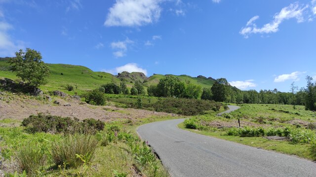
Penny Crag Wood is a picturesque woodland located in the county of Lancashire, England. Nestled in the heart of the Rossendale Valley, this enchanting forest covers an area of approximately 100 acres and is a popular destination for nature lovers and outdoor enthusiasts.

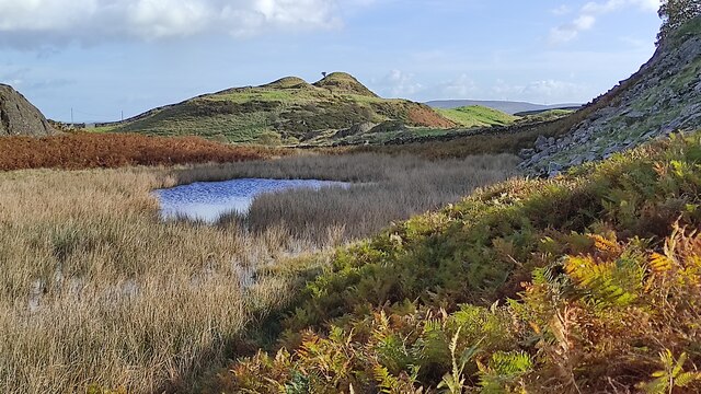
Characterized by its diverse flora and fauna, Penny Crag Wood boasts a rich and varied ecosystem. The forest is predominantly made up of deciduous trees, such as oak, beech, and birch, which create a vibrant canopy during the summer months. Beneath this canopy, the forest floor is adorned with an array of wildflowers, including bluebells and primroses, providing a stunning display of color.

The woodland is crisscrossed with a network of well-maintained trails, making it easily accessible for walkers, hikers, and cyclists. These trails wind their way through the forest, offering breathtaking views of the surrounding countryside and providing a tranquil escape from the hustle and bustle of everyday life.

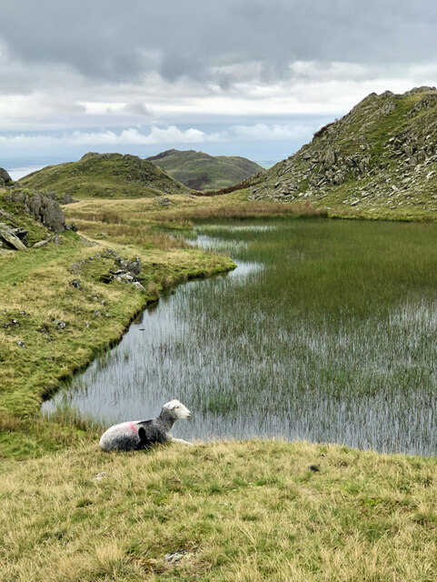
Penny Crag Wood is also home to a diverse range of wildlife. Birdwatchers will be delighted to spot species such as woodpeckers, nuthatches, and tawny owls, while small mammals like squirrels and rabbits can be seen darting through the undergrowth.

In addition to its natural beauty, Penny Crag Wood is also steeped in history. The forest is believed to have been used by local communities for centuries, with remnants of ancient settlements and stone structures still visible today.

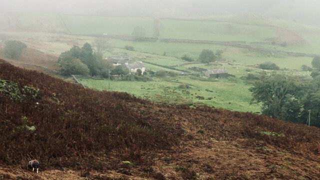
Overall, Penny Crag Wood is a hidden gem in Lancashire, offering visitors a chance to immerse themselves in the beauty of nature and experience the tranquility of a truly captivating woodland setting.

If you have any feedback on the listing, please let us know in the comments section below.

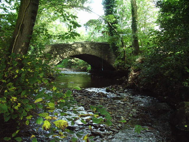
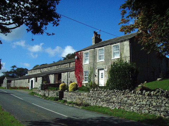
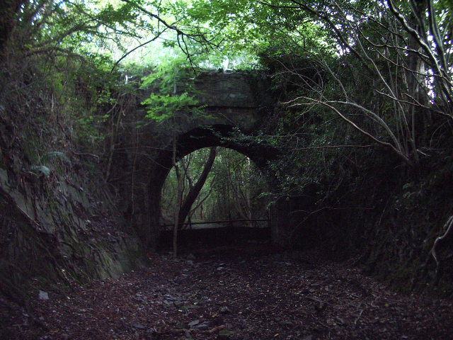
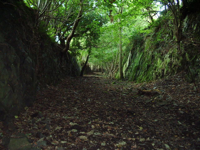
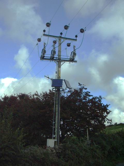
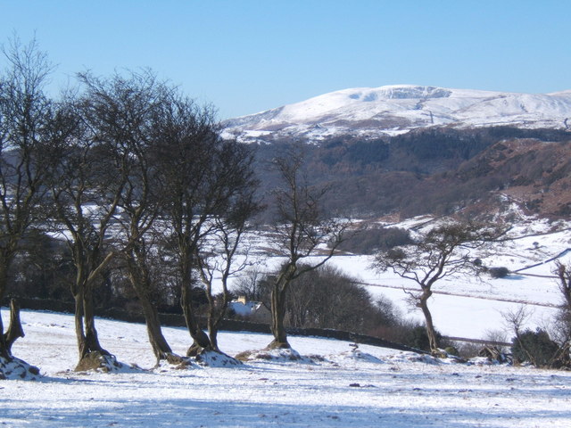
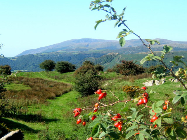
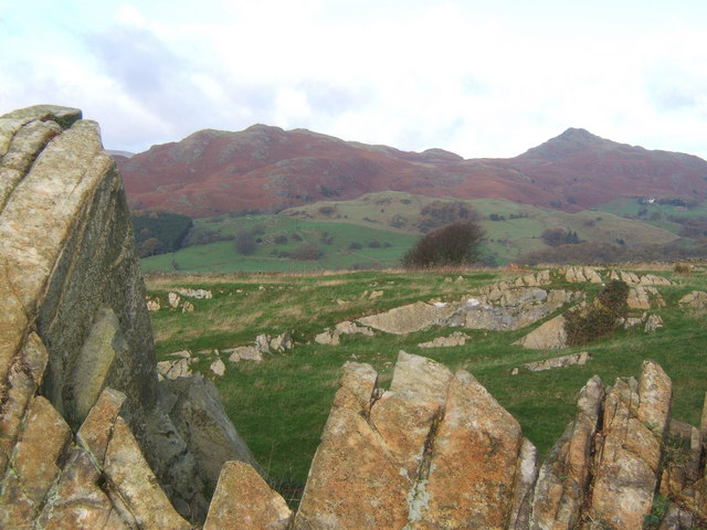
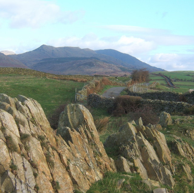
Penny Crag Wood Images

Images are sourced within 2km of 54.309131/-3.1982901 or Grid Reference SD2291. Thanks to Geograph Open Source API. All images are credited.

Dunnerdale Fells above Stonestar There is an old postcard of this scene called "Dunnerdale Fells". This is a recent picture of the same from the same location. Peaks include Cat's Crag and Raven's Crag, and what rock-climbers call Stonestar Crag.
This picture is a reverse view of <a href="https://www.geograph.org.uk/photo/7300826">SD1992 : Duddon Valley south of Ulpha</a>.
Dunnerdale Fells above Stonestar
There is an old postcard of this scene called "Dunnerdale Fells". This is a recent picture of the same from the same location. Peaks include Cat's Crag and Raven's Crag, and what rock-climbers call Stonestar Crag. This picture is a reverse view of SD1992 : Duddon Valley south of Ulpha.
On Dunnerdale Fells near Gowther Barrow I can't work out what these mounds are called. They might be part of Potherilt Hill or Gowther Barrow. They don't seem to be so distinctive when viewed from other angles.
On Dunnerdale Fells near Gowther Barrow
I can't work out what these mounds are called. They might be part of Potherilt Hill or Gowther Barrow. They don't seem to be so distinctive when viewed from other angles.
Stickle Tarn
Stickle Tarn
Carter Ground
Carter Ground
Road bridge Road bridge over the River Lickle near Hartley Ground
Road bridge
Road bridge over the River Lickle near Hartley Ground
High Aulthwaite Side
Road bridge This bridge spans the old Broughton-in-Furness to Coniston Railway about 2 miles NE of Broughton
Road bridge
This bridge spans the old Broughton-in-Furness to Coniston Railway about 2 miles NE of Broughton
Dismantled railway Looking SE towards Broughton-in-Furness along the old Broughton-in-Furness to Coniston Railway
Dismantled railway
Looking SE towards Broughton-in-Furness along the old Broughton-in-Furness to Coniston Railway
Is this the way forward Is this trying to tell us something about the price of electricity? Somebody makes the effort to install solar panels to power their equipment which is attached to a power line. I wonder if they sell the surplus (if any) to the National Grid
Is this the way forward
Is this trying to tell us something about the price of electricity? Somebody makes the effort to install solar panels to power their equipment which is attached to a power line. I wonder if they sell the surplus (if any) to the National Grid
Wintry view of the lower Lickle Valley
View from a lane above Hawthwaite Black Combe in the distance.
View from a lane above Hawthwaite
Black Combe in the distance.
Rocky outcrop on ridge near Broughton Mills Looking to the Dunnerdale Fells, with Stickle Pike to the right.
Rocky outcrop on ridge near Broughton Mills
Looking to the Dunnerdale Fells, with Stickle Pike to the right.
Rocky outcrop, looking along the ridge lane Coniston Fells in the distance.
Rocky outcrop, looking along the ridge lane
Coniston Fells in the distance.
Lane to Broughton Mills in wintry conditions Stickle Pike right background.
Lane to Broughton Mills in wintry conditions
Stickle Pike right background.
Lane above Hawthwaite This lane provides an alternative route between Broughton and Torver, running mostly near the crest of a rising ridge of high ground.
Lane above Hawthwaite
This lane provides an alternative route between Broughton and Torver, running mostly near the crest of a rising ridge of high ground.
Wild Garlic on footpath near Hagg
Lickle Bridge
Lickle Bridge
Derelict Stone Barn, Lickle Valley Looking across the valley from the minor road near Croglinhurst on a frosty New Year's Day.
Derelict Stone Barn, Lickle Valley
Looking across the valley from the minor road near Croglinhurst on a frosty New Year's Day.
Show me another place!

Penny Crag Wood is located at Grid Ref: SD2291 (Lat: 54.309131, Lng: -3.1982901)

Administrative County: Cumbria

District: South Lakeland

Police Authority: Cumbria

What 3 Words

///bloodshot.dawn.crockery. Near Millom, Cumbria

Related Wikis

Blacksmiths Arms, Broughton Mills

The Blacksmiths Arms is a Grade II listed public house at Broughton Mills, Cumbria, England.It is on the Campaign for Real Ale's National Inventory of...

Broughton Mills

Broughton Mills is a village in Cumbria, England, located 3.5 kilometres from the larger town of Broughton-in-furness. The village consists of about 40...

Great Stickle

Great Stickle is a fell located in the southern Lake District of England with an altitude of 305 m (1,001 ft). Alfred Wainwright included it in the Stickle...

Broughton West

Broughton West is a civil parish in the Westmorland and Furness district of Cumbria, England. In the 2001 census the parish had a population of 954, decreasing...

Nearby Amenities

Located within 500m of 54.309131,-3.1982901
Source: OS_OpenData_StreetView
Lat/Long: 54.3066001/-3.2038071
The Corn Mill
Naptan AtcoCode: 090079202818
Naptan Bearing: N
Naptan BusStopType: CUS
Naptan CommonName: The Corn Mill
Naptan Indicator: o/s
Naptan Landmark: The Corn Mill near Shop Bridge
Naptan NaptanCode: cumdgwmd
Naptan Street: No name
Naptan Verified: no
Source: naptan_import
Lat/Long: 54.3056835/-3.1963985
Broughton Mills
Place: hamlet
Wikidata: Q2926306
Lat/Long: 54.3054966/-3.1967305
Leisure: picnic_table
Lat/Long: 54.3100081/-3.2015031
Barrier: kissing_gate
Lat/Long: 54.3052457/-3.1989771
Barrier: kissing_gate
Lat/Long: 54.3052974/-3.20039
Barrier: stile
Lat/Long: 54.3053303/-3.1983725
Leisure: picnic_table
Lat/Long: 54.3101747/-3.2018065
Green Bank
Place: hamlet
Lat/Long: 54.307122/-3.2002645
Ford: yes
Lat/Long: 54.3131566/-3.1985035
Ford: yes
Lat/Long: 54.3133192/-3.1991567
Power: pole
Lat/Long: 54.305931/-3.2026186
Power: pole
Lat/Long: 54.306852/-3.2021708
Power: pole
Lat/Long: 54.3076179/-3.2010159
Power: pole
Lat/Long: 54.3083866/-3.1998593
Power: pole
Lat/Long: 54.3083518/-3.1982325
Power: pole
Lat/Long: 54.3083124/-3.1967039
Power: pole
Lat/Long: 54.3084994/-3.1960048
Power: pole
Lat/Long: 54.308693/-3.1953267
Power: pole
Lat/Long: 54.3090463/-3.1939871
Power: pole
Lat/Long: 54.310084/-3.1940789
Power: pole
Lat/Long: 54.3109952/-3.1939559
Power: pole
Lat/Long: 54.3129258/-3.1996102
Power: pole
Lat/Long: 54.3121365/-3.2000358
Power: pole
Lat/Long: 54.3114759/-3.2004263
Power: pole
Lat/Long: 54.3079117/-3.1909511
Power: pole
Lat/Long: 54.3079755/-3.1924955
The data included in this document is from www.openstreetmap.org. The data is made available under ODbL.

Have you been to Penny Crag Wood?

Leave your review of Penny Crag Wood below (or comments, questions and feedback).