Cookson's Plantation
Wood, Forest in Cumberland Copeland
England
Cookson's Plantation

Cookson's Plantation is a sprawling woodland area located in Cumberland, a county in the north of England. Covering a vast expanse of approximately 500 acres, this plantation is a remarkable example of a well-preserved wood forest.
The plantation primarily consists of a diverse range of tree species, including oak, beech, ash, and birch. These trees form a dense canopy, creating a shaded and cool environment throughout the woodland. The forest floor is covered in a thick layer of fallen leaves, providing excellent habitat for a variety of flora and fauna.
Cookson's Plantation is home to a wide range of wildlife, making it a haven for nature enthusiasts and researchers alike. Numerous bird species can be spotted here, such as woodpeckers, owls, and various songbirds. Small mammals like squirrels, rabbits, and foxes are also common inhabitants of the woodland.
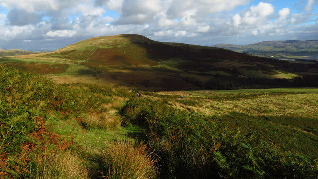
The plantation offers several well-maintained walking trails that allow visitors to explore the area at their own pace. These paths lead through the heart of the woodland, offering breathtaking views of the towering trees and the occasional glimpse of wildlife. The plantation is particularly beautiful during the autumn months when the leaves change color, painting the landscape with vibrant hues of red, orange, and gold.
In addition to its natural beauty, Cookson's Plantation also serves as an important ecological site. The woodland plays a crucial role in maintaining local biodiversity, acting as a natural habitat for various plant and animal species. Efforts have been made to conserve and protect this plantation, ensuring its preservation for future generations to enjoy.
If you have any feedback on the listing, please let us know in the comments section below.
Cookson's Plantation Images
Images are sourced within 2km of 54.272777/-3.2580942 or Grid Reference SD1887. Thanks to Geograph Open Source API. All images are credited.


Cookson's Plantation is located at Grid Ref: SD1887 (Lat: 54.272777, Lng: -3.2580942)
Administrative County: Cumbria
District: Copeland
Police Authority: Cumbria
What 3 Words
///elder.beginning.veal. Near Millom, Cumbria
Nearby Locations
Related Wikis

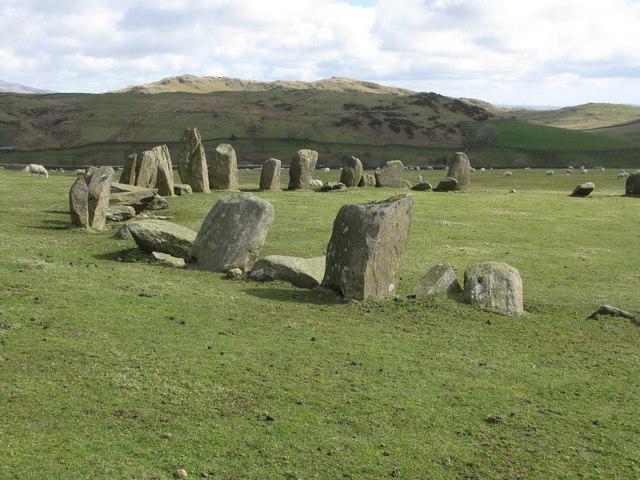
Swinside
Swinside, which is also known as Sunkenkirk and Swineshead, is a stone circle lying beside Swinside Fell, part of Black Combe in southern Cumbria, North...

St Anne's Church, Thwaites
St Anne's Church is in the village of Thwaites, Cumbria, England. It is an active Anglican parish church in the deanery of Millom, the archdeaconry of...
Thwaites, Cumbria
Thwaites is a small village near Duddon Valley and on the edge of the Duddon Estuary in the Lake District National Park in the Borough of Copeland, Cumbria...

Duddon furnace
The Duddon furnace (Grid Reference SD 197883) is a surviving charcoal-fuelled blast furnace near Broughton-in-Furness in Cumbria. It is on the west side...

Duddon Bridge
Duddon Bridge is a hamlet in Cumbria, England. == References ==

Bank End
Bank End is a village in Cumbria, England. == External links == Media related to Bank End, South Lakeland at Wikimedia Commons

Millom Without
Millom Without is a civil parish in the county of Cumbria, England. It had a population of 1,638 in 2001, decreasing to 859 at the 2011 Census. Millom...

St Mary Magdalene's Church, Broughton-in-Furness
St Mary Magdalene's Church is in Broughton-in-Furness, Cumbria, England. It is an active Anglican parish church in the deanery of Furness, the archdeaconry...
Nearby Amenities
Located within 500m of 54.272777,-3.2580942Have you been to Cookson's Plantation?
Leave your review of Cookson's Plantation below (or comments, questions and feedback).