Clovenstone Wood
Wood, Forest in Cumberland Copeland
England
Clovenstone Wood

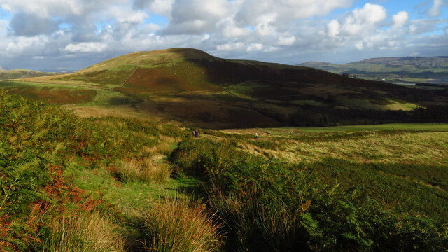
Clovenstone Wood is a picturesque forest located in Cumberland, a historic county in northwest England. This stunning woodland covers an area of approximately 150 acres and is nestled within the breathtaking scenery of the Lake District National Park.
The wood is characterized by its diverse range of tree species, including towering oak, beech, birch, and pine trees. These trees create a dense canopy that provides shade and shelter to a variety of wildlife, making it an ideal habitat for many bird species, such as woodpeckers, owls, and thrushes. Additionally, small mammals like squirrels, badgers, and foxes can be spotted foraging among the undergrowth.
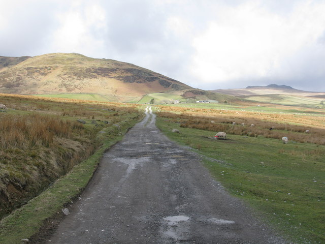
There are several well-marked trails that wind through the wood, allowing visitors to explore its natural beauty. These paths vary in length and difficulty, catering to both casual walkers and more experienced hikers. Along the way, visitors can enjoy the tranquil atmosphere and marvel at the vibrant colors of wildflowers that dot the forest floor during spring and summer.
Clovenstone Wood also offers recreational opportunities for outdoor enthusiasts. The forest is a popular spot for camping, picnicking, and nature photography. Moreover, the wood is intersected by a gentle stream, providing opportunities for fishing and paddling in its clear waters.
Overall, Clovenstone Wood is a captivating woodland in Cumberland that offers a serene escape from the hustle and bustle of everyday life. Its rich biodiversity, well-maintained trails, and scenic beauty make it a must-visit destination for nature lovers and adventure seekers alike.
If you have any feedback on the listing, please let us know in the comments section below.
Clovenstone Wood Images
Images are sourced within 2km of 54.275616/-3.2548326 or Grid Reference SD1887. Thanks to Geograph Open Source API. All images are credited.


Clovenstone Wood is located at Grid Ref: SD1887 (Lat: 54.275616, Lng: -3.2548326)
Administrative County: Cumbria
District: Copeland
Police Authority: Cumbria
What 3 Words
///sports.twinkled.adopt. Near Millom, Cumbria
Nearby Locations
Related Wikis

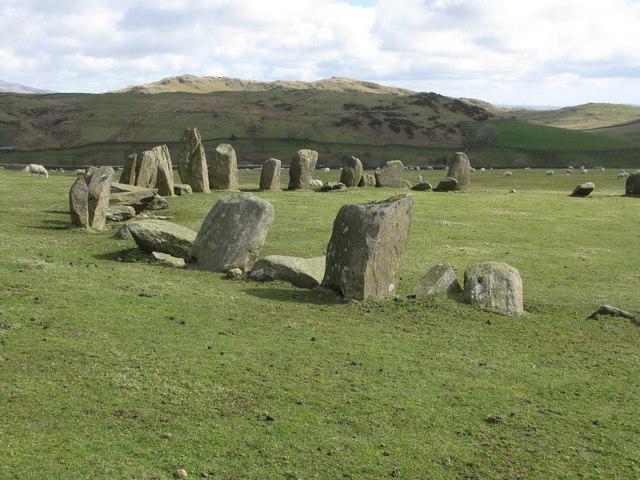
Swinside
Swinside, which is also known as Sunkenkirk and Swineshead, is a stone circle lying beside Swinside Fell, part of Black Combe in southern Cumbria, North...

Duddon furnace
The Duddon furnace (Grid Reference SD 197883) is a surviving charcoal-fuelled blast furnace near Broughton-in-Furness in Cumbria. It is on the west side...

Duddon Bridge
Duddon Bridge is a hamlet in Cumbria, England. == References ==

Bank End
Bank End is a village in Cumbria, England. == External links == Media related to Bank End, South Lakeland at Wikimedia Commons

St Anne's Church, Thwaites
St Anne's Church is in the village of Thwaites, Cumbria, England. It is an active Anglican parish church in the deanery of Millom, the archdeaconry of...
Thwaites, Cumbria
Thwaites is a small village near Duddon Valley and on the edge of the Duddon Estuary in the Lake District National Park in the Borough of Copeland, Cumbria...

St Mary Magdalene's Church, Broughton-in-Furness
St Mary Magdalene's Church is in Broughton-in-Furness, Cumbria, England. It is an active Anglican parish church in the deanery of Furness, the archdeaconry...

Broughton-in-Furness
Broughton in Furness is a market town in the civil parish of Broughton West in the Westmorland and Furness district of Cumbria, England. It had a population...
Nearby Amenities
Located within 500m of 54.275616,-3.2548326Have you been to Clovenstone Wood?
Leave your review of Clovenstone Wood below (or comments, questions and feedback).