Hollowmires Wood

Wood, Forest in Cumberland Allerdale

England

Hollowmires Wood

Whin Ben and the path to Whiteside
Whin Ben and the path to Whiteside Credit: David Robinson

Hollowmires Wood, located in Cumberland, is a captivating forest that mesmerizes visitors with its natural beauty and rich biodiversity. Spanning over a vast area, the wood is a haven for nature enthusiasts and a crucial habitat for numerous plant and animal species.

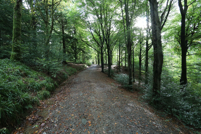
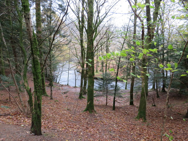
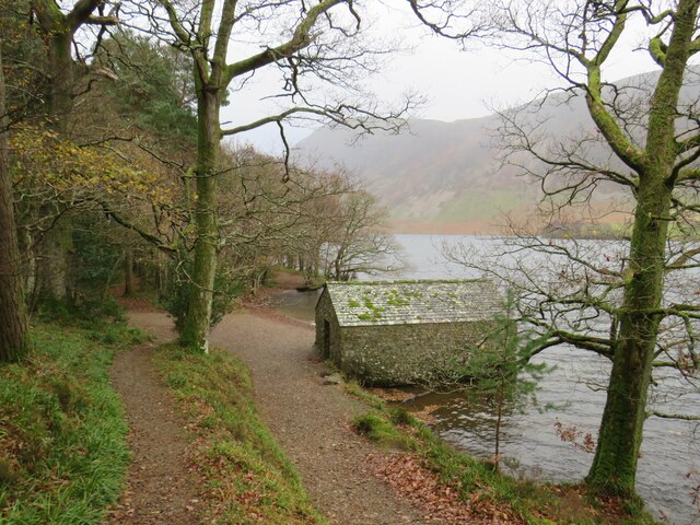
The wood is characterized by its dense canopy of towering trees, primarily consisting of oak, beech, and ash, creating a serene and tranquil atmosphere. The forest floor is adorned with a diverse array of flora, including bluebells, wild garlic, and wood anemones, which carpet the ground in vibrant colors during the spring months.

Hollowmires Wood is home to a plethora of wildlife, making it a popular spot for birdwatching and animal spotting. Birdsong fills the air, with species such as the great spotted woodpecker, tawny owl, and chiffchaff commonly heard and seen. The wood also boasts a variety of mammals, including roe deer, red squirrels, and badgers, which thrive in the undisturbed woodland.

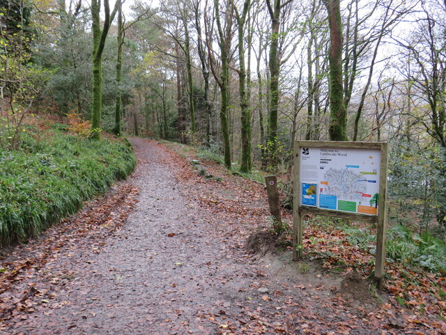
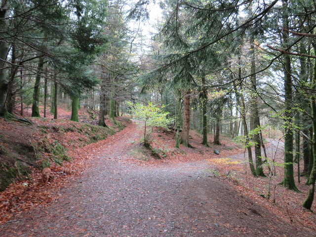
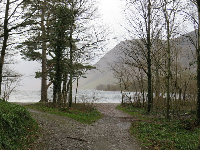
The wood offers several well-maintained walking trails, allowing visitors to explore its natural wonders at their own pace. These trails wind through the ancient woodland, offering glimpses of picturesque streams and small ponds that further enhance the enchanting ambiance.

Hollowmires Wood is not only a sanctuary for wildlife but also serves as an important educational resource. Local schools and nature groups frequently organize field trips to the wood, providing an opportunity for children and adults alike to learn about the delicate balance of nature and the importance of conservation.

Overall, Hollowmires Wood is a captivating and ecologically significant forest, offering visitors a chance to immerse themselves in the wonders of nature while fostering a deeper appreciation for the natural world.

If you have any feedback on the listing, please let us know in the comments section below.

Hollowmires Wood Images

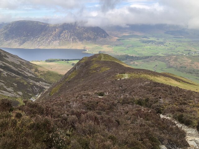
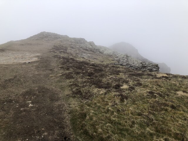
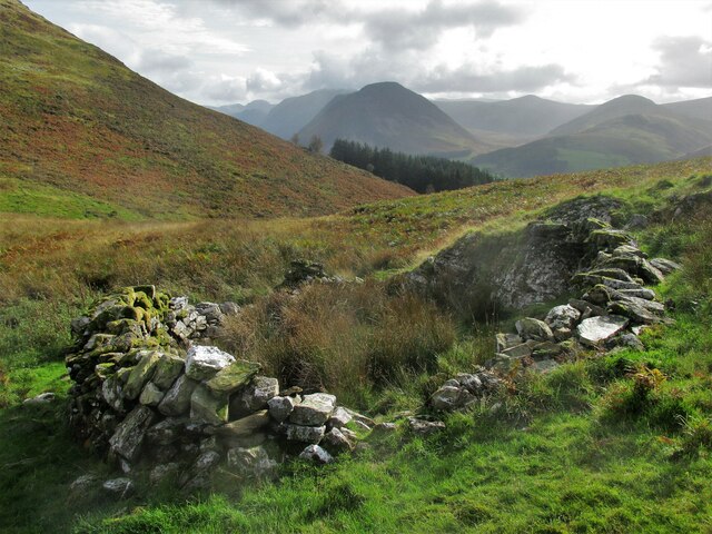
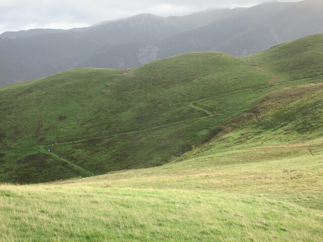
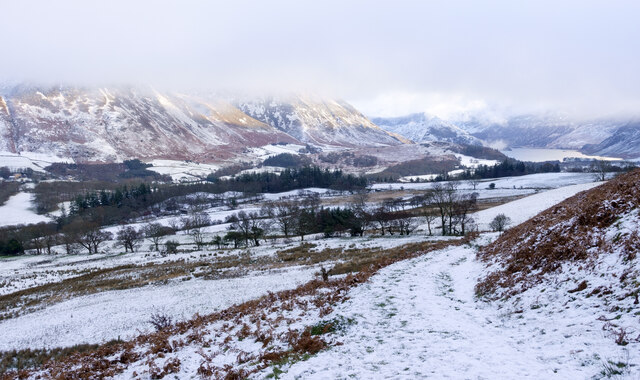
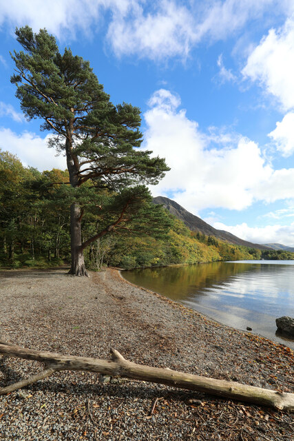
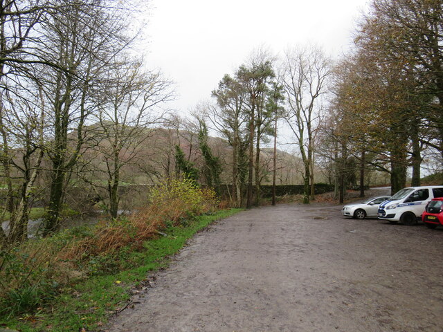
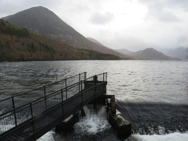
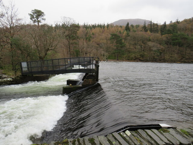
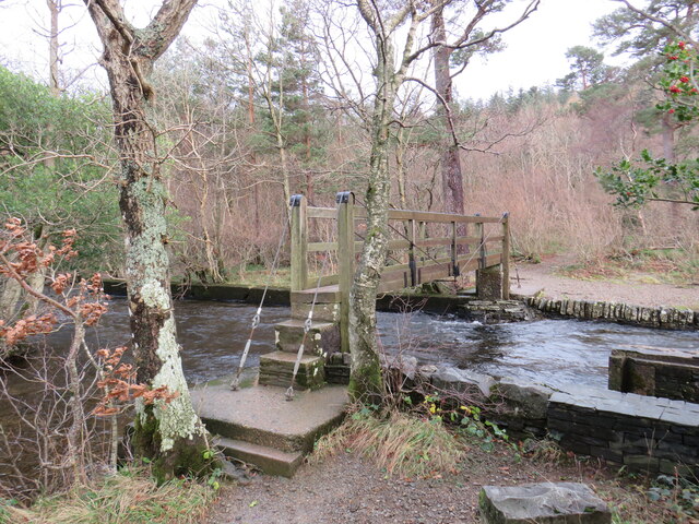
Images are sourced within 2km of 54.590177/-3.3147987 or Grid Reference NY1522. Thanks to Geograph Open Source API. All images are credited.

Whin Ben and the path to Whiteside
Above Gasgale Crags in cloud
Ancient sheepfold on the slopes of Darling Fell Good views towards Mellbreak.
Ancient sheepfold on the slopes of Darling Fell
Good views towards Mellbreak.
Zigzag path from Thackthwaite On Smithy Fell.
Zigzag path from Thackthwaite
On Smithy Fell.
Snow on hill road descending to Thackthwaite Thin snow cover on the road which reaches Thackthwaite in the Vale of Lorton.
The slopes across the valley rise to Whiteside and Grasmoor. Crummock Water can be seen in the distance.
Snow on hill road descending to Thackthwaite
Thin snow cover on the road which reaches Thackthwaite in the Vale of Lorton. The slopes across the valley rise to Whiteside and Grasmoor. Crummock Water can be seen in the distance.
The track to Crummock Water through Lanthwaite Wood The track is a public bridleway at the start, but the more permissive right of way branches left shortly, leaving the track as just a footpath to the lake.
The track to Crummock Water through Lanthwaite Wood
The track is a public bridleway at the start, but the more permissive right of way branches left shortly, leaving the track as just a footpath to the lake.
Crummock Water beach Despite being in "The Lake District", most large bodies of water are waters (with the odd mere), not lakes, and Crummock (raised slightly by a pair of dams) is no exception.
Crummock Water beach
Despite being in "The Lake District", most large bodies of water are waters (with the odd mere), not lakes, and Crummock (raised slightly by a pair of dams) is no exception.
The more Northeasterly of two small dams raising the level of Crummock Water
Slopes descending from Whin Ben The western side of Whin Ben descending to the fields around Peel Place.
The undulating hill country about Fellbarrow and Low Fell is at the centre of the image; the modest feature of Scale Fell is nearer.
Slopes descending from Whin Ben
The western side of Whin Ben descending to the fields around Peel Place. The undulating hill country about Fellbarrow and Low Fell is at the centre of the image; the modest feature of Scale Fell is nearer.
Lanthwaite Wood car park, near Cockermouth A car park at Lanthwaite Wood in the Lake District.
Lanthwaite Wood car park, near Cockermouth
A car park at Lanthwaite Wood in the Lake District.
Lanthwaite Wood car park, near Cockermouth A path leading into Lanthwaite Wood in the Lake District.  The wood is owned and managed by the National Trust.
Lanthwaite Wood car park, near Cockermouth
A path leading into Lanthwaite Wood in the Lake District. The wood is owned and managed by the National Trust.
River Cocker at Lanthwaite Wood, near Cockermouth A view through the trees of Lanthwaite Wood, to a band in the River Cocker.  The woodland is owned and managed by the Naitonal Trust.
River Cocker at Lanthwaite Wood, near Cockermouth
A view through the trees of Lanthwaite Wood, to a band in the River Cocker. The woodland is owned and managed by the Naitonal Trust.
Paths in Lanthwaite Wood, near Cockermouth A fork in the paths through Lanthwaite Wood, a woodland in the Lake District managed by the National Trust.
Paths in Lanthwaite Wood, near Cockermouth
A fork in the paths through Lanthwaite Wood, a woodland in the Lake District managed by the National Trust.
Paths at Crummock Water, near Cockermouth Paths leading out of woodland onto the shore of Crummock Water, in the Lake District.  The woodland is managed by the National Trust.
Paths at Crummock Water, near Cockermouth
Paths leading out of woodland onto the shore of Crummock Water, in the Lake District. The woodland is managed by the National Trust.
Crummock Water, near Keswick A view of Crummock Water in the Lake District, taken in dull and damp conditions on a late November day.  Here, water flows out of the lake over a weir.
Crummock Water, near Keswick
A view of Crummock Water in the Lake District, taken in dull and damp conditions on a late November day. Here, water flows out of the lake over a weir.
Weir at Crummock Water, near Keswick Water flows out of Crummock Water over a weir, into the River Cocker.
Weir at Crummock Water, near Keswick
Water flows out of Crummock Water over a weir, into the River Cocker.
Footbridge over the River Cocker, near Keswick The River Cocker flows out of Crummock Water here.  This is one of two footbridges carrying a lakeside path across the river.
Footbridge over the River Cocker, near Keswick
The River Cocker flows out of Crummock Water here. This is one of two footbridges carrying a lakeside path across the river.
Boat house at Crummock Water, near Keswick A boat house on the shore of Crummock Water in the Lake District.
Boat house at Crummock Water, near Keswick
A boat house on the shore of Crummock Water in the Lake District.
Show me another place!

Hollowmires Wood is located at Grid Ref: NY1522 (Lat: 54.590177, Lng: -3.3147987)

Administrative County: Cumbria

District: Allerdale

Police Authority: Cumbria

What 3 Words

///drips.meanest.iteration. Near Cockermouth, Cumbria

Related Wikis

Brackenthwaite, Buttermere

Brackenthwaite is a settlement and former civil parish, now in the parish of Buttermere, in the unitary authority area of Cumberland, in the ceremonial...

Brackenthwaite Hows

Brackenthwaite Hows (also known as Lanthwaite Hill) is a hill in the Lake District of North West England. Crummock Water, Looking Towards Buttermere, a...

Thackthwaite

Thackthwaite is a village in Cumbria, England, from which hikers can climb Low Fell and Fellbarrow. The place-name contains thwaite ("clearing"). A second...

Low Fell (Lake District)

Low Fell is a fell in the English Lake District. It overlooks the lake of Loweswater to the south and to the north is bordered by its neighbour Fellbarrow...

Nearby Amenities

Located within 500m of 54.590177,-3.3147987
Brackenthwaite
Is In County: Cumbria
Place: hamlet
Source: npe
Wikidata: Q4953681
Lat/Long: 54.5880031/-3.3104175
Cornhow Farm (N bound)
Local Ref: AT
Naptan AtcoCode: 090002190080
Naptan Bearing: N
Naptan BusStopType: CUS
Naptan CommonName: Cornhow Farm (N bound)
Naptan Indicator: at
Naptan Landmark: entrance to Cornhow Farm
Naptan NaptanCode: cumadjpt
Naptan Street: No name
Naptan Verified: no
Source: naptan_import
Lat/Long: 54.5872779/-3.3138313
Cornhow Farm (S bound)
Naptan AtcoCode: 090002193760
Naptan Bearing: S
Naptan BusStopType: CUS
Naptan CommonName: Cornhow Farm (S bound)
Naptan Indicator: near
Naptan Landmark: Palace How
Naptan NaptanCode: cumadjwm
Naptan Street: No name
Naptan Verified: no
Source: naptan_import
Lat/Long: 54.587154/-3.3136571
Post Box
Ref: CA13 99
Lat/Long: 54.587348/-3.3136565
High Latterhead
Place: locality
Lat/Long: 54.5930382/-3.3195393
Latterhead
Place: locality
Lat/Long: 54.591611/-3.3184563
Oakbank Lead Mine
Abandoned: yes
Disused: yes
Man Made: mine
Mineral: lead
Lat/Long: 54.5875375/-3.3196043
Cornhowgill Wood
Natural: wood
Lat/Long: 54.5865426/-3.318713
Cornhow
Place: locality
Lat/Long: 54.5892563/-3.3147446
Hollowmires Wood
Natural: wood
Lat/Long: 54.5901846/-3.3149048
Gillbottom Wood
Natural: wood
Lat/Long: 54.5926114/-3.3144736
Blakehill Wood
Natural: wood
Lat/Long: 54.5944832/-3.3138184
Power: pole
Lat/Long: 54.5931378/-3.3194805
Power: pole
Lat/Long: 54.5924595/-3.3191179
Power: pole
Lat/Long: 54.5915346/-3.3181618
Power: pole
Lat/Long: 54.5896426/-3.3071746
Power: pole
Lat/Long: 54.5893351/-3.3081226
Power: pole
Lat/Long: 54.5886414/-3.3083394
Power: pole
Lat/Long: 54.5879853/-3.3085176
Power: pole
Lat/Long: 54.5884008/-3.3182205
Power: pole
Lat/Long: 54.589098/-3.3195554
Power: pole
Lat/Long: 54.5899419/-3.320315
Power: pole
Lat/Long: 54.5907823/-3.3191948
Power: pole
Lat/Long: 54.5893774/-3.3210605
Power: pole
Lat/Long: 54.5888058/-3.3219578
Power: pole
Lat/Long: 54.5879865/-3.3157715
Power: pole
Lat/Long: 54.5873597/-3.3158282
Power: pole
Lat/Long: 54.5867329/-3.3158505
Power: pole
Lat/Long: 54.585856/-3.3163285
Power: pole
Lat/Long: 54.5866143/-3.3149227
Power: pole
Lat/Long: 54.5865134/-3.3141651
The data included in this document is from www.openstreetmap.org. The data is made available under ODbL.

Have you been to Hollowmires Wood?

Leave your review of Hollowmires Wood below (or comments, questions and feedback).