Scroggs Wood

Wood, Forest in Cumberland Allerdale

England

Scroggs Wood

A66 at Strawberry How Road overbridge
A66 at Strawberry How Road overbridge Credit: Colin Pyle

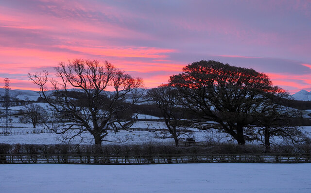
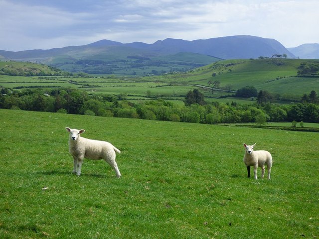
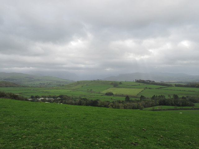
Scroggs Wood is a picturesque forest located in Cumberland, a historic county in the northwest of England. Spread across an area of approximately 100 acres, this wood is an enchanting natural haven that captivates visitors with its serene atmosphere and stunning biodiversity.

The wood is predominantly composed of deciduous trees, including oak, birch, and ash, which create a dense canopy that filters sunlight, casting dappled shadows on the forest floor. These trees provide a rich habitat for various species of birds, such as woodpeckers, owls, and thrushes, making it a popular spot for birdwatchers.

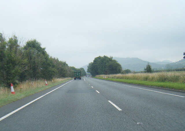
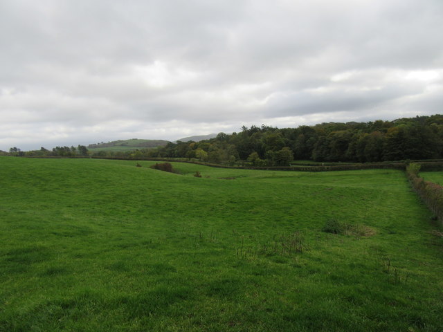
Scroggs Wood is crisscrossed by a network of well-maintained walking trails, allowing visitors to explore its beauty at their own pace. These trails wind through the wood, offering glimpses of wildflowers, ferns, and moss-covered rocks along the way. The forest floor is carpeted with a lush layer of fallen leaves, creating a soothing rustling sound as visitors stroll through the wood.

Nature enthusiasts can also find an array of wildlife in Scroggs Wood. Squirrels can be spotted scampering along the branches, while rabbits and badgers make their homes in the undergrowth. The wood is also home to a variety of insects, including butterflies, beetles, and bees.

Scroggs Wood holds a special place in the hearts of locals and visitors alike, providing a tranquil escape from the hustle and bustle of everyday life. Its natural beauty, diverse flora and fauna, and well-maintained trails make it a must-visit destination for those seeking solace in nature.

If you have any feedback on the listing, please let us know in the comments section below.

Scroggs Wood Images

Images are sourced within 2km of 54.66023/-3.31689 or Grid Reference NY1530. Thanks to Geograph Open Source API. All images are credited.

A66 at Strawberry How Road overbridge
Hedge and trees at The Old Homestead A 'red sky in the morning' seen from The Old Homestead which is a large barn conversion at Byerstead, in use as holiday accommodation.
Hedge and trees at The Old Homestead
A 'red sky in the morning' seen from The Old Homestead which is a large barn conversion at Byerstead, in use as holiday accommodation.
Walking party passing Hundith Hill Hotel The party is walking along Hundith Hill Road having just passed the Hotel and also Hundith Hill Farm. Snow was falling and accumulating on frozen surfaces.
Walking party passing Hundith Hill Hotel
The party is walking along Hundith Hill Road having just passed the Hotel and also Hundith Hill Farm. Snow was falling and accumulating on frozen surfaces.
A66 near Scales Farm
Station House, Embleton Now a private dwelling, Station House stands beside the A66 road which was constructed along the route of the former Cockermouth, Keswick and Penrith Railway.
There is an Ordnance Survey cut benchmark on the north west corner of the house (photograph <a href="https://www.geograph.org.uk/photo/6898656">NY1630 : Benchmark, Station House, Lambfoot, Embleton</a>).
Station House, Embleton
Now a private dwelling, Station House stands beside the A66 road which was constructed along the route of the former Cockermouth, Keswick and Penrith Railway. There is an Ordnance Survey cut benchmark on the north west corner of the house (photograph NY1630 : Benchmark, Station House, Lambfoot, Embleton).
Old Milestone by the B5291, west of Embleton Metal plate attached to stone post by the B5291, in parish of EMBLETON (ALLERDALE District), West end of village, opposite Blue Bell Inn, on grass verge against wall, on North side of road. Cockermouth plate, erected by the Keswick turnpike trust in the 19th century. 

Inscription reads:-
COCKERMOUTH
3 MILES
KESWICK
10 MILES 

Grade II Listed. List Entry Number: 1145180
<span class="nowrap"><a title="https://historicengland.org.uk/listing/the-list/list-entry/1145180" rel="nofollow ugc noopener" href="https://historicengland.org.uk/listing/the-list/list-entry/1145180">Link</a><img style="margin-left:2px;" alt="External link" title="External link - shift click to open in new window" src="https://s1.geograph.org.uk/img/external.png" width="10" height="10"/></span>

Milestone Society National ID: CU_CMKW03.
Old Milestone by the B5291, west of Embleton
Metal plate attached to stone post by the B5291, in parish of EMBLETON (ALLERDALE District), West end of village, opposite Blue Bell Inn, on grass verge against wall, on North side of road. Cockermouth plate, erected by the Keswick turnpike trust in the 19th century. Inscription reads:- COCKERMOUTH 3 MILES KESWICK 10 MILES Grade II Listed. List Entry Number: 1145180 LinkExternal link Milestone Society National ID: CU_CMKW03.
Embleton church Dedicated to St Cuthbert, this is some way from the village of Embleton.
Embleton church
Dedicated to St Cuthbert, this is some way from the village of Embleton.
Seacross Wood Looking NE.
Seacross Wood
Looking NE.
Byerstead Byerstead is a complex of buildings south-east of Cockermouth, presumably once a single farm but now possibly with divided ownership. There's at least one house, holiday accommodation and barns. It's seen from a narrow public road to the south.
Byerstead
Byerstead is a complex of buildings south-east of Cockermouth, presumably once a single farm but now possibly with divided ownership. There's at least one house, holiday accommodation and barns. It's seen from a narrow public road to the south.
Oval Plantation, Setmurthy Common The Oval Plantation at Setmurthy Common, near Cockermouth.
Oval Plantation, Setmurthy Common
The Oval Plantation at Setmurthy Common, near Cockermouth.
Stand of firs on Cockermouth Golf Course
Minor road approaching Lambfoot This is very wide for a minor road - because it is the old A66.
Minor road approaching Lambfoot
This is very wide for a minor road - because it is the old A66.
Old Milestone by the B5291, west of Embleton Metal plate attached to stone post by the B5291, in parish of EMBLETON (ALLERDALE District), West end of village, opposite Blue Bell Inn, on grass verge against wall, on North side of road. Cockermouth plate, erected by the Keswick turnpike trust in the 19th century. 

Inscription reads:-
COCKERMOUTH
3 MILES
KESWICK
10 MILES 

Grade II Listed. List Entry Number: 1145180
<span class="nowrap"><a title="https://historicengland.org.uk/listing/the-list/list-entry/1145180" rel="nofollow ugc noopener" href="https://historicengland.org.uk/listing/the-list/list-entry/1145180">Link</a><img style="margin-left:2px;" alt="External link" title="External link - shift click to open in new window" src="https://s1.geograph.org.uk/img/external.png" width="10" height="10"/></span>

Milestone Society National ID: CU_CMKW03.
Old Milestone by the B5291, west of Embleton
Metal plate attached to stone post by the B5291, in parish of EMBLETON (ALLERDALE District), West end of village, opposite Blue Bell Inn, on grass verge against wall, on North side of road. Cockermouth plate, erected by the Keswick turnpike trust in the 19th century. Inscription reads:- COCKERMOUTH 3 MILES KESWICK 10 MILES Grade II Listed. List Entry Number: 1145180 LinkExternal link Milestone Society National ID: CU_CMKW03.
Pasture, Cockermouth A view towards Skiddaw from the bridleway climbing Watch Hill.
Pasture, Cockermouth
A view towards Skiddaw from the bridleway climbing Watch Hill.
Pasture, Setmurthy A view towards Grasmoor, Hopegill Head and Grisedale Pike from the bridleway on Watch Hill.
Pasture, Setmurthy
A view towards Grasmoor, Hopegill Head and Grisedale Pike from the bridleway on Watch Hill.
Pasture, Setmurthy Looking towards the edge of forestry on Setmurthy Common with the Skiddaw range in the background.
Pasture, Setmurthy
Looking towards the edge of forestry on Setmurthy Common with the Skiddaw range in the background.
Top of Watch Hill Looking south.
Top of Watch Hill
Looking south.
Near Cockermouth Looking SE on the very windy day.
Near Cockermouth
Looking SE on the very windy day.
Show me another place!

Scroggs Wood is located at Grid Ref: NY1530 (Lat: 54.66023, Lng: -3.31689)

Administrative County: Cumbria

District: Allerdale

Police Authority: Cumbria

What 3 Words

///teams.expel.patting. Near Cockermouth, Cumbria

Nearby Locations

Scroggs Wood

Related Wikis

Slate Fell

Slate Fell is a low hill in the North Western part of the English Lake District. It lies only about a mile from the busy market town of Cockermouth, and...

Embleton railway station

Embleton railway station was situated on the Cockermouth, Keswick and Penrith Railway between Penrith and Cockermouth in Cumberland (now in Cumbria), England...

Embleton, Cumbria

Embleton is a small village and civil parish located in the Allerdale district in Cumbria, England. It is located east of Cockermouth on the A66 road,...

Watch Hill (Cockermouth)

Watch Hill is a small hill lying on the north-western fringe of the Lake District in England. The name Setmurthy Common is sometimes used (including by...

Cockermouth School

Cockermouth School is a coeducational secondary school and sixth form located in Cockermouth in the English county of Cumbria.Previously a community school...

Armaside

Armaside is an agricultural village in Cumbria, England, situated north of Low Lorton, south west of the River Cocker, and south east from Cockermouth...

Cockermouth

Cockermouth is a market town and civil parish in the Cumberland unitary area of Cumbria, England, so named because it is at the confluence of the River...

Cockermouth Castle

Cockermouth Castle (grid reference NY123309) is in the town of Cockermouth in Cumbria on a site by the junction of the Rivers Cocker and Derwent. It is...

Nearby Amenities

Located within 500m of 54.66023,-3.31689
Power: pole
Lat/Long: 54.656291/-3.3143841
Power: pole
Lat/Long: 54.6572464/-3.3160334
Power: pole
Lat/Long: 54.6578544/-3.3171763
Power: pole
Lat/Long: 54.6586214/-3.3180003
Power: pole
Lat/Long: 54.6599388/-3.3193523
Power: pole
Lat/Long: 54.6606987/-3.3201427
Power: pole
Lat/Long: 54.6614446/-3.3209504
Power: pole
Lat/Long: 54.6620401/-3.3219279
Power: pole
Lat/Long: 54.6626316/-3.3228882
Give Way
Direction: forward
Lat/Long: 54.6591662/-3.3180875
Power: pole
Lat/Long: 54.6563592/-3.3185385
Power: pole
Lat/Long: 54.656572/-3.3168127
Power: pole
Lat/Long: 54.6567155/-3.3155911
Power: pole
Lat/Long: 54.6567656/-3.3152033
The data included in this document is from www.openstreetmap.org. The data is made available under ODbL.

Have you been to Scroggs Wood?

Leave your review of Scroggs Wood below (or comments, questions and feedback).