Spring Coombe Coppice

Wood, Forest in Devon East Devon

England

Spring Coombe Coppice

Laburnum Cottages, Church Street A pair of Grade II listed <span class="nowrap"><a title="https://www.britishlistedbuildings.co.uk/101097990-laburnumlaburnum-cottage-sidmouth#.WXtVpdQrLGh" rel="nofollow ugc noopener" href="https://www.britishlistedbuildings.co.uk/101097990-laburnumlaburnum-cottage-sidmouth#.WXtVpdQrLGh">Link</a><img style="margin-left:2px;" alt="External link" title="External link - shift click to open in new window" src="https://s1.geograph.org.uk/img/external.png" width="10" height="10"/></span> 18th Century cottages, set slightly back from the main road.
Laburnum Cottages, Church Street Credit: Richard Law

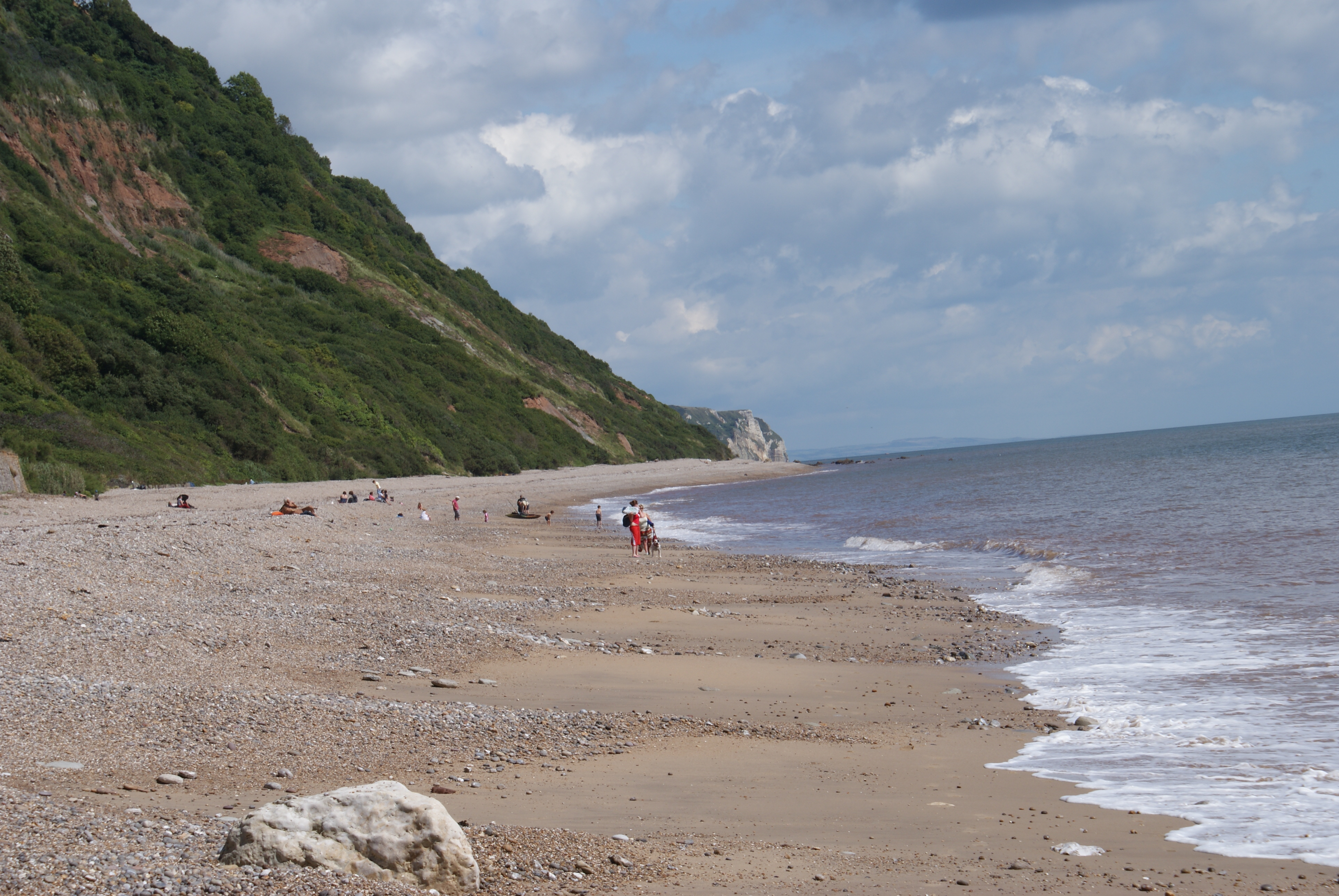
Spring Coombe Coppice is a picturesque woodland located in the county of Devon, England. Covering an area of approximately 50 hectares, this ancient woodland is a haven for nature enthusiasts and outdoor lovers alike. The coppice is situated in a secluded valley, creating a serene and tranquil atmosphere for visitors to enjoy.

The woodland is predominantly composed of deciduous trees such as oak, beech, and ash, which provide a stunning display of colors throughout the year. In the springtime, the forest floor comes alive with a vibrant carpet of bluebells, creating a breathtaking sight for visitors. The diverse range of flora and fauna found within the coppice makes it an important habitat for various species of birds, insects, and small mammals.

Spring Coombe Coppice offers a network of well-maintained footpaths and trails that wind through the woodland, allowing visitors to explore the area at their own pace. These paths lead to picturesque viewpoints, offering panoramic views of the surrounding countryside. The coppice is also home to a small stream that meanders through the woodland, adding to its natural beauty.

The site is managed by the local conservation authority, which ensures the preservation of the woodland's unique ecosystem. Visitors are encouraged to follow the designated pathways and adhere to the guidelines set out by the authority to protect the fragile habitat.

Whether it's a leisurely stroll, birdwatching, or simply immersing oneself in nature, Spring Coombe Coppice offers a truly enchanting experience for all who visit.

If you have any feedback on the listing, please let us know in the comments section below.

Spring Coombe Coppice Images

Images are sourced within 2km of 50.689961/-3.2066341 or Grid Reference SY1488. Thanks to Geograph Open Source API. All images are credited.

Laburnum Cottages, Church Street A pair of Grade II listed <span class="nowrap"><a title="https://www.britishlistedbuildings.co.uk/101097990-laburnumlaburnum-cottage-sidmouth#.WXtVpdQrLGh" rel="nofollow ugc noopener" href="https://www.britishlistedbuildings.co.uk/101097990-laburnumlaburnum-cottage-sidmouth#.WXtVpdQrLGh">Link</a><img style="margin-left:2px;" alt="External link" title="External link - shift click to open in new window" src="https://s1.geograph.org.uk/img/external.png" width="10" height="10"/></span> 18th Century cottages, set slightly back from the main road.
Laburnum Cottages, Church Street
A pair of Grade II listed LinkExternal link 18th Century cottages, set slightly back from the main road.
Lane to Boswell Farm The lane is also a bridleway that heads off up to Harcombe.
Lane to Boswell Farm
The lane is also a bridleway that heads off up to Harcombe.
Boswell Farmhouse Dating in the most part from the 17th century, and given a Grade II listing <span class="nowrap"><a title="https://www.britishlistedbuildings.co.uk/101228395-boswell-farmhouse-sidmouth#.WYwBa1V96M8" rel="nofollow ugc noopener" href="https://www.britishlistedbuildings.co.uk/101228395-boswell-farmhouse-sidmouth#.WYwBa1V96M8">Link</a><img style="margin-left:2px;" alt="External link" title="External link - shift click to open in new window" src="https://s1.geograph.org.uk/img/external.png" width="10" height="10"/></span> in 1951. The farm also has an unusual listed barn <span class="nowrap"><a title="https://www.britishlistedbuildings.co.uk/101228689-bank-barn-to-north-west-of-boswell-farmhouse-sidmouth#.WYwBlVV96M8" rel="nofollow ugc noopener" href="https://www.britishlistedbuildings.co.uk/101228689-bank-barn-to-north-west-of-boswell-farmhouse-sidmouth#.WYwBlVV96M8">Link</a><img style="margin-left:2px;" alt="External link" title="External link - shift click to open in new window" src="https://s1.geograph.org.uk/img/external.png" width="10" height="10"/></span> just to the west, but this was inaccessible on the day I passed by.
Boswell Farmhouse
Dating in the most part from the 17th century, and given a Grade II listing LinkExternal link in 1951. The farm also has an unusual listed barn LinkExternal link just to the west, but this was inaccessible on the day I passed by.
Old Milestone by the A3052, Church Street, Sidford Stone post (plate lost) by the A3052, in parish of SIDMOUTH (EAST DEVON District), Church Street, Sidford Village, by Milestone Cottage, East of cul de sac, in pavement beside door, on North side of road. Lyme iron plate, erected by the Lyme Regis (Charmouth to Wimple) turnpike trust in the 19th century. 
See also <span class="nowrap"><a title="https://www.flickr.com/photos/tollhouses/5600825652" rel="nofollow ugc noopener" href="https://www.flickr.com/photos/tollhouses/5600825652">Link</a><img style="margin-left:2px;" alt="External link" title="External link - shift click to open in new window" src="https://s1.geograph.org.uk/img/external.png" width="10" height="10"/></span>

Inscription once read:-
(Lyme Regis 14)
(Exeter 14)

Devon & Dartmoor HER listed. HER Number: MDV76438
<span class="nowrap"><a title="https://www.heritagegateway.org.uk/Gateway/Results_Single.aspx?uid=MDV76438&resourceID=104" rel="nofollow ugc noopener" href="https://www.heritagegateway.org.uk/Gateway/Results_Single.aspx?uid=MDV76438&resourceID=104">Link</a><img style="margin-left:2px;" alt="External link" title="External link - shift click to open in new window" src="https://s1.geograph.org.uk/img/external.png" width="10" height="10"/></span>

Milestone Society National ID: DV_EXLR14.
Old Milestone by the A3052, Church Street, Sidford
Stone post (plate lost) by the A3052, in parish of SIDMOUTH (EAST DEVON District), Church Street, Sidford Village, by Milestone Cottage, East of cul de sac, in pavement beside door, on North side of road. Lyme iron plate, erected by the Lyme Regis (Charmouth to Wimple) turnpike trust in the 19th century. See also LinkExternal link Inscription once read:- (Lyme Regis 14) (Exeter 14) Devon & Dartmoor HER listed. HER Number: MDV76438 LinkExternal link Milestone Society National ID: DV_EXLR14.
The Church of St Peter, Sidford
Thatched cottages on Church Street
Bridleway to Boswell Farm and Knowle House
Passing place on bridleway to Boswell Farm
Boswell Lake The local farm has created a path around this lake and a notice by the bridleway invites passers-by to explore the small nature reserve
Boswell Lake
The local farm has created a path around this lake and a notice by the bridleway invites passers-by to explore the small nature reserve
Fields on the south of Buckton Hill
Path in Boswell Lake nature reserve
Cattle grid on bridleway to Knowle House
The gate to Knowle House
The Snod Brook near Boswell Farm For much of its length by the farm road, the brook runs through dense woodland.  This was a glimpse through one of few gaps in the foliage
The Snod Brook near Boswell Farm
For much of its length by the farm road, the brook runs through dense woodland. This was a glimpse through one of few gaps in the foliage
Footpath to Harcombe from Knowle House
Ford and footbridge over Snod Brook Looking towards Harcombe farm and Buckton Hill
Ford and footbridge over Snod Brook
Looking towards Harcombe farm and Buckton Hill
Footbridge on path to Harcombe from Knowle House
Ford for farm animals across Snod Brook
Show me another place!

Spring Coombe Coppice is located at Grid Ref: SY1488 (Lat: 50.689961, Lng: -3.2066341)

Administrative County: Devon

District: East Devon

Police Authority: Devon and Cornwall

What 3 Words

///vegetable.thickened.cuts. Near Sidmouth, Devon

Related Wikis

Salcombe Regis

Salcombe Regis is a coastal village and former civil parish, now in the parish of Sidmouth, in the East Devon district, in the county of Devon, England...

Norman Lockyer Observatory

The Norman Lockyer Observatory, the Lockyer Technology Centre, and the Planetarium (jointly NLO), is a public access optical observatory 1 mile (1.6 km...

The Donkey Sanctuary

The Donkey Sanctuary is a British charitable organisation devoted to the welfare of donkeys. The charity, which is based near Sidmouth in Devon, England...

Weston Mouth

Weston Mouth is an isolated beach on the East Devon coast between Sidmouth and Seaton in England. It can be reached only by footpath, either along the...

River Sid

The River Sid, situated in East Devon, is often claimed to be the shortest complete river in England. It flows for 6.5 miles (10.5 km) southwards from...

Sidmouth College

Sidmouth College is a coeducational secondary school and sixth form, located in Sidmouth in the English county of Devon. The school attracts pupils from...

Weston, Devon

Weston is a small hamlet near Sidmouth in East Devon, England. It is near the Donkey Sanctuary and less than a mile from the beach at Branscombe; footpaths...

Sidford

Sidford is a small village in the civil parish of and on the outskirts of the town of Sidmouth in the English county of Devon. It has a population of just...

Nearby Amenities

Located within 500m of 50.689961,-3.2066341
Salcombe Regis
Created By: Potlatch 0.10f
Place: village
Wikidata: Q745875
Lat/Long: 50.6935703/-3.2066743
Barrier: stile
Lat/Long: 50.6925782/-3.2027865
Barrier: kissing_gate
Lat/Long: 50.6907774/-3.2089872
Barrier: kissing_gate
Lat/Long: 50.6889561/-3.2093568
Barrier: kissing_gate
Lat/Long: 50.6872665/-3.209753
Barrier: kissing_gate
Lat/Long: 50.686493/-3.209957
War Memorial
Historic: memorial
Memorial: war_memorial
Lat/Long: 50.6917202/-3.2115344
Telephone
Booth: K6
Covered: booth
Survey Date: 2023-04-07
Lat/Long: 50.6936972/-3.2071464
Fire Hydrant
Emergency: fire_hydrant
Fire Hydrant Type: underground
Survey Date: 2023-04-07
Lat/Long: 50.6933671/-3.2071253
Post Box
Collection Times: Mo-Fr 09:00, Sa 07:00
Operator: Royal Mail
Operator Wikidata: Q638098
Post Box Mounting: building
Post Box Type: wall
Ref: EX10 99D
Royal Cypher: EIIR
Royal Cypher Wikidata: Q33102113
Survey Date: 2023-04-07
Lat/Long: 50.6932717/-3.2069704
Fire Hydrant
Emergency: fire_hydrant
Fire Hydrant Type: underground
Survey Date: 2023-04-07
Lat/Long: 50.6931831/-3.2073048
Fire Hydrant
Emergency: fire_hydrant
Fire Hydrant Type: underground
Survey Date: 2023-04-07
Lat/Long: 50.6918349/-3.2107985
The data included in this document is from www.openstreetmap.org. The data is made available under ODbL.

Have you been to Spring Coombe Coppice?

Leave your review of Spring Coombe Coppice below (or comments, questions and feedback).